
Gothic Quarter self-guided walking tour · 90 min · map
Two thousand years in 2.6 km: the Gothic Quarter and El Born on foot
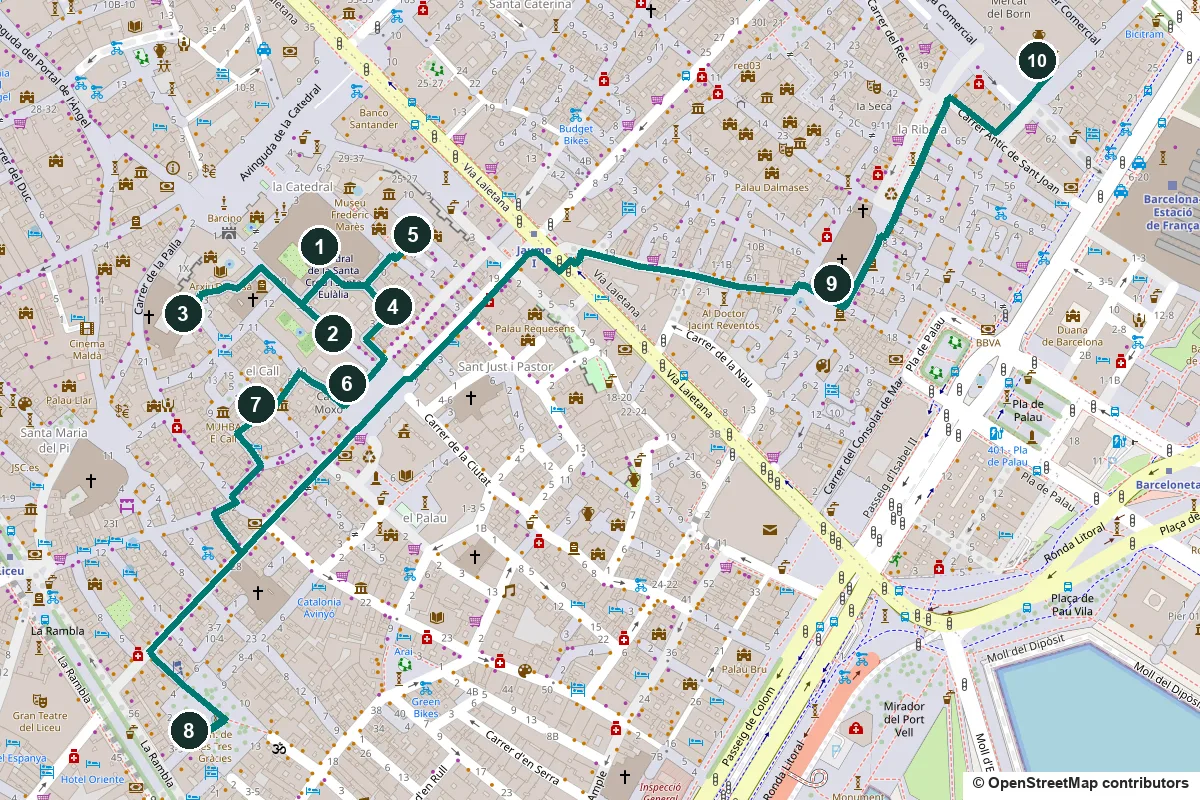
Start at the cathedral and end at an old market hall that stands over a buried city. On the way you pass Roman columns, a square scarred by a Civil War bomb, the medieval Jewish quarter and a church the Ribera neighbourhood, it seems, helped build.
- Start
- Barcelona Cathedral, about 250 m from Jaume I metro (L4)
- Finish
- Mercat del Born, about 500 m from Barceloneta metro (L4)
- Distance
- 2.6 km, one way
- Time
- About 90 minutes: 35 min walking and 10 stops
Terrain, water, toilets and shorter versions ↓
The stops
-
Barcelona Cathedral, a church rebuilt in layers
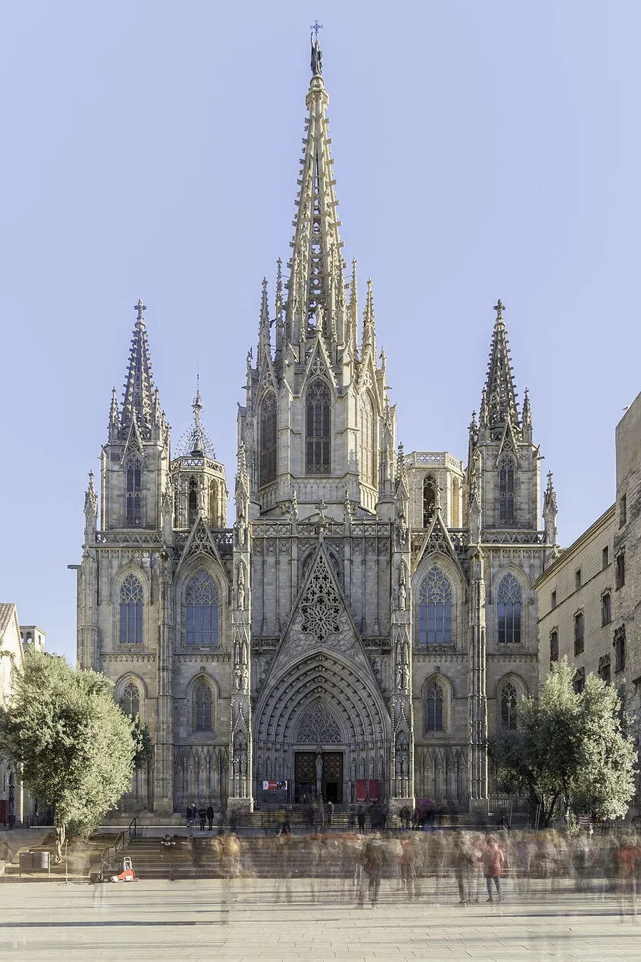
The main front. Photo: Fernando, CC BY-SA 4.0, via Wikimedia Commons (resized). Stand back in the square and look up. The Gothic cathedral looks all of a piece, but its front was only finished in the 19th century, and the 70-metre tower over the crossing, the cimbori, went up between 1906 and 1913. It grew out of a Romanesque church and, before that, an early Christian basilica. If you go inside, the Gothic cloister is home to thirteen white geese.
More history
It began as an early Christian basilica dedicated to the Holy Cross, from the 5th to 7th centuries, which may have been turned into a mosque during the Muslim occupation. Around 877 Bishop Frodoí restored it, and Saint Eulalia was added to its dedication. A Romanesque church was consecrated in 1058. The Gothic works began in May 1298 as an enlargement, not a new building, and services carried on throughout. Popular tradition says the gargoyles are petrified witches.
Source: Wikipedia (Spanish), Catedral de la Santa Cruz y Santa Eulalia. Visiting: check hours on the cathedral's official site.
-
Carrer del Bisbe, the street under the bridge
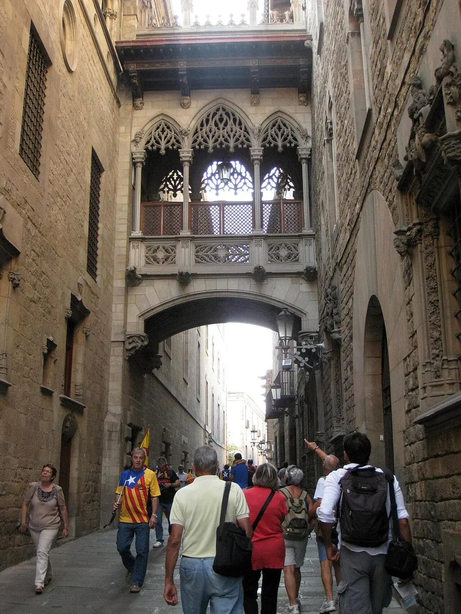
The bridge over Carrer del Bisbe. Photo: Enfo, CC BY-SA 3.0, via Wikimedia Commons (resized). Walk into Carrer del Bisbe, the Bishop's Street. A neo-Gothic bridge crosses overhead, joining the Palau de la Generalitat to the Cases dels Canonges, the canons' houses. On the Generalitat side, look for a medallion of Saint George spearing the dragon by the sculptor Pere Joan, and a roofline of pinnacles, gargoyles and a carved stone balustrade.
More history
The Bishop's Palace was built beside the Roman gate, which from then on was called the Portal Bisbal, the Bishop's Gate. The street has been called Santa Eulàlia, Bisbal, Diputació, Martín Zurbano, García Lorca and Obispo Irurita. A few months after the Civil War, a public collection opened for a monument to Bishop Irurita, an ultra- conservative bishop, as one of the martyrs of the "Cruzada Nacional"; his bronze statue by Vicenç Navarro was unveiled in its niche on 9 December 1943. In 1982 the city council decided the street would simply be del Bisbe.
Sources: Viquipèdia, Carrer del Bisbe; Viquipèdia, Palau de la Generalitat de Catalunya.
-
Plaça de Sant Felip Neri, the square with scarred walls
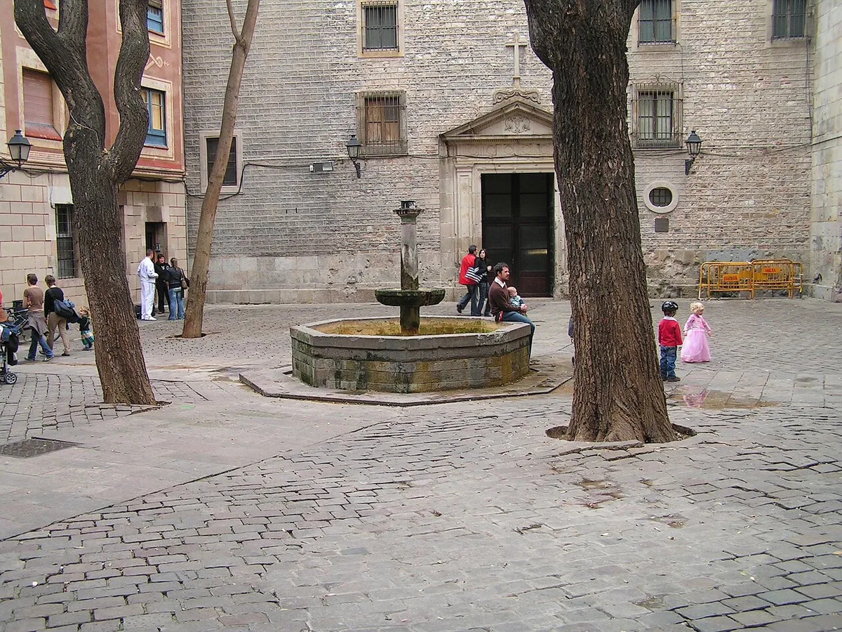
Photo: Manel Zaera, CC BY-SA 2.0, via Wikimedia Commons (resized). Turn off along Carrer de Montjuïc del Bisbe into this small square. Look closely at the church façade: the pitted stone is shrapnel damage. On 30 January 1938, during the Civil War, a bomb from a Nationalist aircraft fell here and killed 42 people, most of them children sheltering in the church basement. The square, with its fountain on an eight-sided base, was once a cemetery.
More history
This was the cathedral's cemetery, known in the 17th century as the Fossar de Natzaret, and also as the cemetery of the condemned: people sentenced to hang or be quartered were buried here. It filled up in the plague of 1653. From 1748 the Oratory built its Baroque church over part of it, and the cemetery closed in 1816. After the bomb, the city architect Adolf Florensa rebuilt the square using the Renaissance fronts of two buildings taken down to open Avinguda de la Catedral and Via Laietana. The Renaissance fronts of the old Calderers' (boilermakers') and Sabaters' (shoemakers') guild houses have been rebuilt here.
Source: Viquipèdia, Plaça de Sant Felip Neri.
-
Temple d'August, four Roman columns
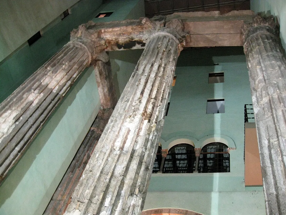
The columns inside Carrer del Paradís 10. Photo: Enfo, CC BY-SA 3.0, via Wikimedia Commons (resized). Head back past the bridge and along Carrer de la Pietat to Carrer del Paradís. Inside number 10, the home of the Centre Excursionista de Catalunya, four fluted Roman columns still stand, with Corinthian capitals and the stone beam across their tops. They belonged to a temple of the Roman colony of Barcino, probably built in the early 1st century AD. This is where the walk's two thousand years begin.
More history
The ruins are recorded from at least the 14th century, and people read them other ways: as the tomb of the legendary king Hispan, of Hercules or of Ataulf, or as part of an aqueduct. In 1850 a house demolition damaged two columns; one was rebuilt from the pieces and stood outdoors in Plaça del Rei until 1956, when Adolf Florensa put it back with the other three. In 2023 a pavement of the temple's forum turned up under Carrer d'Hèrcules 3.
Source: Viquipèdia, Temple d'August de Barcelona. Visiting: the site belongs to the Barcelona History Museum (MUHBA); check its hours there.
-
Plaça del Rei, Chillida's iron corner
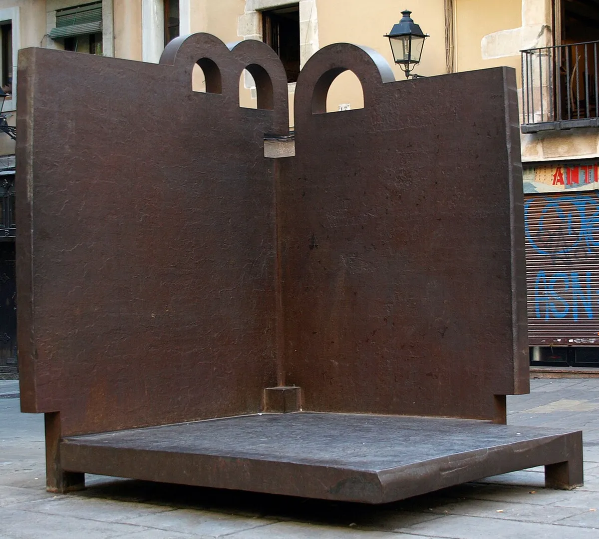
Topos V by Eduardo Chillida. Photo: Mutari, public domain, via Wikimedia Commons (resized). Look for Topos V, a cast-iron sculpture from 1986 by the Basque artist Eduardo Chillida. It is shaped like two walls meeting at an angle, closed on two sides, with its two open sides facing the square. Some of its rounded shapes could suggest a B for Barcelona, or medieval arches and windows.
More history
The city bought Topos V when it was shown at the Fundació Joan Miró in 1986, and Chillida himself suggested Plaça del Rei as its best home. In 1488, at several autos de fe, the effigies of the Àrguens, a family descended from Jewish converts and linked to the old Major Synagogue property, were burned here, and their goods were confiscated.
Sources: Wikipedia, Topos V; Viquipèdia, Sinagoga Major de Barcelona; Viquipèdia, Temple d'August de Barcelona.
-
Plaça de Sant Jaume, Catalonia's government palace
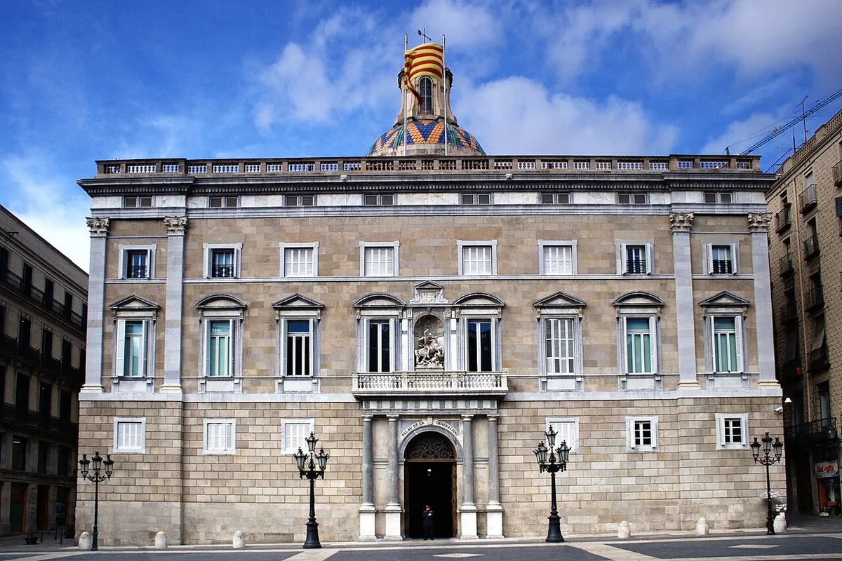
The Palau de la Generalitat. Photo: Jan Harenburg, CC BY 4.0, via Wikimedia Commons (resized). The Palau de la Generalitat is the seat of Catalonia's government and its presidency. The front on this square, built when the palace grew south at the end of the 16th century, was inspired by the Palazzo Farnese in Rome. Inside, the palace still keeps its Gothic gallery in its original form. Its story starts in 1400, in houses that had belonged to Jewish families.
More history
On 3 December 1400 the money-changer Pere Brunet sold the original house, on Carrer de Sant Honorat, to three deputies to set up the Diputació del General de Catalunya. That first building grouped properties once owned by Jews and was part of the Call. Marc Safont designed the chapel of Sant Jordi, built between 1432 and 1434, and the building was finished between 1616 and 1619. On 29 September 1977 the palace became the seat of the restored Generalitat.
-
El Call and the Major Synagogue, the medieval Jewish quarter
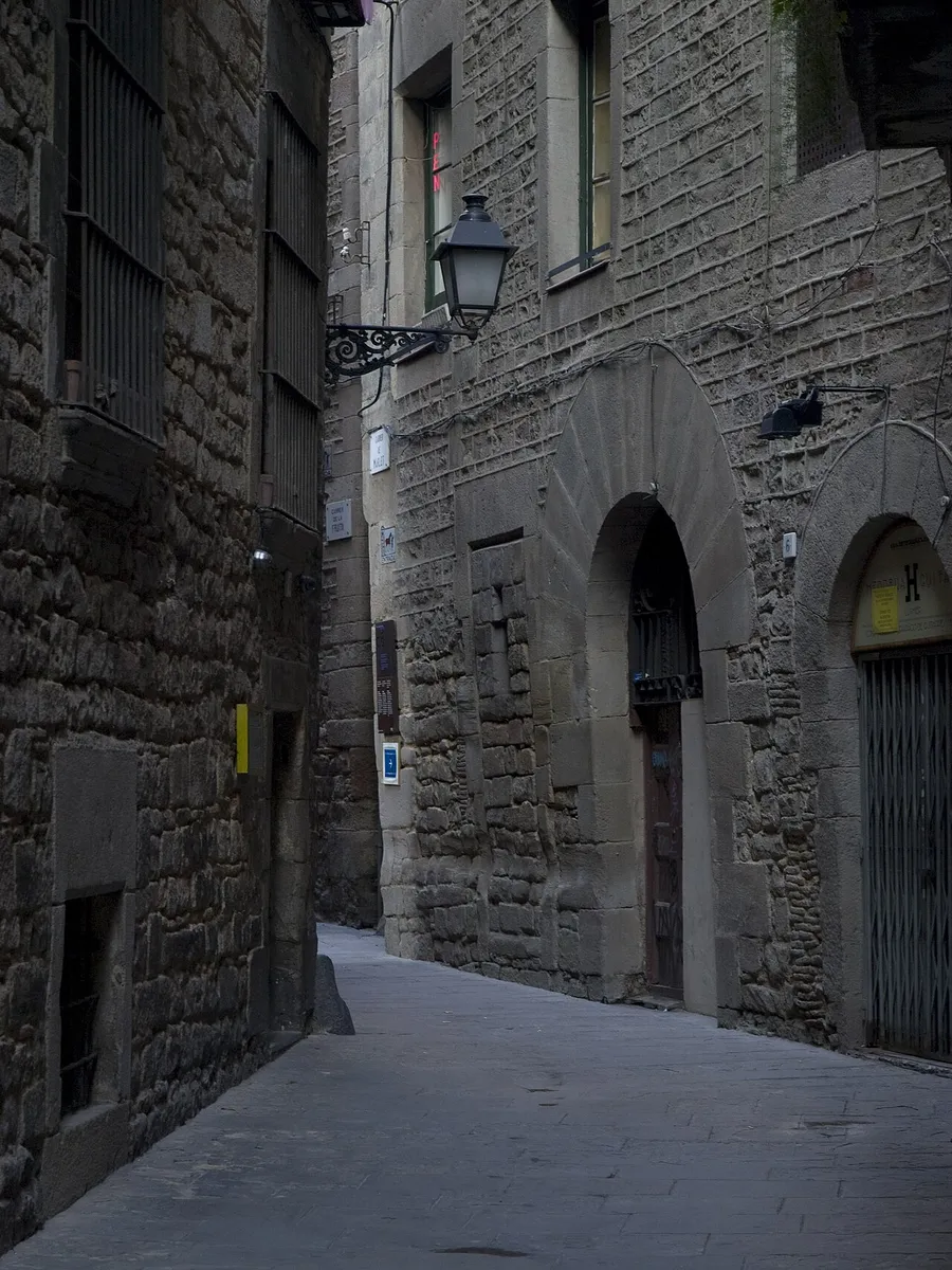
A lane in the Call. Photo: Mariusmm, derivative work by Malik Shabazz, CC BY-SA 3.0, via Wikimedia Commons (resized). Leave the square along Carrer de Sant Honorat and Carrer de la Fruita into Carrer de Salomó ben Adret. These lanes were the Call, Barcelona's Jewish quarter. The Major Synagogue stood at what is now number 9 of this street. It has disappeared: the block of flats there was built after it was demolished in 1861. Nearby, at Carrer de Marlet 5 and Salomó ben Adret 7, the Associació Call de Barcelona has recreated it.
More history
Jews probably reached Barcelona soon after the Roman colony of Barcino was founded. By the end of the 11th century the Call had fixed limits. By the 14th century the Jewish population was close to 4,000, and the Call was the most crowded part of the city. It had two gates, one at the arc del Gall, now called Sant Ramon. In 1391 the Call was attacked and 300 people died; those who took refuge in the Castell Nou were forced to convert, scattered or killed.
According to the records, the Major Synagogue had three parts: a free- standing hall for men, a women's section entered from what is now Carrer de Marlet, and a room of unknown use. After 1391 it passed to the Crown, and in 1392 King Joan I and Queen Violant gave it to the jurist Esperandreu Cardona. It passed through many owners, was left uninhabitable by the siege of 1713–1714, and was pulled down in 1861. MUHBA El Call, a Barcelona History Museum site in the middle of the Call, tells the story of the city's Jews.
Sources: Viquipèdia, Call de Barcelona; Viquipèdia, Sinagoga Major de Barcelona. Visiting MUHBA El Call: check hours on the MUHBA site.
-
Plaça Reial, a square with Gaudí's lamps
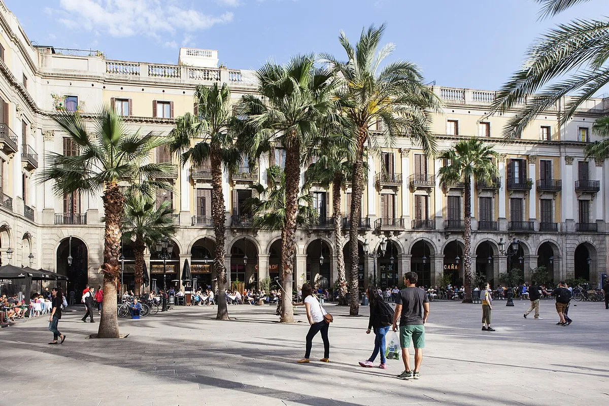
Photo: Paux127, CC BY-SA 4.0, via Wikimedia Commons (resized). Walk out along Carrer de Marlet and Carrer de l'Arc de Sant Ramon del Call, then down to Carrer de Ferran, and enter through the Passatge de Madoz. The two six-armed gas lamps are by Antoni Gaudí, from 1879: cast iron on marble bases, topped with two coiled serpents and a winged helmet. The square itself, by the architect Francesc Daniel Molina, was begun in 1850 on the site of a Capuchin convent.
More history
The land came free after the sale of church property in 1836. The city first planned a theatre, but a competition in 1848 for a closed square was won by Molina, who drew on French town planning of Napoleon's time. It was meant for the leisure of Barcelona's bourgeoisie. The centre was meant for a statue of Ferdinand the Catholic, but people smashed its plaster model with stones. The square's fountain, the Fountain of the Three Graces, is by Antoine Durenne. From 1931 to 1939 it was called Plaça de Francesc Macià.
Source: Wikipedia (Spanish), Plaza Real.
-
Santa Maria del Mar, the church its neighbourhood built
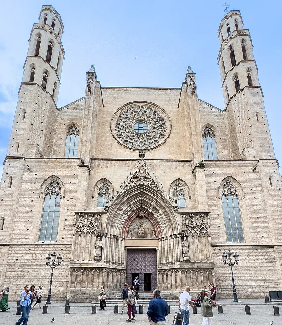
The main front. Photo: Kent Wang, CC BY-SA 4.0, via Wikimedia Commons (resized). The longest leg takes you along Carrer de Ferran and Carrer de Jaume I, across Via Laietana and down Carrer de l'Argenteria. The church was meant to belong only to its parishioners, and it seems the whole Ribera helped pay for it or build it. Look for the bastaixos, who carried its stone from the royal quarry on Montjuïc and from the beaches: they are shown on the capitals and on the bronze reliefs of the doors.
More history
An earlier church, Santa Maria de les Arenes, is documented in 998, over an early Christian cemetery; tradition places here Bishop Frodoí's discovery of Saint Eulalia's relics. The contract for the Gothic church was signed on 2 March 1329, King Alfons the Benign laid the first stone on 25 March, and the last keystone went in on 3 November 1383. The earthquake of 1428 brought down the rose window and killed about thirty people. The church burned on 19 and 20 July 1936 and lost its altarpieces. Its building is the subject of Ildefonso Falcones's novel L'església del mar.
Source: Viquipèdia, Santa Maria del Mar. Visiting: check hours on the basilica's official site.
-
Mercat del Born, a market over a buried city
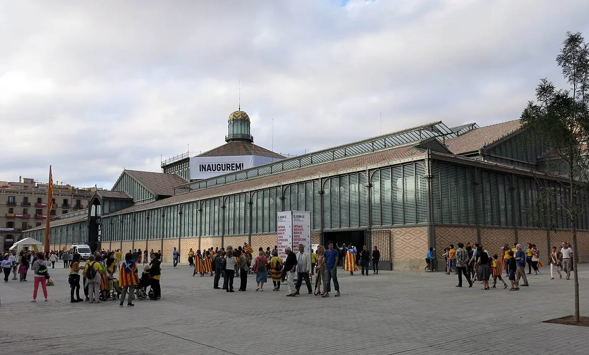
Photo: Enfo, CC BY-SA 3.0, via Wikimedia Commons (resized). Follow the Passeig del Born to the iron market hall at its end, built in 1874–1876 by Josep Fontserè and the engineer Josep Maria Cornet i Mas and inspired by Les Halles in Paris. Under its roof you look down on streets of late medieval La Ribera, uncovered in 2002. Today it is El Born, a site of the Barcelona History Museum that tells the story of the siege of 1713–1714. The walk ends here.
More history
It opened in 1876 as the Ribera's market, selling mostly fish, and from 1921 it was the city's wholesale fruit and vegetable market. It closed on 7 August 1971, and neighbours' campaigning saved it from demolition. In 2002, work to turn it into the Provincial Library uncovered the old streets; the remains were kept and the library went elsewhere. It opened as El Born Centre de Cultura i Memòria on 11 September 2013.
Source: Viquipèdia, Mercat del Born. Visiting: check hours on the MUHBA site.


.jpg)


Practical details
- Terrain
- Nearly flat: stops sit between about 10 and 30 m above sea level, gently downhill after Plaça de Sant Jaume. Old stone paving and narrow lanes.
- Step-free
- OpenStreetMap shows no steps on the route, and marks Jaume I and Barceloneta metro stations as wheelchair accessible.
- Water and toilets
- Free drinking fountains near the cathedral, Jaume I metro, Plaça Reial and the Born. A paid, step-free toilet beside the cathedral, a free one 150 m north of it (not step-free), and free toilets at the Born. All from OpenStreetMap.
- Where to sit
- Café terraces under the Plaça Reial arcades; OpenStreetMap maps benches near Jaume I metro and outside the Born.
- When to go
- The lanes are narrow and fill up, so an early start is easier. Buildings you can enter keep their own hours: see the official sites linked under each stop.
- Shorter walks
- Finish at stop 7, El Call (0.9 km, about 45 minutes; Jaume I metro is 350 m away). Or skip Plaça Reial and go straight from El Call to Santa Maria del Mar: 1.9 km, about 75 minutes.
Walking distances and times from the OSRM foot router on OpenStreetMap data. Elevations from Open-Meteo. Checked 22 September 2026.
Questions people ask
How long does this Gothic Quarter self-guided walking tour take, and is there a map?
About 90 minutes: 2.6 km, 35 minutes of walking and ten stops. The map is on this page, and you can print it or save it as a PDF. For 45 minutes, finish at stop 7, El Call.
What is the Gothic Quarter known for?
Layers of history in a few streets: a temple of Roman Barcino, a cathedral that grew from an early Christian basilica, the seat of Catalonia's government, and El Call, the medieval Jewish quarter.
Are there Roman ruins in the Gothic Quarter?
Yes. Four columns of the Temple d'August, a building of Roman Barcino, stand inside Carrer del Paradís 10 (stop 4). It is a Barcelona History Museum (MUHBA) site, so check its opening times.
Is the Gothic Quarter safe at night?
We have no reliable figures, so we won't rate it either way. The practical advice is the same as in any busy old town: the lanes are narrow and crowded, so keep your bag closed and in front of you, and your phone out of your back pocket.
Should I visit the Gothic Quarter or El Born?
This walk does both. Stops 1 to 8 are in the Gothic Quarter. Then you cross Via Laietana into La Ribera, the El Born side, for Santa Maria del Mar and the Mercat del Born.
Walk it with Strolio
Open Strolio at Barcelona Cathedral and ask for a 90-minute walk through the Gothic Quarter and El Born. Stories play as you reach each place, and you can ask about anything else you pass, by voice or with a photo. This is one example: you can also start from your own street and choose your own time and interests.
More walks
- Gaudí and Modernisme on foot: about 2 hours in the Eixample. Plaça Reial's lamps (stop 8) are by Gaudí; that walk follows more of his work.
- El Born, from the 1714 graveyard to the Ciutadella: about 75 minutes. It starts where this walk ends and carries on through La Ribera, past Carrer de Montcada and the Palau de la Música.
- Gràcia's village squares: about an hour.
- Montjuïc, from the fountain to the Olympic ring: about 2.5 hours, uphill.
- Neighbourhood walks in Horta, Poblenou, Sants and Nou Barris.
Sources
- Viquipèdia: Carrer del Bisbe, Plaça de Sant Felip Neri, Temple d'August de Barcelona, Palau de la Generalitat de Catalunya, Call de Barcelona, Sinagoga Major de Barcelona, Santa Maria del Mar, Mercat del Born
- Wikipedia (Spanish): Catedral de la Santa Cruz y Santa Eulalia, Plaza Real
- Wikipedia (English): Topos V
- Opening times: Catedral de Barcelona, Santa Maria del Mar, Barcelona History Museum (MUHBA)
- Map data and places: © OpenStreetMap contributors, ODbL
- Photos: Wikimedia Commons contributors Fernando, Enfo, Manel Zaera, Mutari, Jan Harenburg, Mariusmm and Malik Shabazz, Paux127 and Kent Wang, credited under each photo