
O'Connell Street self-guided walking tour · 1 hour · map
O'Connell Street on foot: the GPO, Moore Street and the 1916 Rising
O'Connell Street is Dublin's main street and the stage of the 1916 Easter Rising. This one-hour walk goes from O'Connell Bridge up to the GPO and the Spire, into Moore Street, where the Rising ended, and down to the Liffey at Liberty Hall and the Custom House.
The Rising began on Easter Monday, 24 April 1916, and lasted six days. Irish Volunteers and the smaller Irish Citizen Army seized buildings across Dublin and proclaimed an Irish Republic, with their headquarters in the General Post Office. The British Army shelled the rebel positions, and 485 people were killed, 260 of them civilians. Most of the city's physical damage was on this street, then still officially Sackville Street. Between 1916 and 1922, which includes the Civil War fighting of 1922, about three-quarters of its properties were destroyed or demolished, so most of what you see dates from the early 20th century; only one Georgian town house, No. 42, is left.
A note on accuracy: the GPO you see is a rebuilt building behind its original front, Liberty Hall is a 1960s replacement, and the Moore Street houses are under conservation work. We say so at each stop, and every fact links to its source. The James Joyce statue on North Earl Street, the Abbey and Gate theatres and Parnell Square are on our Literary Dublin walk, so they are not repeated here.
- Start
- O'Connell Bridge, east side
- Finish
- The Famine memorial, Custom House Quay
- Distance
- 1.7 km, one way
- Time
- About an hour: 23 min walking and 8 stops, plus any museum visits
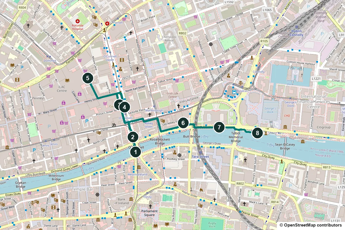
Terrain, toilets, opening times and getting back ↓
What to see: the stops
-
O'Connell Bridge, wider than it is long
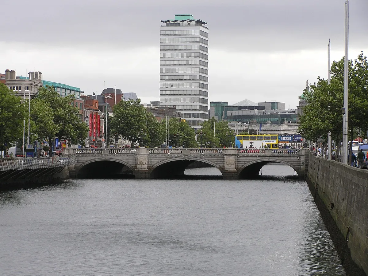
O'Connell Bridge from upstream, with Liberty Hall behind. Photo: Thpohl, public domain, via Wikimedia Commons (resized). Start on the east pavement of the bridge and look downstream: the tower is Liberty Hall and the green dome is the Custom House, stops 6 and 7. James Gandon designed the first bridge here, Carlisle Bridge, finished in 1794. It was the most easterly stone bridge on the Liffey, and it pulled the port eastwards, which made room for the Custom House. In the 1870s Bindon Blood Stoney, the port's engineer, replaced it with a bridge almost three times as wide. It now spans about 45 m of river and is about 50 m wide, so it is wider than it is long. Look over the parapet for the carved heads on the central arch and the triple cast-iron lamp standards. On 15 August 1882 it was renamed after Daniel O'Connell, the day his monument at its north end was unveiled.
More history
From the 1930s to the 1980s Arthur Fields, known as the Man on the Bridge, took more than 182,000 photographs of people crossing it.
Sources: NIAH, O'Connell Bridge; Wikipedia, O'Connell Bridge; Wikipedia, Easter Rising.
-
The O'Connell Monument and its bullet holes
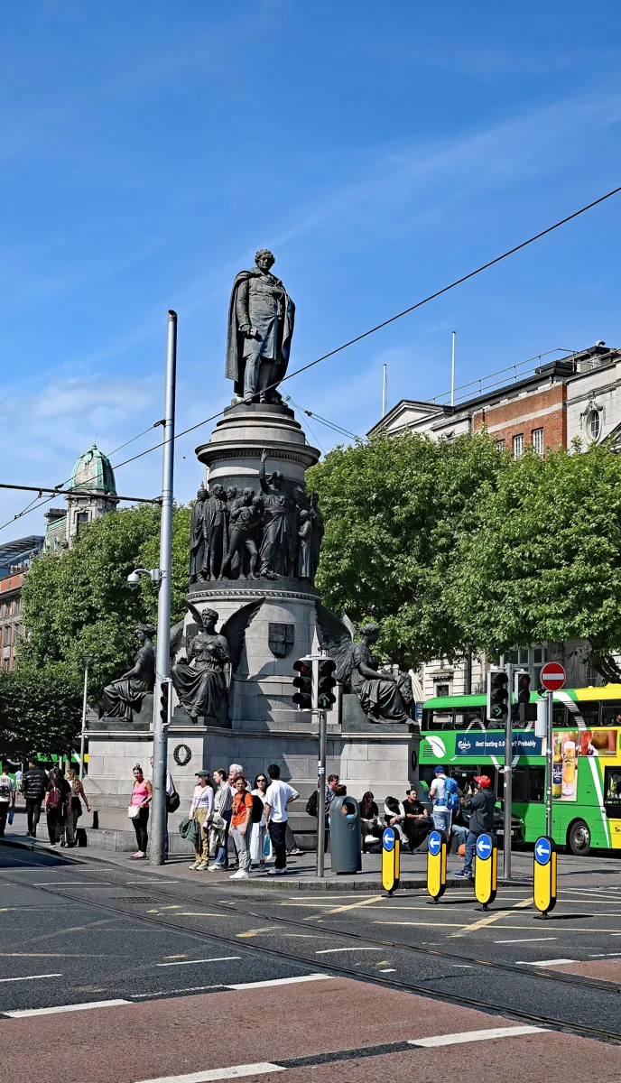
O'Connell above the frieze and the four winged victories. Photo: P. Hughes, CC BY 4.0, via Wikimedia Commons (resized). Walk north off the bridge to the monument on the central island at the foot of O'Connell Street. The Lord Mayor laid its two-ton Dalkey granite foundation stone on 8 August 1864. The committee rejected all 60 designs in the competition, so the Irish sculptor John Henry Foley took the job; he died in 1874, and his assistant Thomas Brock finished it. It was unveiled on 15 August 1882, and the four winged figures were added in May 1883. The whole monument is 40 feet high, and O'Connell, in bronze, looks south, with his back to where Nelson's Pillar stood. In the frieze of nearly thirty figures, Erin tramples chains and holds the 1829 Act of Catholic Emancipation, which O'Connell had won. The winged figures stand for Patriotism, Courage, Eloquence and Fidelity. Walk round them: two have bullet holes in their arms and breasts, left by the fighting of 1916 to 1922. Dubliners call the monument "the Angels".
More history
O'Connell was the first Catholic given a public monument like this, and the only Catholic to get a statue on Dublin's streets in the 19th century. At about 4 am on 26 December 1969 a bomb planted by the Ulster Volunteer Force shattered the figure of Courage into four pieces.
Sources: NIAH, O'Connell Monument; Dublin City Council, History of Monuments, O'Connell Street Area (2003); Wikipedia, O'Connell Monument.
-
The GPO, headquarters of the Rising
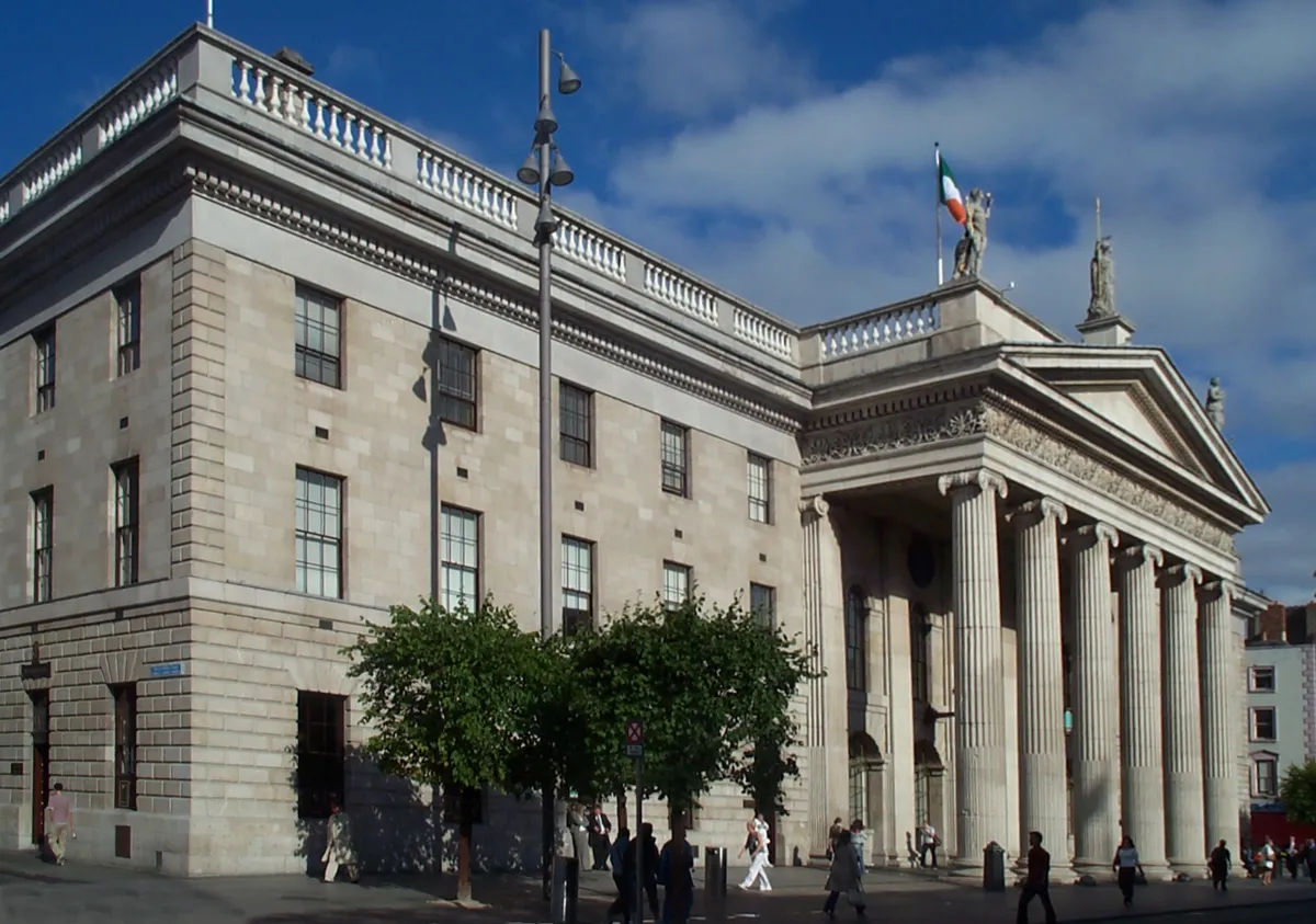
The GPO and its portico. Photo: Kaihsu Tai, CC BY-SA 3.0, via Wikimedia Commons (resized). Walk up the central island, cross to the west side of the street and carry on north to the portico. Francis Johnston designed the General Post Office, built in 1814–18; it opened in 1818. The portico of six Ionic columns is Portland stone; the rest is granite. The statues on the roof, Hibernia between Mercury and Fidelity, are replica casts. On Easter Monday 1916 about 400 Volunteers and Citizen Army members marched here from Liberty Hall, took the building and raised two flags, and Patrick Pearse read the Proclamation of the Irish Republic outside. By Friday, British shelling had set it on fire, and the garrison had to get out. Only Johnston's front survived. The Free State rebuilt the rest behind it, and it reopened in 1929. Look closely at the columns: the heritage record points out the small scars and bullet holes from the Rising. Oliver Sheppard's bronze of the dying hero Cúchulainn, made in 1911, was installed in the GPO in 1935 in memory of the Rising; it now stands in the central window behind the portico.
More history
The GPO Museum, which opened in March 2016 as GPO Witness History, tells the story from the Rising to modern times. An Post moved its headquarters out in June 2023, but this is still Dublin's main post office.
Sources: NIAH, General Post Office; Wikipedia, General Post Office; Wikipedia, Easter Rising. Visiting: hours and tickets on the GPO Museum's site.
-
Jim Larkin and the Spire, on the site of Nelson's Pillar
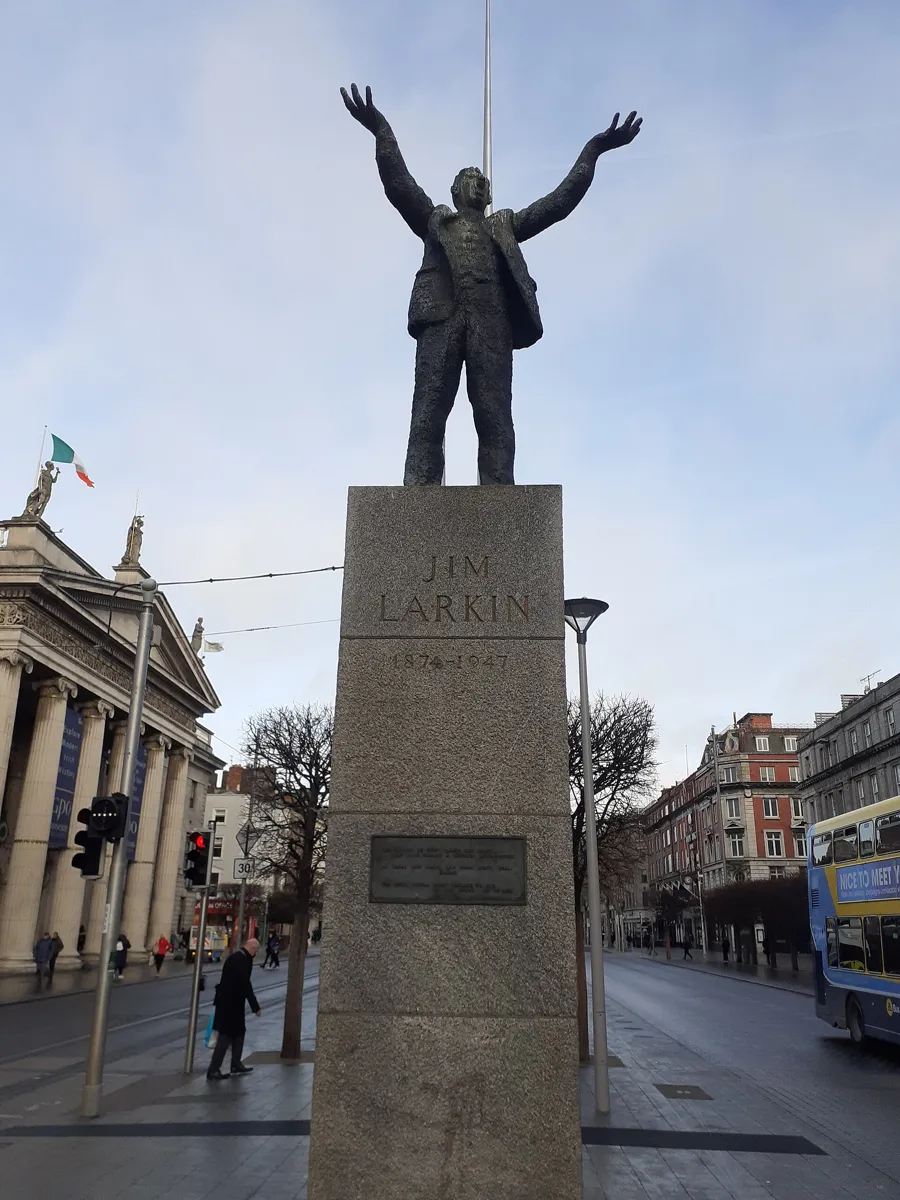
Larkin on the central island, with the GPO and the Spire behind. Photo: Darren J. Prior, CC BY-SA 4.0, via Wikimedia Commons (resized). Cross back to the central island, where Jim Larkin, the trade union leader, stands with both arms in the air. Oisín Kelly's bronze was unveiled on 15 June 1979. The base quotes, in English, Irish and French: "The great appear great because we are on our knees. Let us rise!" Across the street, on 31 August 1913, during the Lockout, Larkin got into the Imperial Hotel in disguise, past a ban on his meeting, and spoke to the crowd from a balcony; police baton-charged them. The hotel was in the building that became Clerys department store; it was destroyed in 1916, and the present building is from 1922. Then walk north along the island to the Spire. It is 120 m of stainless steel by Ian Ritchie Architects, 3 m wide at the base and 15 cm at the top, which is lit at night. It went up in 2002–03 on the site of Nelson's Pillar, a 134-foot column topped by a statue of Nelson, finished in 1809, which republicans blew up on 8 March 1966.
More history
On the Tuesday of Easter Week, Pearse stood in front of Nelson's Pillar to read a manifesto to the citizens of Dublin.
Sources: Dublin City Council, History of Monuments, O'Connell Street Area (2003); Wikipedia, James Larkin; Wikipedia, O'Connell Street; Wikipedia, Clerys; Wikipedia, Spire of Dublin; Wikipedia, Nelson's Pillar; Wikipedia, Easter Rising.
-
Moore Street, where the Rising ended
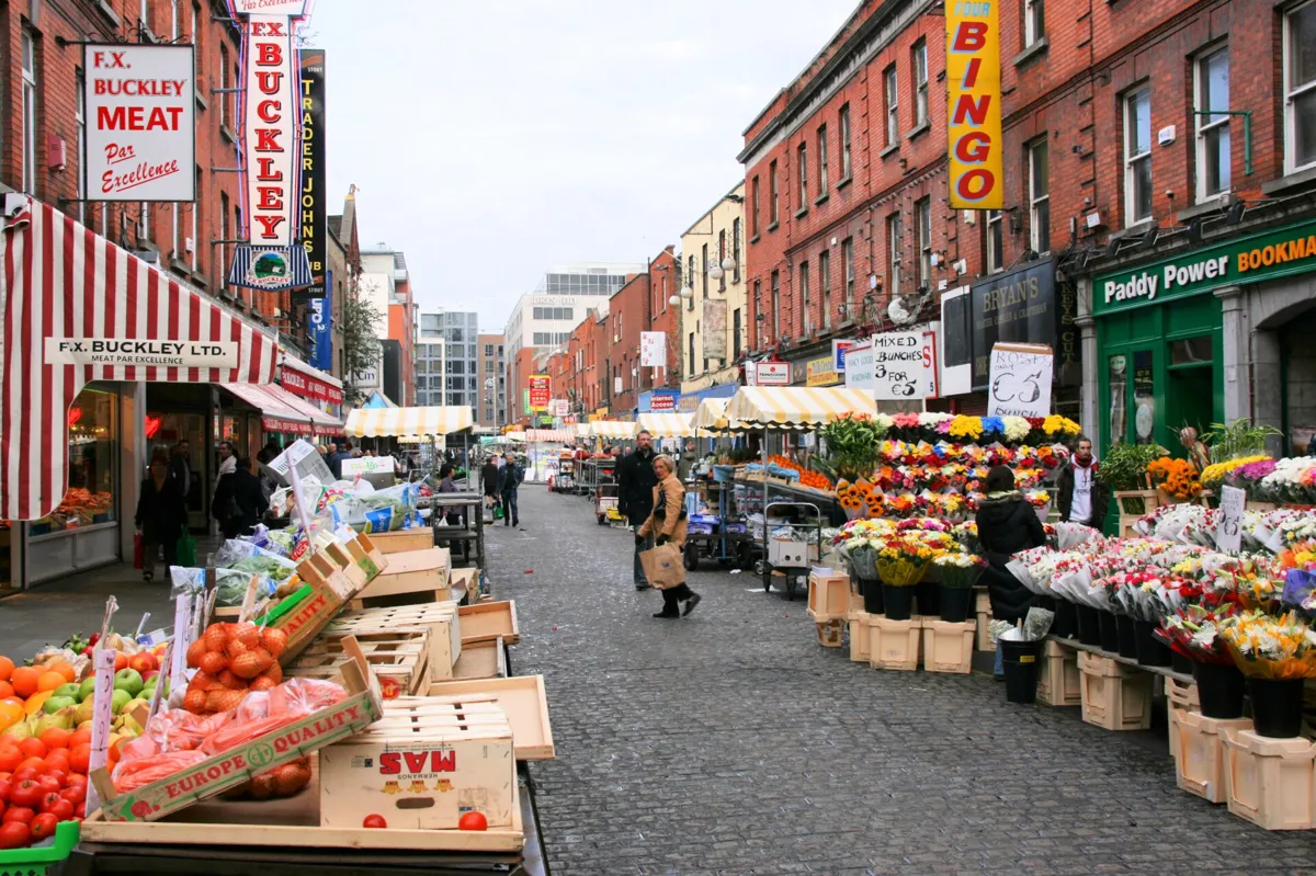
The street market on Moore Street. Photo: Marek Ślusarczyk (Tupungato), CC BY 2.5, via Wikimedia Commons. Cross back to the GPO side, walk west along Henry Street and turn right into Moore Street. Its open-air fruit and vegetable market is Dublin's oldest food market. Walk up to Nos. 14 to 17, on your right; No. 16 carries a plaque. By Friday 28 April 1916 the GPO was burning. The O'Rahilly, one of the Volunteer leaders, led a charge up this street and was cut down by a British machine gun at the top; he died in a lane close by. Meanwhile about 300 men ran from a side door of the GPO into Henry Place and Moore Lane, broke into No. 10 Moore Street and tunnelled through the walls along the terrace to No. 16, their last headquarters. There, on Saturday 29 April, the leaders decided to surrender. The story goes that Pearse made up his mind after watching from a window as a family was fired on and the father killed. The famous photograph of Pearse and the nurse Elizabeth O'Farrell handing the surrender to General Lowe was taken at the top of the street. The houses, built around 1760, became a national monument in 2007. The state bought them in 2015, and the Office of Public Works is turning them into a commemorative centre. Heritage Ireland lists them as an unguided site and says conservation work is under way.
More history
Five of the seven men who signed the Proclamation were in the terrace when it surrendered, with Michael Collins. The lane The O'Rahilly ran into, then Sackville Lane, is now O'Rahilly Parade. Before he died he scribbled a farewell note to his wife.
Sources: Heritage Ireland, Moore Street (no. 14–17); History Ireland, Save Moore Street!; Wikipedia, Moore Street; Wikipedia, Easter Rising; Wikipedia, The O'Rahilly; OpenStreetMap, 16 Moore Street.
-
Liberty Hall, where the rebels set out
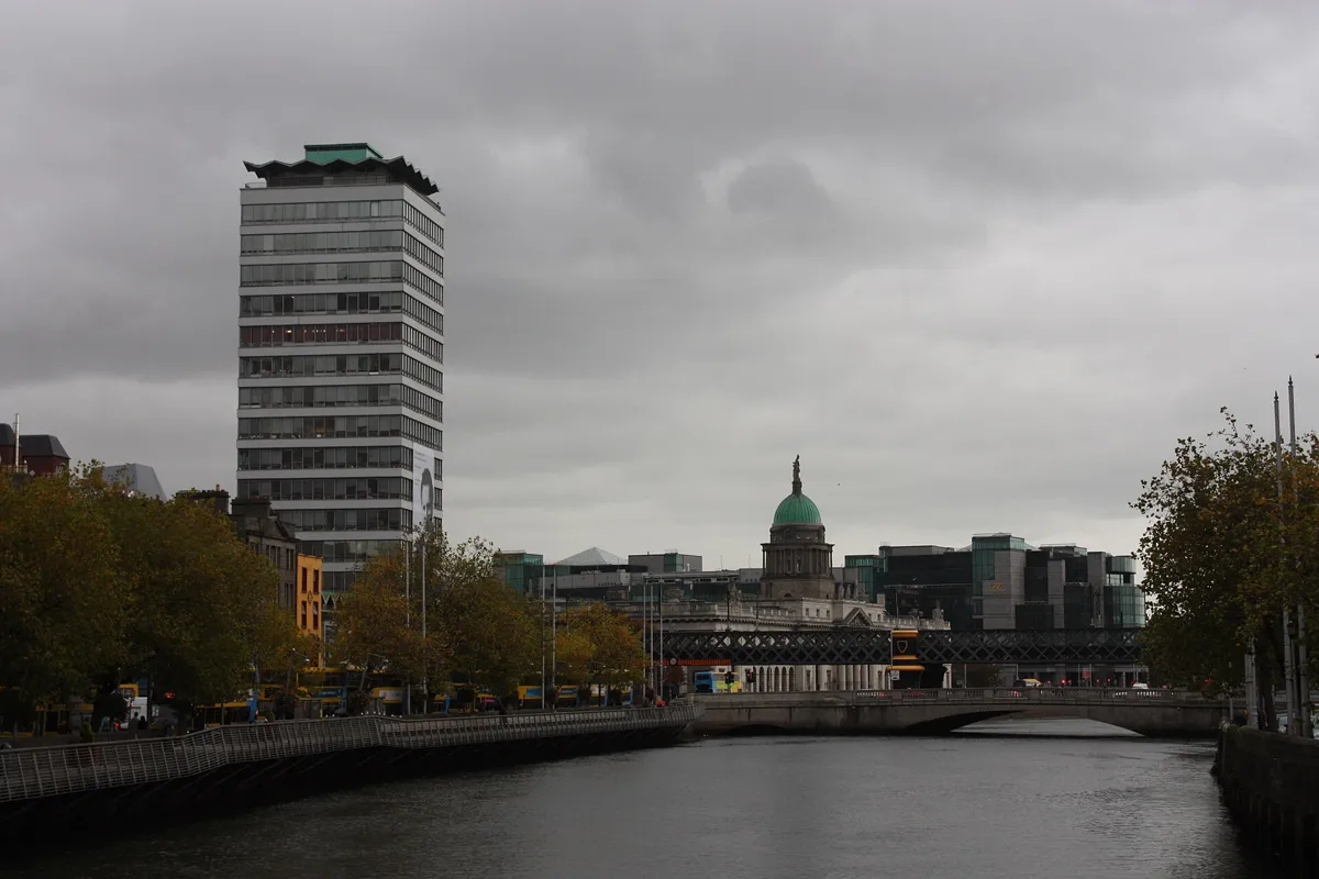
Liberty Hall, with the Custom House dome behind the railway bridge. Photo: Ardfern, CC BY-SA 3.0, via Wikimedia Commons (resized). Walk back down Moore Street, turn left along Henry Street and right down O'Connell Street past the GPO. Cross over and turn left into Lower Abbey Street, passing the Abbey Theatre (on our literary walk). Turn right down Marlborough Street to the river and left along Eden Quay. The building you see is not the one of 1916. This 16-storey tower, designed by Desmond Rea O'Kelly and finished in 1965, is 59.4 m high and was for a time the tallest building in Ireland; it is the headquarters of the union SIPTU. The old Liberty Hall, a former hotel, was the base of the Irish Transport and General Workers' Union and the Irish Citizen Army. In the 1913 Lockout it ran a soup kitchen for workers' families. Before the Rising, bombs and bayonets were made inside. On Easter Sunday the rebel Military Council met here and decided to rise the next day; on Monday the headquarters battalion formed up outside and marched to the GPO. On the Wednesday the gunboat Helga, on the Liffey, and guns at Trinity College shelled the hall, though only its caretaker was inside. It was repaired, but in the late 1950s it was declared unsafe and pulled down.
More history
Across Beresford Place, Éamonn O'Doherty's statue of James Connolly, leader of the Citizen Army, has faced Liberty Hall since 1996.
Sources: Wikipedia, Liberty Hall; Wikipedia, Easter Rising; Wikipedia, Beresford Place; Wikipedia, Eden Quay.
-
The Custom House, burned in 1921
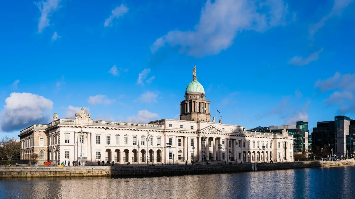
The Custom House from across the Liffey. Photo: Christian David, CC BY-SA 4.0, via Wikimedia Commons (resized). Carry on east, under the railway bridge, onto Custom House Quay and stop by the middle of the river front. John Beresford, Ireland's first commissioner of revenue, wanted a new custom house, and in 1781 he hired James Gandon, the architect of the first O'Connell Bridge; it was Gandon's first big commission. It opened on 7 November 1791, at a cost of £200,000. Look for Edward Smyth's fourteen carved river heads on the outside, which stand for Ireland's rivers. On 25 May 1921, in the War of Independence, about 120 IRA volunteers set it on fire. It was the headquarters of the Local Government Board, part of the British administration, and the aim was to disrupt British rule. Five IRA men and three civilians were killed, and about 80 volunteers were captured. The fire gutted Gandon's interior and brought down the dome. The Free State restored the building, rebuilding the dome in Irish Ardbraccan limestone, darker than the original Portland stone, as you can still see. A visitor centre has told the story inside since November 2021.
More history
Michael Collins argued against the attack but was overruled. Today the building houses the Department of Housing, Local Government and Heritage.
Sources: Heritage Ireland, Custom House Visitor Centre; Wikipedia, The Custom House; Wikipedia, Burning of the Custom House. Visiting: hours and tickets on Heritage Ireland.
-
The Famine memorial on Custom House Quay
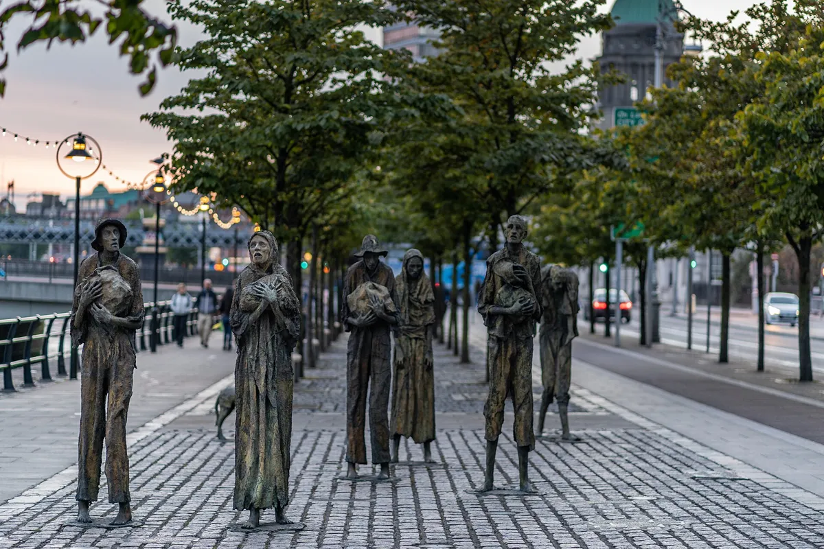
Rowan Gillespie's Famine on Custom House Quay. Photo: AlBa344, CC BY-SA 4.0, via Wikimedia Commons (resized). Continue east along Custom House Quay, past the end of Talbot Memorial Bridge, to the bronze figures by the river. The memorial, called simply Famine, is by the Dublin sculptor Rowan Gillespie and was given to the city in 1997. Norma Smurfit commissioned it to remember those who died in the Great Famine of 1845–1852 and the Irish who left; through death and emigration the famine halved the country's population. Six gaunt figures, among them a man carrying a child and a woman on her own, walk with their few belongings towards the docks, with a dog, its head down. The site was chosen because many emigrants sailed from this quay. Gillespie also made a companion group, Arrival, unveiled in Toronto in 2007. This is the end of the walk.
More history
In 1999 the Canadian prime minister, Jean Chrétien, unveiled a plaque here in English and French, in memory of the famine's victims and their descendants in Canada.
Sources: Wikipedia, Famine Memorial (Dublin); Wikipedia, Rowan Gillespie.


Practical details
- Terrain
- Flat all the way, with only a very gentle rise from the river up O'Connell Street. It is all paved city streets.
- Step-free
- OpenStreetMap maps no steps on the route. It marks the Westmoreland, Abbey Street and O'Connell - GPO tram stops near the start, and Tara Street station near the finish, as wheelchair accessible.
- Water
- OpenStreetMap lists no drinking-water fountains on the route, so bring a bottle.
- Toilets
- OpenStreetMap shows one toilet open to the public, free, in a McDonald's about 120 m from the GPO (stop 3). It is marked as not wheelchair accessible.
- When to go
- The GPO Museum opens Monday to Saturday, 10:00-17:00 (last admission 16:00), and is closed on Sundays, public holidays and Christmas Eve; online adult tickets are €15 and walk-in tickets €17. The Custom House Visitor Centre opens daily, 09:30-17:30 (last admission 16:45); adult tickets are €8 guided or €6 self-guided.
- Getting there
- The nearest tram stop to the start is Westmoreland, about 90 m away, and Tara Street station is about 320 m away.
- Getting back
- From the Famine memorial, the George's Dock tram stop (marked wheelchair accessible) is about 230 m away. The Busáras stop on the Luas Red Line, which OpenStreetMap marks as limited wheelchair access, is about 240 m away, and Tara Street station is about 300 m away.
Walking distances and times from the OSRM foot router on OpenStreetMap data. Stations, fountains and toilets from OpenStreetMap; opening times and prices from the GPO Museum and Heritage Ireland. Checked 5 October 2026.
Questions people ask
How long does an O'Connell Street walking tour take, and is there a map?
This one takes about an hour: 1.7 km, 23 minutes of walking and eight stops, from O'Connell Bridge to the Famine memorial on Custom House Quay. The route is flat. Add time if you visit the GPO Museum or the Custom House Visitor Centre. The map is on this page, and you can print it or save it as a PDF.
What happened at the GPO in 1916?
On Easter Monday, 24 April 1916, about 400 Irish Volunteers and Irish Citizen Army members marched from Liberty Hall, took over the General Post Office and made it the headquarters of the Rising. Patrick Pearse read the Proclamation of the Irish Republic outside. By the end of the week shelling had set the building on fire, and the garrison escaped to Moore Street. Only the front survived; the Free State rebuilt the rest, and it reopened in 1929.
Can you still see bullet holes from 1916 on O'Connell Street?
Yes. The heritage record for the GPO notes small scars and bullet holes on its front, columns and portico from the Rising. On the O'Connell Monument at the foot of the street, two of the four winged figures have bullet holes in their arms and breasts, left by the fighting of 1916 to 1922.
How tall is the Spire in Dublin?
120 metres. The stainless steel Spire by Ian Ritchie Architects went up in 2002 and 2003 on the site of Nelson's Pillar, a 134-foot column that republicans blew up in March 1966. It is 3 metres wide at the base and 15 centimetres at the top, which is lit at night.
Where did the 1916 leaders surrender?
On Moore Street. After leaving the burning GPO, the garrison tunnelled through a terrace of houses to No. 16 Moore Street, and there on Saturday 29 April 1916 the leaders decided to surrender. Pearse surrendered unconditionally to Brigadier-General Lowe; the photograph of the surrender was taken at the top of Moore Street. Nos. 14 to 17 are now a national monument, being turned into a commemorative centre.
Walk it with Strolio
Open Strolio on O'Connell Bridge and ask for an hour on O'Connell Street and the 1916 Rising. Strolio builds walks in any city with mapped streets, so its route may pick different stops from this page. Stories play as you reach each place, and you can ask about anything else you pass, by voice or with a photo. You can also start from your hotel and choose your own time and interests.
More walks in Dublin
- Georgian and medieval: ~90 min, 8 stops. Oscar Wilde's square, the Book of Kells, the old Parliament, Temple Bar and both medieval cathedrals.
- Literary Dublin: ~1 h 40 min, 8 stops. From Joyce's bust on St Stephen's Green past Bloom's pub, the Abbey and the Gate to the James Joyce Centre.
- The Liberties to Kilmainham: ~90 min, 7 stops. Marsh's Library to the Guinness Storehouse and Kilmainham Gaol, through the old Liberties.
- All Dublin walks, with maps side by side.
- Walks in other cities.
Sources
- National Inventory of Architectural Heritage (Buildings of Ireland): the records for O'Connell Bridge, the O'Connell Monument and the General Post Office. We used their facts and wrote our own text.
- Dublin City Council: History of Monuments, O'Connell Street Area (Archive Consultants, 2003)
- Official sites: GPO Museum, Heritage Ireland (Office of Public Works) for 14–17 Moore Street and the Custom House Visitor Centre
- History Ireland: Save Moore Street!
- Wikipedia: Easter Rising, O'Connell Street, O'Connell Bridge, O'Connell Monument, General Post Office, James Larkin, Clerys, Spire of Dublin, Nelson's Pillar, Moore Street, The O'Rahilly, Liberty Hall, Beresford Place, Eden Quay, The Custom House, Burning of the Custom House, Famine Memorial, Rowan Gillespie
- Map data and places: © OpenStreetMap contributors, ODbL; walking route from the OSRM foot router run by FOSSGIS
- Photos: Wikimedia Commons contributors Thpohl, P. Hughes, Kaihsu Tai, Darren J. Prior, Marek Ślusarczyk (Tupungato), Ardfern, Christian David and AlBa344, credited under each photo