
Amsterdam canal self-guided walking tour · 90 minutes · map
Amsterdam canal walk: from the Munttoren along the Golden Bend to the Rijksmuseum
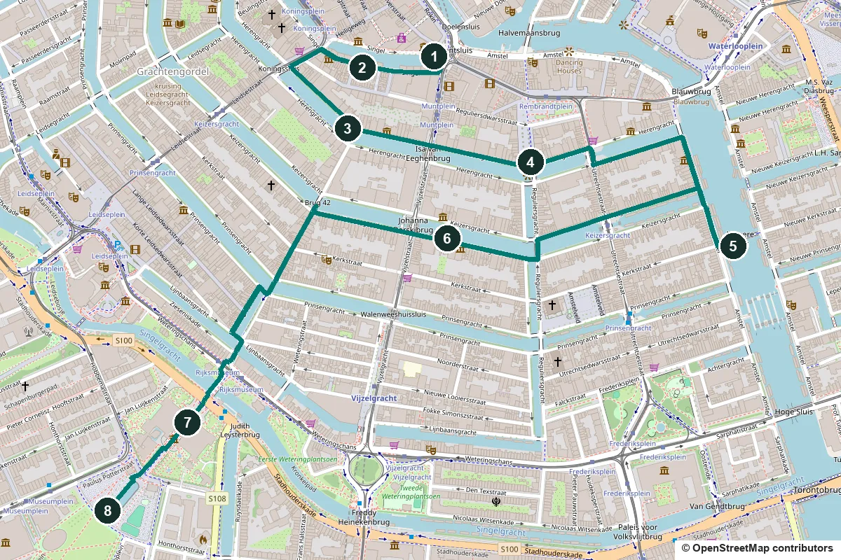
The canals are what most people come to Amsterdam to see. This 90-minute walk starts at the Munttoren, passes the flower market and the Golden Bend of the Herengracht, finds the Reguliersgracht with its seven bridges and crosses the Amstel at the Magere Brug. It ends by walking through the Rijksmuseum itself, along the passage under the building, to the Museumplein.
The canal ring was dug in the 17th century. The decision to lay it out was taken on 5 March 1613, and work began at the Brouwersgracht. Its four main canals, the Singel, Herengracht, Keizersgracht and Prinsengracht, bend round the old centre and end in the Amstel. This walk touches all four. Since 2010 the canal ring has been a UNESCO World Heritage Site. Many of the houses along it date from the 18th century rather than the 17th, and have been rebuilt several times. The western half of the ring is on our Jordaan walk.
A note on accuracy: where a building has been rebuilt, or a date is disputed, we say so, and every fact links to its source.
- Start
- The Muntplein, at the foot of the Munttoren (82 m from the Muntplein tram stop, 289 m from the Rokin metro entrance)
- Finish
- The Museumplein, behind the Rijksmuseum, 126 m from the Museumplein tram stop
- Distance
- 3.5 km, one way
- Time
- About 90 minutes: 47 min walking and 8 stops, plus any visit to Museum Van Loon, the KattenKabinet or the Rijksmuseum
Toilets, opening days, step-free notes and a shorter version ↓
What to see: the stops
-
The Munttoren, a gate tower named for its mint
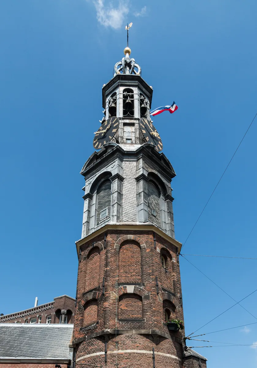
The Munttoren. Photo: Dietmar Rabich, CC BY-SA 4.0, via Wikimedia Commons (resized). Start on the Muntplein at the foot of the tower, where the Amstel meets the Singel canal. The tower is what is left of the Regulierspoort, one of the three main gates in the medieval city wall, built between 1480 and 1487. It was named after the Reguliers monastery. A fire wrecked the gate in 1618, and only the western tower was rebuilt. In 1619 and 1620 it was given the eight-sided top and the open lantern designed by Hendrick de Keyser, with a clock on four sides. The tower is 35 m high. The name comes from the coins struck in the guard house next to it in 1672, the "year of disaster". French troops held much of the country, and silver and gold could not safely travel to the usual mints. The guard house you see today is not the medieval one. It is a neo-Renaissance building of 1885 to 1887 by the architect Willem Springer.
More history
The tower's carillon (a set of tuned bells) dates from 1668, when the bell founder Pieter Hemony enlarged a set that he and his brother had made for the old stock exchange tower. It now has 38 bells, and the city carillonneur plays a concert on Saturdays at 14:00.
Sources: Wikipedia (nl), Munttoren; Wikipedia, Munttoren.
-
The Bloemenmarkt, a flower market on the Singel
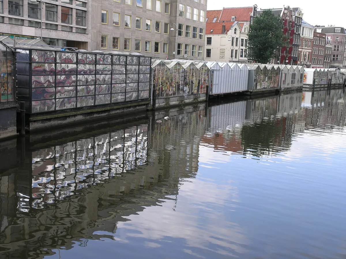
The stalls along the Singel. Photo: חזרתי, CC BY 4.0, via Wikimedia Commons (resized). From the tower, walk west along the Singel with the water on your right. The stalls line the canal between the Muntplein and the Koningsplein. The market's English name calls it floating, and it did start on the water: from 1862 plants and trees were sold from boats that brought them in daily from nurseries outside the city. Late in the 20th century the boats were replaced by concrete bases carrying stalls that look like small greenhouses, so today it feels like a row of shops. The market moved here in 1862 from the Sint-Luciënwal, by the Nieuwezijds Voorburgwal. The oldest mention of it, from 1620, is at that earlier spot. Today it sells mostly bulbs and souvenirs. A 2019 survey, quoted by the English Wikipedia, found that bulbs bought here rarely flowered, so check what you are buying.
More history
Few cut flowers were sold here until the 1960s. Amsterdammers now buy plants and flowers at the markets on the Amstelveld and the Noordermarkt. In 2022 an advice said the Bloemenmarkt should change its character or be closed, because it no longer serves locals.
Sources: Wikipedia (nl), Bloemenmarkt; Wikipedia, Bloemenmarkt.
-
The Golden Bend of the Herengracht
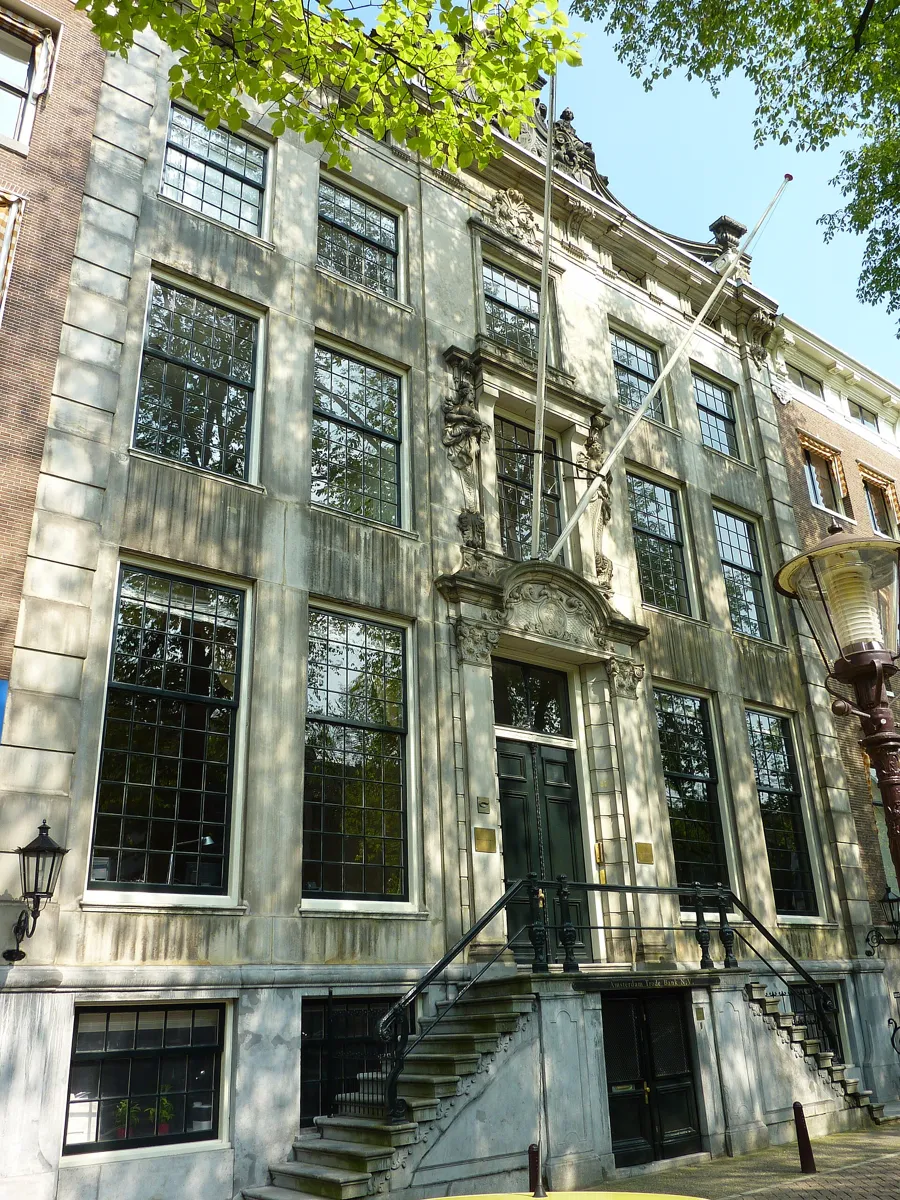
Herengracht 475, the House De Neufville. Photo: Rudolphous, CC BY-SA 3.0, via Wikimedia Commons (resized). Keep on along the Singel to the Koningsplein, then follow the Herengracht (344 m from the flower market) to the corner of the Nieuwe Spiegelstraat. You are in the Gouden Bocht, the Golden Bend, the grandest stretch of the canal between the Leidsestraat and the Vijzelstraat. Until 1663 the Herengracht ended at the Leidsegracht. When the canal ring was extended, the canal was given a kink at the Nieuwe Spiegelstraat. Here the three canals were laid further apart, so the plots on the south side are deeper. They were sold between 1664 and 1668, and the mayors pushed buyers to take double plots. Rich merchants and regents built grand houses with classical fronts, stuccoed ceilings and gardens. Number 466, on this corner, was the office of the Nederlandsche Handel-Maatschappij from 1858 to 1926. Number 475, the House De Neufville of 1731, is sometimes called the most beautiful house on the Bend. About 80 m further on, number 497 holds the KattenKabinet, a small museum of cat art, founded in 1990 in memory of a red tomcat named after the banker J. P. Morgan. Many of the houses on the Bend are now offices of banks and insurers.
More history
Many early owners were directors of the East and West India companies, the VOC and the WIC. Their houses were decorated by well-known artists: Jan van Logteren made stucco ceilings, and Gerard de Lairesse and Jacob de Wit painted ceiling pieces.
Sources: Wikipedia (nl), Gouden Bocht; Wikipedia, Gouden Bocht; Wikipedia (nl), KattenKabinet; Wikipedia, Herengracht. Visiting the KattenKabinet: kattenkabinet.nl (tickets online).
-
The Reguliersgracht and its seven bridges
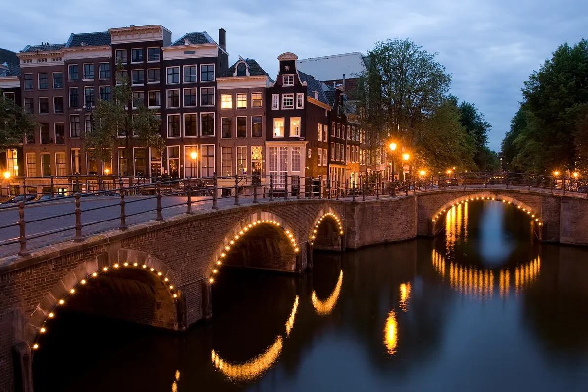
The Reguliersgracht from its corner with the Keizersgracht, at dusk. Photo: Massimo Catarinella, CC BY-SA 3.0, via Wikimedia Commons (resized). Follow the Herengracht east (398 m) to the Thorbeckeplein at numbers 561 and 563, where the Reguliersgracht meets it. The square is the filled-in northern end of the canal, which was closed in 1785. Seven arched bridges cross the Reguliersgracht. The Dutch Wikipedia says the view from the Herengracht runs under all seven, and it describes that view from a tour boat. Look across the Herengracht and down the canal from here. You will cross the Reguliersgracht itself on your way to stop 6. The canal was dug from 1658 and named after the Reguliers monastery, which stood outside the city gate from 1394 to 1532. It was meant to reach the Amstel, but the plan was dropped because buying the houses on the Halvemaansteeg would have cost more than the new plots earned. In 1901 the city wanted to fill in what was left, to make room for the electric tram, and was stopped by protests. Ferdinand Leenhoff's statue of Thorbecke, who helped shape the Dutch constitution, was unveiled here in 1876. He faces the Reguliersgracht, not his square.
More history
On the way here, just beyond the Vijzelstraat, number 502 on the Herengracht, the House with the Columns of 1672, has been the mayor's official residence since 1927. A drinking tap and a free toilet are mapped close to this stop (see the practical details).
Sources: Wikipedia (nl), Reguliersgracht; Wikipedia (nl), Thorbeckeplein; Wikipedia (nl), Herengracht; Wikipedia (nl), Huis met de Kolommen.
-
The Magere Brug over the Amstel
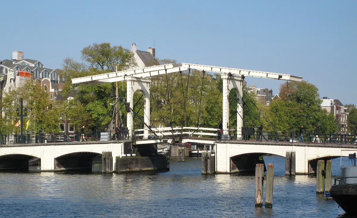
The Magere Brug over the Amstel. Photo: S Sepp, CC BY-SA 3.0, via Wikimedia Commons (resized). Continue east along the Herengracht, across the Utrechtsestraat, to the Amstel, where the canal ends. Turn right and walk south along the river to the bridge at the Kerkstraat, between the Keizersgracht and the Prinsengracht. The Magere Brug, the "skinny bridge", is a double drawbridge of white-painted wood. Since 2003 only walkers and cyclists have used it, and it is a national monument. The Dutch Wikipedia explains the name: a broad stone bridge was planned here in the 1660s, but the bad year of 1672 scrapped it, and when a bridge was finally built in the 1690s it was cheaper, wooden and narrower. The tale of two thin sisters who paid for it is, it says, invention. The first bridge here was built in or just after 1691. The present one dates from 1934. It has steel beams and a concrete foundation, hidden behind a wooden skin. Up to 1994 two bridge keepers opened it by hand, and it is lit by lights in the evening. It also appears in the 1971 James Bond film "Diamonds Are Forever".
More history
The bridge carries replicas of lanterns by Jan van der Heyden, which the Dutch Wikipedia calls Amsterdam's oldest street lamps (17th century). A concert is held at the bridge every year on Liberation Day.
Sources: Wikipedia (nl), Magere Brug; Wikipedia, Magere Brug.
-
Museum Van Loon, a canal house with its garden
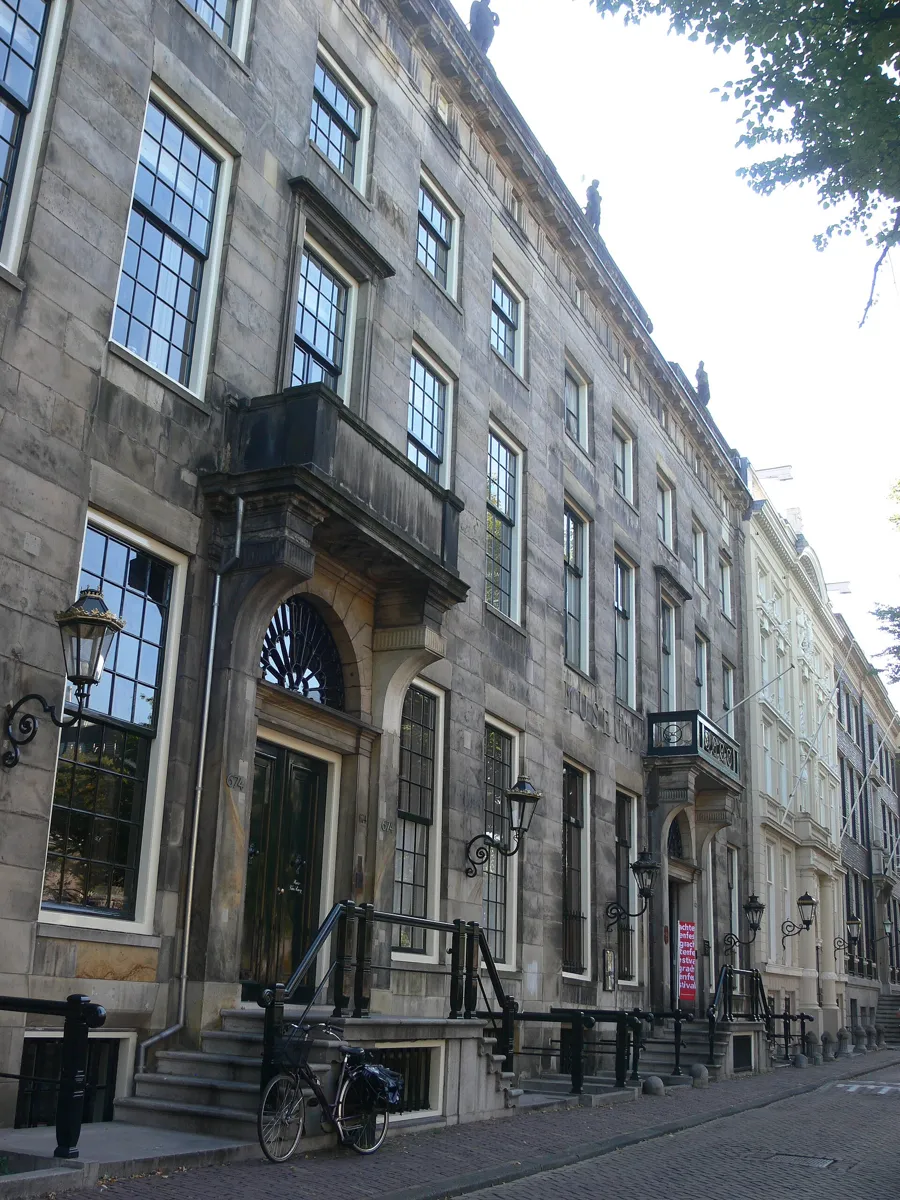
The fronts of Keizersgracht 672 and 674. Photo: Remi Mathis, CC BY-SA 3.0, via Wikimedia Commons (resized). Walk back north along the Amstel to the Keizersgracht and turn left (west). You cross the Reguliersgracht on the way: stop on the bridge and look down the canal, which is the view in the photo at stop 4. Museum Van Loon is at Keizersgracht 672, a little further on. It stands in a pair of twin houses, 672 and 674, built in 1671 and 1672 for Jeremias van Raey, a Flemish merchant, to a design by Adriaan Dortsman. Four Greek and Roman gods stand on top of the shared front. The first tenant of number 672 was the painter Ferdinand Bol, a pupil of Rembrandt. The Van Loon family bought the house in 1884, when Hendrik van Loon gave it to his son Willem as a wedding present. The family's history goes back to 1602, when Willem van Loon helped to found the VOC. The house opened to the public in 1973. Behind it are a garden in 17th-century style and a coach house. The museum is open about this past. Exhibitions such as Suspended Histories (2013) and Aan de Surinaamse grachten (2019) deal with the family's links to the VOC, the WIC and the plantation system.
More history
The coach house, on the Kerkstraat behind the garden, was bought by the museum in 2009 and restored. On the garden front of the coach house the upstairs windows are false, because the owners did not want the staff looking out at the garden.
Sources: Museum Van Loon, Huis (nl); Museum Van Loon, Familie Van Loon (nl); Wikipedia (nl), Museum Van Loon; Wikipedia, Museum Van Loon. Visiting: opening hours and prices (the museum's own site).
-
The Rijksmuseum passage, a street through a museum
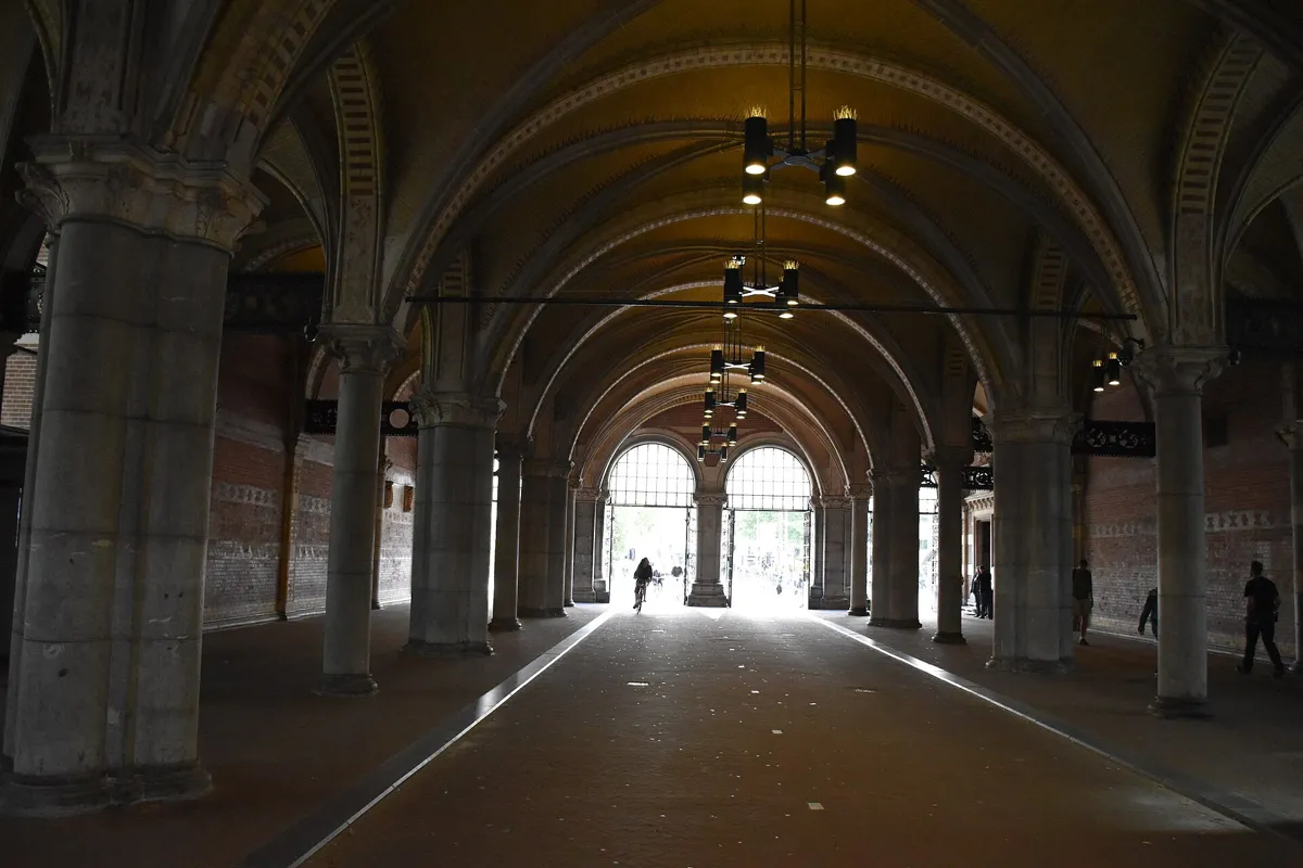
Inside the passage. Photo: Vasyatka1, CC BY-SA 4.0, via Wikimedia Commons (resized). Walk west along the Keizersgracht to the Nieuwe Spiegelstraat, turn left, cross the Prinsengracht and keep going down the Spiegelgracht to the museum (894 m from the last stop). The street and canal are the heart of the Spiegelkwartier, a neighbourhood known for antique shops and galleries. The Spiegelgracht was dug in 1663 and is named after the Spiegel family. The Rijksmuseum is the work of Pierre Cuypers, and it opened in 1885. It stands on about 8,000 wooden piles. The city of Amsterdam required the building to act as a gate to a villa district planned to the south, which is why a wide passage runs through its middle. At first all traffic could use it, and a horse tram was even drawn on an old print. Cars were banned in 1931 because of the vibrations. During the long renovation, from 2003 to 2013, people argued about whether to open the passage to bikes again, and it did reopen to cyclists on 13 May 2013. Walk through it on the side, and watch for bikes.
More history
In 1953 a brick road was laid from the passage across the field behind the museum. It was called the "shortest motorway in the Netherlands" and was meant to link the city centre to the motorway from The Hague. Neighbours protested and the link was never built, but the road stayed until 1997.
Sources: Wikipedia (nl), Rijksmuseumgebouw; Wikipedia (nl), Rijksmuseum; Wikipedia (nl), Spiegelgracht; Wikipedia (nl), Museumplein. Visiting the museum: opening hours and booking.
-
The Museumplein, a square on the site of seven windmills
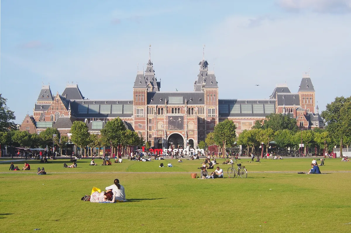
The Rijksmuseum from the Museumplein. Photo: C messier, CC BY-SA 4.0, via Wikimedia Commons (resized). Go on through the passage, the Museumstraat, onto the Museumplein (282 m from the passage stop). The Rijksmuseum is behind you. Around the square are the Van Gogh Museum, the Stedelijk Museum and the Concertgebouw. From the 17th century there were seven windmills here, mainly sawmills and grain mills. The last were pulled down in 1878 to make room for the museum. The empty site held the 1883 International Colonial and Export Exhibition. Part of it became an ice rink in 1887, where the first official world speed skating championships were held in 1893. The square got its name in 1903. The present park dates from 1999, designed by the landscape architect Sven-Ingvar Andersson. Look for the sloping lawn called the "donkey's ear", with a car park and a supermarket under it. The giant "I amsterdam" letters stood here from 2005 until December 2018, when the city removed them as part of its fight against mass tourism.
More history
The pond behind the museum was demolished in 2024 because of long-running leaks, to be replaced by a new one, so check what you find. In winter the pond has been used as an ice rink.
Sources: Wikipedia (nl), Museumplein; Wikipedia, Museumplein.


Practical details
- Terrain
- Flat, on paved streets and canal quays, with a few canal bridges.
- Step-free
- OpenStreetMap maps a few flights of steps 74 to 121 m from the Rijksmuseum passage and the Museumplein stops. Museum Van Loon says its historic houses are hard to enter in a wheelchair, because of the many stairs, steps and thresholds. OpenStreetMap marks the Muntplein and Museumplein tram stops as wheelchair accessible, and the Rijksmuseum tram stop as not.
- Water
- OpenStreetMap lists Waternet drinking taps by the Munttoren, near the flower market, on the Thorbeckeplein and on the Museumplein.
- Toilets
- OpenStreetMap shows free toilets near the flower market, a free one open around the clock about 150 m from the Golden Bend (not wheelchair accessible), one by the Thorbeckeplein and a paid one on the Museumplein.
- Sit and eat
- Museum Van Loon has a café with coffee, tea and apple pie. The Rijksmuseum has Het Café. The Thorbeckeplein has been a going-out square for decades, with many cafés.
- When to go
- Museum Van Loon opens daily 10:00 to 17:00 (closed on King's Day, 25 December and 1 January; closes at 15:00 on 24 and 31 December). An adult ticket cost €17.50 when we checked. The KattenKabinet opens Tuesday to Sunday 12:00 to 17:00, with tickets bought online. The Rijksmuseum opens daily 9:00 to 17:00 and asks everyone to book a start time. Its garden is free to enter. The Munttoren's carillon concert is on Saturdays at 14:00. Check all of these before you go.
- Shorter walk
- Finish at stop 5, the Magere Brug: 1.6 km, about 45 minutes with five stops.
- Getting back
- From the Museumplein, the Museumplein tram stop is about 126 m away, and the Concertgebouw stop about 304 m. The Dutch Wikipedia lists trams 2, 3, 5 and 12 at the Museumplein stop, but check a route planner.
Walking distances and times from the OSRM foot router on OpenStreetMap data. Tram stops, drinking taps and toilets from OpenStreetMap; opening hours and prices from Museum Van Loon, the KattenKabinet and the Rijksmuseum. Checked 5 October 2026.
Questions people ask
How long is a self-guided canal walk in Amsterdam?
This one is 3.5 km, 47 minutes of walking, and about 90 minutes with its eight stops, from the Munttoren to the Rijksmuseum and the Museumplein. Going into Museum Van Loon or the Rijksmuseum adds more time. The map is on this page, and you can print it or save it as a PDF. For a shorter walk, stop at the Magere Brug (stop 5): 1.6 km, about 45 minutes.
Are Amsterdam's canals a UNESCO World Heritage Site?
Yes. The Seventeenth-Century Canal Ring Area of Amsterdam inside the Singelgracht was inscribed in 2010 (UNESCO dossier 1349), under criteria (i), (ii) and (iv). The protected area covers 198.2 hectares, with a buffer zone of 481.7 hectares. UNESCO calls the canal district a new port city built from the end of the 16th century and a model of large-scale town planning.
What is the Golden Bend in Amsterdam?
The Gouden Bocht is the grandest stretch of the Herengracht, between the Leidsestraat and the Vijzelstraat. The Herengracht ended at the Leidsegracht until 1663, when the canal ring was extended. Plots here were sold between 1664 and 1668, and the mayors encouraged buyers to take double plots. Today many of them hold banks, insurers and offices, plus a few small museums such as the KattenKabinet at number 497.
Can you walk through the Rijksmuseum?
Yes, along the passage under the building. It is a public way for pedestrians and cyclists, and cars have not been allowed through since 1931. The passage reopened to bikes on 13 May 2013, after the ten-year renovation. You need a timed ticket only to see the art. The museum opens daily from 9:00 to 17:00 and asks everyone to book a start time, and its garden is free to enter.
Where can you see the seven bridges in a row in Amsterdam?
On the Reguliersgracht. Seven arched bridges cross it, and the Dutch Wikipedia says the Herengracht gives a view under all seven, which it describes as seen from a tour boat. This walk looks down the canal at stop 4, on the Herengracht, and crosses the Reguliersgracht at its corner with the Keizersgracht on the way from stop 5 to stop 6.
Walk it with Strolio
Open Strolio at the Munttoren and ask for 90 minutes along the Amsterdam canals. Strolio builds walks in any city with mapped streets, so its route may pick different stops from this page. Stories play as you reach each place, and you can ask about anything else you pass, by voice or with a photo. You can also start from your hotel and choose your own time and interests.
More walks in Amsterdam
- The Jordaan: ~80 min, 8 stops. The Nine Streets, Rembrandt's Westerkerk, the Anne Frank House, a 1650 widows' courtyard and the Brouwersgracht.
- Old Centre and Red Light District: ~75 min, 8 stops. From Centraal Station through De Wallen, past Amsterdam's oldest church and a hidden attic church, to the Dam and the Begijnhof.
- The Jewish Quarter: ~75 min, 8 stops. Rembrandt's house, two 17th-century synagogues, the February Strike statue and the Holocaust memorials of the Weesperstraat and Plantage.
- All Amsterdam walks, with maps side by side.
- Walks in other cities.
Sources
- UNESCO World Heritage Centre, Seventeenth-Century Canal Ring Area of Amsterdam inside the Singelgracht: inscription 2010, criteria (i), (ii) and (iv), 198.2 ha with a 481.7 ha buffer zone. We used their facts and wrote our own text.
- Wikipedia (Dutch): Grachtengordel, Munttoren, Bloemenmarkt, Gouden Bocht, Herengracht, KattenKabinet, Huis met de Kolommen, Reguliersgracht, Thorbeckeplein, Magere Brug, Museum Van Loon, Spiegelgracht, Rijksmuseum, Rijksmuseumgebouw, Museumplein
- Wikipedia (English): Munttoren, Bloemenmarkt, Gouden Bocht, Herengracht, Magere Brug, Museum Van Loon, Museumplein, Rijksmuseum
- Opening times and visits: Museum Van Loon, Bezoek, Huis, Familie Van Loon, KattenKabinet, Rijksmuseum, visit
- Map data and places: © OpenStreetMap contributors, ODbL; walking route from the OSRM foot router run by FOSSGIS
- Photos: Wikimedia Commons contributors Dietmar Rabich, חזרתי, Rudolphous, Massimo Catarinella, S Sepp, Remi Mathis, Vasyatka1 and C messier, credited under each photo