
Porto self-guided walking tour · 1.5 hours · map
Downhill through old Porto: a tower, a lost synagogue, a tiled station and the river
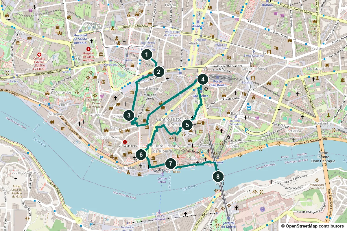
Old Porto falls steeply from the Clérigos tower to the Douro. This walk follows the slope down: a famous bookshop, a Baroque tower, the street of the medieval synagogue, a tiled station hall, the cathedral, the merchants' palace, the old quay and the iron bridge.
Porto grew from two centres: the cathedral hill, where the town began, and the Ribeira, a trading quarter by the river. In the 19th century business moved uphill, and the Ribeira declined until a rescue programme began in 1974. In 1996 UNESCO made the historic centre a World Heritage Site; its core is the old town inside the 14th-century Fernandine wall.
Some stops remember things that have gone, such as the synagogue and the convent under São Bento station. We say so where it matters, and every fact links to its source.
- Start
- Livraria Lello, Rua das Carmelitas 144, about 480 m on foot from Aliados metro station
- Finish
- The lower deck of the Luís I bridge, at the east end of the Ribeira quay
- Distance
- 2.9 km, one way
- Time
- About 1.5 hours: 39 min walking, 8 stops and two short climbs; 2 hours or more with the tower and the bookshop
Hills, steps, water, tickets and a shorter version ↓
What to see: the stops
-
Livraria Lello, the bookshop with the red staircase
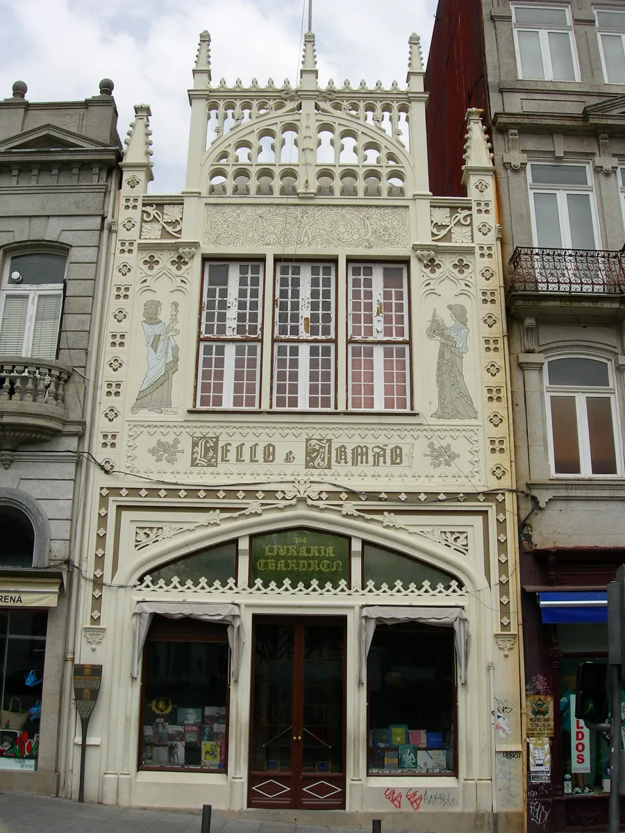
The front at Rua das Carmelitas 144. Photo: Maragato1976, CC BY-SA 3.0, via Wikimedia Commons (resized). Start outside number 144 on Rua das Carmelitas. The business began in 1869 as Ernesto Chardron's bookshop on Rua dos Clérigos; José Pinto de Sousa Lello bought it in 1894. This building, by the engineer Francisco Xavier Esteves, opened on 13 January 1906. The two figures painted on the neo-Gothic front stand for Art and Science. Inside are the red staircase and a stained-glass skylight with the motto Decus in Labore. Since July 2015 you need a ticket to go in, and it counts towards a book. Locals long said the staircase inspired a bookshop in Harry Potter, as J. K. Rowling once lived in Porto, but in May 2020 she said she had never been inside.
More history
The ticket was brought in to manage the crowds and pay for restoration; in 2016 more than a million people visited. That year the 8-metre skylight, by the Dutch artist Gerardus Samuel van Krieken, was taken down and restored for the first time.
Sources: Wikipedia (pt), Livraria Lello; Wikipedia, Livraria Lello. Tickets and hours: Livraria Lello's site.
-
Igreja and Torre dos Clérigos, Nasoni's tower
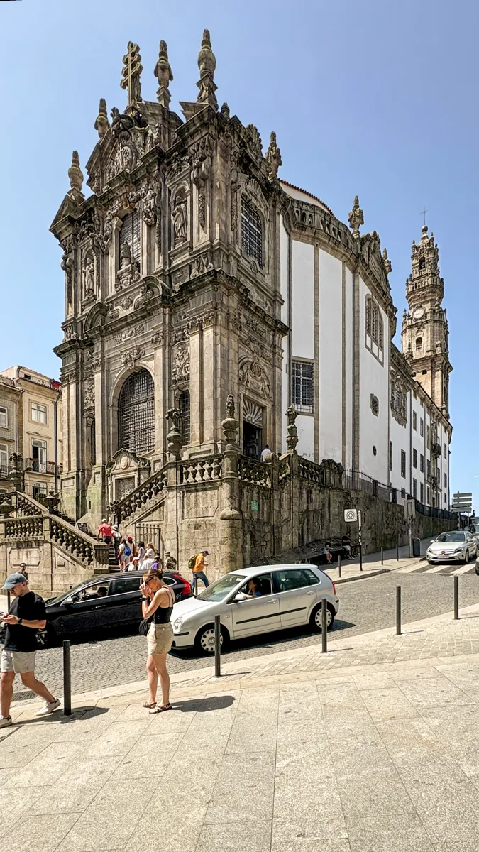
The church front, with the tower behind. Photo: Dale Cruse, CC BY 4.0, via Wikimedia Commons (resized). Walk south along Rua das Carmelitas for two minutes to the top of Rua dos Clérigos, facing the church's narrow carved front. The Irmandade dos Clérigos, a brotherhood formed in 1707 to care for poor, sick and dying priests, asked the Tuscan-born Nicolau Nasoni to design a church in 1731. Their plot lay near the Adro dos Enforcados, where condemned criminals were executed and buried. Nasoni built the church in 1732–1749 and the granite tower in 1754–1763. The tower is 75 metres high, with 225 steps up to two viewing galleries. The entrance is on Rua de São Filipe de Nery; one ticket covers the tower and the museum, and you can book it online.
More history
The tower also marked noon with a daily blank shot, served as a commercial telegraph and guided boats on the Douro. Nasoni, who died in 1773, asked to be buried in the church's crypt, in an unmarked tomb.
Sources: Wikipedia (pt), Igreja e Torre dos Clérigos; Wikipedia, Nicolau Nasoni. Tickets: the Torre dos Clérigos ticket office.
-
Rua de São Miguel, the street of the medieval synagogue
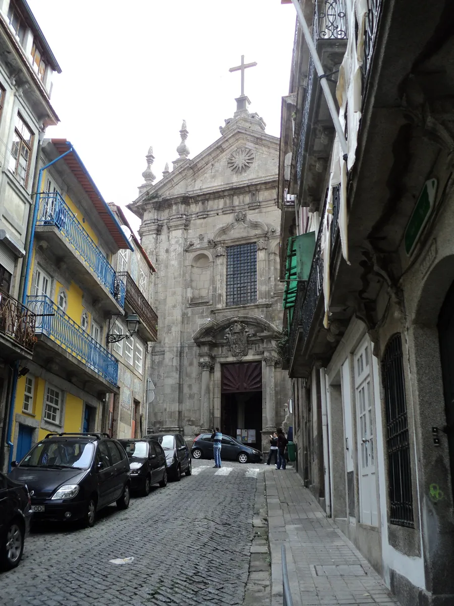
Rua de São Miguel, with the church of Nossa Senhora da Vitória at the end. Photo: Béria Lima de Rodríguez, CC BY-SA 3.0, via Wikimedia Commons (resized). Walk round the church to Largo da Porta do Olival, follow Rua de São Bento da Vitória past the long front of the São Bento da Vitória monastery, and turn right into Rua de São Miguel. Stop at number 9. This was the Judiaria do Olival, Porto's Jewish quarter in the late Middle Ages. In 1386 the Jewish community chose Ananias to negotiate its move to the Campo do Olival, inside the city walls, and a deed of 1388 leased the land to them for ever for 200 old maravedis a year. In 2005, during building work at number 9, the historian Elvira Mea found a stone niche in the east wall, the side facing Jerusalem, and identified it as the ark for the Torah scrolls of the quarter's synagogue. Some later accounts link it instead to a secret synagogue of the late 16th century. In 1496 King Manuel I ordered Portugal's Jews to convert or leave, and in 1497 they were forcibly converted.
More history
Old deeds name goldsmiths, physicians and makers of mail coats among the quarter's people. In 1491 Rabbi Isaac Aboab came from Castile, and about 30 refugee families, his among them, were given houses here. In the late 16th century the Benedictines built the São Bento da Vitória monastery on the site of the quarter.
Sources: NOVA FCSH, Western Sephardic Diaspora Roadmap: São Bento da Vitória records; the same, Porto municipal parchments; RTP / Lusa, 26 October 2005; Diário de Notícias, 20 January 2012; Visit Porto, Escadas da Vitória; Wikipedia, History of the Jews in Portugal.
-
São Bento station and Jorge Colaço's tiles
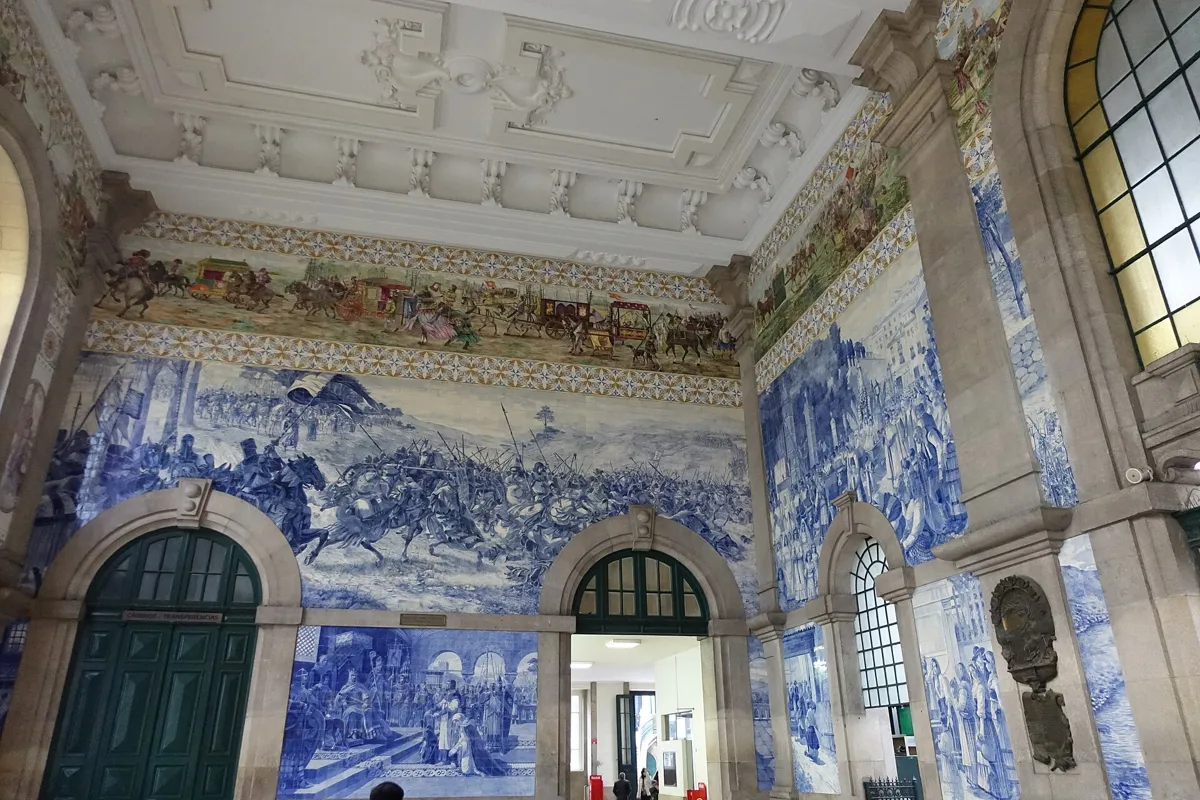
The station's entrance hall. Photo: Joseolgon, CC BY-SA 4.0, via Wikimedia Commons (resized). Walk on into Rua da Bataria da Vitória, past the Vitória viewpoint, and take the Escadas da Vitória down to Largo de São Domingos. These steps were once the Escadas da Esnoga, the synagogue stairs. Then walk up Rua das Flores, cut through the bishop's gardens in 1521–1525, where merchants, officials and some New Christians (converted Jews) lived. The station at the top is named after the convent of São Bento de Avé-Maria, founded in 1518 and pulled down for the railway. The Porto architect José Marques da Silva designed the building, which officially opened on 5 October 1916. Step into the hall. About 20,000 tiles, painted by Jorge Colaço, cover some 551 square metres. The blue scenes include King João I entering Porto with Philippa of Lancaster in 1387, and a coloured frieze tells the history of transport.
More history
A temporary station opened here on 7 November 1896. Sources give different dates for the tiles, between 1905 and 1916. They were restored in 2010–2011.
Sources: Wikipedia (pt), Estação de São Bento; Wikipedia, São Bento railway station; Visit Porto, Escadas da Vitória; Wikipedia (pt), Rua das Flores.
-
The Sé, Porto's cathedral, and its terrace
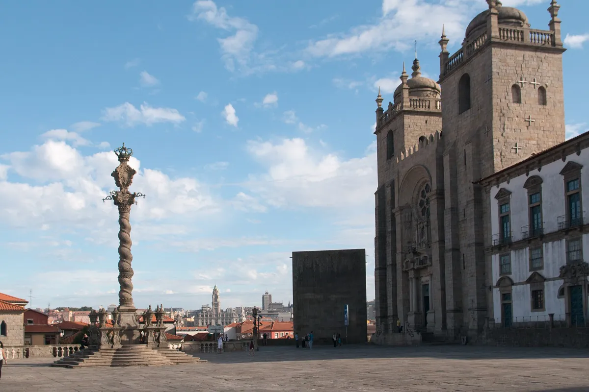
The Terreiro da Sé and the cathedral front. Photo: Daniel Villafruela, CC BY-SA 4.0, via Wikimedia Commons (resized). Now a short, steep climb. From the station, Viela da Cadeia, Rua de São Sebastião and the Escadas da Sé bring you out on the cathedral terrace. This hilltop was Porto's first core. The cathedral was begun in the 12th century as a Romanesque church; the towers and rose window keep that look, and it was one of the first buildings in Portugal with flying buttresses. King João I married Philippa of Lancaster here in 1387. Nasoni added the Baroque loggia on the side, and a new main door came in 1772. Much of the rest is 20th-century work, which Porto's tourist office calls an idealised reconstruction. The terrace is newer too: the old houses in front were pulled down in 1939–40 to widen it. A small fee covers the cloister, museum and tower.
More history
The Gothic cloister, of the 14th and 15th centuries, has Baroque tiles of 1729–31 from the Song of Songs. Miguel Francisco da Silva, who later worked on the Clérigos, carved the high altar in 1727–29, and Nasoni painted the main chapel's murals.
Sources: Wikipedia (pt), Sé do Porto; Wikipedia, Porto Cathedral; Visit Porto, Sé Catedral; Wikipedia (pt), Centro Histórico do Porto; Wikipedia (pt), Ribeira.
-
Palácio da Bolsa and the church of São Francisco
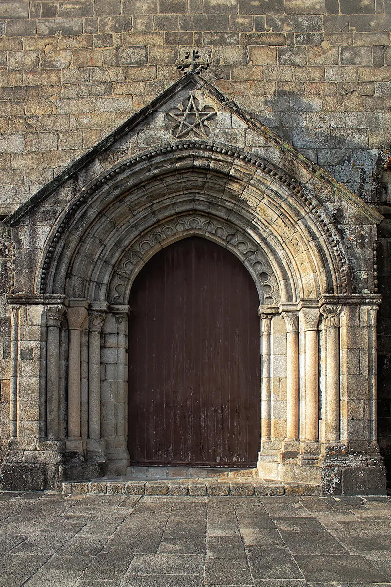
The Gothic south door of São Francisco, facing the river. Photo: John Samuel, CC BY-SA 4.0, via Wikimedia Commons (resized). Leave by Calçada de Dom Pedro Pitões, go down the Escadas do Colégio and Travessa da Bainharia, cross the foot of Rua das Flores and follow Rua de Ferreira Borges to the Palácio da Bolsa. The Franciscans began the church beside it in 1383, and it is the best example of Gothic building in Porto. During the siege of 1832–33, fire destroyed their cloister but spared the church. In 1841 Queen Maria II gave the ruins to the city's merchants, then trading in the open street. Their palace, designed by Joaquim da Costa Lima, was begun on 6 October 1842; the front was finished in 1850, the interior only in 1909. Walk round to the church's south side to see its Gothic door, with a five-pointed star in the gable. Inside, gilded carved wood from the first half of the 18th century covers almost every surface. Both charge for visits; the Bolsa is seen by guided tour.
More history
The church's Tree of Jesse altarpiece, contracted in 1718, shows the ancestors of Jesus as a carved family tree. The Bolsa's Moorish-style Arab Room opened in 1880; the city receives visiting heads of state there.
Sources: Palácio da Bolsa, history; Wikipedia, Palácio da Bolsa; Wikipedia (pt), Palácio da Bolsa; Wikipedia (pt), Igreja de São Francisco; Wikipedia, Church of São Francisco; Wikipedia (pt), Ribeira. Visiting: Palácio da Bolsa's site; Time Out Porto, Igreja de São Francisco.
-
Praça da Ribeira, the old riverside square
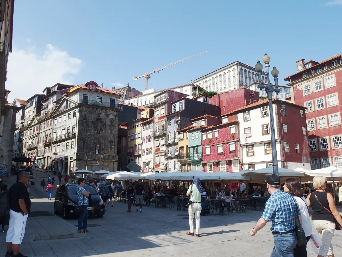
Praça da Ribeira. Photo: Palickap, CC BY-SA 4.0, via Wikimedia Commons (resized). From the church, walk east to Rua da Alfândega. At number 10 is the Casa do Infante, the royal customs house begun in 1325; tradition says Henry the Navigator was born there in 1394. Follow Rua da Fonte Taurina, one of the oldest streets in the city, into Praça da Ribeira. Royal letters mention the square and quay in 1389. After a fire in 1491 it was rebuilt with houses on columns. From 1776 it was remodelled under João de Almada e Melo's city plan, but only the north and west sides were finished; medieval houses survive on the east. The river wall came down in 1821. The fountain in the middle is 17th-century, found in digs in the 1980s, and now carries José Rodrigues' cube sculpture.
More history
On the quay, the Alminhas da Ponte, a bronze relief of 1897 by Teixeira Lopes the elder, recall 29 March 1809. That day the Ponte das Barcas, a bridge of boats, gave way under crowds fleeing Marshal Soult's French troops; more than 4,000 people are thought to have died.
Sources: Wikipedia (pt), Praça da Ribeira; Wikipedia (pt), Ribeira; Wikipedia (pt), Casa do Infante; Wikipedia (pt), Ponte das Barcas.
-
The Luís I bridge, the double-decker over the Douro
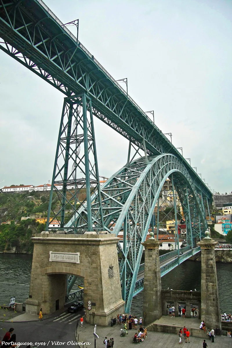
The Porto end of the bridge, with the lower deck's stone entrance. Photo: Vitor Oliveira, CC BY-SA 2.0, via Wikimedia Commons (resized). Walk east along the Cais da Ribeira and the Cais dos Guindais and out onto the bridge's lower deck. It was built in 1881–1886 to replace a suspension bridge of 1843, whose stone pillars still stand beside it at the Porto end. Théophile Seyrig, a former partner of Gustave Eiffel, designed it, and its 172-metre arch was then the longest of its type in the world. The upper deck opened on 31 October 1886 and the lower deck a year or two later; sources differ. The plaques over the lower-deck entrances read "Luiz I", with no "Dom". The story that the city dropped the title because the king missed the opening is a legend: newspapers used "Ponte Luiz I" while it was being built. Since 2005 Metro line D has run on the upper deck, which also has walkways.
More history
Crossing cost 4 réis a person until 1 January 1944. The lower deck closed for repairs in October 2021 and reopened in April 2023 for public transport, taxis, cyclists and people on foot only. Across the river, the Gaia waterfront is lined with Port wine lodges.
Sources: Wikipedia (pt), Ponte de D. Luís; Wikipedia, Dom Luís I Bridge; Wikipedia (pt), Ponte pênsil D. Maria II.
.jpg)
.jpg)

.JPG)

.jpg)
.jpg)
.jpg)
Practical details
- Terrain
- Steep, but mostly downhill. Open-Meteo puts Livraria Lello at about 96 m above sea level, São Bento station at about 61 m and Praça da Ribeira at about 18 m. There are two short climbs: up Rua das Flores to the station, and from the station up to the cathedral.
- Step-free
- No. OpenStreetMap maps steps on the route, including the Escadas da Vitória, the 75 steps of the Escadas da Sé and the Escadas do Colégio. The Guindais funicular station by the finish is tagged wheelchair accessible.
- Water
- OpenStreetMap lists drinking fountains on Rua das Carmelitas near stop 1, on Rua da Vitória near stop 3, on Rua de São Sebastião on the climb to stop 5, in Praça da Ribeira and at the Porto end of the bridge.
- Toilets
- OpenStreetMap shows paid toilets at São Bento station (07:00 to 22:30, tagged wheelchair accessible) and free toilets at the Porto end of the bridge's lower deck.
- Sit and eat
- The Ribeira (stop 7) and its quay are lined with bars and restaurants.
- When to go
- All daily: Livraria Lello 9:00 to 19:30, the Clérigos tower 9:00 to 19:00 (last entry 30 minutes before closing), the cathedral 9:00 to 18:30. Check before you go.
- Shorter walk
- Finish at stop 4, São Bento station: 1.3 km, about 40 minutes.
- Getting back
- The Guindais funicular's lower station, Ribeira, is about 190 m from the finish and goes up to Batalha. On foot, São Bento station is about 770 m and 10 minutes away, uphill.
Walking distances and times from the OSRM foot router on OpenStreetMap data. Elevations from Open-Meteo. Stations, steps, fountains and toilets from OpenStreetMap; opening hours from Livraria Lello, the Torre dos Clérigos and Visit Porto. Checked 4 October 2026.
Questions people ask
How long does a self-guided walking tour of Porto take, and is there a map?
About an hour and a half: 2.9 km, 39 minutes of walking and eight stops, from Livraria Lello to the Luís I bridge. Allow 2 hours or more if you climb the Clérigos tower and visit the bookshop. The map is on this page, and you can print it or save it as a PDF.
Is Porto walkable, and is it hilly?
The historic centre is small enough to walk, but steep. On this route Open-Meteo puts the start at about 96 m above sea level and Praça da Ribeira at about 18 m, so it is mostly downhill, with two short climbs and several flights of steps.
Do you need tickets for Livraria Lello?
Yes. Entry has needed a ticket since July 2015, and it counts towards the price of a book. Buy it on the shop's site; the shop opens daily, 9:00 to 19:30. The staircase is often linked to Harry Potter, but in May 2020 J. K. Rowling said she had never been inside.
Can you walk across the Dom Luís I bridge?
Yes, on both decks. The upper deck carries Metro line D and has walkways. The lower deck, at the end of the Ribeira quay, reopened in April 2023 for public transport, taxis, cyclists and people on foot only.
What is the Ribeira in Porto?
The old town's riverside quarter, along the Douro; royal letters mention its square and quay in 1389. It declined after business moved uphill in the 19th century and has been restored since 1974. It is part of the UNESCO World Heritage Site and full of bars and restaurants.
Walk it with Strolio
Open Strolio outside Livraria Lello and ask for an hour and a half through old Porto down to the river. Strolio builds walks in any city with mapped streets, so its route may pick different stops from this page. Stories play as you reach each place, and you can ask about anything else you pass, by voice or with a photo. You can also start from your hotel and choose your own time and interests.
More self-guided walks
- All Strolio walks: every self-guided walk with a map and sourced stops.
- Madrid's Barrio de las Letras: about an hour, from Lope de Vega's church to the press that printed Don Quixote.
- Barcelona's Gothic Quarter and El Born: about 90 minutes, from Roman columns to the cathedral and El Call.
Sources
- Wikipedia (Portuguese): Centro Histórico do Porto, Ribeira, Livraria Lello, Igreja e Torre dos Clérigos, Mosteiro de São Bento da Vitória, Estação de São Bento, Rua das Flores, Sé do Porto, Palácio da Bolsa, Igreja de São Francisco, Casa do Infante, Praça da Ribeira, Ponte das Barcas, Ponte de D. Luís, Ponte pênsil D. Maria II
- Wikipedia (English): Porto, Livraria Lello, Nicolau Nasoni, History of the Jews in Portugal, São Bento railway station, Porto Cathedral, Palácio da Bolsa, Church of São Francisco, Dom Luís I Bridge
- Jewish Porto: NOVA FCSH, Western Sephardic Diaspora Roadmap, archive records of São Bento da Vitória and the Porto municipal parchments; RTP / Lusa, 26 October 2005; Diário de Notícias, 20 January 2012
- Visit Porto (city tourism): Escadas da Vitória, Sé Catedral
- Opening times and tickets: Livraria Lello, Torre dos Clérigos, Palácio da Bolsa (and its history page), Sé Catedral, Time Out Porto, Igreja de São Francisco
- Map data and places: © OpenStreetMap contributors, ODbL; walking route from the OSRM foot router at routing.openstreetmap.de
- Elevations: Open-Meteo
- Photos: Wikimedia Commons contributors Maragato1976, Dale Cruse, Béria Lima de Rodríguez, Joseolgon, Daniel Villafruela, John Samuel, Palickap and Vitor Oliveira, credited under each photo