
Porto to Foz do Douro self-guided walk · 2½ hours · map
Porto to Foz do Douro on foot: from the old customs house along the Douro to the sea
This walk follows the north bank of the Douro from the old customs house in Miragaia to the lighthouse where the river meets the Atlantic. It is 7.9 km and about two and a half hours, with one climb through the Crystal Palace gardens and a level riverside path after the Arrábida Bridge.
The route passes through four very different Portos: a customs house of the 1860s, the gardens of a palace that was pulled down in 1951, a power station turned tram museum, and Foz do Douro, the seaside district at the river's mouth, with a tower from 1527. It keeps away from the Ribeira, the Baixa and the Gaia wine lodges, which have their own walks: see our historic centre walk, the Baixa walk and the Vila Nova de Gaia walk.
A note on accuracy: some sights are not what they were. The Crystal Palace is gone, the Felgueiras lighthouse was switched off for years, and the stone fountain at Passeio Alegre was moved. Where sources disagree, we say so, and every fact links to its source.
- Start
- Largo de São Pedro de Miragaia, about 380 m from the Infante tram stop
- Finish
- Farolim de Felgueiras at the end of the Foz pier; the Passeio Alegre tram terminus is about 560 m back
- Distance
- 7.9 km, one way
- Time
- About 2½ hours: 106 min walking and 8 stops, plus any visit to the tram museum or the bridge climb
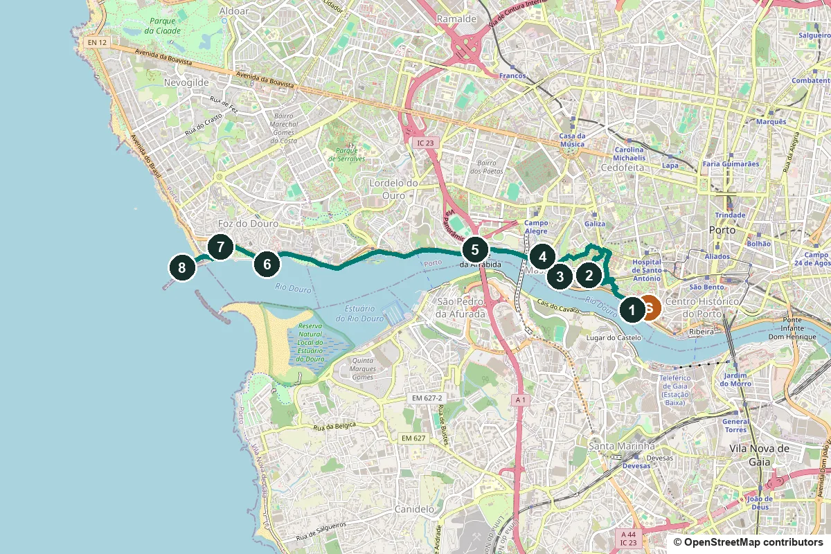
Terrain, water, opening days, a shorter version and the tram back ↓
What to see: the stops
-
Alfândega Nova, the old customs house on the Miragaia quay
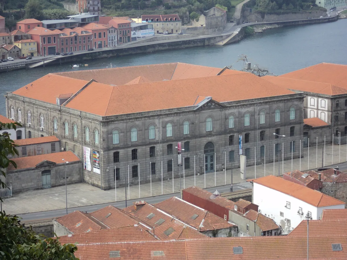
The Alfândega Nova seen from above. Photo: Béria Lima de Rodríguez, CC BY-SA 3.0, via Wikimedia Commons (resized). Start in Largo de São Pedro de Miragaia, by the church. Miragaia began as a fishing village, which is why its patron is St Peter, the fisherman. The present church is the latest on the spot; it was partly pulled down in 1740, and only the chancel and transept were kept. Walk down Viela do Espírito Santo, Rua de São Pedro de Miragaia, Rua da Atafona and Rua de Miragaia, then take the path to the quay (333 m). The huge building in front of you is the Alfândega Nova, the customs house. It was ordered on 25 September 1859, on what was then Miragaia beach, to a design by the French architect Jean-François Colson. The first part opened in 1869 and the work was finished ten years later. To carry it, builders made the broad quay you are standing on, which replaced the beach. Colson built it mostly in iron, mixed with stone, small bricks and wood, and the roof of the central block is Riga oak. After a restoration project by Eduardo Souto de Moura from the 1990s, it holds a congress centre and the Museu dos Transportes e Comunicações. The museum opens Tuesday to Friday 10:00 to 13:00 and 14:00 to 18:00, and on Saturday, Sunday and holidays 15:00 to 19:00; check before you go.
More history
In 1888 a railway branch linked the customs house to Campanhã station, to move goods more easily. The museum's second-floor exhibition on everyday life in the customs service is free from Tuesday to Friday, except for guided visits.
Sources: Wikipedia (pt), Alfândega Nova; Wikipedia (pt), Igreja de São Pedro de Miragaia; Wikipedia (pt), Museu dos Transportes e Comunicações; AMTC, the building; AMTC, the museum. Hours and prices: AMTC, Visitar.
-
Jardins do Palácio de Cristal, the palace that is gone
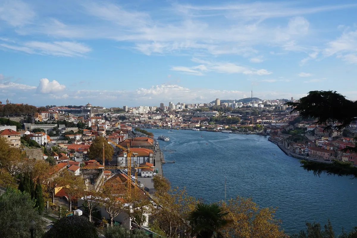
The Douro from the gardens. Photo: Matt Kieffer, CC BY-SA 2.0, via Wikimedia Commons (resized). From the quay, climb Calçada de Monchique to Rua de Sobre-o-Douro, follow Rua da Restauração, then go through the main gate on Rua de Dom Manuel II and along Avenida das Tílias to the Capela Carlos Alberto (1.7 km, mostly uphill). Since 1542 this high ground was the Campo da Torre da Marca, named for a tower that guided ships into the river mouth. The palace that gave the gardens their name is not here any more. The English architect Thomas Dillen Jones built it from granite, iron and glass, 150 m by 72 m and modelled on London's Crystal Palace, and King Luís opened it on 18 September 1865 for the Porto International Exhibition. The city council bought it in 1933, and in 1951 it was pulled down. A concrete sports pavilion, now named for the marathon runner Rosa Mota, was put up for the 1952 roller hockey world championship. Public anger kept the old name alive for the gardens. They were laid out in the 1860s by the German landscape gardener Émile David and have several viewpoints over the river. The little chapel on the avenue honours King Charles Albert of Piedmont-Sardinia, who died in exile in Porto. The city council dates it to 1854; Portuguese Wikipedia says 1849, the year the king died. Entry is free; from October to March the gates are open 8:00 to 19:00, and from April to September 8:00 to 21:00.
More history
In 1865 the palace hosted what Portuguese Wikipedia calls the first Christmas tree in a public space in Portugal. In 2009 a plan to build a congress hall on the lake site set off protests, and it was dropped in 2013.
Sources: Câmara Municipal do Porto; Wikipedia (pt), Palácio de Cristal; Wikipedia (pt), Jardins do Palácio de Cristal; Wikipedia, Crystal Palace (Porto).
-
Igreja do Corpo Santo de Massarelos, the sailors’ brotherhood
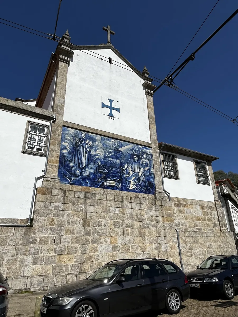
The back of the church, facing the river. Photo: Bishop-f1, CC BY-SA 4.0, via Wikimedia Commons (resized). Leave the gardens by Rua de Dom Manuel II and walk down Rua de Entre Quintas, Travessa da Macieirinha and Rua da Macieirinha, then through Largo do Adro to Rua do Adro (1.2 km, downhill). OpenStreetMap maps flights of steps on Rua de Entre Quintas (67 steps) and Rua da Macieirinha (39 steps). The church of Corpo Santo is the seat of the Confraria das Almas do Corpo Santo, a brotherhood of sailors and merchants founded in 1394 by men who had survived a storm on the way back from England. It looked after seafarers and ran its own ships. Building of the present church began in 1776. The front has a niche with its patron, St Telmo, and the tower clocks and tiles. It became the parish church only after the old parish church of Massarelos fell into ruin. On the back wall, facing the Douro, a cross dated 1394 (the Cross of the Order of Christ) and a tile panel recall a tradition that Prince Henry the Navigator was one of the brothers.
More history
The brotherhood did more than pray. Portuguese Wikipedia says it acted as a bank and trading company. Its treasury holds silver and a fine 16th-century monstrance, and an oil painting of St Telmo, once beside the door, hangs in its meeting room.
-
Museu do Carro Eléctrico, a tram museum in a power station
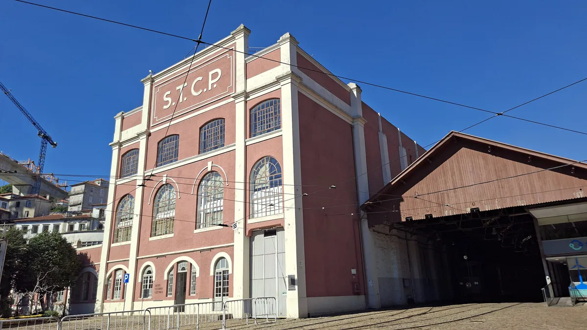
The former power station, now the tram museum. Photo: Novoklimov, CC0, via Wikimedia Commons (resized). From the church, go down Rua do Adro to Cais das Pedras, take Rua da Restauração, then Rua Dom Pedro V (372 m). The museum is at Alameda de Basílio Teles 51, on the river. It fills the old Massarelos thermoelectric power station, designed by the engineer Luís Couto dos Santos, with two central halls and a chimney. It was finished in 1911 and in full use by 1915. Coal from the São Pedro da Cova mines fed steam engines, and the water was taken straight from the Douro. The station made power for the tram network until 1955 and then became a substation in 1960. The museum opened in the building on 18 May 1992 and now holds 28 vehicles. It closed in December 2012 and reopened on 28 November 2015. It is open Tuesday to Sunday, 10:00 to 18:00, with last entry 30 minutes before closing. An adult ticket was 8 euros when we checked. You can see the building from outside without a ticket.
More history
Porto's first tram line opened in 1872 with "American cars", and the first electric trams ran in 1895. The museum's own page counts 28 vehicles; English Wikipedia lists 16 electric cars, 5 trailers and 2 maintenance vehicles.
Sources: Museu do Carro Eléctrico, O Museu; Wikipedia (pt), Museu do Carro Elétrico; Wikipedia, Porto Tram Museum; STCP, Porto Tram City Tour. Hours and prices: museum, Visitar.
-
Ponte da Arrábida, the record-breaking concrete arch
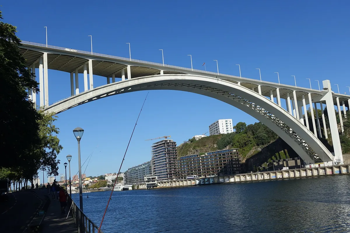
The bridge from the riverside path. Photo: Joseolgon, CC BY-SA 4.0, via Wikimedia Commons (resized). Follow Rua Dom Pedro V on to Alameda de Basílio Teles, then Rua do Ouro to the foot of the bridge (816 m). The Arrábida Bridge opened on 22 June 1963. Its single concrete arch spans 270 m, and at the time it was the largest concrete arch of any bridge in the world. The engineer was Edgar Cardoso. The bridge had four lifts so that walkers could get from the river up to the deck, 70 m above the water, and its lift towers carry four bronze sculptures, each five metres tall. The lifts stopped working in the mid-1990s. Portugal classed the bridge a national monument on 23 May 2013. Since June 2016 you can also climb over the arch with Porto Bridge Climb, which runs a tour of about 40 minutes and asks you to allow an hour. Book on its website, and check the price: it was 20 euros per person when we looked.
More history
Work began in 1957. Portuguese Wikipedia puts the cost at about 240,000 contos, or 1.2 million euros. Sources differ on the deck's length, so we leave it out.
Sources: Wikipedia (pt), Ponte da Arrábida; Wikipedia, Arrábida Bridge. Climb: Porto Bridge Climb, price and schedule.
-
Capela-Farol de São Miguel-o-Anjo, a 1527 beacon tower
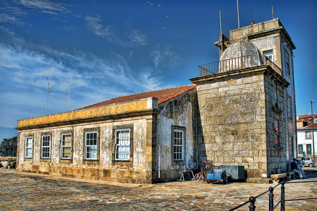
The tower and the buildings beside it. Photo: António Amen, CC BY-SA 3.0, via Wikimedia Commons (resized). Now the long stretch: keep on Rua do Ouro and then the riverside path for 2.3 km, flat and with no stops, to the Cantareira. You are now in Foz do Douro, "the mouth of the Douro". The small granite tower in front of you was built in 1527 by Miguel da Silva, bishop-elect of Viseu. A Latin inscription on the wall facing the river says he built it to guide ships and gave land whose income paid for fires lit there every night. It is a square tower with an eight-sided interior, shell-shaped niches and a spiral stair in the wall. Portuguese Wikipedia calls it the first dated purely Renaissance building in Portugal. It is a classified building of public interest, but only the area around it is open. A building for the customs guard was added beside it in 1841, and a three-storey tower for a telegraph station in 1852.
More history
The building shows no sign of where the lamp stood. Some say it was inside the tower, in front of a west window that a later building now covers.
Sources: Wikipedia (pt), Farol de São Miguel-o-Anjo; Wikipedia (pt), Foz do Douro; Wikipedia, Foz do Douro.
-
Jardim do Passeio Alegre, the garden at the end of the tram line
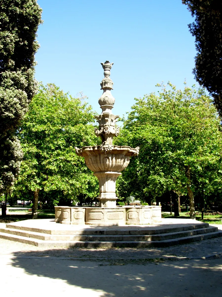
The Passeio Alegre fountain. Photo: JotaCartas, CC BY 3.0, via Wikimedia Commons (resized). Continue along the river path for 601 m to the garden. This is the Jardim do Passeio Alegre, planned by Émile David, the same designer as the Crystal Palace gardens. The whole area around it, the Passeio Alegre, has been listed as a property of public interest since 1993. The stone fountain is by Nicolau Nasoni and dates from the 18th century; it is a national monument, listed in 1910. It was moved here when the city bought the Quinta da Prelada for a campsite. Some authors say it first stood in the cloister of the Convento de São Francisco, where the Palácio da Bolsa is now, so the sources do not agree on its origin. Look for the Swiss Chalet, an octagonal wood and cast-iron kiosk in the Romantic style. Of the six kiosks left in Porto, Portuguese Wikipedia says it is the only one open inside, as a tea house; check that it is open. Tram line 1 ends at this garden.
More history
The tram line between Massarelos and Passeio Alegre reopened in 2002.
Sources: Wikipedia (pt), Jardim do Passeio Alegre; Wikipedia (pt), Chafariz do Passeio Alegre; Wikipedia (pt), Quiosque no Jardim do Passeio Alegre; Wikipedia (pt), Elétricos do Porto; STCP, Porto Tram City Tour.
-
Farolim de Felgueiras, the lighthouse at the river’s mouth
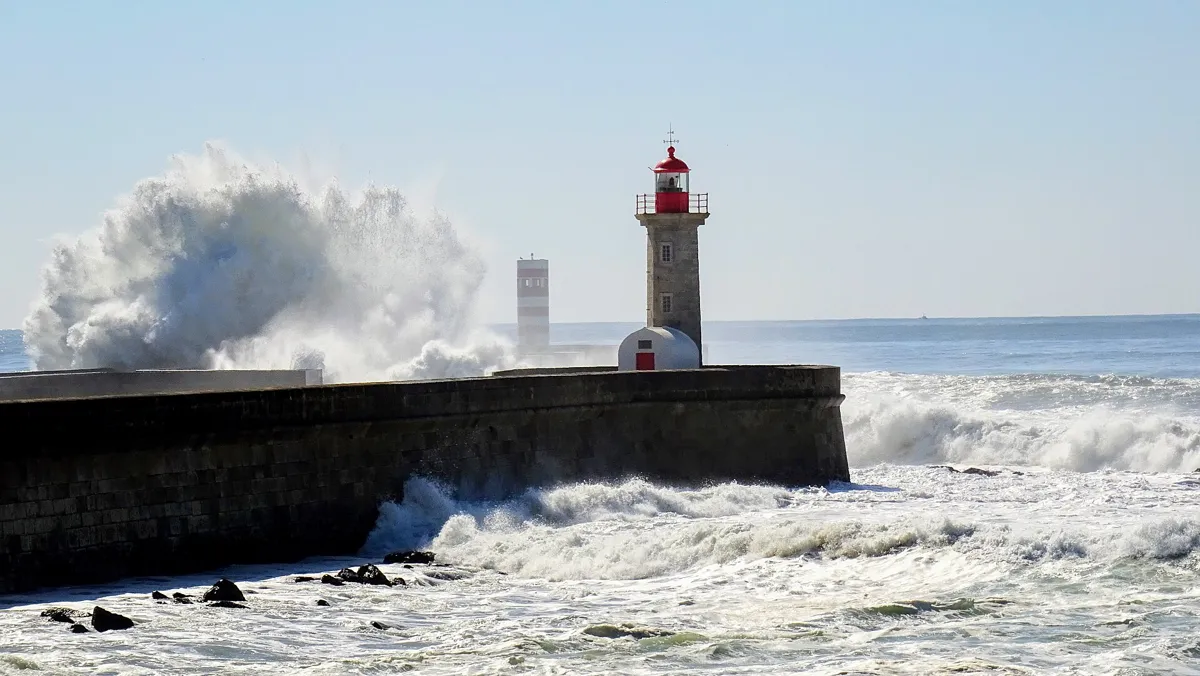
The lighthouse in a big swell. Photo: Pveverdingen, CC BY-SA 4.0, via Wikimedia Commons (resized). Follow the path along the shore for 564 m and walk out along the pier to the lighthouse. Here the Douro meets the Atlantic. The pier was begun in 1790 to help ships get past the sandbar that kept wrecking them on the way up to Porto. The tower went up in 1886: a hexagon of bare granite, 10 m high, with a red balcony and lantern. It was switched off on 31 March 2009 and, according to English Wikipedia, brought back into service on 13 December 2021 (Portuguese Wikipedia still lists it as switched off, and we found no official source). A foghorn kept sounding throughout. You cannot go inside, only around it. The photo was taken in a big swell, so look at the sea before you walk out. You have now walked 7.9 km, from the old customs house to the sea.
More history
The lighthouse is named after the Felgueiras rock, which lies to the west, facing the pier.
Sources: Wikipedia (pt), Farolim de Felgueiras; Wikipedia, Felgueiras Lighthouse.


Practical details
- Terrain
- Flat along the river, with one climb. Open-Meteo gives about 12 m at the customs house and 68 m at the garden chapel, then you come back down to the water. After the bridge the path is level to the sea. We do not quote the 60 m it gives for the bridge stop, which probably reads the bridge deck, not the path.
- Step-free
- OpenStreetMap maps flights of steps on Rua de Entre Quintas, Rua da Macieirinha and the Escadaria do Adro by Massarelos church, so the way down from the gardens is not step-free, and we did not check an alternative. It marks the tram stops near the start as not wheelchair accessible. The customs-house museum says it is equipped for visitors with reduced mobility and keeps two wheelchairs, to be booked ahead.
- Water
- OpenStreetMap lists drinking fountains in the gardens, one called Fontanário do Campo do Rou about 120 m from Massarelos church, and another about 100 m from the tram museum.
- Toilets
- OpenStreetMap shows free public toilets in the gardens, about 110 m from the tram museum and about 230 m from the Felgueiras lighthouse. The last one is tagged as not wheelchair accessible.
- Sit and eat
- The Crystal Palace gardens have a restaurant and a terrace over the lake, and the customs-house museum has a cafeteria. In Foz, Wikipedia describes a seafront promenade dotted with esplanades and bars, and the Chalet Suíço tea house at Passeio Alegre is worth a look if it is open.
- When to go
- Customs-house museum: Tuesday to Friday 10:00 to 13:00 and 14:00 to 18:00, Saturday, Sunday and holidays 15:00 to 19:00; closed Mondays. Tram museum: Tuesday to Sunday 10:00 to 18:00. Gardens: 8:00 to 19:00 from October to March, to 21:00 from April to September. For the bridge climb, book online; the operator asks for bookings by 9:00 on the day.
- Shorter walk
- Finish at stop 4, the tram museum: 3.6 km, about 50 minutes of walking. STCP buses 403, 500 and 900 stop outside it.
- Getting back
- Tram line 1 runs from Passeio Alegre, about 560 m back from the lighthouse, to Infante, near the start. STCP lists service every day from 8:40 to 20:43, about every 20 minutes, and tickets are sold on board. Line 18 runs from Passeio Alegre to Carmo from 9:15 to 19:45, about every 30 minutes. Check the timetable on the day.
Walking distances and times from the OSRM foot router on OpenStreetMap data. Elevations from Open-Meteo. Fountains, toilets and steps from OpenStreetMap; opening times and prices from the venues' own sites and STCP. Checked 5 October 2026.
Questions people ask
Can you walk from Porto to Foz do Douro along the river?
Yes. This route goes from Miragaia to the Felgueiras lighthouse in 7.9 km, about 106 minutes of walking. It leaves the water for a climb through the Crystal Palace gardens. From the Arrábida Bridge to the lighthouse, the last 3.5 km follow Rua do Ouro and riverside paths.
How long does it take to walk to Foz do Douro?
About two and a half hours with stops: 106 minutes of walking plus about five minutes at each of eight stops. The tram museum and the bridge climb add time, since the climb asks you to allow an hour. A shorter version ends at the tram museum after 3.6 km, about 50 minutes of walking.
How do you get back from Foz do Douro?
Take tram line 1 from the Passeio Alegre garden, about 560 m from the lighthouse, to Infante, near where the walk starts. STCP lists it every day from 8:40 to 20:43, about every 20 minutes, with tickets sold on board. Line 18 goes from Passeio Alegre to Carmo. Check the timetable on the day.
Is the Crystal Palace garden free?
Yes, the city council lists free access. The gates are open 8:00 to 19:00 from October to March and 8:00 to 21:00 from April to September. The glass palace that gave the gardens their name was pulled down in 1951; a sports pavilion stands on its site.
Is Foz do Douro worth visiting?
Portuguese Wikipedia describes Foz as a mixed district, best known as home to the city's upper class, with a seafront promenade dotted with esplanades, bars and gardens. On this walk you see a tower built in 1527 to guide ships, the Passeio Alegre garden with its 18th-century fountain, and the Felgueiras lighthouse where the river meets the sea.
Walk it with Strolio
Open Strolio in Miragaia and ask for a walk along the Douro to Foz. Strolio builds walks in any city with mapped streets, so its route may pick different stops from this page. Stories play as you reach each place, and you can ask about anything else you pass, by voice or with a photo. You can also start from your hotel and choose your own time and interests.
More walks in Porto
- Downhill to the river: ~90 min, 8 stops. From Livraria Lello and the Clérigos tower past the medieval synagogue site and São Bento's tiles to the Ribeira and the Luís I bridge.
- Vila Nova de Gaia: ~90 min, 8 stops. Cross the Douro to the port wine lodges and rabelo boats, climb to the round church of Serra do Pilar and walk back over the bridge's top deck.
- The Baixa: ~1 h, 7 stops. Porto's downtown on foot: the Avenida dos Aliados, the Bolhão market, two blue-tiled churches and Café Majestic.
- All Porto walks, with maps side by side.
- Walks in other cities.
Sources
- Official sites: Câmara Municipal do Porto, Jardins do Palácio de Cristal; Museu do Carro Eléctrico (hours and prices); Museu dos Transportes e Comunicações (the building, hours); STCP, Porto Tram City Tour; Porto Bridge Climb. We used their facts and wrote our own text.
- Wikipedia (Portuguese): Alfândega Nova, Igreja de São Pedro de Miragaia, Museu dos Transportes e Comunicações, Palácio de Cristal, Jardins do Palácio de Cristal, Igreja Matriz de Massarelos, Museu do Carro Elétrico, Elétricos do Porto, Ponte da Arrábida, Farol de São Miguel-o-Anjo, Foz do Douro, Jardim do Passeio Alegre, Chafariz do Passeio Alegre, Quiosque no Jardim do Passeio Alegre, Farolim de Felgueiras
- Wikipedia (English): Crystal Palace (Porto), Porto Tram Museum, Arrábida Bridge, Foz do Douro, Felgueiras Lighthouse
- Map data and places: © OpenStreetMap contributors, ODbL; walking route from the OSRM foot router
- Elevations: Open-Meteo
- Photos: Wikimedia Commons contributors Béria Lima de Rodríguez, Matt Kieffer, Bishop-f1, Novoklimov, Joseolgon, António Amen, JotaCartas and Pveverdingen, credited under each photo