
Le Marais self-guided walking tour · 80 minutes · map
Le Marais on foot: a medieval wall, a royal square and the Jewish quarter
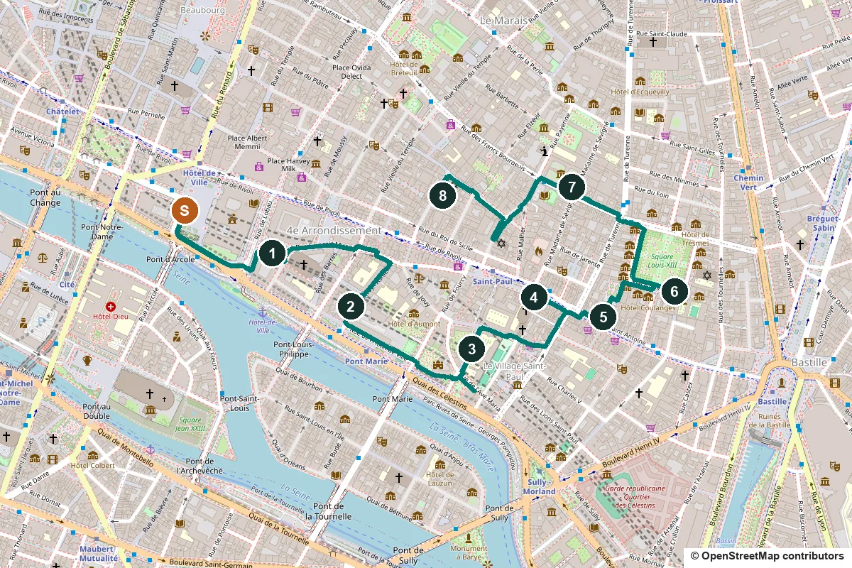
The Marais was the grand address of 17th-century Paris. This 80-minute walk runs from the Hôtel de Ville past the medieval city wall, two noble mansions and the Place des Vosges to the Jewish quarter on rue des Rosiers.
Marais means marsh, and this was flood-prone land until it was drained for farming in the 12th century. Nobles built town houses here in the 17th century, especially after Henri IV laid out the Place Royale, today's Place des Vosges. After the Revolution craftsmen and workshops filled the old mansions, and by the 1950s much of it was run down. In 1964 it became one of the first protected "secteurs sauvegardés" under André Malraux's heritage law of 1962, and restoration followed. From the late 19th century Jews from Eastern Europe settled around rue des Rosiers; stops 2 and 8 follow their story.
A note on accuracy: some of what you see was restored or rebuilt, and some stops mark the site of what they remember. Where that is so, we say it, and every fact links to its source.
- Start
- Place de l'Hôtel-de-Ville, by Hôtel de Ville metro (line 1)
- Finish
- Rue des Rosiers, about 300 m from Saint-Paul metro (line 1)
- Distance
- 3.0 km, one way
- Time
- About 80 minutes: 40 min walking and 8 stops, plus any museum visits
Terrain, water, opening days and a shorter version ↓
What to see: the stops
-
Saint-Gervais and the half-timbered houses of rue François-Miron
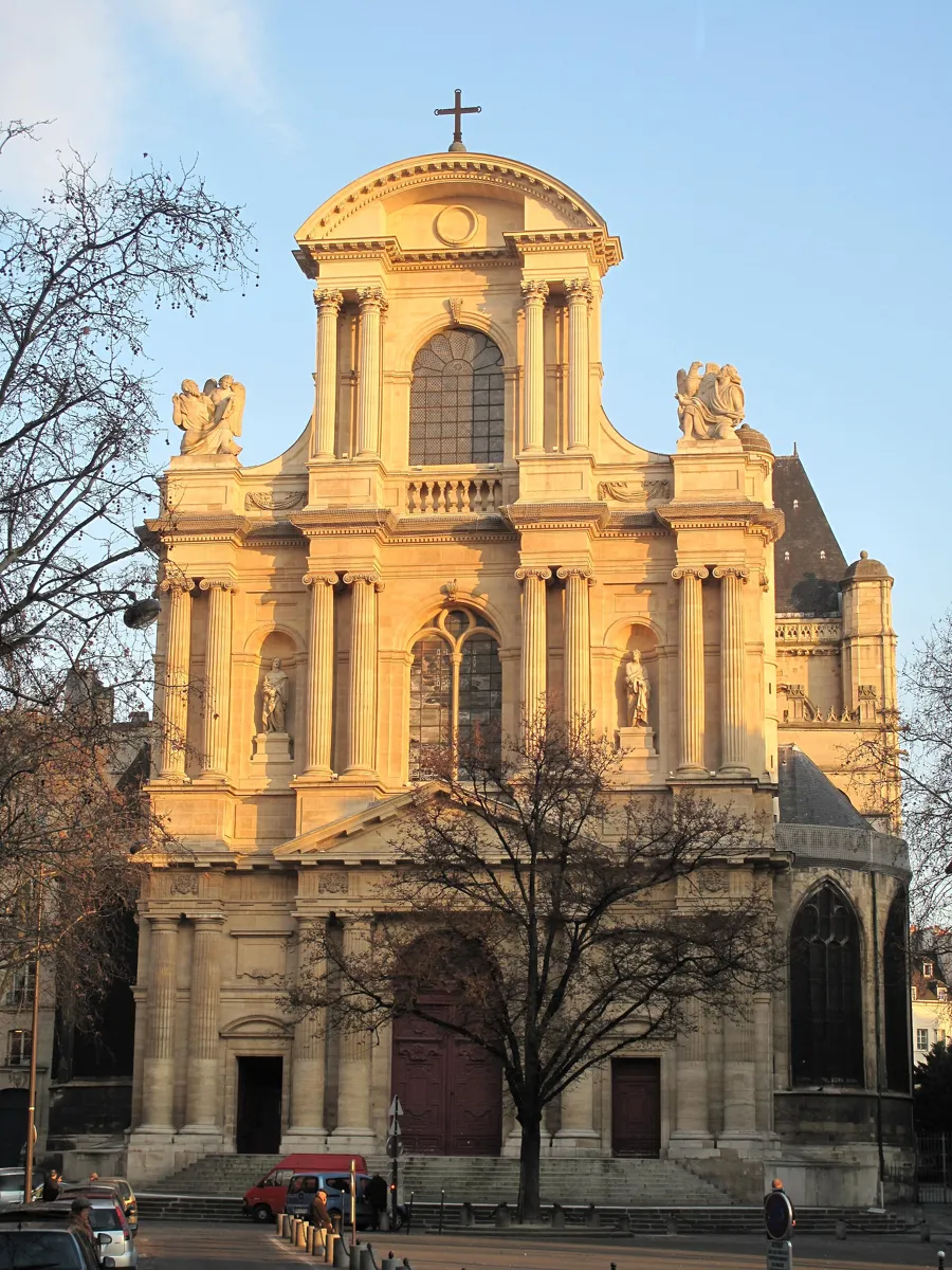
The west front of Saint-Gervais. Photo: Tangopaso, public domain, via Wikimedia Commons (resized). Paris has been run from the Hôtel de Ville since 1357, but the building is a rebuild: the Communards burned the old one in May 1871, and it went up again from 1874 to 1882 to a similar design. Walk along its south side and turn left up rue de Lobau to Place Saint-Gervais. The church stands on a low rise that stayed dry above the marsh, where a basilica stood by the late 6th century. The present church was begun in 1494; its front, built from 1616, stacks Doric, Ionic and Corinthian columns. On Good Friday 1918 a German long-range shell hit the roof during the service and killed 92 people. Then walk east along rue François-Miron, an old Roman road. Numbers 11 and 13 are known by their old signs, the Reaper and the Sheep. Their timber frames were uncovered in a restoration in 1967, so much of what you see is that work.
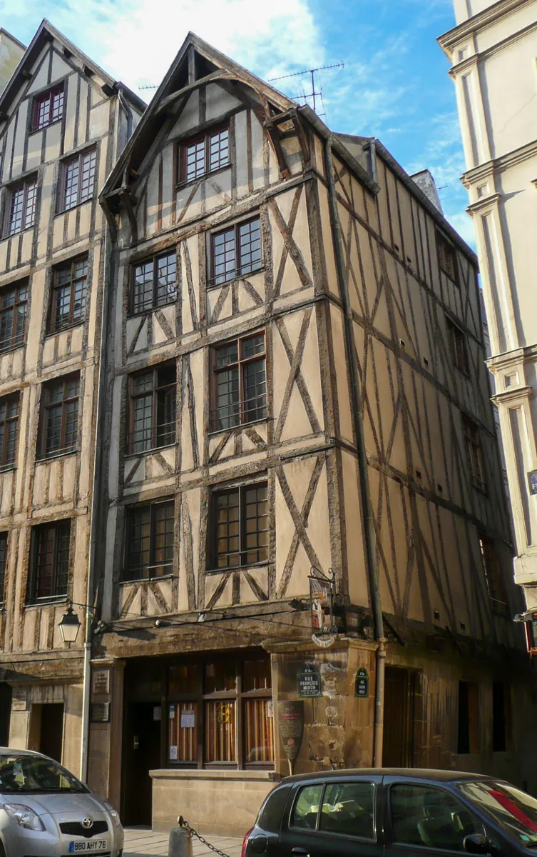
13 rue François-Miron, the house of the Sheep. Photo: Wikinade, CC BY-SA 3.0, via Wikimedia Commons (resized). More history
From 1653 the Couperin family supplied the church's organists for more than two centuries, from Louis Couperin to Céleste-Thérèse. The organ they played, rebuilt by François-Henri Clicquot in 1766–68 with parts of the older one, is still inside. The family lived at 4 rue François-Miron, in the row built in 1733–37 beside the church; the second-floor balconies recall the elm on the square.
Sources: Wikipedia (fr), Église Saint-Gervais-Saint-Protais; Wikipedia (fr), Rue François-Miron; Wikipedia (fr), Hôtel de ville de Paris; Wikipedia, Hôtel de Ville; Wikidata, Maisons du Moyen Âge.
-
Mémorial de la Shoah, the Holocaust memorial
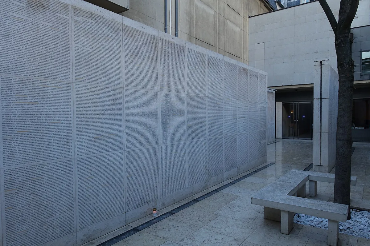
The Wall of Names. Photo: Guilhem Vellut, CC BY 2.0, via Wikimedia Commons (resized). Take rue Geoffroy-l'Asnier, which leaves rue François-Miron on its south side, down to number 17. This is the Holocaust memorial and museum of Paris. It began as the Memorial of the Unknown Jewish Martyr, built from 1953 to 1956 by the architects Alexandre Persitz and Georges Goldberg. In the crypt, a black marble tomb holds ashes from the death camps and the Warsaw ghetto, laid there in 1957. In January 2005 the site was enlarged and renamed. The Wall of Names at the entrance lists more than 75,000 Jews deported from France from 1942 to 1944, among them 11,400 children, by year and in alphabetical order. Along the side alley, another wall lists the Righteous of France, honoured for saving Jews. Entry is free; it is closed on Saturdays.
More history
The documentation centre upstairs is older than the building. Isaac Schneersohn and Léon Poliakov set it up in secret in Grenoble in April 1943, to collect evidence of the destruction of Europe's Jews. The memorial building has been a listed historic monument since 1992.
Sources: Wikipedia (fr), Mémorial de la Shoah; Wikipedia, Mémorial de la Shoah; Wikipedia (fr), Rue Geoffroy-l'Asnier. Visiting: the Mémorial's practical information.
-
The wall of Philippe Auguste on rue des Jardins-Saint-Paul
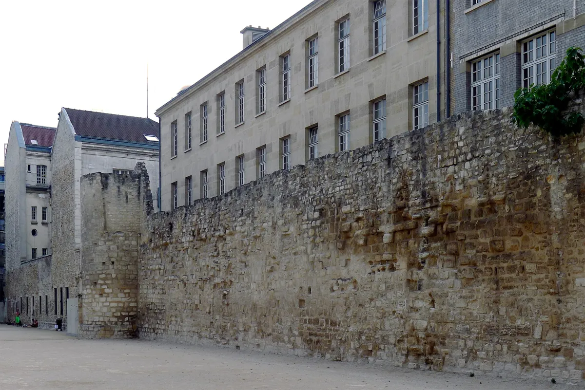
The wall and one of its towers, seen from the sports ground. Photo: Mbzt, CC BY-SA 3.0, via Wikimedia Commons (resized). Continue down rue Geoffroy-l'Asnier and turn left along rue de l'Hôtel-de-Ville to its end by the Hôtel de Sens. Carry on into rue de l'Ave-Maria, which leads on from rue du Fauconnier, and turn left up rue des Jardins-Saint-Paul. On your left, beyond a sports ground, stands the longest surviving stretch of the wall King Philippe Auguste built round Paris; the Right Bank part went up from 1190 to 1209. This piece is about 60 m long and some 7 m high; look for masons' marks in the stone. It has two towers: a restored one in the middle of the ground and, at the corner of rue Charlemagne, a quarter of the Tour Montgomery. It is named after the captain of Henri II's guard, said to have been locked up here after he fatally wounded the king in a joust in 1559 (see stop 6). Houses hid the wall until 1946, when they were pulled down in a slum-clearance scheme. François Rabelais died in this street on 9 April 1553; a plaque marks it.
More history
The old houses opposite were also due for demolition until the 1964 protection saved them. From 1970 to 1985 the architect Félix Gatier took down buildings inside the block to make the Village Saint-Paul: six linked courtyards reached through porches, with antique dealers, galleries and tea rooms on the ground floors.
Sources: Wikipedia (fr), Rue des Jardins-Saint-Paul; Wikipedia (fr), Enceinte de Philippe Auguste; Wikipedia, Wall of Philip II Augustus; Wikipedia (fr), Village Saint-Paul; Wikipedia (fr), Rue de l'Hôtel-de-Ville; Wikipedia (fr), Rue de l'Ave-Maria.
-
Saint-Paul-Saint-Louis, the Jesuits' Baroque church
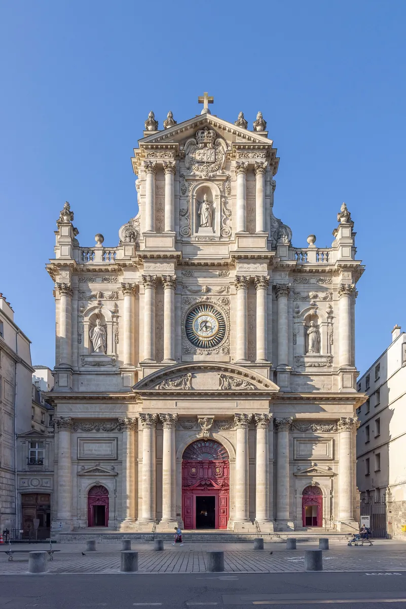
The front on rue Saint-Antoine. Photo: ZeusUpsistos, CC BY-SA 4.0, via Wikimedia Commons (resized). At the top of the street, turn right along rue Charlemagne, then left up rue Saint-Paul and left again along rue Saint-Antoine; the church is on your left. The Jesuits built it from 1627 to 1641 with Louis XIII's support, to plans by two Jesuit architects, Étienne Martellange and François Derand. Inspired by the Gesù in Rome, it was the first church in Paris to leave Gothic behind entirely for the Baroque. Its 55 m dome, one of the first in Paris, is mostly hidden by the tall front. Cardinal Richelieu said the first Mass in 1641, and the hearts of Louis XIII and Louis XIV were kept here until the Revolution. Inside the door are two shell-shaped holy-water stoups given by Victor Hugo, whose daughter Léopoldine married here in 1843.
More history
The name joins two churches. The old parish church of Saint-Paul nearby was pulled down after the Revolution, and in 1802 its parish moved into the Jesuit church, which took both names. Marc-Antoine Charpentier was master of music here from 1688 to 1698. On a pillar on the right of the nave, a faint inscription reads "République française ou la mort", probably from the Commune of 1871.
Sources: Wikipedia (fr), Église Saint-Paul-Saint-Louis; Wikipedia, Saint-Paul-Saint-Louis.
-
Hôtel de Sully, a mansion with a back door to the square
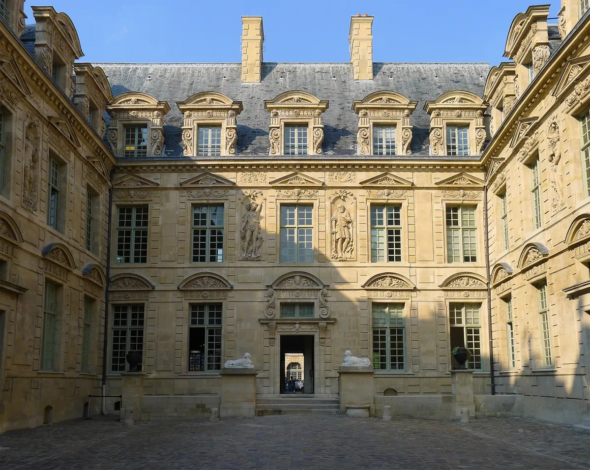
The courtyard, with the 19th-century sphinxes by the door. Photo: Mbzt, CC BY-SA 3.0, via Wikimedia Commons (resized). Cross rue Saint-Antoine and walk east to number 62. The financier Mesme Gallet bought the land in 1624 and began this mansion the next year; it is usually credited to the architect Jean Androuet du Cerceau. Gallet, a gambler, lost his fortune and sold it unfinished. In 1634 Maximilien de Béthune, Duke of Sully, Henri IV's former finance minister, bought it complete and finished the decoration; his grandson added a wing in 1660. Split into shops and flats in the 19th century, it was bought by the state in 1944 and restored; since 1967 it has housed the body now called the Centre des monuments nationaux. The courtyard and garden are free. Go through the house into the garden, then through the door in the right-hand pavilion of the orangery at the far end: it opens onto the Place des Vosges.
More history
The two sphinxes by the steps are not original: the heirs of a jeweller, Radu, who rented most of the house, added them in 1856. On the garden side, two women stand for Spring and Summer, and a sundial is cut into the stone over the orangery's middle arch.
Sources: Centre des monuments nationaux, history; Centre des monuments nationaux, the passage to the Place des Vosges; Wikipedia (fr), Hôtel de Sully; Wikipedia, Hôtel de Sully. Visiting: the Hôtel de Sully's practical information.
-
Place des Vosges and Victor Hugo's flat
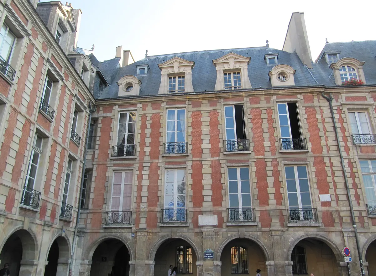
Number 6, the Maison de Victor Hugo, above the arcades. Photo: Staroad.fr, CC BY-SA 4.0, via Wikimedia Commons (resized). You come out under the arcades. This was the Place Royale, built for Henri IV from 1605 to 1612 on the site of a royal residence, the Hôtel des Tournelles. Close by, on 30 June 1559, Montgomery's lance struck Henri II in the eye during a joust; the king died on 10 July, and his widow, Catherine de' Medici, had the Tournelles pulled down. The square is about 140 m a side, lined with matching houses of red brick and pale stone over arcades, under steep slate roofs. It opened in 1612 with a display of horsemanship for the engagement of Louis XIII, two years after Henri IV was murdered. The Louis XIII statue in the garden replaced one destroyed in the Revolution. Victor Hugo rented the second-floor flat at number 6, in the south-east corner, from 1832 to 1848, and wrote Ruy Blas and much of Les Misérables there. It is now a city museum, open Tuesday to Sunday.
More history
The name dates from 1800: the Vosges was the first département to pay its taxes under the Revolution. "Place Royale" came back from 1814 to 1830 and from 1852 to 1870, before the present name returned for good. The Hugo museum opened on 30 June 1903, built around a gift from the writer's friend Paul Meurice. The flat has been altered since, so its rooms evoke his life rather than recreate it.
Sources: Wikipedia (fr), Place des Vosges; Wikipedia, Place des Vosges; Wikipedia (fr), Maison de Victor Hugo; Wikipedia, Maison de Victor Hugo. Visiting: the museum's practical information.
-
Musée Carnavalet, the free museum of Paris history
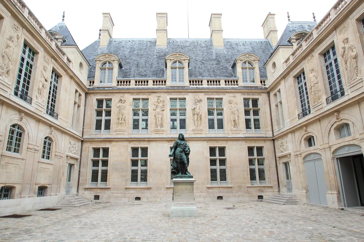
Coysevox's Louis XIV in the Hôtel Carnavalet. Photo: Lionel Allorge, CC BY-SA 3.0, via Wikimedia Commons (resized). Leave the square by its north-west corner and walk west along rue des Francs-Bourgeois. Turn right into rue Madame-de-Sévigné; the entrance is at number 23. This is the city's museum of its own history, and the permanent collections are free. The house was built from 1548 to 1560 for Jacques de Ligneris, a president of the Paris parlement. It is credited to Pierre Lescot, and its sculptures to Jean Goujon and his workshop. The name comes from a later owner, the widow of the Breton François de Kernevenoy, a name Parisians turned into Carnavalet. François Mansart enlarged it around 1660, and from 1677 the letter writer Madame de Sévigné lived here. The city bought it in 1866 on Haussmann's advice, and the museum opened in 1880. Antoine Coysevox's Louis XIV, dressed as a Roman emperor, is one of the few images of the king to survive the Revolution; it stood at the Hôtel de Ville and came here in 1890.
More history
The museum fills two mansions: the Hôtel Le Peletier de Saint-Fargeau, built in 1688–90 by Pierre Bullet, was joined to it in 1989. After a full renovation from 2016 it reopened in 2021, telling the city's story in order from prehistory to today. Marcel Proust's bedroom is among its rooms.
Sources: Wikipedia (fr), Musée Carnavalet; Wikipedia, Musée Carnavalet; Musée Carnavalet, history of the museum. Visiting: the museum's practical information.
-
The Guimard synagogue and rue des Rosiers, the Pletzl
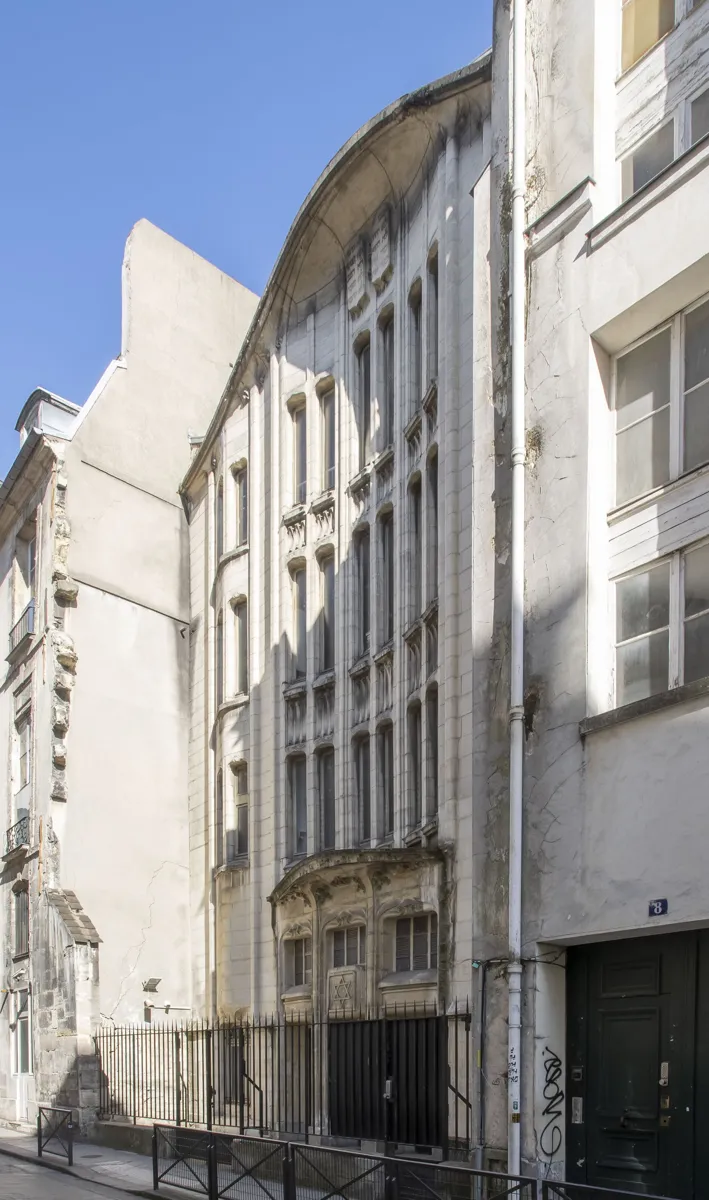
The synagogue at 10 rue Pavée. Photo: Arthur Weidmann, CC BY-SA 4.0, via Wikimedia Commons (resized). Walk back to rue des Francs-Bourgeois and turn left down rue Pavée, across rue des Rosiers, to number 10. Hector Guimard, the Art Nouveau architect known for his work on the Paris Métro, built this synagogue in 1913 for Agoudas Hakehilos, a union of nine Orthodox societies founded mostly by Jews from Russia. On a plot only about 5 m wide, he built upwards, in thin piers and slit windows. Collaborationists dynamited it, along with other Paris synagogues, in the night of 2–3 October 1941; it was later restored. It is still in use, open to visitors only on special days. Now return to rue des Rosiers and turn left. This is the heart of the Pletzl, Yiddish for "little place". From 1881 Ashkenazi Jews fleeing persecution in Russia, Romania and Austria-Hungary settled in these streets. At number 4 bis, a plaque on the school remembers its director, staff and pupils, arrested in 1943 and 1944 and murdered at Auschwitz. At number 7, the front of Jo Goldenberg's restaurant survives; an attack there in 1982 killed six people. On the corner of rue Ferdinand-Duval, called rue des Juifs until 1900, a city panel tells the Pletzl's story.
More history
The street was named after rose bushes in nearby gardens by about 1230. A few steps on, on rue des Hospitalières-Saint-Gervais, the city founded a primary school in 1844 for the children of the Jewish community, with help from the Jewish Consistory. The Vel d'Hiv roundup of 16 and 17 July 1942 hit its pupils and teachers hard. Since November 2018 the space in front has been the Parvis des 260-Enfants, named for the 260 children of the school who were deported and murdered.
Sources: Wikipedia (fr), Synagogue de la rue Pavée; Wikipedia (fr), Pletzl; Wikipedia, Pletzl; Wikipedia (fr), Rue des Rosiers; Wikipedia (fr), Rue des Hospitalières-Saint-Gervais; Wikipedia (fr), École élémentaire des Hospitalières-Saint-Gervais; Wikipedia, 1941 Paris synagogue attacks; Mairie du 4e, speech at the naming of the Parvis des 260-Enfants (2018).


.jpg)


Practical details
- Terrain
- Flat: Open-Meteo puts every stop between about 37 and 47 m above sea level.
- Step-free
- OpenStreetMap maps short flights of steps on the route: on the raised pavement of rue François-Miron by Saint-Gervais, in the Hôtel de Sully between courtyard and garden (three to five steps), and at the doors of Saint-Paul-Saint-Louis and the Carnavalet. To skip the Sully steps, take the street round to the Place des Vosges instead. OpenStreetMap marks Hôtel de Ville and Saint-Paul stations as not wheelchair accessible.
- Water
- OpenStreetMap lists drinking fountains at the start on Place de l'Hôtel-de-Ville, near the Mémorial (stop 2) and on the way to stop 3, about 75 m before the wall.
- Toilets
- OpenStreetMap shows free public toilets on the route near the Mémorial (open 24 hours, wheelchair accessible) and about 70 m before stop 3.
- Sit and eat
- The garden in the middle of the Place des Vosges (stop 6) is shaded by lime trees, and the Maison de Victor Hugo has a café in its courtyard that you can use without a museum ticket. Rue des Rosiers (stop 8) is known for its falafel.
- When to go
- Not Monday, when the Carnavalet and the Hugo museum close; both open Tuesday to Sunday, 10:00 to 18:00. The Mémorial de la Shoah opens Sunday to Friday, 10:00 to 18:00, to 21:00 on Thursdays, and is closed on Saturdays. The Hugo museum charges admission while a temporary exhibition is on. The Hôtel de Sully's courtyard and garden open every day, 9:00 to 19:00. In the Pletzl many shops close on Friday evening and Saturday and open on Sunday. Check before you go.
- Shorter walk
- Finish at stop 6, the Place des Vosges: 2.1 km, about an hour. Saint-Paul metro is about 520 m away, 7 minutes on foot.
- Getting back
- Saint-Paul metro (line 1) is about 300 m from the finish, 4 minutes on foot. Hôtel de Ville metro, where you started, is about 640 m away.
Walking distances and times from the OSRM foot router on OpenStreetMap data. Elevations from Open-Meteo. Stations, fountains and toilets from OpenStreetMap; opening hours from Paris Musées, the Mémorial de la Shoah and the Centre des monuments nationaux. Checked 4 October 2026.
Questions people ask
How long does it take to walk Le Marais, and is there a map?
This walk takes about 80 minutes: 3.0 km, 40 minutes of walking and eight stops, from the Hôtel de Ville to rue des Rosiers, near Saint-Paul metro. Add time for any museum. The map is on this page, and you can print it or save it as a PDF.
What is Le Marais known for?
Its 16th- and 17th-century mansions, called hôtels particuliers, many now museums; the Place des Vosges, the oldest planned square in Paris; the Jewish quarter around rue des Rosiers; and, since the 1980s, an LGBT district, along with art galleries and shops.
Is the Marais the Jewish quarter of Paris?
Part of it is. The Pletzl, around rue des Rosiers, rue des Écouffes and rue Ferdinand-Duval, is the best-known Jewish quarter in Paris. Jews lived here in the 13th century, and from 1881 Ashkenazi Jews from Eastern Europe settled in these streets. The Marais also has the Mémorial de la Shoah and the Museum of Jewish Art and History. Stops 2 and 8 of this walk follow that history.
What is there to see in Le Marais?
On this walk: Saint-Gervais and the half-timbered houses of rue François-Miron, the Mémorial de la Shoah, the longest surviving stretch of the medieval city wall, the church of Saint-Paul-Saint-Louis, the Hôtel de Sully's garden, the Place des Vosges with Victor Hugo's flat, the free Musée Carnavalet, and the Guimard synagogue and rue des Rosiers.
Why is it called the Marais?
Marais means marsh. This part of the Right Bank was flood-prone marshland. It was used as pasture from the 9th century and drained with channels so it could be farmed from the early 12th century.
Walk it with Strolio
Open Strolio at the Hôtel de Ville and ask for 80 minutes through the Marais. Strolio builds walks in any city with mapped streets, so its route may pick different stops from this page. Stories play as you reach each place, and you can ask about anything else you pass, by voice or with a photo. You can also start from your hotel and choose your own time and interests.
More self-guided walks
- Madrid's Barrio de las Letras: about an hour, from Lope de Vega's church to the press that printed Don Quixote.
- Barcelona's Gothic Quarter and El Born: about 90 minutes, from Roman columns to the cathedral and El Call.
- All walks
Sources
- Wikipedia (French): Le Marais, Hôtel de ville de Paris, Église Saint-Gervais-Saint-Protais, Rue François-Miron, Mémorial de la Shoah, Rue Geoffroy-l'Asnier, Enceinte de Philippe Auguste, Rue des Jardins-Saint-Paul, Village Saint-Paul, Rue de l'Hôtel-de-Ville, Rue de l'Ave-Maria, Église Saint-Paul-Saint-Louis, Hôtel de Sully, Place des Vosges, Maison de Victor Hugo, Musée Carnavalet, Synagogue de la rue Pavée, Pletzl, Rue des Rosiers, Rue des Hospitalières-Saint-Gervais, École élémentaire des Hospitalières-Saint-Gervais
- Wikipedia (English): The Marais, Hôtel de Ville, Mémorial de la Shoah, Wall of Philip II Augustus, Saint-Paul-Saint-Louis, Hôtel de Sully, Place des Vosges, Maison de Victor Hugo, Musée Carnavalet, Pletzl, 1941 Paris synagogue attacks
- Wikidata: Maisons du Moyen Âge, rue François-Miron
- Ville de Paris: Le Marais, un secteur sauvegardé; Mairie du 4e, speech at the naming of the Parvis des 260-Enfants (16 November 2018)
- Musée Carnavalet, history of the museum
- Centre des monuments nationaux, Hôtel de Sully: history, the garden passage and opening times. We used their facts and wrote our own text.
- Opening times and visits: Musée Carnavalet, Maison de Victor Hugo, Mémorial de la Shoah, Hôtel de Sully
- Map data and places: © OpenStreetMap contributors, ODbL; walking route from the OSRM foot router run by FOSSGIS
- Elevations: Open-Meteo
- Photos: Wikimedia Commons contributors Tangopaso, Wikinade, Guilhem Vellut, Mbzt, ZeusUpsistos, Staroad.fr, Lionel Allorge and Arthur Weidmann, credited under each photo