
Soho and Covent Garden self-guided walking tour · 90 minutes · map
Soho and Covent Garden on foot: Carnaby Street, Chinatown, theatreland and the piazza
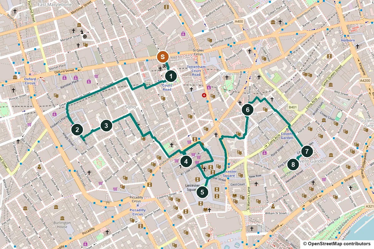
Soho and Covent Garden sit side by side in London's West End. This walk crosses both, from Soho Square past Carnaby Street, the pump that changed medicine and Chinatown, through the theatres to Seven Dials, and on to the Covent Garden piazza and the actors' church.
Soho's name first appears around 1636 and comes from an old hunting cry. Its streets were built in the late 17th century for the well-off, who had mostly moved out by the mid-19th century. Since then it has been one of London's main entertainment districts, home to music clubs, film companies and restaurants. Covent Garden was once the walled garden of the monks of Westminster Abbey. In the 1630s Inigo Jones laid out a grand square there, and a fruit and vegetable market filled it for more than 300 years.
A note on accuracy: some stops are not what they seem. The cholera pump is a replica, the Seven Dials column is a 1989 reconstruction, and one Gerrard Street plaque is on the wrong house. We say so at each stop, and every fact links to its source.
- Start
- Tottenham Court Road station (Central, Northern and Elizabeth lines), at the top of Soho Street
- Finish
- St Paul's Church, Covent Garden, about 170 m from Covent Garden tube station (Piccadilly line)
- Distance
- 3.4 km, one way
- Time
- About 90 minutes: 45 min walking and 8 stops, longer if you shop or eat
Toilets, water, market days and a shorter version ↓
What to see: the stops
-
Soho Square, Charles II and the Tudor-style hut
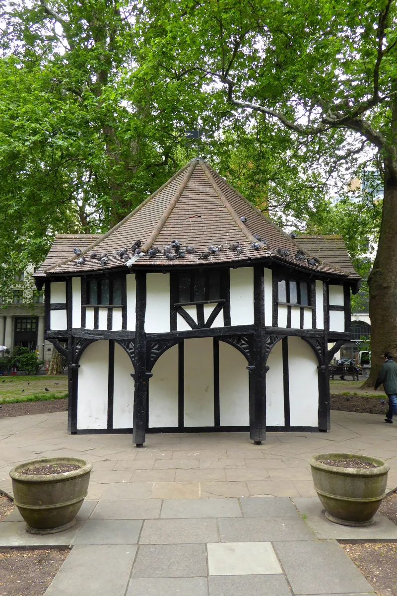
The hut in the middle of the square. Photo: Ethan Doyle White, CC BY-SA 4.0, via Wikimedia Commons (resized). From Tottenham Court Road station, walk down Soho Street into Soho Square. The square was built in the late 1670s and was first called King Square, after Charles II. His weathered stone statue, carved by Caius Gabriel Cibber in 1681, once stood in the centre above a fountain. It was taken away in 1875–76 and came back in February 1938, though not to the centre. The centre is now held by the half-timbered hut. It looks Tudor, but it was built around 1925–26 for the Charing Cross Electricity Company to hide an electricity substation, using reclaimed 17th- or 18th-century beams. The garden was private until April 1954, when it opened to the public.
More history
The naturalist Joseph Banks, who had sailed round the world with James Cook, moved to No. 32 in the 1770s and opened his library and herbarium to visitors. Of the first houses, only Nos. 10 and 15 still stand. A bench in the garden remembers the singer Kirsty MacColl, who wrote the song "Soho Square"; fans meet there every year on the Sunday nearest her birthday.
Sources: Historic England, Statue of Charles II; Historic England, the hut; Survey of London, Soho Square Garden; Wikipedia, Soho Square.
-
Carnaby Street, where 1960s London went shopping
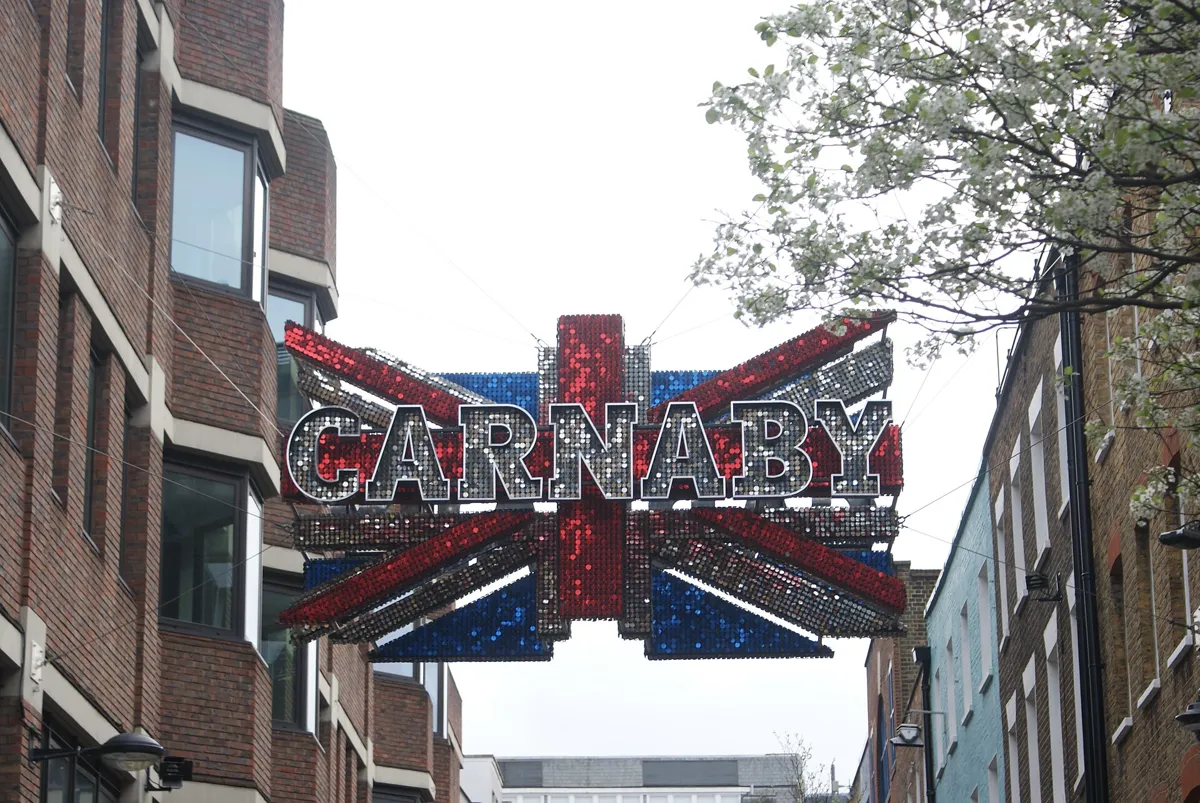
A Carnaby sign over the street. Photo: Robert Lamb, CC BY-SA 2.0, via Wikimedia Commons (resized). Leave the square by Carlisle Street on its west side, cross Dean Street and carry on along Sheraton Street. At Wardour Street cross into Hollen Street and follow it round into Noel Street, which runs on across Berwick Street and Poland Street to Great Marlborough Street. Turn left down Carnaby Street. The street takes its name from Karnaby House, built in 1683 just to the east. In the early 1950s it was a shabby backstreet of workshops. In 1957 John Stephen opened his men's boutique His Clothes here, and other fashion shops followed. By the mid-1960s it was the street of mods and "Swinging London": a Time magazine cover story of 15 April 1966 picked it out, and the Kinks sang about the "Carnabetian army" the same year. The Greater London Council closed it to traffic in October 1973. Westminster City Council has put up two green plaques: to John Stephen at No. 1, and to the Small Faces and their manager Don Arden at Nos. 52–55.
More history
In 1934 Amy Ashwood Garvey and Sam Manning opened the Florence Mills Social Club at No. 50, a jazz club where supporters of Pan-Africanism met. In 1961 the first Cranks restaurant opened at No. 22, the start of a vegetarian chain.
Sources: Wikipedia, Carnaby Street; Wikipedia, John Stephen.
-
The Broad Street pump, where John Snow traced cholera
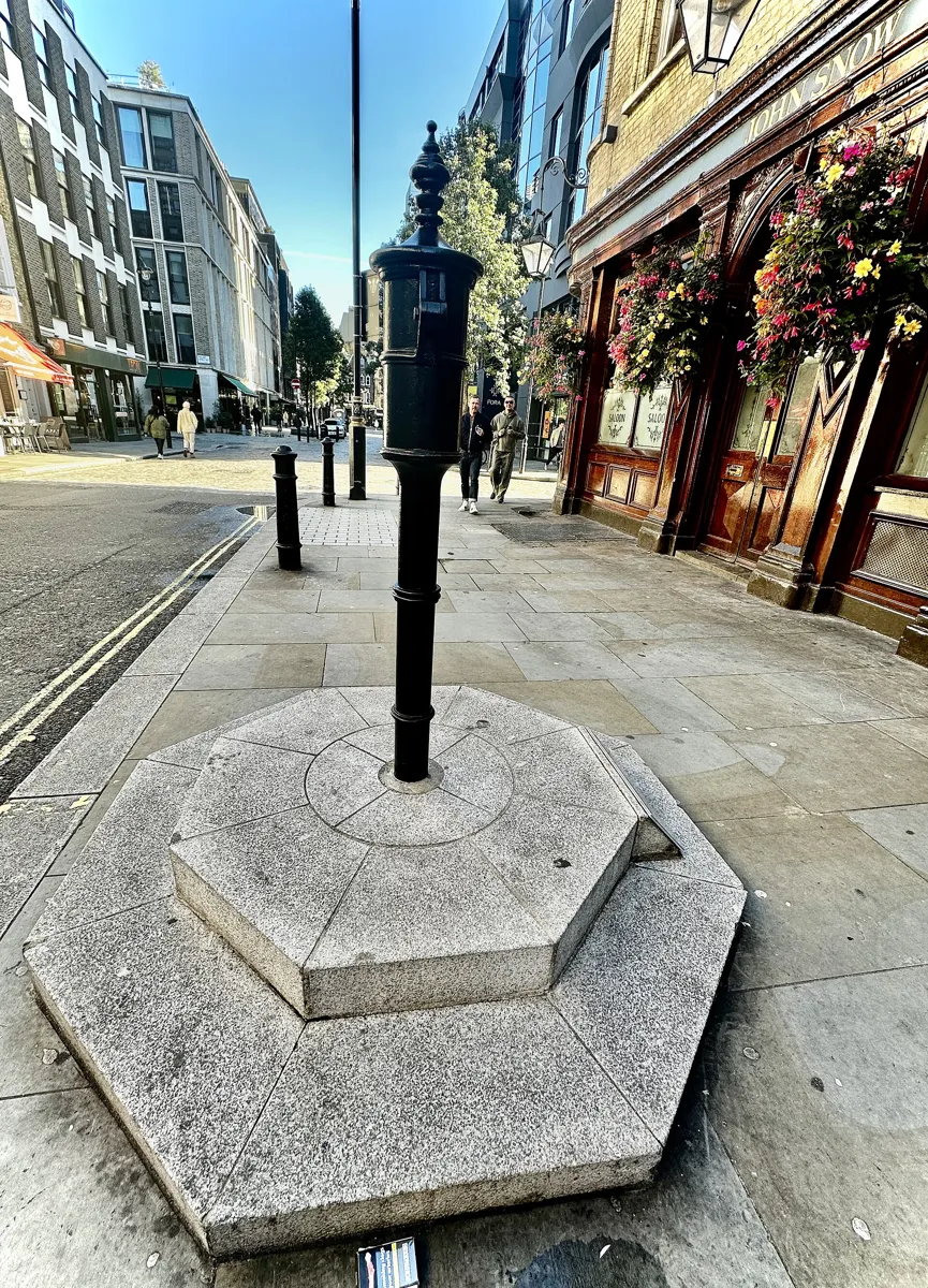
The handleless replica pump by the John Snow pub. Photo: Whispyhistory, CC BY-SA 4.0, via Wikimedia Commons (resized). Walk on down Carnaby Street and turn left into Broadwick Street. Carry on to the corner of Lexington Street and the John Snow pub. Broadwick Street was then Broad Street, and on 31 August 1854 cholera broke out here; within three days 127 people on or near the street had died. The doctor John Snow believed cholera spread through dirty water, not bad air. With the help of a local curate, Henry Whitehead, he found that the dead had drunk from the street pump. On 7 September he put his case to the parish guardians, and the next day the pump's handle was removed. His dot map of the deaths around the pump became famous. The pump you see is a replica. Westminster City Council put one up at the Poland Street corner in 1992; it was removed for building work in 2015 and set up here, on the original spot, on 20 July 2018. A pink granite kerbstone marks where the old pump stood.
More history
The well was later found to lie about a metre from an old cesspit that was leaking. Workers at the brewery on the street escaped, because they drank their daily beer allowance instead of the water. The pub, built in the 1870s as the Newcastle-upon-Tyne, was renamed the John Snow in 1954, a century after the handle came off.
Sources: The John Snow Society; Wikipedia, 1854 Broad Street cholera outbreak; Wikipedia, John Snow; Wikipedia, John Snow (pub); Wikipedia, Broadwick Street.
-
Gerrard Street and Chinatown
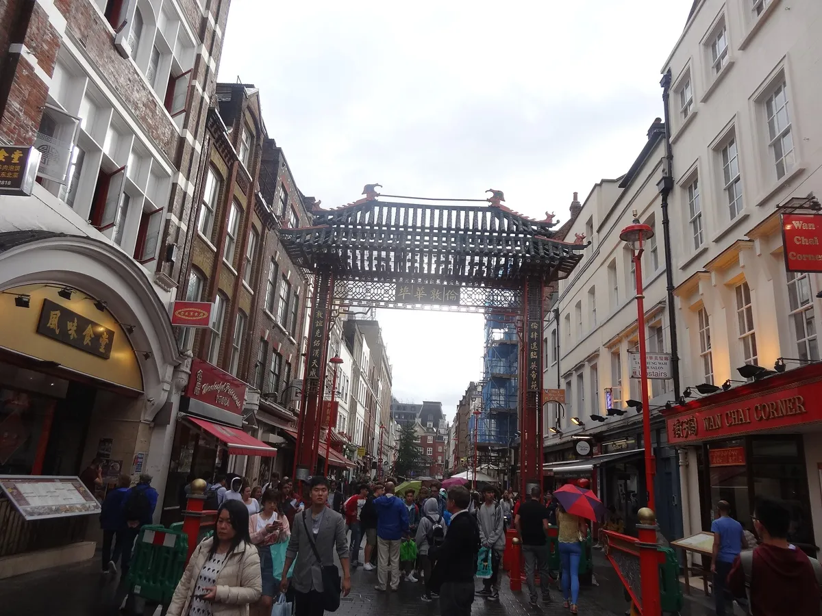
Gerrard Street in 2017. Photo: Jordiferrer, CC BY-SA 4.0, via Wikimedia Commons (resized). Keep east along Broadwick Street and turn right down Berwick Street. Its street market dates back at least to the early 1840s; the cover photo of Oasis's album (What's the Story) Morning Glory? was taken on this street. At the bottom, turn left along Peter Street and right down Wardour Street, across Old Compton Street. At Shaftesbury Avenue turn left, cross over and turn right down Macclesfield Street into Gerrard Street. The street was built between 1677 and 1685 by Nicholas Barbon on the Military Ground, where a volunteer company once drilled, and is named after the landowner Charles, Lord Gerard. Chinatown was being recognised as such by the 1970s, and the first Chinese restaurants probably opened on Lisle Street, next to Gerrard Street. The area now has more than 80 restaurants. A plaque at No. 9 marks the Turk's Head tavern, where Joshua Reynolds and Samuel Johnson founded their dining club, The Club, in 1764. Another, at No. 43, says the poet John Dryden lived here. The Survey of London says he lived next door, at the old No. 44, and both original houses have gone.
More history
Ronnie Scott's jazz club started in the basement of No. 39, and in August 1968 Led Zeppelin held their first rehearsal in a basement somewhere on this street. A newer Chinatown gate, in the style of the Qing dynasty, was made by Chinese craftsmen and opened on Wardour Street in July 2016.
Sources: Survey of London, the Military Ground and Gerrard Street; Wikipedia, Gerrard Street; Wikipedia, Chinatown, London. On the way: Wikipedia, Berwick Street; Wikipedia, Berwick Street Market.
-
Leicester Square, from muddy fields to cinema premieres
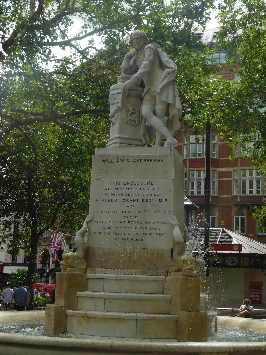
The Shakespeare statue and fountain. Photo: Bryn Holmes, CC BY-SA 2.0, via Wikimedia Commons (resized). Walk to the east end of Gerrard Street, go down Newport Place to Lisle Street, turn right and go down Leicester Place into the square. It was laid out in the 1670s as Leicester Fields, named after Leicester House, the home of Robert Sidney, 2nd Earl of Leicester. Well-off people lived around it, among them William Hogarth at No. 30 from 1733 to 1764. In the 19th century it turned into a place of shows and entertainments, with theatres that later became cinemas. The garden in the middle had decayed badly when the MP Albert Grant bought it in 1874 for £11,060 and gave it to the Metropolitan Board of Works. The Shakespeare statue and fountain came with that restoration. The square was pedestrianised in the 1980s and refurbished for £15.3 million, reopening in May 2012. Today it is the cinema premiere square: the Odeon here has the most seats in a single screen in the UK.
More history
In 1851 the showman James Wyld put a giant globe in the garden, a scale map of the Earth. In January 1979, during a refuse strike, the square became a dump and was nicknamed “Fester Square”.
Sources: Wikipedia, Leicester Square.
-
Seven Dials, a 17th-century plan for triangles
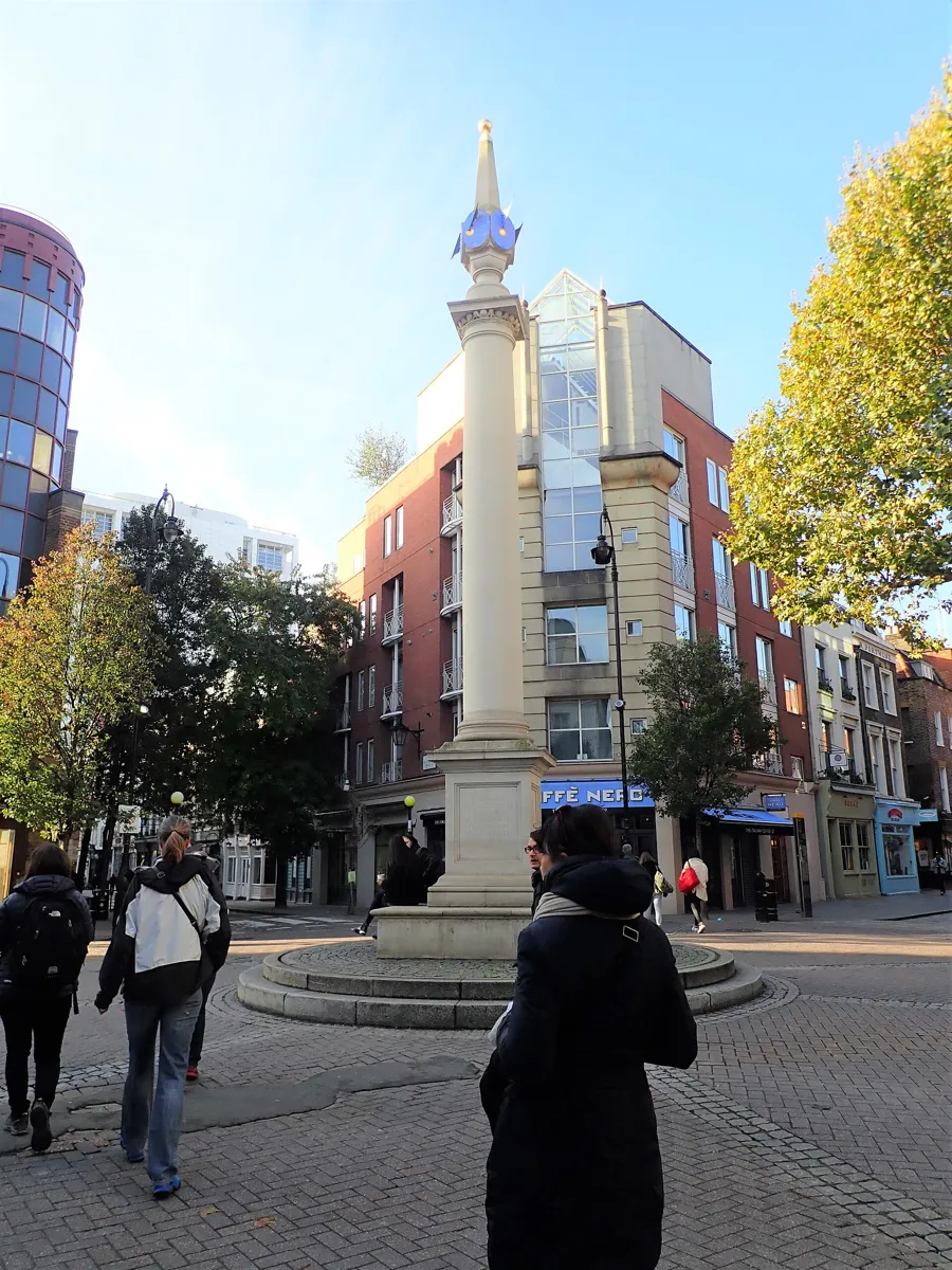
The Seven Dials column. Photo: Eirian Evans, CC BY-SA 2.0, via Wikimedia Commons (resized). Go up to Cranbourn Street and follow it east, then take Litchfield Street and West Street. St Martin's Theatre is on West Street. The Mousetrap, Agatha Christie's murder mystery, has played there since March 1974. It is the longest-running play in the world, paused only by the pandemic closures of 2020–21. Cross Upper St Martin's Lane into Monmouth Street and walk up to Seven Dials, where streets meet at a small roundabout around a stone column. Thomas Neale laid the area out in the early 1690s with six roads, and a seventh was added later. The column has six sundial faces and acts as the seventh dial itself. The layout gave triangular plots with short street frontages, because rentals were charged by the foot of frontage rather than by floor area. Neale hoped to attract wealthy residents, but the area's status fell, and by the 19th century it was among the most notorious slums in London. The column is a replica: the original was taken down in 1773, and the present one was built in 1988–89 and unveiled by Beatrix of the Netherlands in June 1989.
More history
Only two of Neale's houses survive, at 61 Monmouth Street and 64 Neal Street. Dickens described the tangled streets in 1835, and Agatha Christie set The Seven Dials Mystery (1929) here. Just off Monmouth Street is Neal's Yard, a small courtyard named after Neale. In 1976 Michael Palin and Terry Gilliam bought offices there, and Nicholas Saunders opened a whole-food warehouse that grew into a group of shops.
Sources: Wikipedia, Seven Dials; Wikipedia, St Martin's Theatre; Wikipedia, The Mousetrap; Wikipedia, Neal's Yard.
-
Covent Garden: the market hall and the Royal Opera House
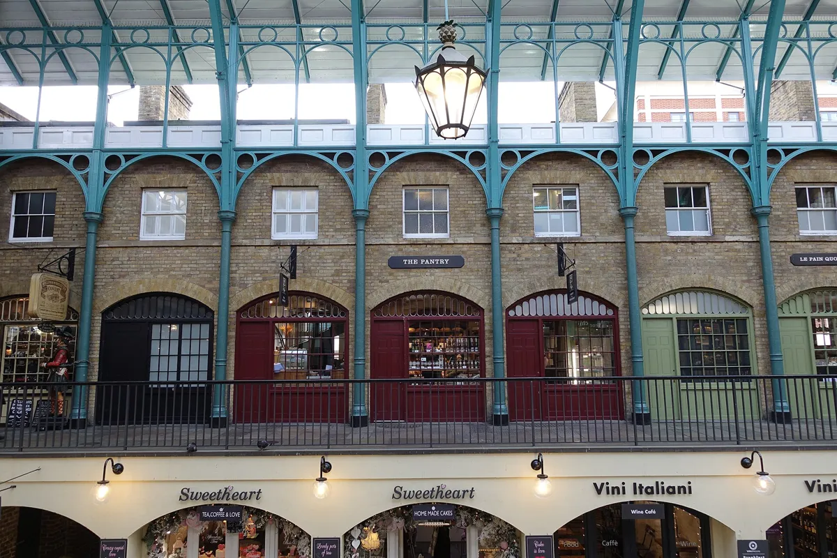
The first floor of the market building. Photo: CrisNYCa, CC BY-SA 4.0, via Wikimedia Commons (resized). From Seven Dials turn into Neal's Yard, then follow Shorts Gardens, Neal Street, Long Acre and James Street into the piazza. The land was once the walled garden of the monks of Westminster Abbey; the name “Covent” comes from an old word for a religious community. In 1630 the 4th Earl of Bedford commissioned Inigo Jones to build a church and terraces of fine houses around a square, the first modern square in London. The market hall in front of you is Charles Fowler's neo-classical building of 1830. The fruit and vegetable market moved to Nine Elms in 1974, and the building reopened as shops and cafés in 1980. The Royal Opera House is next to the piazza. Its portico fronts Bow Street, but a side entrance to its box office is on the square. This is the third theatre on the site, after fires in 1808 and 1856, and it opened in 1858. The front, foyer and auditorium date from then, while almost everything else comes from the rebuilding of the 1990s. The London Transport Museum, on the piazza's east side, is in the flower market building designed by William Rogers in 1871. Check its website for opening hours and ticket prices.
More history
The wealthy residents left once a market grew up on the south side from about 1654, and street performers now work the piazza by audition. Handel worked at the theatre here from 1735, and many of his operas and oratorios were first performed on this site.
Sources: Wikipedia, Covent Garden; Royal Opera House, history; Wikipedia, Royal Opera House; Wikipedia, London Transport Museum.
-
St Paul's Church, the actors' church
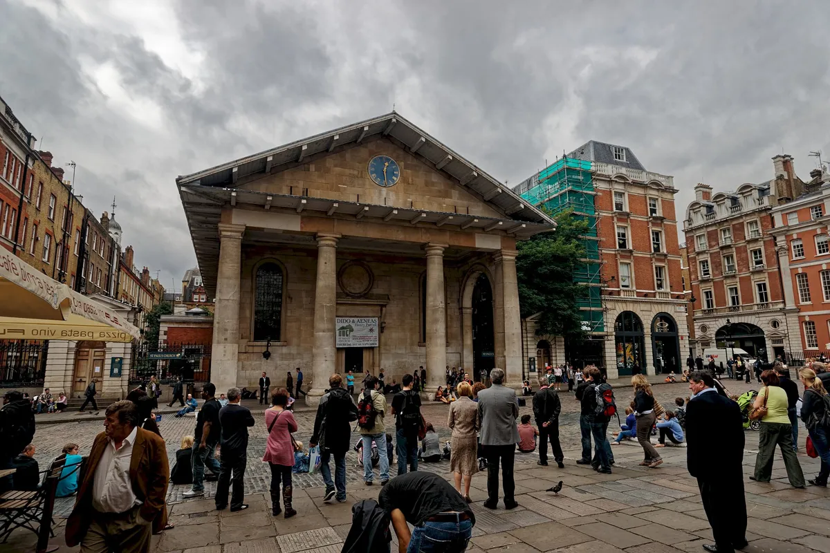
The portico of St Paul's, facing the piazza. Photo: Txllxt TxllxT, CC BY-SA 4.0, via Wikimedia Commons (resized). Cross to the west side of the piazza, where the church stands behind its portico. It was built for the Earl of Bedford and finished in 1633, and it was the first entirely new church built in London since the Reformation. Inigo Jones is credited with it, though firm documents are missing. A well-known story says the earl asked for something not much better than a barn, and Jones promised “the handsomest barn in England”. The portico facing you is not the entrance, because the altar is behind that wall. Go round to the west front to enter. This is not quite the 1630s building: a fire gutted it in 1795, and Thomas Hardwick restored it, with the church reconsecrated in 1798. The nickname “the actors' church” comes from its long link with the theatre. In May 1662 Samuel Pepys noted an Italian puppet play under the portico, recorded as the first Punch and Judy show. Shaw's Pygmalion opens under it. Inside are memorials to Charlie Chaplin and Vivien Leigh. Check actorschurch.org for opening hours.
More history
The painter J. M. W. Turner and W. S. Gilbert were both baptised here. The first known victim of the 1665–66 plague in England, Margaret Ponteous, was buried in the churchyard on 12 April 1665.
Sources: Wikipedia, St Paul's, Covent Garden.


Practical details
- Terrain
- Flat. Open-Meteo puts every stop within about 10 m of height of the others, though its figures can be off in dense city centres. Many streets are narrow or closed to traffic, and the piazza is cobbled.
- Step-free
- OpenStreetMap shows no steps on the route line; the nearest mapped flights are 47 m or more from it, around Leicester Square and Chinatown. It marks the Elizabeth line at Tottenham Court Road as wheelchair accessible. Covent Garden tube is not mapped as step-free: its own site counts 193 steps to street level and recommends the lifts. In the market building, the smoothest way in is by the ramps from Russell Street or the foot of James Street.
- Water
- OpenStreetMap lists drinking fountains near Ganton Street on Carnaby Street and near Seven Dials. Covent Garden's FAQ lists a free refill station at Boots on Long Acre.
- Toilets
- OpenStreetMap shows toilets by Soho Square (no fee) and a free one by Leicester Square. Covent Garden says its pay toilets are in the Market Building (£1.50) and beside the St Paul's portico (50p).
- Sit and eat
- Chinatown is full of restaurants, and the Covent Garden market building has cafés, pubs and shops. Berwick Street has its street market; check before you go for the days it trades.
- When to go
- The piazza is open all day and night, but shops close in the evening. Covent Garden lists the Apple Market as antiques on Mondays and British hand-made crafts from Tuesday to Sunday. Churches, the Royal Opera House and the London Transport Museum keep their own hours, so check before you go.
- Shorter walk
- Finish at stop 5, Leicester Square: 2.2 km, about 55 minutes with stops. Leicester Square tube is right there.
- Getting back
- Covent Garden tube (Piccadilly line) is about 170 m from the church. Leicester Square tube is about 300 m away, and the Covent Garden FAQ suggests it at busy times. The Covent Garden FAQ puts Embankment station about ten minutes' walk away.
Walking distances and times from the OSRM foot router on OpenStreetMap data. Elevations from Open-Meteo. Stations, fountains and toilets from OpenStreetMap; prices and hours from coventgarden.london. Checked 5 October 2026.
Questions people ask
How long does the Soho and Covent Garden self-guided walking tour take, and is there a map?
About 90 minutes: 3.4 km, 45 minutes of walking and eight stops, from Tottenham Court Road station to St Paul's Church in Covent Garden. The map is on this page, and you can print it or save it as a PDF.
What is Soho known for?
Soho has been one of London's main entertainment districts since the 19th century. It is known for its theatres and music clubs, for the headquarters of film companies, for restaurants, and for a gay village around Old Compton Street. It is also where John Snow traced the 1854 cholera outbreak to a water pump on Broad Street, now Broadwick Street.
How far is Soho from Covent Garden?
They share a border. Soho is usually taken to end at Charing Cross Road, and Covent Garden lies to its east. On this walk it is 1.1 km from Leicester Square, via Seven Dials, to the Covent Garden piazza.
Is Covent Garden free to visit?
Yes. According to Covent Garden's own FAQ, the Piazza and the Market Building are a public space, free for anyone to walk around day or night. Shops usually open 10am to 8pm Monday to Saturday and around 11am to 6pm on Sunday, and the Apple Market is open daily from 10am to 6pm. The Royal Opera House and the London Transport Museum set their own hours and prices.
What is the John Snow pump?
It is a replica of the Broad Street water pump that John Snow linked to the 1854 cholera outbreak. Its handle was removed on 8 September 1854, and the replica was set up on the original spot on Broadwick Street, beside the John Snow pub, on 20 July 2018.
Walk it with Strolio
Open Strolio at Soho Square and ask for a walk through Soho and Covent Garden. Strolio builds walks in any city with mapped streets, so its route may pick different stops from this page. Stories play as you reach each place, and you can ask about anything else you pass, by voice or with a photo. You can also start from your hotel and choose your own time and interests.
More walks in London
- The City of London: ~90 min, 8 stops. From Wren's cathedral past a Roman fort wall, amphitheatre and temple to where the Great Fire began.
- Westminster: ~80 min, 8 stops. From Trafalgar Square down Whitehall to Big Ben and the Abbey, then through St James's Park to Buckingham Palace.
- Greenwich: ~70 min, 8 stops. From the Cutty Sark through Wren's naval college and past the Queen's House, then up the park to the view from General Wolfe's statue.
- All London walks, with maps side by side.
- Walks in other cities.
Sources
- Official and heritage pages: Historic England, Statue of Charles II, Historic England, the hut in Soho Square, Survey of London, Soho Square Garden, Survey of London, the Military Ground, Survey of London, Gerrard Street, The John Snow Society, Royal Opera House, history and Covent Garden, FAQs. We used their facts and wrote our own text.
- Wikipedia: Soho, Soho Square, Carnaby Street, 1854 Broad Street cholera outbreak, John Snow, John Snow (pub), Broadwick Street, Berwick Street, Berwick Street Market, Gerrard Street, Chinatown, Leicester Square, Seven Dials, St Martin's Theatre, The Mousetrap, Neal's Yard, Covent Garden, Royal Opera House, London Transport Museum, St Paul's, Covent Garden
- Opening times and visits: Covent Garden, FAQs, St Paul's Church, London Transport Museum
- Map data and places: © OpenStreetMap contributors, ODbL; walking route from the OSRM foot router run by FOSSGIS
- Elevations: Open-Meteo
- Photos: Wikimedia Commons contributors credited under each photo