
City of London self-guided walking tour · 90 minutes · map
The City of London on foot: Roman walls, the Great Fire and St Paul's
The City of London sits on top of Roman Londinium, and most of it burned in 1666. This walk follows both stories: from Wren's cathedral to a Roman fort wall, an amphitheatre, a temple and the forum site, then to the bakery where the Great Fire began and the wall at Tower Hill.
The City, or Square Mile, is the old core of London. The Romans founded Londinium here around AD 47–50, and around AD 200 they walled it. In September 1666 the Great Fire gutted the medieval city inside that wall. London was rebuilt on much the same street plan, and Cheapside, on this route, still follows a Roman road. Today the City has its own local authority, the City of London Corporation, led by the Lord Mayor.
A note on accuracy: several stops are ruins, rebuilds or sites of things that are gone. Where something is not the original, we say so, and every fact links to its source.
- Start
- St Paul's station (Central line)
- Finish
- The Roman wall beside Tower Hill station (District and Circle lines)
- Distance
- 3.7 km, one way
- Time
- About 90 minutes: 50 minutes of walking and 8 stops. Allow 2 hours or more to go down to the amphitheatre and the Mithraeum
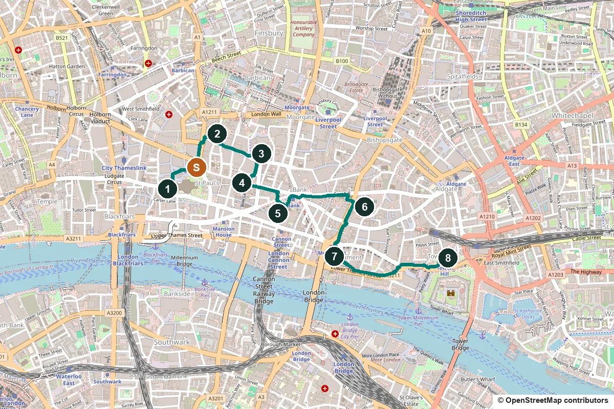
Terrain, opening times, tickets and a shorter version ↓
What to see: the stops
-
St Paul's Cathedral, Wren's answer to the Great Fire
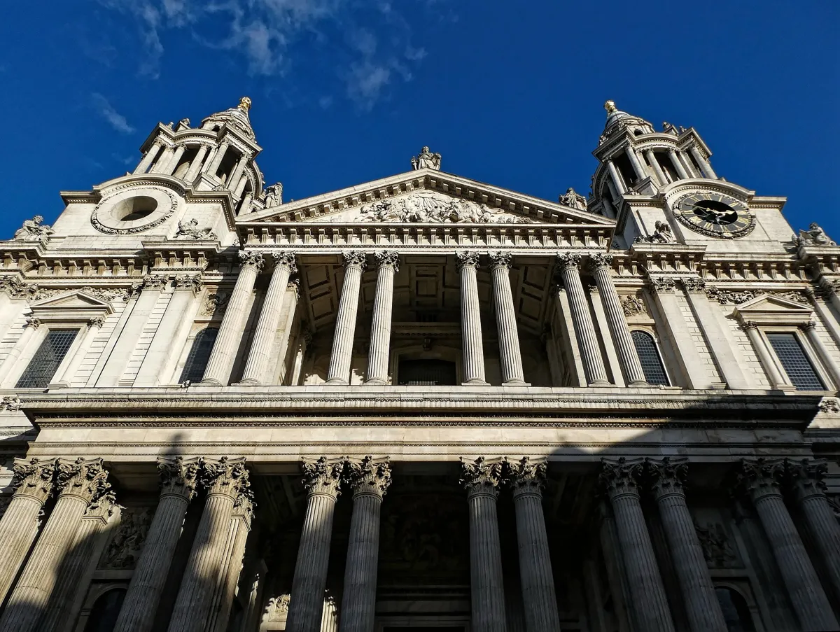
The west front. Photo: Acabashi, CC BY-SA 4.0, via Wikimedia Commons (resized). From St Paul's station, walk through Panyer Alley and along Paternoster Row, then round the north side of the cathedral to the foot of the west steps. A church of St Paul was founded in 604 as the seat of a new bishop; it is assumed, not proved, that it stood here. The Gothic cathedral that came later, Old St Paul's, was gutted by the Great Fire in September 1666, only months after Christopher Wren had proposed a radical renovation. Wren was given the job of designing a new one on 30 July 1669. It was consecrated in 1697, and in 1708 Wren's son helped set the last stone on the lantern. The dome rises 111 m (365 ft) to the cross, and from 1710 to 1963 this was London's tallest building. Wren was the first person buried in the crypt, in 1723. Above his tomb, in Latin: "Reader, if you seek his monument, look around you."
More history
On 12 September 1940 a team of Royal Engineers under Robert Davies defused and removed a delayed-action bomb; Davies and Sapper George Wylie received the George Cross. On 29 December 1940 Herbert Mason photographed the dome above the smoke from a roof in Tudor Street, a picture known as "St Paul's Survives".
Sources: Wikipedia, St Paul's Cathedral. Visiting: hours and tickets on St Paul's Cathedral's site.
-
Noble Street, where a Roman fort became the city wall
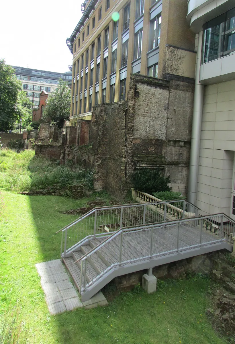
The wall at Noble Street, looking south. Photo: 3BRBS, CC BY-SA 3.0, via Wikimedia Commons (resized). Walk back through Paternoster Square and Panyer Alley, cross St Martin's Le Grand into Gresham Street, and turn left up Noble Street. The ruins lie in a sunken garden on your left. Here you see two Roman walls in one. Between AD 120 and 150 the army built a fort at Cripplegate. When the city wall went up around AD 190–225, the builders did not start again here: they thickened the fort's west wall by building a narrower wall against its inner face. The scheduled stretch is about 80 m long, with the bases of two fort turrets and, at the south end, a D-shaped bastion. The highest Roman masonry is opposite Oat Lane; the 4.5 m section at the north end is mostly medieval. The walls jutting out are the remains of buildings, from the late 18th century on, that used the old wall as a foundation. Bombing on 29 December 1940 laid this section bare.
More history
The Roman gates were Ludgate, Newgate, Cripplegate, Bishopsgate and Aldgate; Aldersgate was added around 350 and Moorgate in the Middle Ages. All seven City gates came down between 1760 and 1767.
Sources: Historic England, list entry 1018890; Wikipedia, London Wall.
-
Guildhall Yard and London's Roman amphitheatre
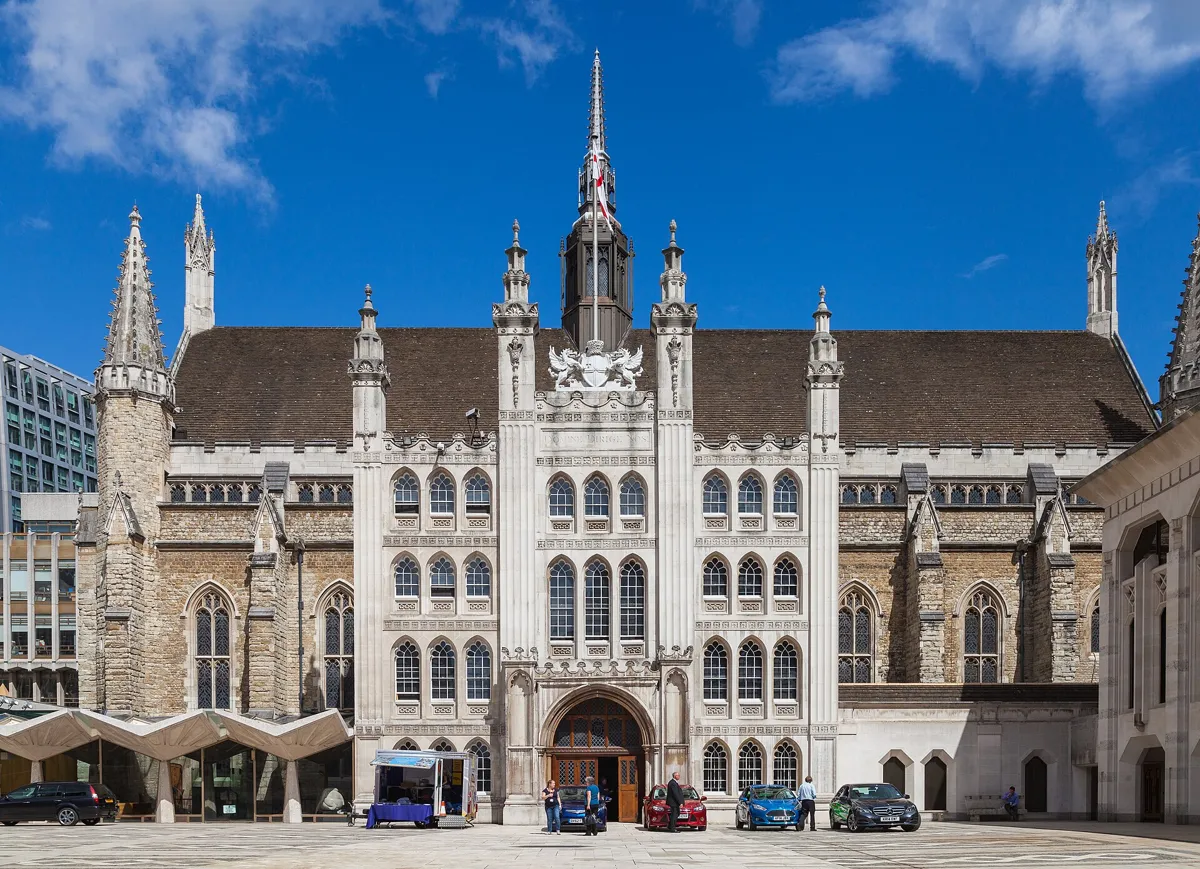
Guildhall across Guildhall Yard. Photo: Diego Delso, CC BY-SA 4.0, via Wikimedia Commons (resized). Go back down Noble Street and turn left along Gresham Street for about 250 m; Guildhall Yard opens on your left. Look down: a curve of dark paving stones marks the outer wall of Roman London's amphitheatre. It was first built of wood around AD 70 and renovated in the early 2nd century with stone walls and tiled entrances. It staged animal fights, gladiator combats and executions. Museum of London archaeologists found it in 1988 while digging for the new Guildhall Art Gallery. Its entrance tunnel, east gate and arena walls are kept 20 feet below the yard, and have been open to visitors since 2002, free. The hall itself was built from 1411 to 1440 under John Croxton. It was damaged in the Great Fire, and its roof burned in the raid of 29–30 December 1940; the present roof dates from 1954.
More history
The church of St Lawrence Jewry, on the south side of the yard, sits at an odd angle, which may follow the curve of the buried arena. Lady Jane Grey and Archbishop Thomas Cranmer were tried in Guildhall. On 16 November 1848 Frédéric Chopin gave his last public concert here.
Sources: City of London (OneCity), London's Roman Amphitheatre; Wikipedia, Amphitheatre (London); Wikipedia, Guildhall. Visiting: City of London Corporation, Guildhall Art Gallery.
-
St Mary-le-Bow, the church of the Bow Bells
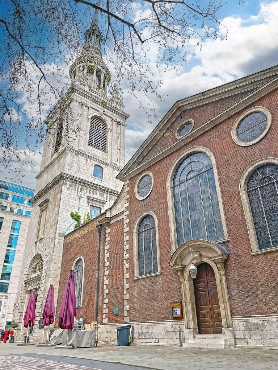
The brick church and its Portland stone tower. Photo: Bellminsterboy, CC BY-SA 4.0, via Wikimedia Commons (resized). Leave the yard, cross Gresham Street and walk south down Lawrence Lane, then jog right into Honey Lane, which brings you out on Cheapside. The tower stands across the road, a few steps to your right. Archbishop Lanfranc founded a church here in 1080. Its round stone arches, a novelty then, gave it the name St Mary of the Arches; "bow" is an old word for arch. The Great Fire destroyed all but the tower, and attempts to repair that failed. Wren rebuilt the body of the church by 1673 and the tower by 1680; of all his churches, only St Paul's cost more. He moved the tower forward onto the street and, digging its foundations, hit a Roman causeway 18 feet down. Tradition says anyone born within the sound of Bow Bells is a true Cockney. On the last night of the Blitz, 10–11 May 1941, fire gutted the church and the bells crashed down. What you see is Laurence King's 1956–64 restoration to Wren's design, inside the surviving walls and tower.
More history
From 1363 the tower held the city's curfew bell, rung at 9 every evening. Legend says Dick Whittington heard these bells call him back to London in 1392, and the new ring of twelve, dedicated in December 1961, spells "D. Whittington" with the first letters of its inscriptions. Look up for the weathervane: a winged dragon.
Sources: Wikipedia, St Mary-le-Bow. Opening times on the church's site.
-
The London Mithraeum, a Roman temple under Bloomberg
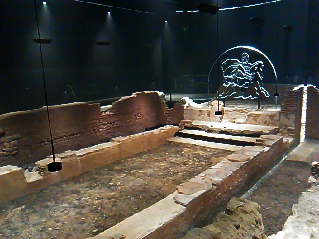
The temple in its underground display. Photo: Gapfall, CC BY-SA 4.0, via Wikimedia Commons. Walk east along Cheapside and Poultry, turn right down Bucklersbury Passage, cross Queen Victoria Street and go round the Bloomberg building to its entrance at 12 Walbrook. In September 1954, builders digging for an office block found a Roman temple of the mystery god Mithras. It was built in the mid-3rd century, partly underground, on the bank of the Walbrook, a river now covered over. Marble heads of Mithras, in his Phrygian cap, of Minerva and of Serapis had been carefully buried inside. The ruin was then moved about 100 m and rebuilt in the open on Queen Victoria Street in 1962, inaccurately. Bloomberg, which bought the site in 2010, put the temple back near its original spot, 7 m below the street, when its European headquarters opened in 2017. Most of the stones and bricks are original; the mortar and wood are new. Entry is free; it is closed on Mondays.
More history
From 2010 to 2013 archaeologists dug the site again and recovered more than 14,000 objects. Among them were over 400 wooden writing tablets. One, dated AD 57, is London's oldest financial document.
Sources: Wikipedia, London Mithraeum; City of London (OneCity), London Mithraeum; Art Fund. More on the London Mithraeum's site.
-
Leadenhall Market, on the Roman forum
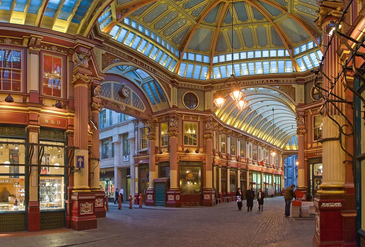
Horace Jones's 1881 market roof. Photo: Diliff, CC BY 2.5, via Wikimedia Commons (resized). Walk up Walbrook to Bank junction. The Bank of England stands on its north-east corner, on Threadneedle Street since 1734. Beside it, between Threadneedle Street and Cornhill, is the Royal Exchange, first opened by Elizabeth I on 23 January 1571 and rebuilt in the 1840s. Head east along Cornhill and turn right down St Peter's Alley, beside Wren's St Peter upon Cornhill, which stands on the highest point of Roman London. Cross Gracechurch Street into the market. Under your feet lay the centre of Londinium: the forum, its marketplace, and the basilica, its town hall and law courts. Between about AD 90 and 120 the forum was rebuilt as a square of roughly 168 by 167 m, with a three-storey basilica, the largest north of the Alps. The market dates back to 1321. Dick Whittington gave the site to the City in 1411. The iron and glass arcade is Horace Jones's work of 1881.
More history
A pier of the basilica survives in the basement of 90 Gracechurch Street. The market stood in for the London streets near the Leaky Cauldron in the 2001 film Harry Potter and the Philosopher's Stone.
Sources: Leadenhall Market, history; Wikipedia, Leadenhall Market; Wikipedia, Londinium. On the way: Wikipedia, Royal Exchange; Wikipedia, Bank junction.
-
The Monument and Pudding Lane, where the Great Fire began
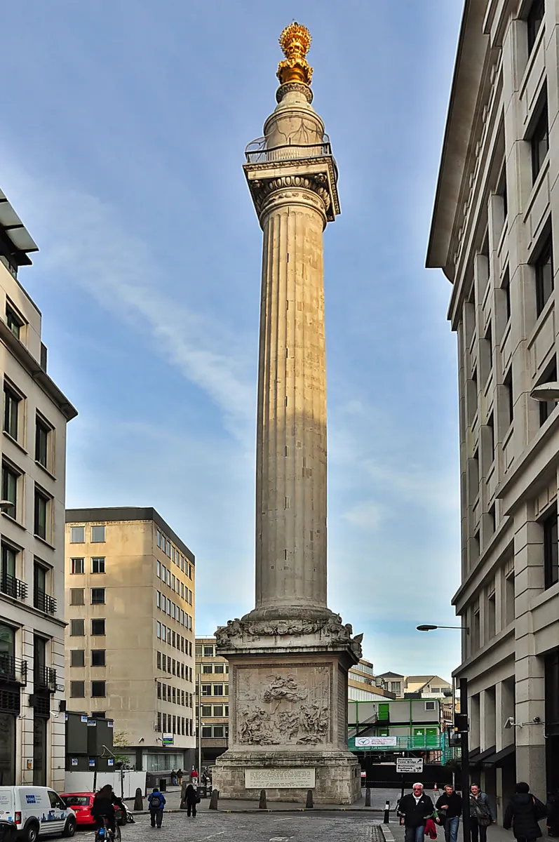
The Monument from Fish Street Hill. Photo: Eluveitie, CC BY-SA 3.0, via Wikimedia Commons (resized). Leave the market by its Gracechurch Street entrance and walk south down Gracechurch Street, across Eastcheap and into Fish Street Hill; the column is on your left. Shortly after midnight on Sunday 2 September 1666, fire broke out in Thomas Farriner's bakery on Pudding Lane, just east of here. The family escaped through an upstairs window, but their maid was too frightened to follow and became the first victim. By Tuesday the fire covered nearly the whole city; it was over on Wednesday 5 September. The Monument counts 13,200 houses and 87 churches lost and six recorded deaths, though some historians think many more died. Robert Hooke designed the column with Wren, and it was built from 1671 to 1677. It is 202 feet (61.6 m) tall and stands 202 feet from where the fire began. You can climb its 311 steps. Then walk round to Pudding Lane. The bakery stood on its east side, opposite the Monument; the spot was paved over when Monument Street was built in 1886–87, and a plaque put up by the Bakers' Company in 1986 marks it.
More history
The Monument stands on the site of St Margaret, New Fish Street, the first church the fire destroyed. Pudding Lane is said to take its name from the offal, or "pudding", that Eastcheap butchers carted down it to the river. In 1681 the City's Court of Aldermen added words to the Monument blaming Catholics for the fire. They were chiselled off in 1830.
Sources: The Monument, Great Fire FAQs; Wikipedia, Monument to the Great Fire of London; Wikipedia, Great Fire of London; Wikipedia, Pudding Lane. Tickets and hours on the Monument's site.
-
The Roman wall at Tower Hill
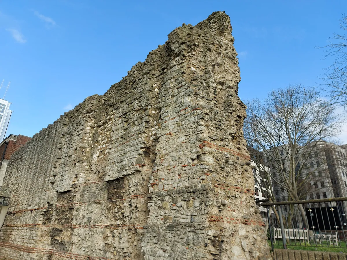
The wall at Tower Hill: the red tile bands are Roman. Photo: Jamzze, CC BY-SA 4.0, via Wikimedia Commons (resized). Walk east along Monument Street, past the end of Pudding Lane, then follow Lower Thames Street and Byward Street. On Byward Street you pass All Hallows-by-the-Tower: it survived the fire because Admiral William Penn had his men blow up the buildings around it, and Samuel Pepys climbed its tower to watch the fire. Keep on towards Tower Hill station; the wall stands beside it, north of the Tower of London. Londoners built their stone wall around AD 200, from Kentish ragstone quarried near Maidstone and shipped in by river. This stretch is 10.7 m high, one of the tallest left. The lower 4 m, with the bands of red tiles, are Roman; the upper part and many facing stones are medieval. The statue in front is an 18th-century copy of a Roman statue thought to show the emperor Trajan, put up in the 1950s. In 1666 the Tower's garrison blew up houses around here to make firebreaks, which stopped the fire spreading east.
More history
A bastion just north of here had reused stones from a monument to Julius Alpinus Classicianus, the Roman official who rebuilt London after Boudica's revolt; a copy of its inscription is set in the concrete wall nearby, and the original is in the British Museum. Around 1300 a postern, a side gate for people on foot, was cut through the wall; its remains are at the south end of the underpass to the Tower.
Sources: English Heritage, history of London Wall; Wikipedia, All Hallows-by-the-Tower; Wikipedia, Great Fire of London. Visiting: English Heritage, London Wall.


Practical details
- Terrain
- Gentle. Londinium began on two small hills, now under St Paul's and Leadenhall Market, and the Walbrook, a stream now buried, ran between them; the Mithraeum stood on its bank. The whole City rises no higher than about 22 m above sea level.
- Step-free
- Most of the route is on pavements; the steps OpenStreetMap maps beside it are mostly station stairs. OpenStreetMap marks Tower Hill station as wheelchair accessible but not St Paul's. The amphitheatre and the Mithraeum are below street level, and the Monument's 311 steps are not suitable for wheelchair users.
- Water and toilets
- OpenStreetMap lists drinking-water points by St Paul's station, on Cheapside at St Mary-le-Bow and by the Monument, and a paid public toilet about 80 m from the cathedral's west front.
- Sit and eat
- Leadenhall Market (stop 6) has cafés, bars and restaurants, but their hours vary; the market's public areas are open around the clock. Scaffolding is up for repairs, and the market says it stays open as usual.
- When to go
- St Paul's opens for sightseeing Monday to Saturday, usually from 08:30 with last entry around 16:00; adult tickets cost £27. The amphitheatre is free, daily 10:00 to 17:00 (last entry 16:45). The Mithraeum is free, Tuesday to Saturday 10:00 to 18:00 (from 12:30 on Wednesdays in term time) and Sunday 12:00 to 17:00, closed Mondays. The Monument opens daily 09:30 to 13:00 and 14:00 to 18:00; adults £7. The Tower Hill wall is free in daylight. Go Tuesday to Saturday to find everything open.
- Shorter walk
- Finish at stop 7, the Monument: 3.0 km, about 75 minutes. Monument station is next to it.
- Getting back
- Tower Hill station (District and Circle lines) is beside the wall. Fenchurch Street and Tower Gateway (DLR) stations are both under 200 m away.
Walking distances and times from the OSRM foot router on OpenStreetMap data. Stations, fountains and toilets from OpenStreetMap; opening times and prices from St Paul's Cathedral, the City of London, Art Fund, the Monument, Leadenhall Market and English Heritage. Checked 4 October 2026. Hours and prices change, so check before you go.
Questions people ask
How long does a self-guided walking tour of the City of London take, and is there a map?
This one takes about 90 minutes: 3.7 km, 50 minutes of walking and eight stops, from St Paul's station to Tower Hill station. Allow two hours or more if you go down to the Roman amphitheatre and the Mithraeum. The map is on this page, and you can print it or save it as a PDF.
What is the City of London, and how is it different from London?
The City of London, or the Square Mile, is the historic core of London, where the Romans founded Londinium. It covers 2.9 square kilometres, had 8,583 residents at the 2021 census, and is run by its own City of London Corporation, led by the Lord Mayor. Greater London around it is a much bigger area made up of 32 boroughs and the City.
Where can you see the Roman wall in London?
Two easy places are on this walk. On Noble Street, near St Paul's, about 80 m of Roman and medieval wall stands in a sunken garden. At Tower Hill, beside the station, a section rises 10.7 m, with Roman stonework and red tile bands in its lower 4 m. Both are free to see from the street.
Where did the Great Fire of London start?
In Thomas Farriner's bakery on Pudding Lane, shortly after midnight on Sunday 2 September 1666. The bakery stood on the east side of the lane, opposite today's Monument. The spot is paved over, but a plaque placed by the Bakers' Company in 1986 marks it. The Monument stands 202 feet (61.6 m) from it and is 202 feet tall.
Can you go up the Monument?
Yes. You climb 311 steps to a viewing platform near the top. It opens daily from 09:30 to 13:00 and 14:00 to 18:00, with last entry at 12:30 and 17:30, and an adult ticket costs £7, bought on the day. The Monument says the climb is not suitable for people with mobility difficulties or wheelchair users.
Walk it with Strolio
Open Strolio at St Paul's and ask for 90 minutes through Roman London and the Great Fire. Strolio builds walks in any city with mapped streets, so its route may pick different stops from this page. Stories play as you reach each place, and you can ask about anything else you pass, by voice or with a photo. You can also start from your hotel and choose your own time and interests.
More self-guided walks
- All Strolio walks: every self-guided walk with a map.
- Madrid's Barrio de las Letras: about an hour, from Lope de Vega's church to the press that printed Don Quixote.
- Barcelona's Gothic Quarter and El Born: about 90 minutes, from Roman columns to the cathedral and El Call.
Sources
- Official and heritage pages: Historic England, London Wall at Noble Street, English Heritage, history of London Wall, City of London (OneCity), London's Roman Amphitheatre, Leadenhall Market, history, The Monument, Great Fire FAQs. We used their facts and wrote our own text.
- Wikipedia: City of London, Greater London, Londinium, St Paul's Cathedral, London Wall, Amphitheatre (London), Guildhall, St Mary-le-Bow, London Mithraeum, Royal Exchange, Bank junction, Leadenhall Market, Great Fire of London, Monument to the Great Fire of London, Pudding Lane, All Hallows-by-the-Tower
- Opening times and visits: St Paul's Cathedral, Guildhall Art Gallery and London's Roman Amphitheatre, London Mithraeum (OneCity), London Mithraeum (Art Fund), The Monument, Leadenhall Market, English Heritage, London Wall
- Map data and places: © OpenStreetMap contributors, ODbL; walking route from the OSRM foot router run by FOSSGIS
- Photos: Wikimedia Commons contributors Acabashi, 3BRBS, Diego Delso, Bellminsterboy, Gapfall, Diliff, Eluveitie and Jamzze, credited under each photo