
Baixa and Chiado self-guided walking tour · Lisbon · 75 minutes · map
Baixa and Chiado on foot: the city rebuilt after 1755, a ruined church and Pessoa's café
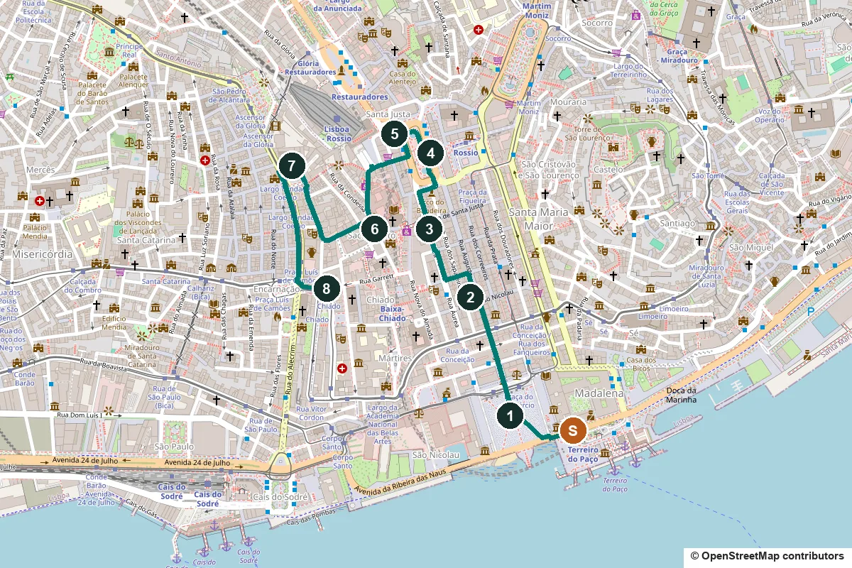
On 1 November 1755 an earthquake, a tsunami and fire wrecked Lisbon. The Baixa, the flat lower town by the river, was rebuilt from scratch on a grid. This 75-minute walk crosses that grid from the river to Rossio, then climbs to the roofless Carmo church and ends at a café in the Chiado.
The earthquake struck on the morning of All Saints' Day. About 40 minutes later a tsunami swept the lower town, and candles lit for the feast started a fire that burned for hours. Tens of thousands died. Within weeks the chief engineer, Manuel da Maia, offered four plans, and the king and his minister, the future Marquis of Pombal, chose the boldest: clear the Baixa and lay out new streets. That grid, the Baixa Pombalina, is the first half of this walk. The second half climbs to the Chiado, the café quarter on the hill to the west.
A note on accuracy: almost everything in the Baixa is a rebuild, and the Chiado was partly rebuilt again after a fire in 1988. Where what you see is not the original, we say so, and every fact links to its source.
- Start
- Praça do Comércio, at Terreiro do Paço metro
- Finish
- Largo do Chiado, at Baixa-Chiado metro
- Distance
- 2.4 km, one way
- Time
- About 75 minutes: 32 min walking and 8 stops, plus any visits inside. Allow more for the climb to the Carmo.
Terrain, steps, opening days and a shorter version ↓
What to see: the stops
-
Praça do Comércio and the Rua Augusta Arch
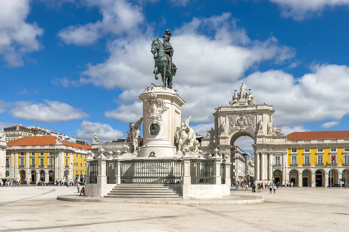
King José I and the Rua Augusta Arch. Photo: Kent Wang, CC BY 4.0, via Wikimedia Commons (resized). From the metro, walk west along the river side of the square to the statue in the middle. For about two centuries the kings lived here: Manuel I moved from the castle to a riverside palace, the Paço da Ribeira, in 1511. The earthquake destroyed it, with its library of some 70,000 volumes. In the rebuilding, Eugénio dos Santos turned the site into a U-shaped square open to the Tagus, with arcades on the ground floors and a tower at each end, an echo of the lost palace's tower. It was renamed the Square of Commerce, though locals still call it Terreiro do Paço, Palace Yard. Joaquim Machado de Castro's bronze of King José I went up on 6 June 1775. The arch on the north side was planned in 1759, but a first version begun in 1775 was pulled down in 1777, after Pombal fell from power. It was completed in 1875 to a design by Veríssimo José da Costa. On top, by Célestin Anatole Calmels, Glory crowns Genius and Valour; below stand Vítor Bastos's Viriatus, Vasco da Gama, Pombal and Nuno Álvares Pereira. You can go up: a lift, then 74 steps.
More history
On 1 February 1908 King Carlos and his heir were shot in their carriage as it crossed the square. In one of the square's buildings, Martinho da Arcada (1782) is said to be the city's oldest café. Our Alfama walk also starts here.
Sources: Wikipedia (pt), Praça do Comércio; Wikipedia, Praça do Comércio; Wikipedia (pt), Arco da Rua Augusta; Visit Lisboa, Arco da Rua Augusta. Visiting: tickets on the Visit Lisboa shop.
-
Rua Augusta and the earthquake-proof grid
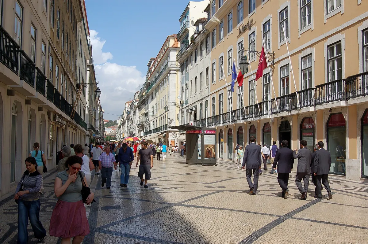
Rua Augusta, the spine of the grid. Photo: Bahnfrend, CC BY-SA 4.0, via Wikimedia Commons (resized). Walk through the arch and up Rua Augusta to the crossing with Rua de São Nicolau, and look both ways. The military engineers Manuel da Maia, Eugénio dos Santos and Elias Sebastião Pope replaced the old tangle of lanes with straight streets at right angles on either side of Rua Augusta, named for the "august" King José. The buildings were made alike on purpose: shops below, homes above, and windows in standard sizes, with one stone frame for main streets and another for side streets, so parts could be made in advance. Inside the walls is the gaiola pombalina, the "Pombaline cage": a three-dimensional timber frame built into the masonry, an idea taken from shipbuilding. Wood bends without breaking in a quake, and the stone around it resists fire. Models were tested by marching troops around them. The buildings stand on piles of green pine driven into the wet river silt, and the walls between them rise above the roofs to stop fire spreading. Even trades were placed: a decree of 1760 gave Rua Áurea, one street west, to the goldsmiths, and Rua da Prata, one street east, went to the silversmiths.
More history
Rubble from the old city raised the ground by more than a metre. The Baixa has been on Portugal's World Heritage tentative list since 2004, and in 2023 the city council formally put it forward.
Sources: Wikipedia (pt), Baixa de Lisboa; Wikipedia (pt), Gaiola pombalina; Wikipedia (pt), Rua Augusta; Wikipedia (pt), Rua Áurea; Wikipedia (pt), Rua da Prata; Wikipedia, Pombaline style; Wikipedia, Lisbon Baixa.
-
Elevador de Santa Justa, the iron lift to the Carmo
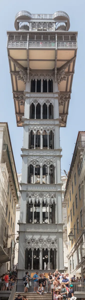
The tower from Rua de Santa Justa. Photo: Diego Delso, CC BY-SA 4.0, via Wikimedia Commons (resized). Go on up Rua Augusta a few steps and turn left along Rua da Vitória to Rua Áurea, also called Rua do Ouro. Turn right and walk up past Rua da Assunção to the corner of Rua de Santa Justa: the tower stands at the end of that street. Raoul Mesnier du Ponsard designed it to link the Baixa with Largo do Carmo, on the hill above. It opened on 10 July 1902 as the Ascensor Ouro-Carmo, ran on steam and got electric motors in November 1907. The Neo-Gothic iron tower is 45 m tall, with two wooden cabins and a 25 m walkway to the Carmo. The lift has been shut since September 2025: after the Glória funicular derailed on 3 September 2025, killing 16 people, the city suspended Carris's historic lifts for inspection. In late August 2026 CNN Portugal, citing the newspaper Nascer do Sol, reported it should reopen in January 2027, but on 1 September Carris's president gave no date. Carris and Visit Lisboa still listed it as temporarily closed in early October 2026, so walk up instead: from stop 5 it is about 350 m by Calçada do Carmo.
More history
Mesnier, a Porto-born engineer of French parents, also built the Glória, Bica and Lavra funiculars. The lift and those three became national monuments in 2002.
Sources: Carris, Elevador de Santa Justa; Wikipedia (pt), Elevador de Santa Justa; Wikipedia, Santa Justa Lift; Wikipedia (pt), Chiado; RTP, 1 September 2026; CNN Portugal, 28 August 2026; Visit Lisboa.
-
Rossio and the wave pavement
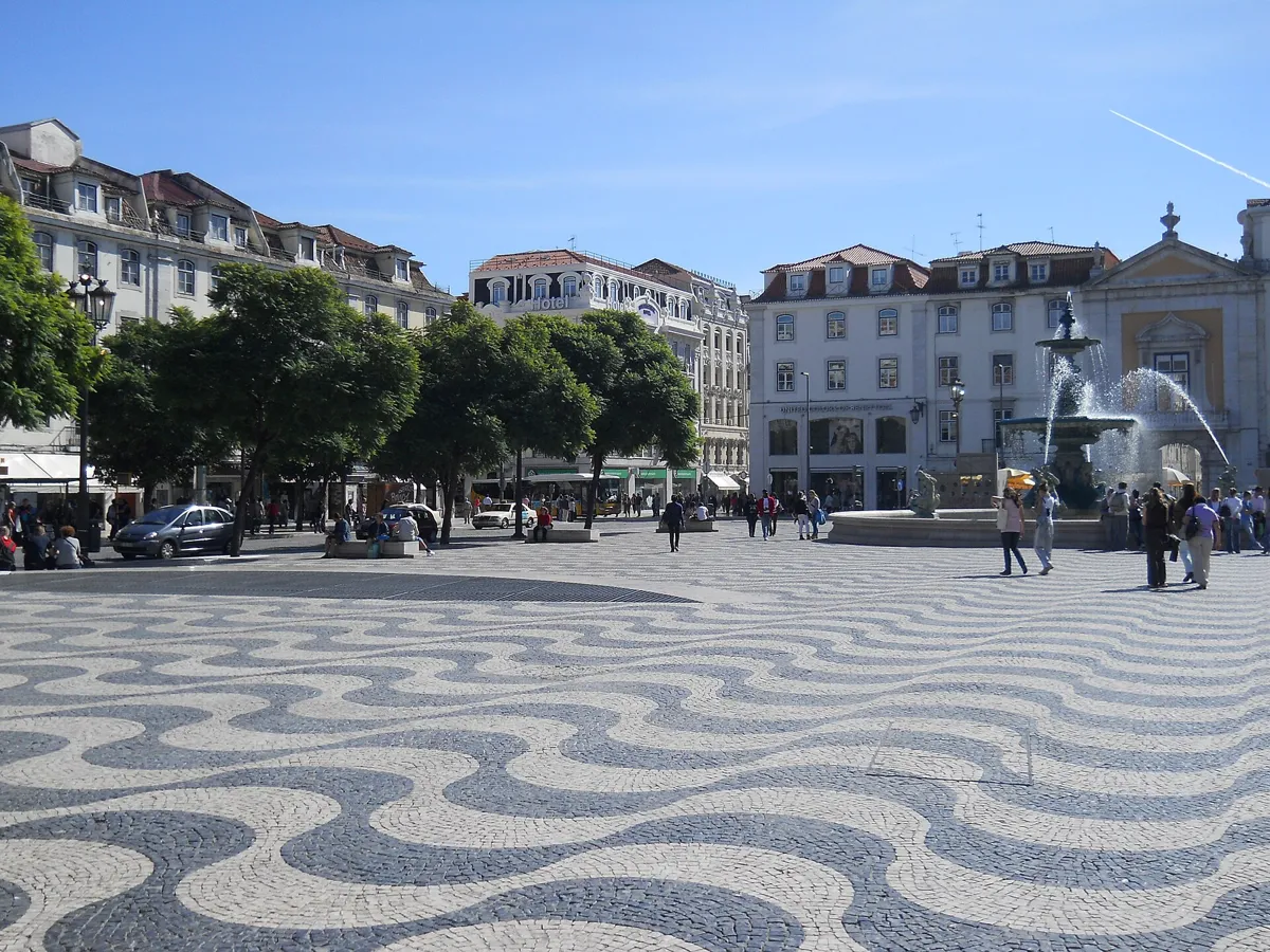
Rossio's wave pavement and one of its fountains. Photo: David Holt, CC BY-SA 2.0, via Wikimedia Commons (resized). Carry on up Rua Áurea into Rossio and stop by the column in the middle. Its official name is Praça de D. Pedro IV, but nobody uses it; rossio means something like common land. Since the Middle Ages it has seen fairs, bullfights, revolts and executions, among them the Inquisition's autos-da-fé. Along its east side stood the All Saints Royal Hospital, which burned in 1755 with hundreds of patients inside. Carlos Mardel and Eugénio dos Santos rebuilt the square as a rectangle about 166 by 52 m. Now look down. From August 1848 the men of General Eusébio Pinheiro Furtado, whose convict crews had already paved the castle square in 1842, laid all 8,712 m² of Rossio in black basalt and white limestone, in waves for the sea crossed by Portuguese sailors. This pavement, calçada portuguesa, then spread across Portugal. The column carries a bronze of Pedro IV by Élias Robert; the monument, 27.5 m tall, was unveiled in 1870.
More history
The poet Bocage improvised sonnets in the square's early-19th-century cafés, the Nicola and the Parras. During a restoration in 2001, two flasks of documents and a photograph turned up in the base of the column.
Sources: Wikipedia (pt), Praça D. Pedro IV; Wikipedia, Rossio; Wikipedia (pt), Calçada portuguesa; Wikipedia, Portuguese pavement; Wikipedia, 1755 Lisbon earthquake.
-
The National Theatre and Rossio station
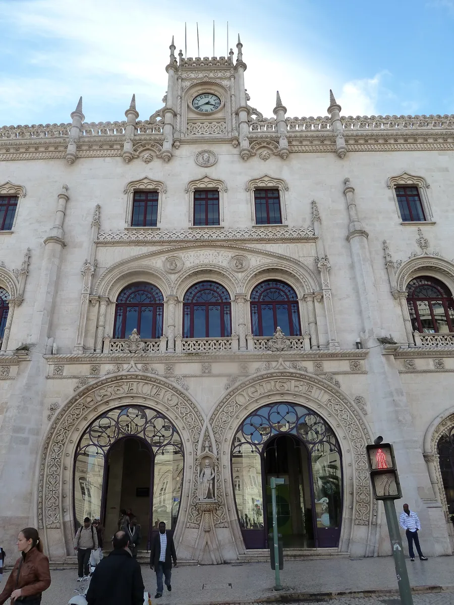
The two horseshoe doorways of Rossio station. Photo: deror_avi, CC BY-SA 3.0, via Wikimedia Commons (resized). Cross to the north-west corner of the square. The columned building at the north end is the Teatro Nacional D. Maria II. Here stood the Estaus Palace, built around 1450 to lodge foreign envoys and from 1571 the seat of the Inquisition. It burned in 1836, the year the writer Almeida Garrett was asked to found a national theatre. The Italian Fortunato Lodi designed it, and it opened on 13 April 1846, Queen Maria II's 27th birthday. On the pediment stands the playwright Gil Vicente, some of whose plays the Inquisition censored. A fire on 2 December 1964 left only the outer walls; the rebuilt theatre reopened in 1978. Now step left into Praça D. João da Câmara for Rossio station. José Luís Monteiro designed it in 1886–87 in Neo-Manueline style, a 19th-century revival of Portugal's ornate early-16th-century manner, with two intertwined horseshoe doorways and a clock turret. It opened on 18 May 1890, and trains still arrive through a tunnel under the city.
More history
President Sidónio Pais was assassinated in the station in December 1918. The King Sebastião between the doorways is a 2021 replica: in 2016 a man climbing for a selfie knocked down the original.
Sources: Wikipedia (pt), Teatro Nacional D. Maria II; Wikipedia, Rossio; Wikipedia (pt), Estação Ferroviária do Rossio; Wikipedia, Rossio railway station. What's on: the Visit Lisboa page links to the theatre.
-
Convento do Carmo, the church left roofless since 1755
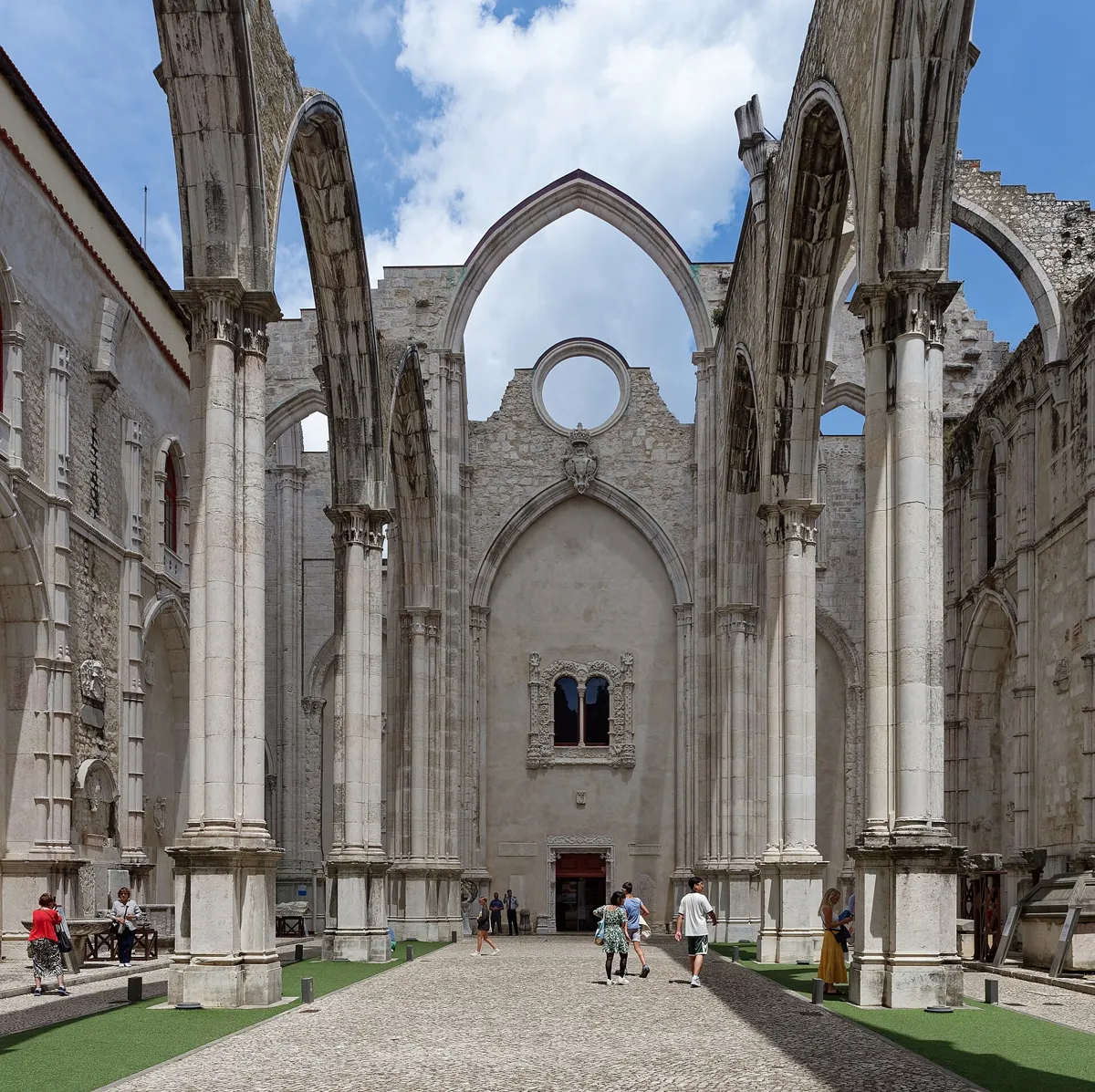
The open nave, now part of the Carmo Archaeological Museum. Photo: Jakub Hałun, CC BY 4.0, via Wikimedia Commons (resized). Now the climb. Walk along Calçada do Carmo past Largo do Duque do Cadaval, climb a flight of 40 steps (OpenStreetMap's count), and follow Calçada do Carmo on up to Largo do Carmo. Open-Meteo puts Rossio at about 12 m above sea level and Largo do Carmo at about 53 m. The convent was founded in 1389 by Nuno Álvares Pereira, the Constable of Portugal, who entered it as a friar in 1423. Its Gothic church rivalled the cathedral in grandeur. The 1755 earthquake and fire wrecked it. Rebuilding stopped in 1834, when religious orders were abolished, and Romantic taste then chose to leave the nave open to the sky. Since 1864 the ruins have held the Carmo Archaeological Museum; inside are the tomb of King Fernando I and two Peruvian mummies. On 25 April 1974 the head of the dictatorship, Marcelo Caetano, took refuge in the barracks in the convent's other wing. Captain Salgueiro Maia's troops surrounded it, and the regime surrendered here. The 18th-century fountain with four dolphins is by Ângelo Belasco.
More history
The fall of the Carmo and the neighbouring Trindade convent may be behind a Portuguese saying for an uproar: cair o Carmo e a Trindade, "the Carmo and the Trindade are falling down".
Sources: Wikipedia (pt), Convento do Carmo; Wikipedia, Carmo Convent; Museu Arqueológico do Carmo, history; Wikipedia (pt), Chiado. Visiting: hours and prices on the museum's site.
-
Igreja de São Roque and its chapel shipped from Rome
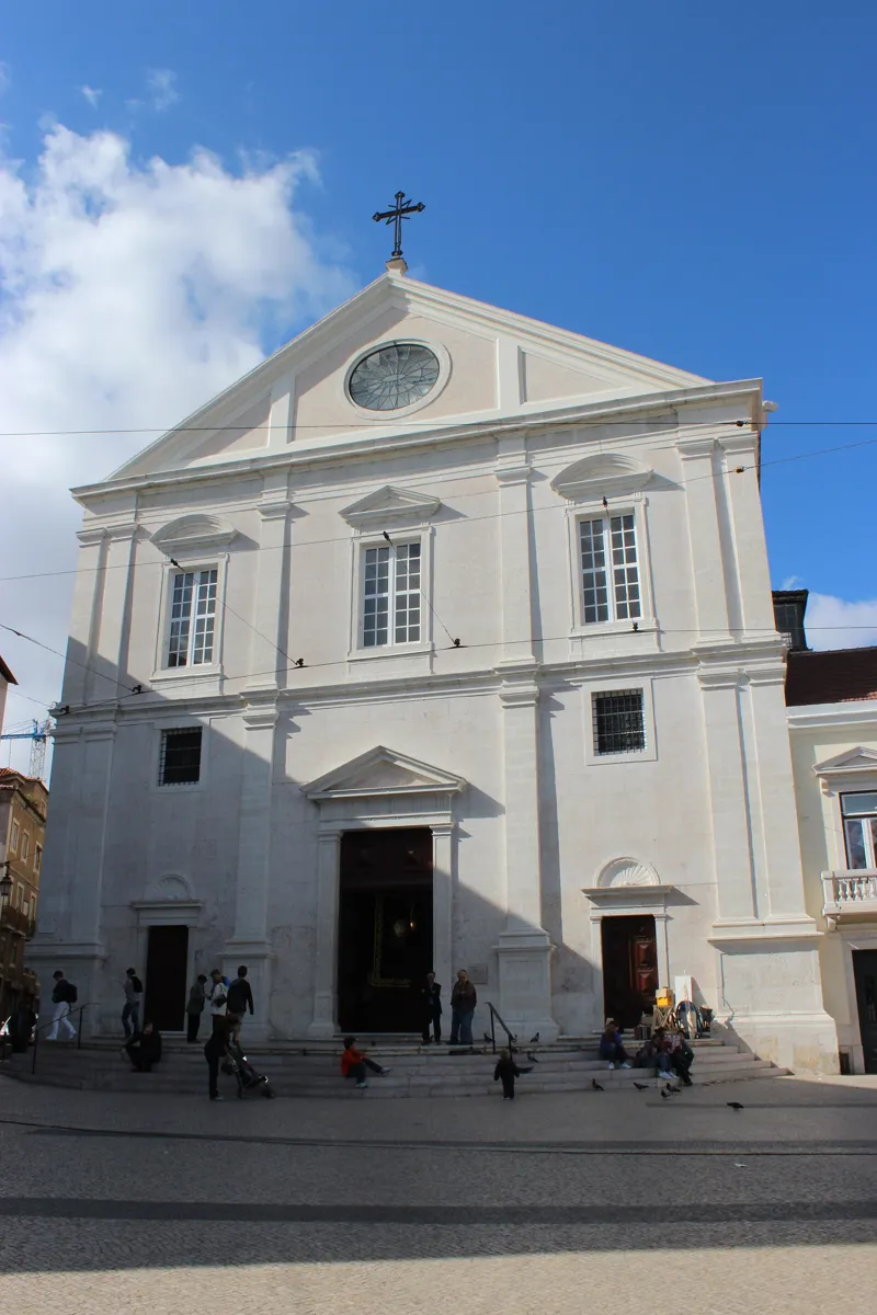
The church from Largo Trindade Coelho. Photo: Uhooep, CC BY-SA 4.0, via Wikimedia Commons (resized). Leave the square along Rua da Trindade, turn right up Rua Nova da Trindade and come out on Largo Trindade Coelho; the church faces the square. In 1505 plague hit Lisbon, and this hillside outside the walls became a cemetery for its victims. Manuel I asked Venice for a relic of St Roch, protector against plague, and a shrine was built for it here from 1506. The Jesuits took over the site in 1553 and began this church in 1555: the first Jesuit church in the Portuguese world, a single wide hall built for preaching. The front is deliberately plain; inside are gilded chapels, tiles and a painted ceiling of 1584–90. The church came through 1755 with little damage and passed to the Santa Casa da Misericórdia, Lisbon's old charity, which still owns it. Look for the chapel of St John the Baptist. King João V ordered it from the Roman architects Luigi Vanvitelli and Nicola Salvi; it was built in Rome from 1742 to 1747, consecrated by the pope, then taken apart and shipped to Lisbon in three ships.
More history
The chapel is thought to have been the most expensive in Europe at the time. The Museu de São Roque next door has a section on the chapel, along with goldsmiths' work, paintings and relics.
Sources: Wikipedia (pt), Igreja de São Roque; Wikipedia, Igreja de São Roque; Santa Casa da Misericórdia de Lisboa, Cultura. Visiting: hours and prices on the Museu de São Roque site.
-
Largo do Chiado and A Brasileira, Pessoa's café
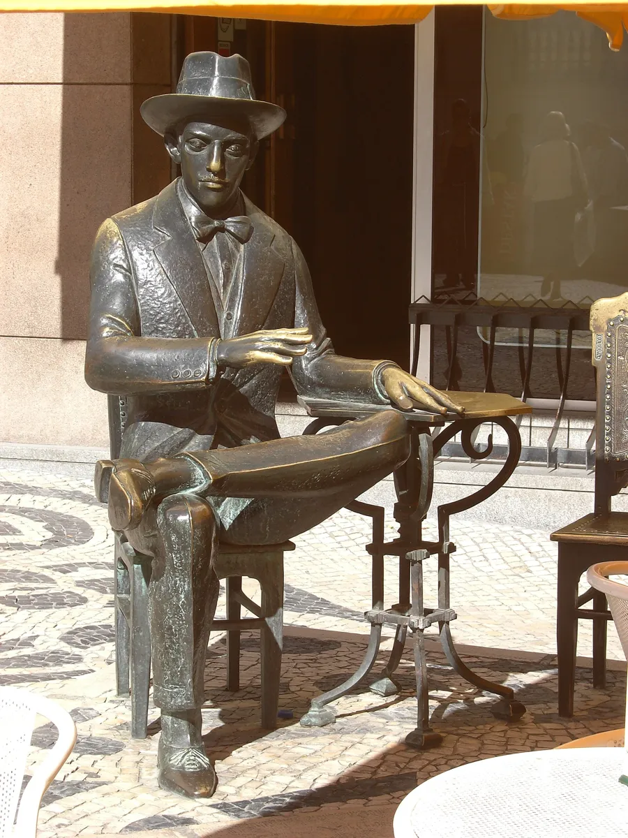
Lagoa Henriques's Pessoa outside A Brasileira. Photo: Nol Aders, CC BY 2.5, via Wikimedia Commons (resized). Walk downhill along Rua da Misericórdia to Praça Luís de Camões and turn left into Largo do Chiado, at the top of Rua Garrett. The statue at the east end, from 1929, is the poet António Ribeiro, nicknamed "Chiado". A Brasileira, at Rua Garrett 120, was opened on 19 November 1905 by Adriano Telles to sell coffee from Brazil. Lisbon's word for an espresso, bica, is said to come from here: the coffee was served straight from the machine's tap, the bica. Its Art Deco front and mirrored room come from a 1922 redesign by José Pacheco. In the 1920s writers and artists met here, among them Fernando Pessoa. Lagoa Henriques's bronze of him at a table outside went up in 1988, a century after his birth. Also in 1988, on 25 August, a fire broke out in the Grandella store on Rua do Carmo, just below, and destroyed 18 buildings. Álvaro Siza Vieira led the rebuilding, keeping many old fronts. Baixa-Chiado metro is on the square.
More history
The fire spread fast partly because fire engines could not get into Rua do Carmo, then a pedestrian street lined with concrete planters. Rua Garrett also has the first Livraria Bertrand, a bookshop founded in 1732.
Sources: Wikipedia (pt), Largo do Chiado; Wikipedia (pt), Chiado; Wikipedia (pt), Café A Brasileira; Wikipedia, Café A Brasileira; Wikipedia (pt), Incêndio do Chiado; Wikipedia (pt), Rua Garrett.


Practical details
- Terrain
- Flat, then a steep climb. The Baixa is a level valley floor; Open-Meteo puts the start at about 9 m above sea level and Rossio at 12 m. From Rossio the walk climbs to about 53 m at Largo do Carmo and 63 m at São Roque, then drops a little to 56 m at Largo do Chiado. Pavements are mostly calçada, small limestone and basalt cobbles.
- Step-free
- No. OpenStreetMap maps a flight of 40 steps on Calçada do Carmo, between stops 5 and 6. It marks Terreiro do Paço metro as wheelchair accessible; at Baixa-Chiado, the entrance on Largo do Chiado is not, and the station is marked only "limited".
- Water
- OpenStreetMap lists drinking fountains in Rossio, about 60 m from stop 4, and by Largo do Chiado.
- Toilets
- OpenStreetMap lists free city-council toilets by Largo do Carmo, open daily 9:30 to 13:00 and 14:00 to 17:30, and near Largo do Chiado, open daily 8:00 to 20:00, plus paid toilets by the start.
- Sit and eat
- Martinho da Arcada on Praça do Comércio (stop 1) and A Brasileira at the finish are both historic cafés; Rossio has cafés around the square.
- When to go
- The Rua Augusta Arch's viewpoint opens daily, 10:00 to 19:00, last entry 18:30 (€5, free with the Lisboa Card). The Carmo Archaeological Museum opens Monday to Saturday, 10:00 to 19:00 from May to October and to 18:00 from November to April (adults €7); it is closed on Sundays, 1 January, 1 May and 25 December. São Roque church opens daily from 10:00 (Mondays from 13:00) to 18:00 from October to March and to 19:00 from April to September; the Museu de São Roque opens Tuesday to Sunday, 10:00 to 18:00 (€8). The Santa Justa lift was still closed in early October 2026. Prices and hours change, so check before you go.
- Shorter walk
- Stay on the flat and finish at stop 5, Rossio station: 1.2 km, about 40 minutes, with no climb.
- Getting back
- Baixa-Chiado metro has an entrance on Largo do Chiado, and tram stop Chiado is a few metres away. For a step-free station, walk back down to Terreiro do Paço.
Walking distances and times from the OSRM foot router on OpenStreetMap data. Elevations from Open-Meteo. Stations, fountains, toilets and steps from OpenStreetMap; opening hours and prices from the Carmo Archaeological Museum, the Museu de São Roque, Visit Lisboa and Carris. Checked 5 October 2026.
Questions people ask
How long does the Baixa and Chiado walking tour take, and is there a map?
About 75 minutes: 2.4 km, 32 minutes of walking by the router's count and eight stops, from Praça do Comércio to Largo do Chiado. The router does not allow for the climb from Rossio to the Carmo, so go slower if you need to, and add time for any visits inside. The map is on this page, and you can print it or save it as a PDF.
Is the Santa Justa lift worth it, or can you walk up instead?
For now you have to walk. The lift has been closed since September 2025, when Lisbon suspended its historic lifts for inspection after the Glória funicular derailed. In August 2026 CNN Portugal reported it should reopen in January 2027, but on 1 September Carris gave no date, so check Carris before you go. On this route, Largo do Carmo, at the top of the lift, is about 500 m on foot from the middle of Rossio by Calçada do Carmo: a climb of about 40 m, with a flight of 40 steps.
What happened in the 1755 Lisbon earthquake?
On the morning of 1 November 1755, All Saints' Day, a great earthquake hit Lisbon. About 40 minutes later a tsunami swept the harbour and the lower town, and fires started by candles burned for hours. Tens of thousands died. The riverside royal palace and its library and the All Saints hospital on Rossio were destroyed. The roofless Carmo church on this walk was left as a reminder.
What is the Baixa Pombalina?
The lower town between the river and Rossio, rebuilt after 1755 under the Marquis of Pombal, King José I's minister. Engineers laid out a grid of straight streets around Rua Augusta, lined with matching buildings: shops below, homes above, a flexible timber frame called the gaiola pombalina inside the walls, and firewalls above the roofs. It is one of the earliest examples of earthquake-resistant building, and it has been on Portugal's World Heritage tentative list since 2004.
Is Lisbon walkable, and how far is the Baixa from the Chiado?
The centre is compact: this walk covers the Baixa and the Chiado in 2.4 km. The Baixa is flat, but the Chiado sits on a hill. From about 12 m above sea level at Rossio the route climbs to about 63 m at São Roque, partly on steps. From Rossio to Largo do Carmo is about 500 m on foot, and from São Roque down to Largo do Chiado about 420 m.
Walk it with Strolio
Open Strolio at Praça do Comércio and ask for 75 minutes through the Baixa and up to the Chiado. Strolio builds walks in any city with mapped streets, so its route may pick different stops from this page. Stories play as you reach each place, and you can ask about anything else you pass, by voice or with a photo. You can also start from your hotel and choose your own time and interests.
More walks in Lisbon
- Alfama: ~75 min, 8 stops. From the river up past Lisbon's fortress cathedral and two viewpoints to São Vicente and the church that took 284 years to finish. Steep.
- Belém: ~75 min, 7 stops. From the President's palace past the Jerónimos Monastery and the Padrão to Belém Tower. Flat.
- Bairro Alto and Príncipe Real: ~70 min, 7 stops. From the river up the Bica hill on foot, through a 16th-century street grid and two viewpoints to a reservoir hidden under a garden lake. Steep, with stairs.
- All Lisbon walks, with maps side by side.
- Walks in other cities.
Sources
- Official sites: Museu Arqueológico do Carmo, Carris, Visit Lisboa and its shop, Santa Casa da Misericórdia de Lisboa and its Museu de São Roque. We used their facts and wrote our own text.
- Wikipedia (Portuguese): Praça do Comércio, Arco da Rua Augusta, Baixa de Lisboa, Gaiola pombalina, Rua Augusta, Rua Áurea, Rua da Prata, Elevador de Santa Justa, Praça D. Pedro IV, Calçada portuguesa, Teatro Nacional D. Maria II, Estação Ferroviária do Rossio, Convento do Carmo, Igreja de São Roque, Largo do Chiado, Chiado, Café A Brasileira, Incêndio do Chiado, Rua Garrett
- Wikipedia (English): 1755 Lisbon earthquake, Praça do Comércio, Lisbon Baixa, Pombaline style, Santa Justa Lift, Rossio, Portuguese pavement, Rossio railway station, Carmo Convent, Igreja de São Roque, Café A Brasileira
- Press: RTP, CNN Portugal
- Map data and places: © OpenStreetMap contributors, ODbL; walking route from the OSRM foot router run by FOSSGIS
- Elevations: Open-Meteo
- Photos: Wikimedia Commons contributors Kent Wang, Bahnfrend, Diego Delso, David Holt, deror_avi, Jakub Hałun, Uhooep and Nol Aders, credited under each photo