
Alfama self-guided walking tour · Lisbon · 75 minutes · map
Alfama on foot: a saint's birthplace, a fortress cathedral and a church that took 284 years
Alfama is the old Lisbon that came through the 1755 earthquake. This 75-minute walk climbs from the river past the cathedral to two viewpoints, drops into the lanes to the fado museum, and climbs again to São Vicente and the National Pantheon.
Under Moorish rule Alfama was the whole city, which later spread west into the Baixa. Its name comes from the Arabic al-hamma, hot springs, and its springs fed public fountains and baths for centuries. Later it became a quarter of fishermen and the poor. The 1755 earthquake left most of its buildings standing, so it kept its maze of narrow streets, stairs and small squares. Be ready for hills: the walk climbs twice, to about 64 m and then 72 m above sea level.
A note on accuracy: several buildings here were rebuilt after 1755 or restored in the 20th century. Where what you see is not the original, we say so, and every fact links to its source.
- Start
- Praça do Comércio, by Terreiro do Paço metro
- Finish
- National Pantheon, Campo de Santa Clara, about 530 m from Santa Apolónia station
- Distance
- 2.5 km, one way
- Time
- About 75 minutes: 34 min walking and 8 stops, plus any visits inside. Allow more for the climbs.
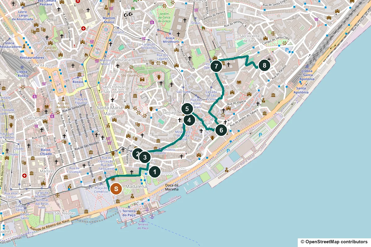
Terrain, water, opening days and a shorter version ↓
What to see: the stops
-
Casa dos Bicos, the house of stone points
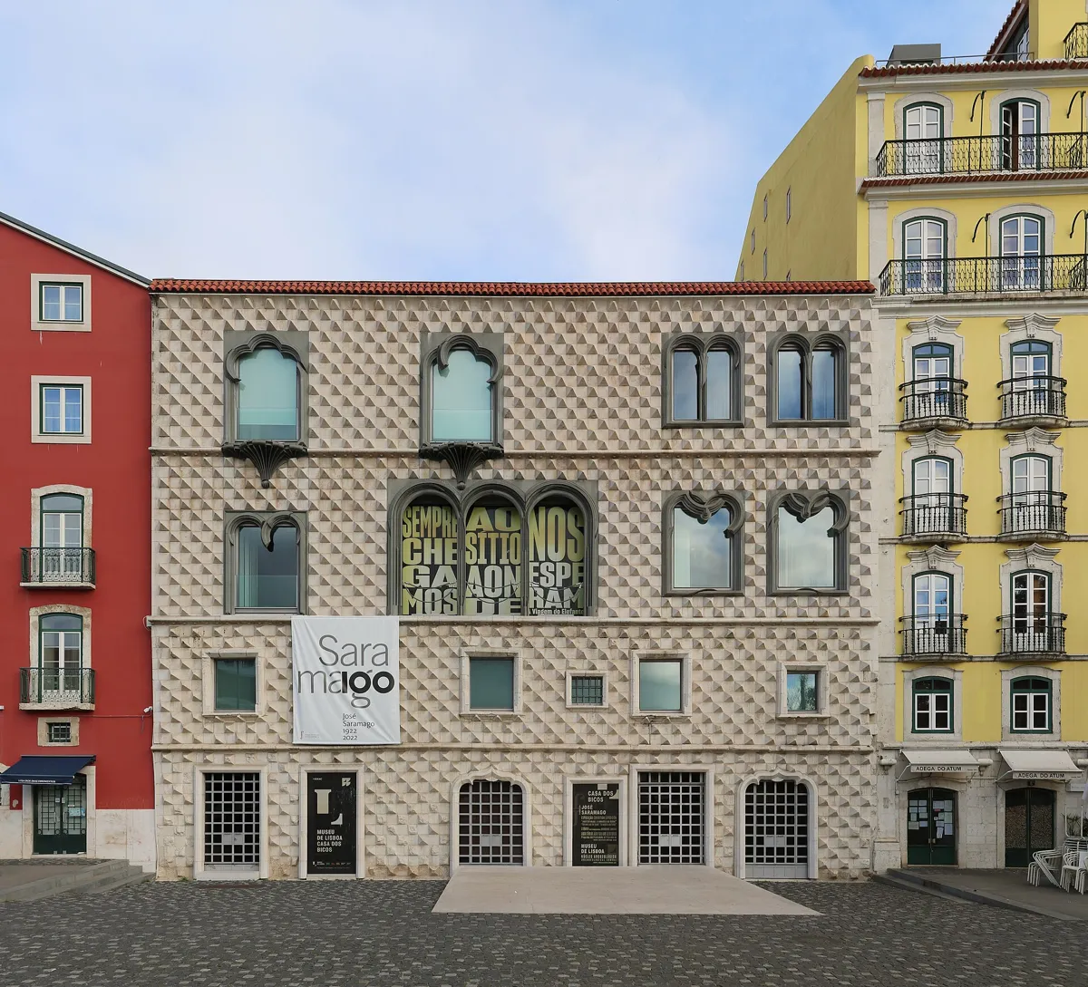
The Casa dos Bicos on Rua dos Bacalhoeiros. Photo: Ingo Mehling, CC BY-SA 4.0, via Wikimedia Commons (resized). From the arcades at the north-east corner of Praça do Comércio, walk east along Rua da Alfândega, turn left up Rua dos Arameiros and right into Rua dos Bacalhoeiros. The house with a front of cut stone points, the bicos, was built in the 1520s for Brás de Albuquerque, son of Afonso de Albuquerque, governor of Portuguese India. He had been to Italy, and the front is thought to echo palaces such as the Palazzo dei Diamanti in Ferrara. The 1755 earthquake brought down its two top floors, and the house later served as a salt-cod warehouse. The top floors you see were rebuilt in 1983 from drawings made before the earthquake. Since 2012 it has been the home of the José Saramago Foundation. In front, under an olive tree brought from his home village of Azinhaga, lie the Nobel-winning writer's ashes, placed there in 2011.
More history
The house was built across the line of the Moorish town wall. Digs in the 1980s found part of that wall, Roman fish-salting tanks and a medieval tower inside. The ground floor is now an archaeology branch of the Museu de Lisboa. The plaque by the olive tree quotes Saramago's novel Memorial do Convento: "But he did not rise to the stars, for he belonged to the earth."
Sources: Wikipedia (pt), Casa dos Bicos; Wikipedia, Casa dos Bicos; Diário de Notícias, 9 June 2011; Wikipedia (pt), José Saramago.
-
Igreja de Santo António, where Lisbon's saint is said to have been born
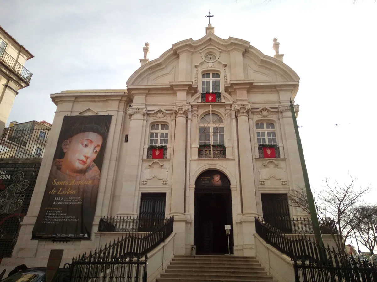
The church front on Largo de Santo António da Sé. Photo: Hugo Ferreira, CC BY-SA 4.0, via Wikimedia Commons (resized). Go back along Rua dos Bacalhoeiros and turn up through the Arco das Portas do Mar to the church, which stands by the site of the old Sea Gate in the medieval wall. Tradition says it was built where Fernando de Bulhões was born in the 1190s. He became a Franciscan friar as António, settled in Padua and was made a saint in 1232; the world knows him as Saint Anthony of Padua. A chapel stood on the site by the 15th century. The 1755 earthquake left only its main chapel standing; today the crypt, reached through the sacristy, is all that is left of the old church. The church you see was begun in 1767 to designs by Mateus Vicente de Oliveira. Children helped pay for it, begging for "a little coin for Saint Anthony".
More history
Since 1755 a procession has left the church every 13 June, Saint Anthony's day, and wound through Alfama. Couples traditionally come on their wedding day to leave him flowers, as he is the saint of newlyweds. Pope John Paul II prayed in the crypt on 12 May 1982 and unveiled the statue of the saint by Soares Branco in the square. A small museum next door is dedicated to him.
Sources: Wikipedia (pt), Igreja de Santo António de Lisboa; Wikipedia, Church of Saint Anthony of Lisbon.
-
Sé de Lisboa, the cathedral that looks like a fortress
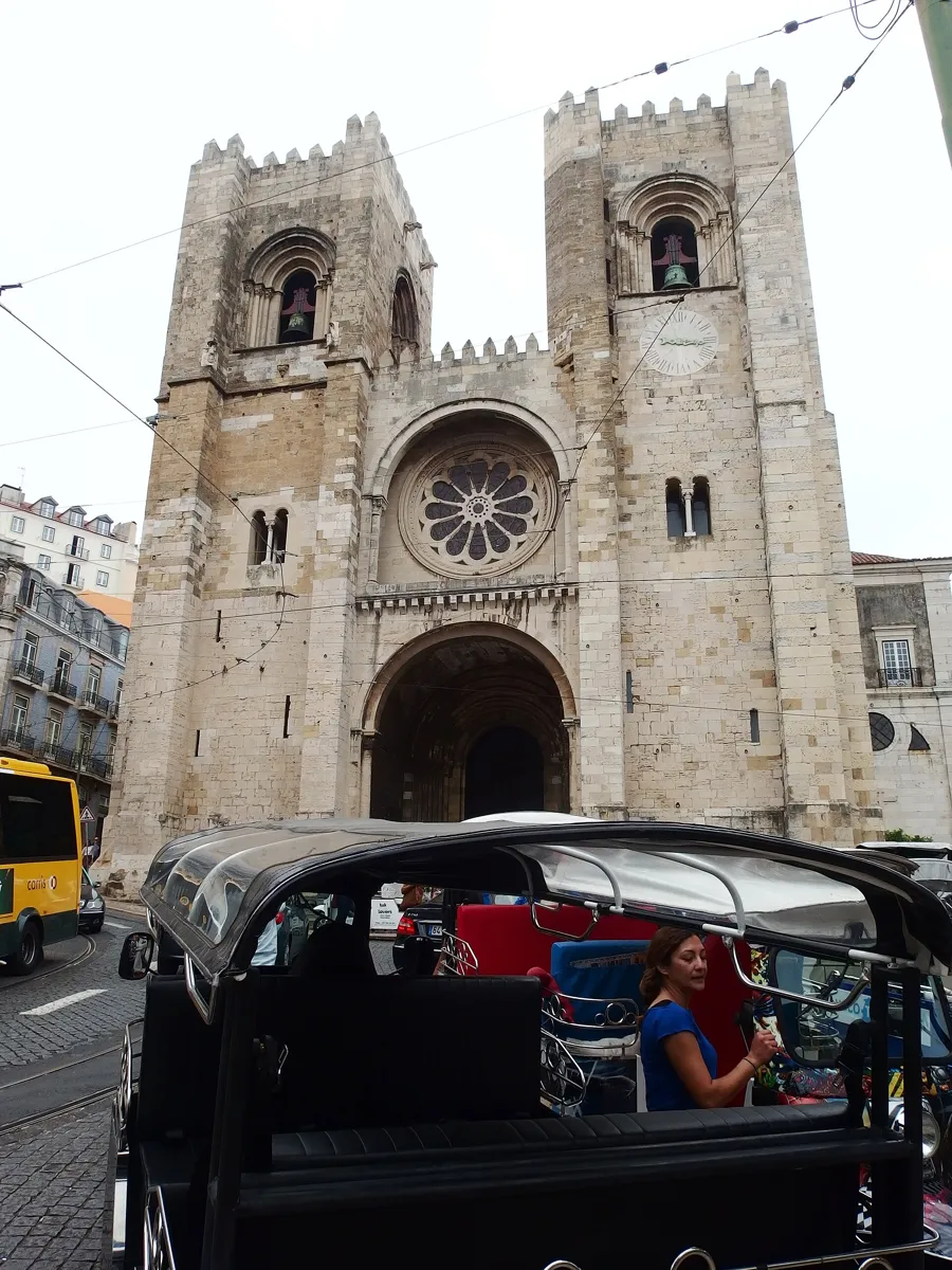
The west front on Largo da Sé. Photo: Palickap, CC BY-SA 4.0, via Wikimedia Commons (resized). The cathedral faces the church across the street. Work began in 1147, after Portugal's first king, Afonso Henriques, took Lisbon from the Moors with the help of crusaders, and an English crusader, Gilbert of Hastings, became bishop. It seems to have been built where the city's main mosque stood. The front, two towers either side of the doorway, follows the plan of the first Romanesque church, and the doorway with its carved capitals is original. Much of the rest is not as old as it looks. The 1755 earthquake brought down the Gothic main chapel, the south tower and the lantern tower. In the early 20th century restorers stripped out later decoration, added the battlements, rebuilt the rose window from fragments and gave it today's medieval look. It reopened in 1940. Saint Anthony was baptised here, in the baptistery to the left of the entrance.
More history
King Afonso IV (1325–1357) added the Gothic ambulatory behind the altar so pilgrims could visit the relics of Saint Vincent, which arrived on 16 September 1173. Legend says two ravens guarded the ship that brought them, and the ship and ravens became Lisbon's symbols. Digs in the cloister since 1990 have found a Roman street with shops and the walls of a mosque. The Portuguese Central Way to Santiago de Compostela starts here. The ticket covers the upper choir, the balcony between the towers, the treasury, the naves and the ambulatory.
Sources: Sé de Lisboa, history; saints and traditions; tickets; Wikipedia (pt), Sé de Lisboa; Wikipedia, Lisbon Cathedral.
-
Miradouro de Santa Luzia, tiles over the Moorish wall
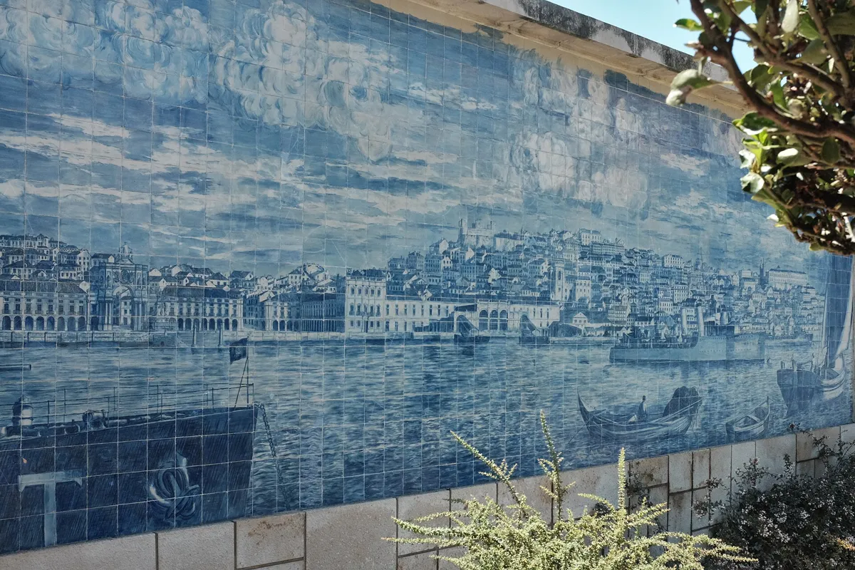
One of the tile panels at the viewpoint. Photo: tomislav medak, CC BY-SA 2.0, via Wikimedia Commons (resized). Now the first climb: from about 29 m at the cathedral to about 64 m in 420 m of walking. Walk uphill past the back of the cathedral along Rua Augusto Rosa and on to the terrace by the small church of Santa Luzia. The viewpoint sits on remains of the Moorish town wall. Looking out over Alfama to the Tagus, find, from left to right, the dome of Santa Engrácia (the last stop), the church of Santo Estêvão and the two white towers of São Miguel. On the side of the church are tile panels by António Quaresma: one shows Praça do Comércio before the earthquake, the other Christians attacking the Moors' castle. In summer 2026, after years of tile theft, the city council had the viewpoint's tile panels repaired with about 500 handmade replica tiles.
More history
The church of Santa Luzia and São Brás goes back to the reign of Afonso Henriques. It was remodelled after 1755 under Mateus Vicente de Oliveira, the architect of Santo António, and is the Portuguese seat of the Order of Malta.
Sources: Wikipedia (pt), Miradouro de Santa Luzia; Wikipedia (pt), Igreja de Santa Luzia; Wikipedia, Alfama; Visit Lisboa; Time Out Lisboa, 7 August 2026.
-
Miradouro das Portas do Sol, the Sun Gate
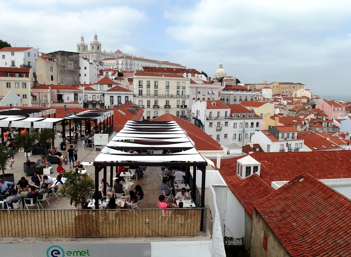
The view from Portas do Sol, with São Vicente de Fora on the skyline. Photo: Palickap, CC BY-SA 4.0, via Wikimedia Commons (resized). Walk on 100 m to the next terrace. The square takes its name from the Porta do Sol, a gate in the Moorish wall that stood here until the 1755 earthquake ruined it. This balcony looks over the east of the old city: the white church of São Vicente de Fora on its hill, and Alfama's lanes running down to the river. The statue of Saint Vincent, Lisbon's patron saint, is by Raul Xavier and was put up in 1949. Tram 28 stops here and at Santa Luzia.
More history
Detour: the main gate of the Castelo de São Jorge, on Rua de Santa Cruz do Castelo, is uphill from here: the castle puts it about 5 minutes on foot from the Portas do Sol tram stop, by Beco do Maldonado and the Porta de Dom Fradique. Entry is ticketed. The castle says what stands today is a Gothic castle; the oldest records of a castle inside the Moorish citadel date from the reigns of Afonso III and Dinis.
Sources: Wikipedia (pt), Largo das Portas do Sol; Wikipedia (pt), Alfama; Castelo de São Jorge, how to arrive; origins.
-
Largo do Chafariz de Dentro and the Museu do Fado
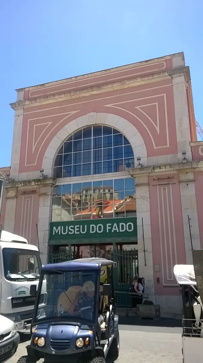
The Museu do Fado, Largo do Chafariz de Dentro 1. Photo: Adrianommb, CC BY-SA 4.0, via Wikimedia Commons (resized). Now down into the lanes, about 45 m in 320 m: go down through Beco de Santa Helena, Beco da Cardosa, Travessa de São Miguel and Rua de São Pedro to the square. Its fountain, the Chafariz de Dentro, is first recorded in 1285. It was also called the Horses' Fountain: the chronicler Fernão Lopes wrote that its spouts were bronze horses' heads, which Castilian troops wanted to carry off after sacking Lisbon in 1373. "De dentro" means inside: it stood inside the later town wall, the Cerca Fernandina. The pink building at number 1 began in 1868 as a steam pumping station that sent Alfama's spring water into the city supply. It pumped until 1938 and opened as the Museu do Fado on 25 September 1998. Fado, the song of Lisbon, has been on UNESCO's list of intangible heritage since 2011.
More history
UNESCO describes fado as a solo singer with a guitar and the Portuguese guitar, a pear-shaped instrument with twelve wire strings. The museum shows José Malhoa's painting O Fado, and its audio guide plays dozens of fados. From 1974 to 1990 the building was a centre of the Portuguese Communist Party.
Sources: Wikipedia (pt), Chafariz de Dentro; Wikipedia (pt), Museu do Fado; Wikipedia, Fado Museum; UNESCO. Visiting: the Museu do Fado's site.
-
São Vicente de Fora, the monastery outside the walls
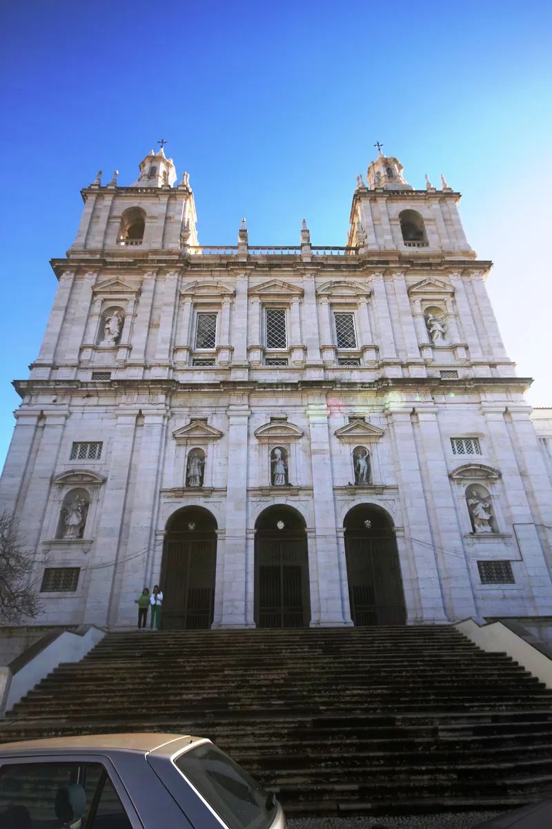
The church front from Largo de São Vicente. Photo: José Luiz, CC BY-SA 3.0, via Wikimedia Commons (resized). The second climb is the longest: about 53 m up in 590 m. Leave the square by Beco do Mexias, then follow Rua da Regueira, Largo do Peneireiro and Calçadinha do Tijolo up to Calçada de São Vicente, and climb through the Arco Grande de Cima to Largo de São Vicente. During the siege of 1147, Afonso Henriques vowed to build a monastery to Saint Vincent if he took the city; he founded it that year, outside (de fora) the walls. In 1582 Philip I, also king of Spain, decided to rebuild it. Filippo Terzi, Juan de Herrera and Baltazar Álvares made it Portugal's first great Mannerist building, a model for churches after it. Above the doors stand Saint Augustine, Saint Sebastian and Saint Vincent. The great dome fell in 1755.
More history
Saint Anthony spent his first years as a monk here, and a chapel is believed to mark his cell. King João IV chose the monastery for his family's tombs, and in 1854 Ferdinand II moved them to the old refectory: almost the whole Braganza dynasty lies there. The cloisters are lined with 18th-century tiles, some telling La Fontaine's fables, and the roof terrace has a 360° view.
Sources: Mosteiro de São Vicente de Fora, history; highlights; Wikipedia (pt), Igreja de São Vicente de Fora; Wikipedia, Monastery of São Vicente de Fora. Visiting: tickets.
-
The National Pantheon, the church that took 284 years
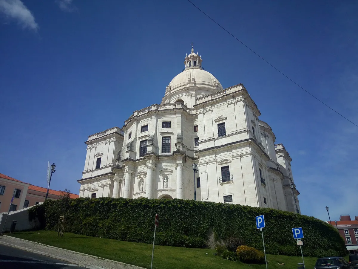
Santa Engrácia, now the National Pantheon. Photo: Hugo Ferreira, CC BY-SA 4.0, via Wikimedia Commons (resized). Go back through the Arco Grande de Cima and east along Campo de Santa Clara to the domed church. In Portuguese, "obras de Santa Engrácia", Santa Engrácia's works, means a job that never ends. A parish church stood here from the late 16th century. In 1630 its tabernacle was robbed; a young New Christian, Simão Pires de Solis, was burned for it in 1631, and he is said to have sworn that his innocence was as sure as the works never ending. A storm in 1681 brought down its main chapel and part of the walls, and the first stone of today's building, designed by João Antunes, was laid on 31 August 1682. Antunes died in 1712 with it unroofed. It later served as an army depot and a factory for military shoes. A 1916 law set it aside to become the National Pantheon, and the works, dome included, only ended in December 1966.
More history
Its Greek-cross plan with curving walls was the first of its kind tried in Portugal. The tombs include presidents, the writers Almeida Garrett, Sophia de Mello Breyner Andresen and Eça de Queiroz, the footballer Eusébio and the fado singer Amália Rodrigues. Camões, Vasco da Gama and Henry the Navigator have memorials without their remains. The dome rises 80 m, and the terrace, 40 m up, looks over the river.
Sources: Panteão Nacional, history; the monument; Wikipedia (pt), Igreja de Santa Engrácia; Wikipedia, Church of Santa Engrácia. Visiting: hours and tickets.

.jpg)
.jpg)
.jpg)


.JPG)
.jpg)
Practical details
- Terrain
- Steep. Open-Meteo puts the start at about 6 m above sea level, the cathedral at 29 m, Santa Luzia and Portas do Sol at 64 m, Largo do Chafariz de Dentro at 19 m and São Vicente at 72 m. Expect cobbles, narrow lanes and stepped alleys. Tram 28 stops at the cathedral, Santa Luzia and Portas do Sol if you want to ride the first climb.
- Step-free
- No. OpenStreetMap maps flights of steps on the way down to stop 6, among them one of 53 steps in Beco de Santa Helena and another in Beco do Pocinho. It marks Terreiro do Paço and Santa Apolónia metro stations as wheelchair accessible, though not every entrance.
- Water
- OpenStreetMap lists drinking fountains by the cathedral and at Portas do Sol.
- Toilets
- OpenStreetMap lists free public toilets at the Santa Luzia viewpoint and paid city-council toilets by Santo António, open 9:30 to 13:00 and 14:00 to 17:30.
- Sit and eat
- OpenStreetMap lists cafés on the Santa Luzia and Portas do Sol terraces (stops 4 and 5), with views over Alfama.
- When to go
- The cathedral is open to visitors Monday to Saturday (adults €7) and closed to tourist visits on Sundays and holy days. The Museu do Fado opens Tuesday to Sunday, 10:00 to 18:00. São Vicente de Fora opens daily, 10:00 to 19:00 from June to October and to 18:00 from November to May (adults €8). The National Pantheon opens Tuesday to Sunday, 10:00 to 17:00 from October to March and to 18:00 from April to September (€10); it is closed on Mondays and on 13 June. The castle opens daily, 9:00 to 21:00 from March to October and to 18:00 from November to February (adults €17). Prices and hours change, so check before you go.
- Shorter walk
- Finish at stop 6, the Museu do Fado: 1.5 km, about 50 minutes, almost all downhill after Portas do Sol. Santa Apolónia station is about 700 m away on foot.
- Getting back
- Santa Apolónia metro and train station is about 530 m downhill, 7 minutes on foot. Tram 28 also stops on Calçada de São Vicente, a few hundred metres away.
Walking distances and times from the OSRM foot router on OpenStreetMap data. Elevations from Open-Meteo. Stations, fountains and toilets from OpenStreetMap; opening hours and prices from the cathedral, the Museu do Fado, São Vicente de Fora, the National Pantheon and the castle. Checked 4 October 2026.
Questions people ask
How long does it take to walk around Alfama, and is there a map?
This walk takes about 75 minutes: 2.5 km, 34 minutes of walking by the router's count and eight stops, from Praça do Comércio to the National Pantheon. The router does not allow for the hills, so go slower if you need to. Add time for any visits inside. The map is on this page, and you can print it or save it as a PDF.
Is Alfama hilly? How steep is it?
Yes. The walk starts about 6 m above sea level and climbs to about 64 m at the Santa Luzia viewpoint, drops to about 19 m at Largo do Chafariz de Dentro, then climbs again to about 72 m at São Vicente de Fora. Much of it is on narrow lanes and stepped alleys. Tram 28 stops at the cathedral, Santa Luzia and Portas do Sol if you want to skip the first climb.
Is Alfama the oldest district of Lisbon?
It is generally called the oldest. Under Moorish rule, Alfama was the whole of the city, which later spread west into the Baixa. Its name comes from the Arabic al-hamma, hot springs. Most of its buildings came through the 1755 earthquake, so it kept its maze of narrow streets.
What is Alfama known for?
Its restaurants and fado houses, its narrow stepped lanes and viewpoints, and the festivities of the popular saints, above all the night of Santo António, 12 to 13 June. The cathedral, the church built where Saint Anthony is said to have been born, São Vicente de Fora and the National Pantheon are all on this walk.
Where can you hear fado in Alfama?
Start at the Museu do Fado on Largo do Chafariz de Dentro (stop 6). Its audio guide plays dozens of fados, it holds concerts, and its online Roteiro do Fado is a guide to fado in Lisbon's streets. UNESCO, which listed fado in 2011, says it is sung professionally in small fado houses and by amateurs in clubs in Lisbon's older neighbourhoods.
Walk it with Strolio
Open Strolio at Praça do Comércio and ask for 75 minutes through Alfama. Strolio builds walks in any city with mapped streets, so its route may pick different stops from this page. Stories play as you reach each place, and you can ask about anything else you pass, by voice or with a photo. You can also start from your hotel and choose your own time and interests.
More self-guided walks
- All Strolio walks: self-guided walking tours with maps in more cities.
- Madrid's Barrio de las Letras: about an hour, from Lope de Vega's church to the press that printed Don Quixote.
- Barcelona's Gothic Quarter and El Born: about 90 minutes, from Roman columns to the cathedral and El Call.
Sources
- Official sites: Sé de Lisboa, Mosteiro de São Vicente de Fora, Panteão Nacional, Museu do Fado, Castelo de São Jorge, UNESCO, Fado. We used their facts and wrote our own text.
- Wikipedia (Portuguese): Alfama, Casa dos Bicos, Igreja de Santo António de Lisboa, Sé de Lisboa, Miradouro de Santa Luzia, Igreja de Santa Luzia, Largo das Portas do Sol, Chafariz de Dentro, Museu do Fado, Igreja de São Vicente de Fora, Igreja de Santa Engrácia, José Saramago
- Wikipedia (English): Alfama, Casa dos Bicos, Church of Saint Anthony of Lisbon, Lisbon Cathedral, Fado Museum, Monastery of São Vicente de Fora, Church of Santa Engrácia, Praça do Comércio
- Press and tourism: Diário de Notícias, Time Out Lisboa, Visit Lisboa
- Map data and places: © OpenStreetMap contributors, ODbL; walking route from the OSRM foot router run by FOSSGIS
- Elevations: Open-Meteo
- Photos: Wikimedia Commons contributors Ingo Mehling, Hugo Ferreira, Palickap, tomislav medak, Adrianommb and José Luiz, credited under each photo