
Bairro Alto self-guided walking tour · Lisbon · 70 minutes · map
Bairro Alto and Príncipe Real on foot: a 16th-century grid, two viewpoints and a reservoir under a garden
The Bairro Alto and Príncipe Real sit on the hill above the river, and this 70-minute walk climbs there on foot, because the Bica and Glória lifts are closed. It links a 16th-century street grid, two viewpoints, a garden cedar and a reservoir hidden under a lake.
The Bairro Alto was planned on a grid outside the old city walls in the early 1500s. Newspapers and printers filled it for well over a century, and bars and restaurants have filled it since the 1980s. Beyond it, Príncipe Real grew up around a garden made on ground that had been a ruin and a rubbish tip. The walk rises from the river at Cais do Sodré to about 85 m, with stairs on the way. It overlaps nothing with our Baixa and Chiado walk, which covers São Roque, the Carmo ruins and Largo do Chiado.
A note on accuracy: the Bica and Glória lifts are part of this story, but both are shut. We date every statement about them and link its source. Where a place is not the original, we say so.
- Start
- Cais do Sodré station, with the river ferry terminal nearby
- Finish
- Entrance of the Jardim Botânico, about 90 m from the Rua da Escola Politécnica tram stop
- Distance
- 2.6 km, one way
- Time
- About 70 minutes: 35 min walking and 7 stops, plus any visit inside the garden or reservoir. Allow more for the climb.
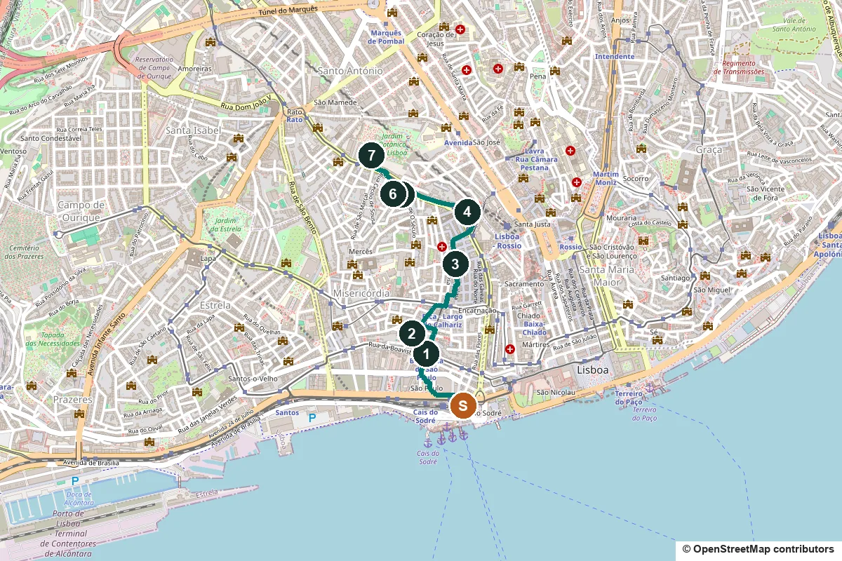
Terrain, water, opening days and a shorter version ↓
What to see: the stops
-
Ascensor da Bica, a lift that is not running
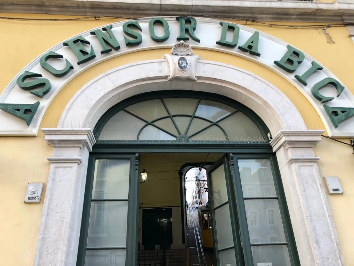
The lower station at Rua de São Paulo 234. Photo: Minh Nguyen, CC BY-SA 4.0, via Wikimedia Commons (resized). From Cais do Sodré station, follow the paths beside Avenida 24 de Julho, then climb Rua da Moeda to Rua de São Paulo. The lift's lower station is at number 234, behind an arched doorway with the name over it in green letters. The Bica lift opened on 28 June 1892 and links Rua de São Paulo with Largo do Calhariz. Raoul Mesnier du Ponsard designed it. He also designed the Glória, Lavra and Santa Justa lifts. Portuguese Wikipedia says it became a national monument in February 2002. It is not running. After the Glória funicular derailed on 3 September 2025, killing 16 people, the city suspended Lisbon's historic lifts for inspection. On 31 October 2026 Carris's own pages still list the Bica lift as temporarily closed. On 1 September its president said the Bica, Lavra and Santa Justa lifts were still under technical evaluation, with no date to run again. Carris runs bus 22B from Cais do Sodré up to Largo do Calhariz in its place, but this walk climbs on foot.
More history
The lift ran on steam in its early years. In 1914, while it was being electrified, a car got loose, ran down the street and crashed into the lower station, destroying it. The lift did not run again until the 1920s.
Sources: Wikipedia (pt), Elevador da Bica; Wikipedia, Ascensor da Bica; Wikipedia (pt), Raoul Mesnier de Ponsard; Wikipedia, 2025 Ascensor da Glória derailment. Status: Carris, funiculars; Carris, bus 22B; RTP, 1 September 2026.
-
Miradouro de Santa Catarina and the Adamastor
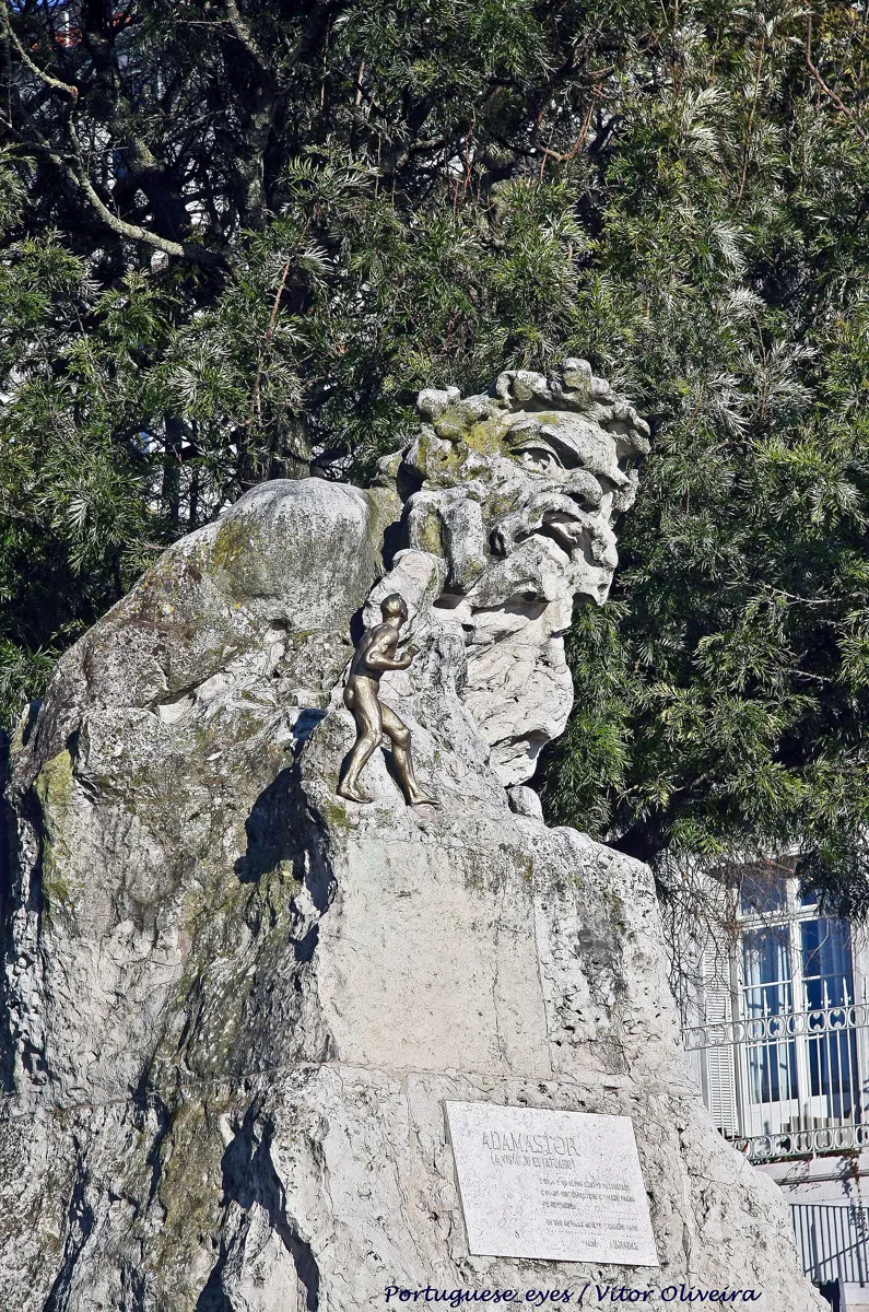
The Adamastor statue. Photo: Vitor Oliveira, CC BY-SA 2.0, via Wikimedia Commons (resized). Turn right on Rua de São Paulo and right again up Calçada da Bica Pequena, a street of stairs; OpenStreetMap maps 57 steps on it. At the top, go on up Rua da Bica de Duarte Belo, the street the lift runs along, for about 30 m. Turn left onto Travessa da Portuguesa, which has more steps, then left on Rua de Santa Catarina. A few steps lead up to the viewpoint. This small garden sits on the Alto de Santa Catarina, one of Lisbon's seven hills. In 1877 a Portuguese man who had made his money in Brazil wanted to put up a large building here. The council refused and made a public garden instead. The statue at its centre is the Adamastor, unveiled on 10 June 1927 and carved by Júlio Vaz Júnior. Adamastor is the giant in Camões' epic Os Lusíadas, who rises out of a storm to threaten the Portuguese fleet at the Cape of Good Hope. From the terrace you look out over the Tagus, the 25 de Abril Bridge and the Cristo Rei statue.
More history
In the poem, which was first printed in 1572, Adamastor is a giant of Greek myth banished to the Cape for loving the sea-goddess's daughter Tethis. He tells his story to Vasco da Gama and then vanishes, leaving the sea calm. Fernando Pessoa wrote verses about him in Mensagem (1934), in the poem O Mostrengo.
Sources: Wikipedia (pt), Jardim do Alto de Santa Catarina; Wikipedia, Adamastor; Wikipedia (pt), Adamastor. Steps: OpenStreetMap, Calçada da Bica Pequena.
-
Rua da Atalaia and the Bairro Alto grid
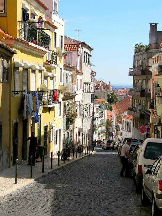
A street in the Bairro Alto. Photo: Thomas from Vienna, Austria, CC BY 2.0, via Wikimedia Commons (resized). Leave by Rua de Santa Catarina and follow Rua Marechal Saldanha uphill to Largo do Calhariz, the top of the Bica lift. Cross to Rua da Rosa, then turn right on Travessa das Mercês, left on Rua do Trombeta, right on Travessa dos Fiéis de Deus and left onto Rua da Atalaia. You are in the Bairro Alto, the “upper district”. It was laid out outside the old city walls, from about 1513, when Bartolomeu de Andrade and his wife Francisca Cordovil were allowed to divide the land into building plots. The first houses went up from 1514. By 1527 there were 408 buildings and 1,600 people. Its first name was Vila Nova de Andrade. The long streets run towards the river, and short lanes cross them. Along Rua da Atalaia you can still see the narrow, three-floor houses typical of the 16th and 17th centuries. The 1755 earthquake did not do great damage here. From the 1800s to the 1970s the district housed the country's main newspapers and printers; Rua Diário de Notícias and Rua d'O Século keep the names. By day it is quiet. From early evening it turns into Lisbon's best-known nightlife district. Some streets became pedestrian only in 2002, and the whole quarter was classified a Conjunto de Interesse Público in 2010.
More history
Visit Lisboa describes a night out as a steady downhill motion: it starts in the Bairro Alto, drops to Bica with a drink in hand, and ends in Cais do Sodré, where this walk began. In 2013 the quarter marked 500 years since the first plan to divide the land into plots.
Sources: Wikipedia (pt), Bairro Alto; Wikipedia, Bairro Alto; Visit Lisboa, Bairro Alto.
-
Miradouro de São Pedro de Alcântara and the Glória lift
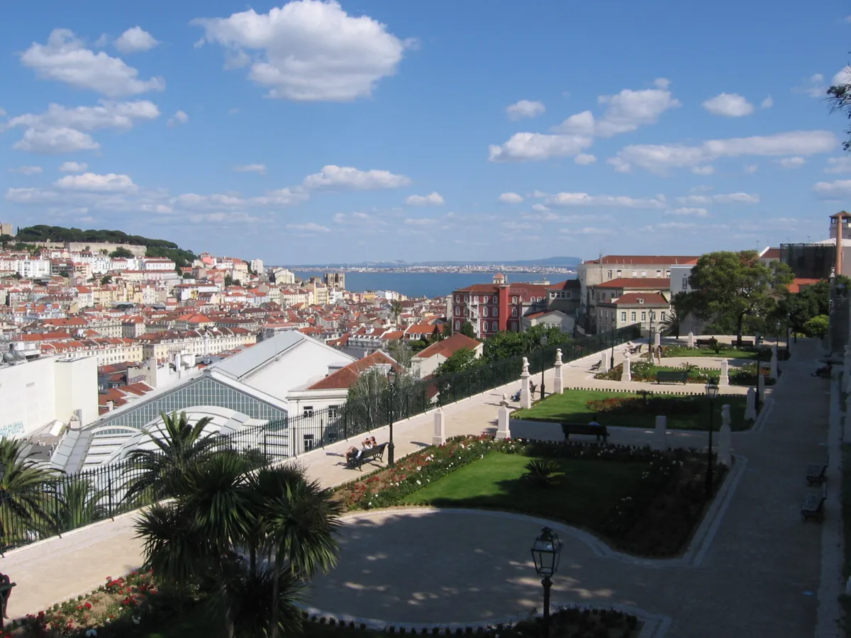
The garden terraces and the view over the lower city. Photo: CorreiaPM, public domain, via Wikimedia Commons (resized). Stay on Rua da Atalaia, turn right into Travessa da Cara and climb the last stretch on small lanes to the viewpoint on Rua de São Pedro de Alcântara. The terraced garden looks east across the lower city. A tiled map by the balustrade names what you see, among them the walls of São Jorge Castle among trees, the cathedral, the Graça church and São Vicente de Fora with its twin towers. Portuguese Wikipedia says the view is most striking at sunset and at night, when the castle and cathedral are lit. In the 1700s this land was meant for a huge water reservoir behind a 20 m wall, but the 1755 earthquake changed the city's priorities and the ground became a dump. In the garden a monument from 1904 honours Eduardo Coelho, who founded the Diário de Notícias in 1864; a newsboy calls out the paper beneath him. The top station of the Ascensor da Glória is here too. It opened on 24 October 1885 and has been closed since the September 2025 derailment. CNN Portugal reported in August 2026 that new Glória cars should arrive in 2029. Meanwhile you can walk down Calçada da Glória to Avenida da Liberdade.
More history
At the viewpoint stands the Ludovice Palace, finished in 1747. João Frederico Ludovice, the architect of Mafra, designed it and had it built partly from Mafra's stone offcuts. Its upper floors use a wooden anti-earthquake frame, a technique that was later used to rebuild the Baixa. It has been a hotel since 2022.
Sources: Wikipedia (pt), Jardim de São Pedro de Alcântara; Wikipedia (pt), Eduardo Coelho; Wikipedia (pt), Palácio Ludovice; Wikipedia, Ascensor da Glória; Carris, lifts; CNN Portugal, 28 August 2026.
-
Jardim do Príncipe Real and its cedar
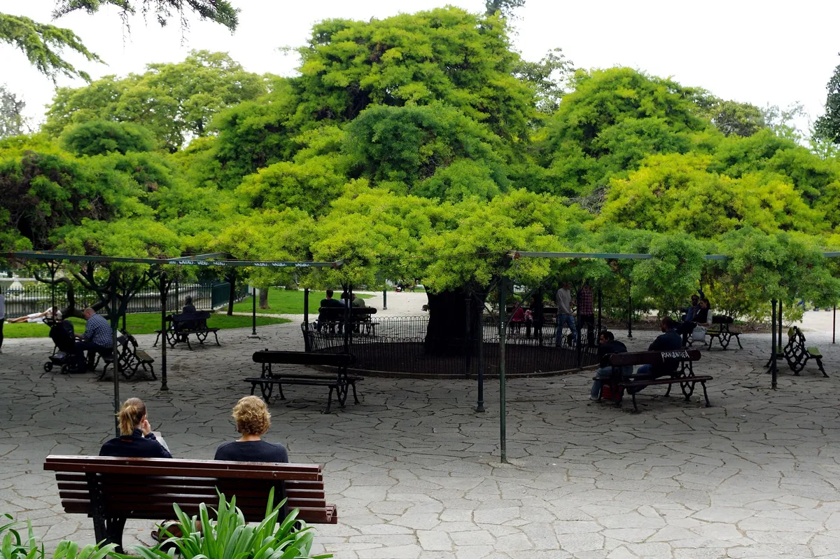
The cedar in the Príncipe Real garden. Photo: Donald Judge, CC BY 2.0, via Wikimedia Commons (resized). Walk west along Rua Dom Pedro V, about 400 m, to Praça do Príncipe Real. The garden in the middle is officially the Jardim França Borges, after a republican journalist whose bust was put up in 1915. It was laid out in the romantic, English style from a design of 1853, around an octagonal lake with a fountain, and the square was named Praça do Príncipe Real in 1859 after Queen Maria II's eldest son. The star is the cedar-of-Buçaco, which despite the name is a cypress, Cupressus lusitanica. Official figures in its 2018 classification give it a total height of only 7 m but a crown about 30 m across, trained into the shape of an arbour. It is about 150 years old. Three Australian rubber trees in the same garden, with strange roots and trunks, were classified as trees of public interest with it.
More history
The square has seen many plans. In the 15th century this hill was the Alto da Cotovia. Around 1740 it was the Bairro Alto's rubbish tip. The Jesuits then built a mission college here, which the 1755 earthquake destroyed. A new Patriarchal cathedral was begun and burned, and a plan for the royal treasury was dropped in 1797. By 1830 the site was rubble, which the council cleared for the square.
Sources: Wikipedia (pt), Jardim do Príncipe Real; Despacho (extrato) n.º 8496/2018, Diário da República, 3 September 2018.
-
Reservatório da Patriarcal, a reservoir under the garden
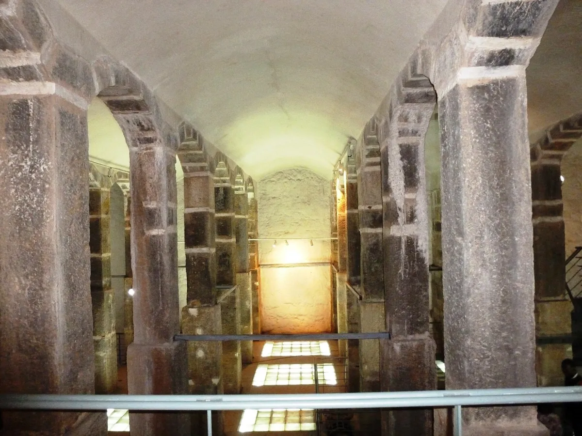
Inside the reservoir. Photo: Nicola, CC BY-SA 3.0, via Wikimedia Commons (resized). Walk on about 110 m to the octagonal lake. The iron railing around it follows the octagonal shape of the reservoir below. The French engineer Louis-Charles Mary designed it in 1856 as part of a plan to supply Lisbon with water, and it was built between 1860 and 1864. Water came in from the Águas Livres aqueduct, and the tank's job was to even out pressure on the way to the lower town. Thirty-one pillars, each 9.25 m high, carry stone arches and vaults over two chambers that hold 884 cubic metres. The jets in the lake above were meant to aerate the water before it went below. The reservoir was taken out of use at the end of the 1940s. Since 1994 it has been part of EPAL's Museu da Água. You can only visit by booking in advance, so arrange it with the museum before you come.
More history
Three underground galleries lead off the reservoir. One joins the Loreto gallery, which once carried water from the Arco reservoir in Rua das Amoreiras. The museum runs guided visits, by prior booking, along 350 m of the Loreto gallery from here to the São Pedro de Alcântara viewpoint, which you have just left.
Sources: EPAL, Reservatório da Patriarcal; EPAL, Museu da Água contacts and hours; Wikipedia (pt), Reservatório da Patriarcal.
-
Jardim Botânico de Lisboa, a botanical garden behind the Politécnica
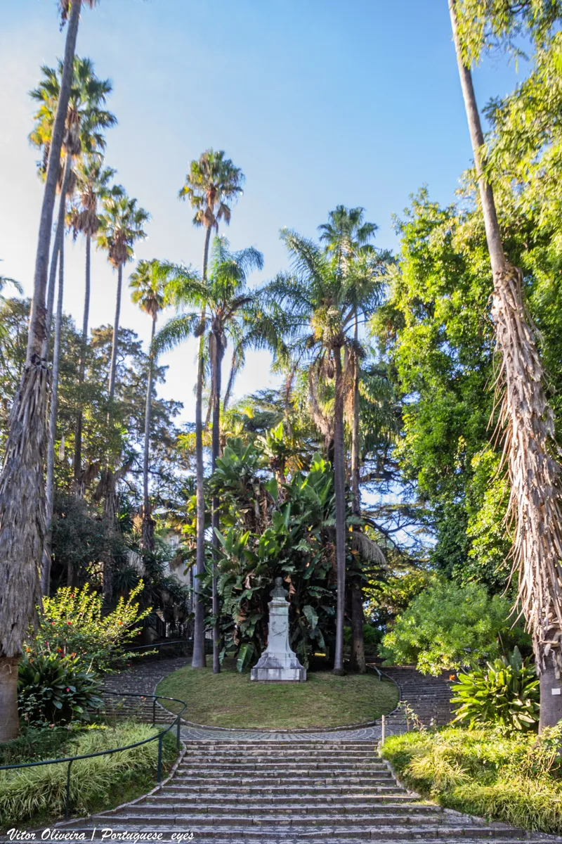
Palms and steps in the garden. Photo: Vitor Oliveira, CC BY-SA 2.0, via Wikimedia Commons (resized). Leave the Príncipe Real garden by its north side and turn left along Rua da Escola Politécnica, then right at the Botanical Garden entrance; the whole leg is about 290 m. The garden was designed in the mid-1800s to help teach and research botany at the Polytechnic School. It stands on Monte Olivete, where botany had been studied for more than two centuries, starting with the Jesuit college of Cotovia (1609 to 1759). Planting began in 1873, led by Count Ficalho and Andrade Corvo, and the garden opened in 1878. The first head gardener was the German Edmund Goeze. The Frenchman Jules Daveau, who followed him, laid out the Alameda das Palmeiras. Palms from every continent give parts of it a tropical air, and cycads, which the garden calls living fossils, are among its prized plants. It became a national monument in 2010. It is part of the Museu Nacional de História Natural e da Ciência. The upper part, the Classe, is free during garden hours. The lower part, the Arboreto, needs a ticket; check the price on the museum's site.
More history
By 2016 the garden had fallen into decline, with dry ponds and dying plants, and it closed in October that year for works. It reopened on 7 April 2018, after a project that won the city's 2013 participatory budget with 7,553 votes.
Sources: Museu Nacional de História Natural e da Ciência, Jardim Botânico; hours and prices; Wikipedia (pt), Jardim Botânico de Lisboa.


Practical details
- Terrain
- Steep. Open-Meteo puts the start at about 6 m above sea level, the Bica stop at 33 m and Santa Catarina at 49 m. Rua da Atalaia is at about 81 m, the São Pedro de Alcântara viewpoint at 73 m, Príncipe Real at 83 m and the Botanical Garden entrance at 86 m. Those readings are rough, and can be too high in dense streets. Many streets are cobbled.
- Step-free
- Not really. OpenStreetMap maps flights of steps on Calçada da Bica Pequena (57) and Travessa da Portuguesa (63 and 16), both on the route, and the lifts are closed. OpenStreetMap marks Cais do Sodré station as wheelchair accessible, but only one of its metro entrances.
- Water
- OpenStreetMap lists drinking-water points at Santa Catarina, the Chafariz Alto do Longo near the Príncipe Real garden and in the Botanical Garden.
- Toilets
- OpenStreetMap shows public toilets at Santa Catarina (every day, 07:30 to 23:30), near the São Pedro de Alcântara viewpoint (Monday to Saturday only) and an automatic one, with a fee, by the Príncipe Real garden.
- Sit and eat
- The viewpoints and the Príncipe Real garden have benches and shade. The Bairro Alto (stop 3) very probably has the biggest cluster of bars and restaurants in Lisbon, according to Portuguese Wikipedia.
- When to go
- The Botanical Garden is open daily except 25 December and 1 January: 10:00 to 17:00 from 1 October to 31 March and 9:00 to 20:00 from 1 April to 30 September, with last entry half an hour before closing. The upper part is free at any time; the lower part needs a ticket, except on Sundays from 10:00 to 13:00. The Patriarcal reservoir can only be visited by booking with the Museu da Água. Portuguese Wikipedia says the São Pedro de Alcântara view is best at sunset and at night.
- Lifts
- On 31 October 2026 Carris listed the Bica, Glória, Lavra and Santa Justa lifts as temporarily closed. It runs bus 22B in place of the Bica lift and bus 51E in place of the Glória lift. The Graça funicular, not on this walk, reopened on 30 April 2026. Check carris.pt before you go.
- Shorter walk
- Start at stop 3, Rua da Atalaia, and finish at stop 7: 1.2 km, about 40 minutes with stops. Or finish at stop 6, the Patriarcal reservoir, after 2.3 km.
- Getting back
- OpenStreetMap has tram stops at Rua da Escola Politécnica (90 m from the finish), Príncipe Real (230 m) and Rato (400 m); step-free access is not mapped. EPAL lists Rato metro and buses 758 and 773 for the Príncipe Real garden. Or walk back down Calçada da Glória to Avenida da Liberdade.
Walking distances and times from the OSRM foot router on OpenStreetMap data. Elevations from Open-Meteo. Stations, fountains, toilets and steps from OpenStreetMap; opening hours from the Museu Nacional de História Natural e da Ciência, EPAL and Carris. Checked 31 October 2026.
Questions people ask
How long is the Bairro Alto walking tour, and is there a map?
About 70 minutes: 2.6 km, 35 minutes of walking and seven stops, from Cais do Sodré station to the Botanical Garden entrance. It is a climb from the river to about 85 m by Open-Meteo's figures. The map is on this page, and you can print it or save it as a PDF.
What is Bairro Alto known for?
Two things. By day it is a quiet old quarter, laid out on a grid from about 1513, with narrow streets, old shops and the former homes of Lisbon's main newspapers and printers. From early evening it is the city's best-known nightlife district, packed with bars and restaurants. It was classified a Conjunto de Interesse Público in 2010.
Is Bairro Alto busy at night?
Yes. Portuguese Wikipedia calls it quiet by day and the main nightlife district from early evening, and Visit Lisboa says its streets fill with people of all ages. A night out often runs downhill from Bairro Alto to Bica and then Cais do Sodré. For quiet streets and clear views, walk this route in daylight.
Are the Lisbon funiculars worth it, or can you walk up instead?
For now you can't ride the ones around this walk, so you walk or take a bus. On 31 October 2026 Carris still listed the Bica, Glória and Lavra lifts and the Santa Justa lift as temporarily closed. The city suspended them after the Glória funicular derailed on 3 September 2025, killing 16 people. On 1 September 2026 Carris's president said the Bica, Lavra and Santa Justa lifts were still under inspection, with no date to reopen. Of the historic lifts, only the Graça funicular has reopened, on 30 April 2026, and it is not on this route. Check Carris before you go. In place of the Bica lift, Carris runs bus 22B from Cais do Sodré up to Largo do Calhariz. This walk climbs the Bica hill on foot, by Calçada da Bica Pequena, which OpenStreetMap shows as 57 steps.
What is the best viewpoint in Lisbon?
That is a matter of taste, and none of our sources ranks them. This walk has two. Santa Catarina looks over the Tagus, the 25 de Abril Bridge and the Cristo Rei statue. São Pedro de Alcântara looks east over the lower city, with a tiled map naming the sights, and Portuguese Wikipedia says it is most striking at sunset and at night.
Walk it with Strolio
Open Strolio at Cais do Sodré and ask for an hour or so through the Bairro Alto and Príncipe Real. Strolio builds walks in any city with mapped streets, so its route may pick different stops from this page. Stories play as you reach each place, and you can ask about anything else you pass, by voice or with a photo. You can also start from your hotel and choose your own time and interests.