
Dean Village self-guided walking tour · 1 hour · map
Dean Village to Stockbridge on foot: Telford's bridge, the Water of Leith and Circus Lane
Dean Village sits at the bottom of a deep river gorge a few minutes from Edinburgh's West End. This one-hour walk starts high on Telford's Dean Bridge, drops into the old milling village, follows the Water of Leith to Stockbridge and ends in cobbled Circus Lane.
The name comes from dene, a deep valley. For more than 800 years this was a grain-milling village, and at one time eleven mills worked on the river here. Bigger, more modern mills in Leith took the trade in the 19th century, and the village slowly declined. From the mid-1970s its mills, warehouses and workers' houses were restored as homes. The riverside from Roseburn to Stockbridge lies inside the Old and New Towns of Edinburgh World Heritage Site.
A note on accuracy: where our sources disagree, as they do on the age of the old bridge in the village, we say so, and every fact links to its source.
- Start
- The Dean Bridge on Queensferry Road, about 750 m (10 min) on foot from the West End – Princes Street tram stop
- Finish
- Circus Lane at North West Circus Place, Stockbridge
- Distance
- 2.1 km, one way
- Time
- About an hour: 24 min walking and 8 stops
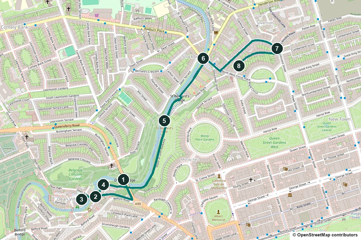
Steps, opening days, the Sunday market and a shorter version ↓
What to see: the stops
-
The Dean Bridge, Telford's bridge over the gorge
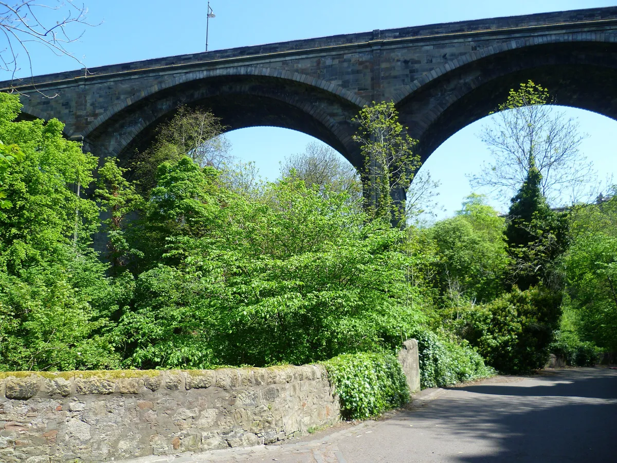
The arches from the path below, which you walk later. Photo: Kim Traynor, CC BY-SA 3.0, via Wikimedia Commons (resized). Start on the west footway of the Dean Bridge, on Queensferry Road, and look over the parapet: the roofs of Dean Village sit far below, at the bottom of the gorge of the Water of Leith. Thomas Telford designed the bridge, and it was built in 1829–31, when he was in his seventies. Its four arches carry the road 136 m across the gorge and about 32 m above the river bed. Telford made the piers hollow to save weight. A three-arch design was dropped because of poor ground on the south bank. The bridge was the idea of John Learmonth, a former Lord Provost who owned the Dean estate on the north side and wanted to build houses there. He seems to have paid most of the cost himself. The road trustees who helped him insisted on Telford and on a bridge with no toll. The parapets beside you were raised in 1912 to stop people jumping.
More history
Before the handover, the builder, John Gibb of Aberdeen, put a toll gate at each end and charged walkers a penny to enjoy the view. Learmonth's plan was slow to pay off: the first plots in Clarendon Crescent, at the north end, were not taken up until 1850.
Telford was the first president of the Institution of Civil Engineers, which put a plaque on the east parapet in 1957.
Sources: Historic Environment Scotland, Dean Bridge; Wikipedia, Dean Bridge; Wikipedia, Thomas Telford.
-
Bell's Brae: the Baxters' Tolbooth and the old bridge
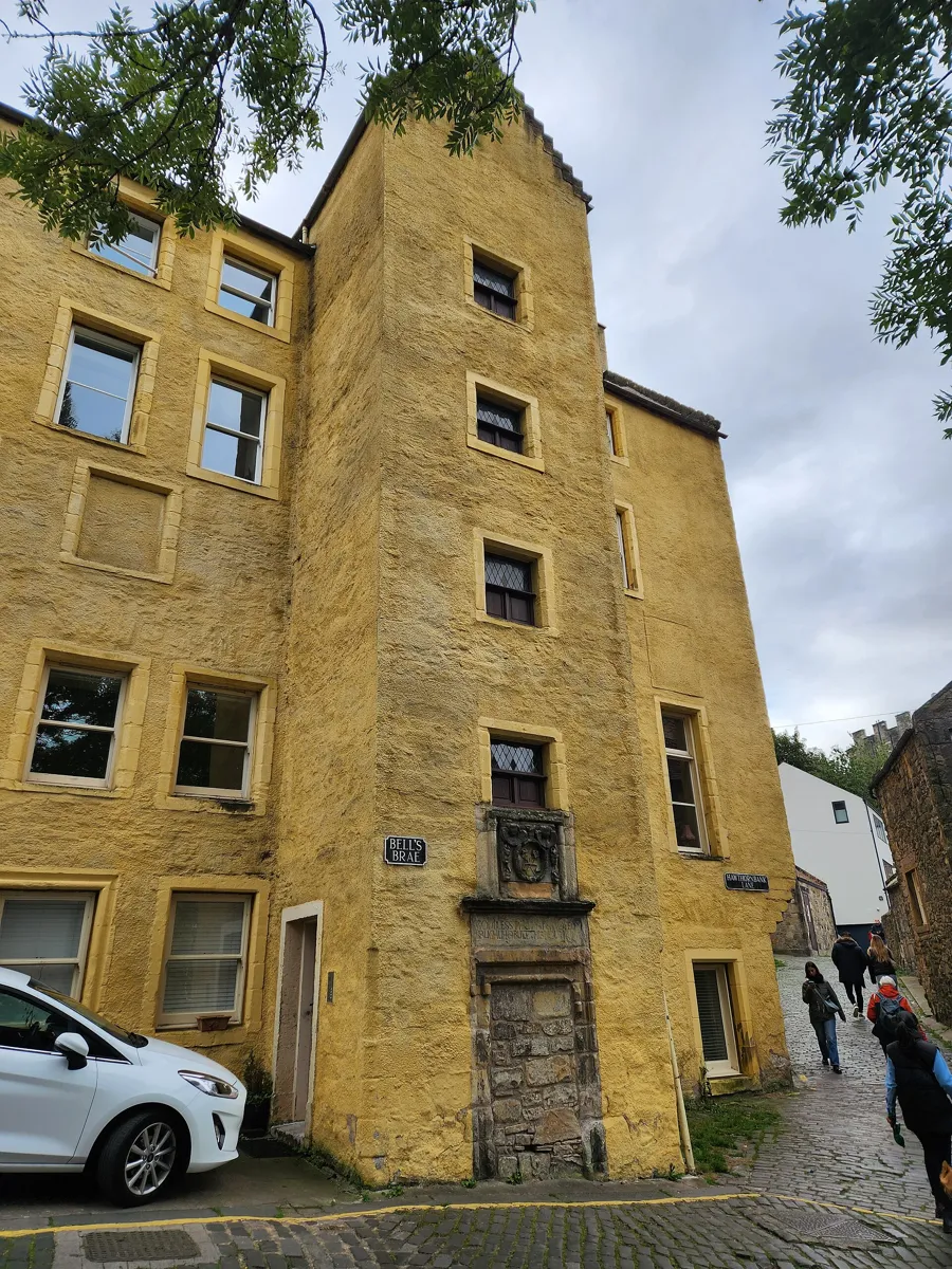
The Old Tolbooth, 13–15 Bell's Brae, with the carved panel on its stair tower. Photo: Discott, CC BY-SA 4.0, via Wikimedia Commons (resized). Walk back to the south end of the bridge, cross Queensferry Street and go down Bell's Brae, the steep lane that drops into the village. Near the bottom, just before the river, stands the ochre-painted Old Tolbooth. The Incorporation of Baxters, Edinburgh's bakers, built it as a granary in 1675. Look for the carved panel of cherubs' heads, scales and cakes on a stair tower, and the line above it, here in modern spelling: "God bless the Baxters of Edinburgh who built this house, 1675". The Baxters owned the village's mills, which supplied the city with flour until steam mills in Leith took the trade in the 19th century. The single-arch bridge beside it sits on the site of the old ford, where the road north out of Edinburgh crossed the river. Historic Environment Scotland dates the bridge to the early 18th century; the Water of Leith Conservation Trust gives 1643.
More history
The village was once called the Water of Leith village. In 1900 the architect Robert Lorimer turned the granary into a mission of St Mary's Episcopal Cathedral, with a chapel whose altarpiece was by Phoebe Anna Traquair. It became flats in 1976.
Sources: Historic Environment Scotland, 13–15 Bell's Brae; Historic Environment Scotland, Water of Leith bridge, Dean Path; Water of Leith Conservation Trust, Dean Village part 2; Dean Village; Wikipedia, Dean Village.
-
Well Court, model housing with a clock tower
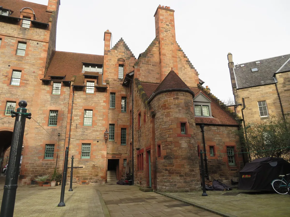
The courtyard of Well Court. Photo: M J Richardson, CC BY-SA 2.0, via Wikimedia Commons (resized). Cross the old bridge, keep left along the river into Damside and go through the round arch into the courtyard of Well Court. By the 1880s the mills were leaving and the village was poor. John R. Findlay, owner of The Scotsman, paid for this block as housing for the village's craftsmen and tradesmen, and Sydney Mitchell, early in his career, designed it in 1883–86. There are 54 small flats around the courtyard, plus a separate hall for reading and recreation, the building with the clock tower. Rents were kept low, and in return tenants had to stay sober and go to church on Sundays. Repairs with help from Edinburgh World Heritage in the 2000s included gilding the clock faces and weathercock again.
More history
The Water of Leith Conservation Trust describes the village of that time as Edinburgh's industrial slum, with grain mills, a brewery, a distillery, a chemical works and a skin factory.
Sources: Historic Environment Scotland, Well Court; Edinburgh World Heritage, Well Court; Water of Leith Conservation Trust, Dean Village; Wikipedia, John Ritchie Findlay.
-
The millstones on Miller Row
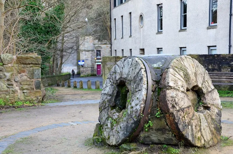
Millstones on Miller Row. Photo: Jim Barton, CC BY-SA 2.0, via Wikimedia Commons (resized). Go back over the old bridge and turn left into Miller Row, the path that follows the river downstream. In a small riverside park on the site of Lindsay's Mill lie old millstones. They are not local stone but French quartz. Grain imported from America was harder and drier than Scottish grain and needed a tougher stone; the stones were too heavy to ship whole, so they came in pieces held together by steel bands. You can hear the World's End weir nearby. It fed the Great Lade, a mill race that ran for more than 3 km and powered more mills all the way to Canonmills, often in a wooden trough above head height. It closed in 1881, reputedly after a landslide. By about 1960 the village had hit bottom; from the mid-1970s its mills and warehouses were restored as homes, such as the West Mills across the river.
More history
The Trust counts 76 mill sites along the river at its peak in the late 1700s.
Sources: Water of Leith Conservation Trust, Dean Village part 2; Water of Leith Conservation Trust, history; Wikipedia, Dean Village.
-
St Bernard's Well, a Roman temple over a spring
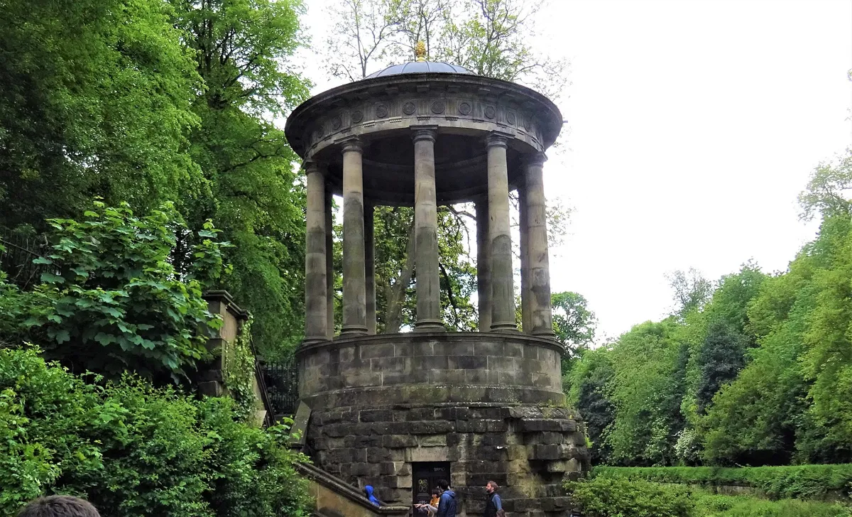
St Bernard's Well from the riverside. Photo: Rosser1954, CC BY-SA 4.0, via Wikimedia Commons (resized). Keep on along Miller Row, which becomes the Water of Leith Walkway and passes right under the Dean Bridge. Follow the south bank downstream for about 500 m, past the smaller St George's Well, to St Bernard's Well. A mineral spring rises here, and a small well house stood over it from 1760. The waters were thought to be good for you. Lord Gardenstone, a judge who believed they had helped him, asked the painter Alexander Nasmyth to design something grander in 1788, and building began the next year. Nasmyth gave it the form of a round Roman temple: ten Doric columns under a dome, modelled on the Temple of the Sibyl at Tivoli, over a pump room. The goddess of health, Hygieia, stands in the middle. She is not the first: the original Coade stone figure wore away, and D. W. Stevenson carved this one in 1888.
More history
The publisher William Nelson later bought the well and its grounds, had them restored by Thomas Bonnar, who also made the mosaic interior, and gave them to the city. A council plaque of January 1888 thanks him. The pump room inside opens only on a few days a year; see "When to go" below.
Sources: Historic Environment Scotland, St Bernard's Well; Water of Leith Conservation Trust, St Bernard's Well; Wikipedia, Stockbridge; Wikipedia, Dean Bridge.
-
Stockbridge and its Sunday market
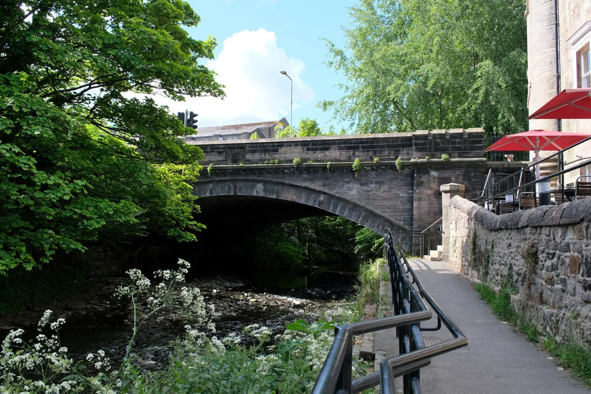
The Water of Leith at Stockbridge. Photo: Jim Barton, CC BY-SA 2.0, via Wikimedia Commons (resized). Carry on downstream. The path passes St Bernard's Bridge, built in 1824, probably by the architect James Milne, then comes out on Saunders Street. Follow it to Kerr Street and the bridge over the river. Stockbridge takes its name from an early timber bridge, a "stock brig" in Scots. The stone bridge here was built in 1801 and widened around 1830. Stockbridge was a separate village of mill workers and tanners, and in the 18th century townspeople came out to drink the waters at St Bernard's Well. The portrait painter Henry Raeburn was born here. He owned the Deanhaugh and St Bernard's estates, and with Milne he laid them out as Georgian streets, among them Ann Street, named after his wife. Saunders Street is newer than it looks: it was built in 1974 to replace slums. On Sundays, from 10am to 4pm, it hosts the Stockbridge Market, with food stalls, crafts and produce.
More history
Raeburn lived in St Bernard's House until his death in 1823; it was pulled down to make way for Carlton Street.
Sources: Historic Environment Scotland, St Bernard's Bridge; Water of Leith Conservation Trust, Stockbridge; Wikipedia, Stockbridge; Stockbridge Market.
-
St Stephen Street, the old market gate and St Stephen's Church
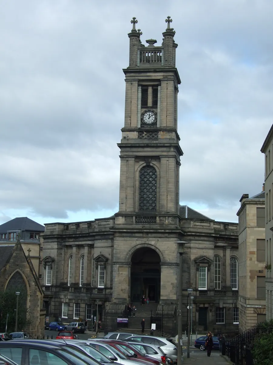
St Stephen's Church from St Vincent Street. Photo: AlasdairW, CC BY-SA 4.0, via Wikimedia Commons (resized). Walk up Kerr Street and turn left into St Stephen Street, a curving street of shops and bars. On the left, St Stephen Place leads to an arch flanked by fluted Greek Doric columns: Archibald Scott's entrance of 1825 to the Stockbridge market, and all that is left of it. Carry on to the end of the street. William Henry Playfair designed St Stephen's Church in 1827–28, on a giant scale. It was first meant to stand in the middle of Circus Place; instead it was squeezed onto this sloping corner, set diagonally behind its tower, with the church itself raised a storey above a tall flight of steps. The tower is 49 m high, and its clock, put in by James Ritchie & Son in 1828, has an 18 m pendulum, said to be the longest in Europe. The congregation shrank, and the building was divided up inside in 1956. Since 2017 it has belonged to the ballet dancer Peter Schaufuss and is now a theatre and event venue.
More history
Outside, a Stolperstein, a small brass memorial set in the pavement, remembers Jane Haining, a Church of Scotland missionary. The church held a service for her in 1932 before she left to work in Budapest. Arrested by the Gestapo in 1944, she died in Auschwitz that July. The stone was unveiled in November 2025.
Sources: Historic Environment Scotland, St Stephen's Church; Historic Environment Scotland, Stockbridge Market gate; Historic Environment Scotland, St Stephen Street; Wikipedia, Saint Stephen's Theatre; Wikipedia, Stockbridge; Wikipedia, Jane Haining.
-
Circus Lane and Royal Circus
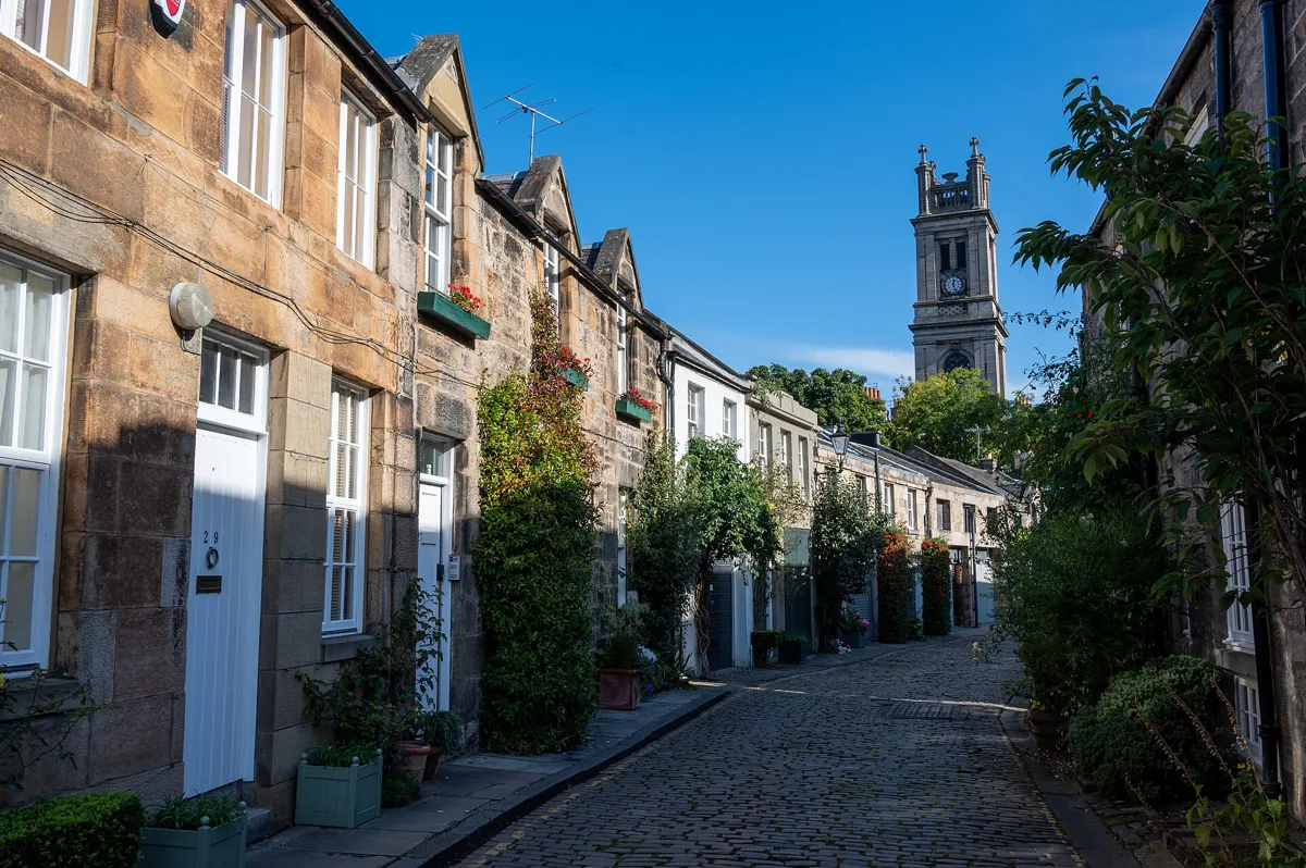
Circus Lane, with St Stephen's tower behind. Photo: Ralf Steinberger, CC BY 2.0, via Wikimedia Commons (resized). From the church, go down to the corner and turn right into cobbled Circus Lane. Walk to the far end and look back for the view of the church tower over the roofs. This was a mews, a back lane where the grand houses of Royal Circus kept their coaches and horses. Its two-storey stone buildings date from the earlier 19th century. The row on the north side is the longest continuous row of mews in the Second New Town, the first extension of the New Town, and it curves because the circus does. The lane comes out on North West Circus Place, whose buildings belong to Royal Circus; the circus curves away to your left. William Henry Playfair drew it in 1820 for the Heriot Trust, and it was built in 1821–23. It sits on a slope, and Playfair kept the old road to Stockbridge running diagonally through it. Our New Town walk covers the first New Town, up the hill.
More history
A plaque at 24 Royal Circus marks the home, from 1866 to 1914, of Sir Henry Littlejohn, Edinburgh's first Medical Officer of Health. He held the post for 46 years.
Sources: Historic Environment Scotland, Circus Lane; Historic Environment Scotland, Royal Circus; Wikipedia, Stockbridge; Wikipedia, Henry Littlejohn.


Practical details
- Terrain
- One steep stretch: Bell's Brae drops from Queensferry Street to the river, and the bridge deck stands about 32 m above the river bed. After that the walk follows the river path, with the Water of Leith Walkway under the Dean Bridge. The streets up to St Stephen's Church and Circus Lane climb a little, as the church stands on a sloping site.
- Step-free
- No. OpenStreetMap maps a flight of 29 steps on the walkway between the Dean Bridge and St Bernard's Well, a flight of 12 steps and one of 21 beside the well, and short flights by St Bernard's Bridge before Saunders Street. Circus Lane is cobbled.
- Water
- OpenStreetMap shows no drinking fountains on the route.
- Toilets
- Free council toilets on Hamilton Place in Stockbridge, about 55 m from the bridge at stop 6, open 10am to 7.30pm, according to the City of Edinburgh Council. OpenStreetMap marks them as not wheelchair accessible.
- Sit and eat
- Stockbridge, around stop 6, has cafés by the bridge and small shops along Raeburn Place, its main street. On Sundays the market on Saunders Street has hot food stalls.
- When to go
- Sunday, if you want the Stockbridge Market: it runs every Sunday, all year, from 10am to 4pm. The pump room of St Bernard's Well opens only on a few days a year; the Water of Leith Conservation Trust says Sundays in August and the Doors Open Day weekend in September. We found no 2026 dates.
- Shorter walk
- Finish at stop 6, the bridge in Stockbridge: 1.4 km, about 45 minutes. There are bus stops on Kerr Street, about 50 m from the bridge.
- Getting back
- The Circus Lane bus stop on North West Circus Place is about 50 m from the end of the lane. The West End – Princes Street tram stop is about 1.4 km, 19 minutes on foot.
Walking distances and times from the OSRM foot router on OpenStreetMap data. Steps, bus stops and toilets from OpenStreetMap; toilet hours from the City of Edinburgh Council; market days from Stockbridge Market. Hours change, so check before you go. Checked 5 October 2026.
Questions people ask
How long is the Dean Village walk, and is there a map?
About an hour: 2.1 km, 24 minutes of walking and eight stops, from the Dean Bridge down through Dean Village, along the Water of Leith to Stockbridge, and on to Circus Lane. The map is on this page, and you can print it or save it as a PDF.
How do you get to Dean Village?
Head for the Dean Bridge, which carries Queensferry Road over the gorge, about 750 m or 10 minutes on foot from the West End – Princes Street tram stop. Buses stop at the north end of the bridge. At the south end of the bridge, the steep lane called Bell's Brae leads down into the village. You can also walk in along the Water of Leith Walkway from Stockbridge, which is this walk in reverse.
Can you walk from Dean Village to Stockbridge along the river?
Yes. The Water of Leith Walkway runs from Miller Row in Dean Village along the south bank, under the Dean Bridge and past St Bernard's Well, and comes out on Saunders Street by the bridge in Stockbridge. From the millstones on Miller Row it is about 900 m, roughly ten minutes on foot. The whole walkway runs 19 km, from Balerno to Leith.
What is Dean Village known for?
Milling. For more than 800 years it was a grain-milling village on the Water of Leith, with at one time eleven working mills, and Edinburgh's bakers, the Baxters, owned them. Today it is known for its restored mill buildings, the bakers' granary of 1675, the Well Court housing of the 1880s and the view down from Telford's Dean Bridge.
Is St Bernard's Well open?
You can see the temple from the walkway at any time. The pump room inside opens only on a few days a year: the Water of Leith Conservation Trust says Sundays in August and the Doors Open Day weekend in September, and Wikipedia says occasional Sundays from April to September. We found no 2026 dates, so check before you go.
Walk it with Strolio
Open Strolio on the Dean Bridge and ask for an hour through Dean Village and Stockbridge. Strolio builds walks in any city with mapped streets, so its route may pick different stops from this page. Stories play as you reach each place, and you can ask about anything else you pass, by voice or with a photo. You can also start from your hotel and choose your own time and interests.
More walks in Edinburgh
- The Royal Mile: ~1½ h, 8 stops. From Greyfriars Bobby and Victoria Street up to the Castle and down the Royal Mile to Holyrood.
- The New Town: ~1½ h, 8 stops. James Craig's Georgian grid from Register House to Charlotte Square, then the castle view and the Scott Monument.
- Calton Hill to Arthur's Seat: 2–3 h, 8 stops. The Calton Hill monuments, a ruined chapel and an extinct volcano: a real hill walk up Arthur's Seat.
- All Edinburgh walks, with maps side by side.
- Walks in other cities.
Sources
- Historic Environment Scotland, listed building records: the record for each building, bridge or lane, linked under each stop. We used their facts and wrote our own text.
- Water of Leith Conservation Trust: audio trail notes for Dean Village, Dean Village part 2, St Bernard's Well and Stockbridge; history; the walkway
- Edinburgh World Heritage: Well Court
- Wikipedia: Dean Village, Dean Bridge, Thomas Telford, Water of Leith Walkway, John Ritchie Findlay, Stockbridge, Saint Stephen's Theatre, Jane Haining, Henry Littlejohn
- Market days: Stockbridge Market
- Map data and places: © OpenStreetMap contributors, ODbL; walking route from the OSRM foot router run by FOSSGIS
- Photos: Wikimedia Commons contributors Kim Traynor, Discott, M J Richardson, Jim Barton, Rosser1954, AlasdairW and Ralf Steinberger, credited under each photo