
Calton Hill to Arthur's Seat self-guided walk · 2–3 hours · map
Calton Hill to Arthur's Seat on foot: Edinburgh's monuments, a ruined chapel and the extinct volcano
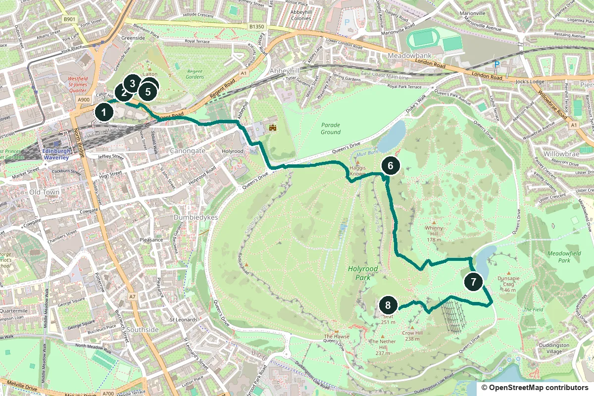
This is a hill walk, not a stroll. It starts among the monuments of Calton Hill, crosses the city on streets to Holyrood Park, then climbs to the top of Arthur's Seat, an extinct volcano and the highest point in Edinburgh. Allow two to three hours, and wear proper shoes.
The first 2.7 km, to the ruined St Anthony's Chapel, are on pavements and paths. The climb comes after that: roughly 150 to 170 m of height from the chapel to the summit, which is 251 m above sea level. The park is open around the clock and free. Where our sources disagree, as on the Radical Road, we say so, and every fact links to its source.
- Start
- Old Calton Burial Ground, Waterloo Place
- Finish
- The summit of Arthur's Seat; the way back is 3.5 km
- Distance
- 4.6 km, one way
- Time
- 2 to 3 hours: 61 min of walking on the router's flat-ground estimate, 8 stops and the climb
- Climb
- Roughly 150 to 170 m from the chapel to the summit
Footwear, the climb, steps, opening days and a shorter version ↓
What to see: the stops
-
Old Calton Burial Ground and David Hume's tomb
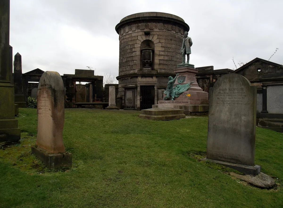
David Hume's tomb in Old Calton Burial Ground. Photo: Euan Nelson, CC BY-SA 2.0, via Wikimedia Commons (resized). Start at the Old Calton Burial Ground beside Waterloo Place, on the south-western side of Calton Hill, and look for the round stone tower. This is the tomb of David Hume (1711–76), one of the great thinkers of the Scottish Enlightenment. His will asked for a monument carrying only his name and the years of his birth and death, and left it to later generations to add the rest. Robert Adam designed the drum-shaped tower in 1777, and Historic Environment Scotland says he probably based it on the tomb of Theodoric at Ravenna. Hume's atheism made him unpopular, and his grave had to be guarded for eight days after the burial. A statue of Abraham Lincoln stands in front of it. It was put up in 1893 for Scots who fought for the Union in the American Civil War, and it is the only statue of Lincoln in Scotland. The graveyard is split in two because Waterloo Place was driven through it between 1815 and 1819.
More history
The burial ground opened in 1718. The tall obelisk is the Political Martyrs' Monument, put up in 1844 for five reformers sentenced in 1793 to 14 years' transportation for asking for votes for all. We found no opening times for the burial ground, so check before you go.
Sources: Historic Environment Scotland, Calton Old Burial Ground; Wikipedia, Old Calton Burial Ground; Wikipedia, Calton Hill.
-
The Dugald Stewart Monument
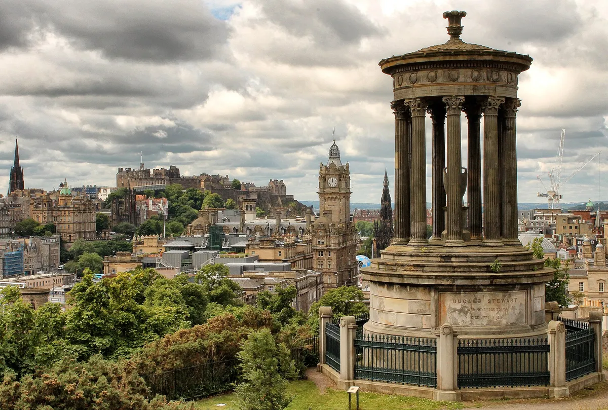
The Dugald Stewart Monument. Photo: Arran Bee, CC BY 2.0, via Wikimedia Commons (resized). Leave the burial ground, walk along Regent Road and take the path up the hill to the monument on its west side. There are flights of steps here. Dugald Stewart (1753–1828) was professor of moral philosophy at Edinburgh University from 1786 until he died. The Royal Society of Edinburgh commissioned the monument, William Henry Playfair designed it, and it was finished in September 1831. It is a small round Greek temple: nine fluted Corinthian columns around an urn, copied from the Choragic Monument of Lysicrates in Athens. Historic Environment Scotland suggests the choice is a nod to Stewart's fame as an orator. Thomas Hamilton's Burns Monument, built in 1830–32 on Regent Road, uses the same Greek form. You will pass it later, when you leave Calton Hill along that road.
More history
Playfair also designed the National Monument, which you will reach in a few minutes, and the road that circles Calton Hill on three sides: Royal Terrace, Carlton Terrace and Regent Terrace.
Sources: Historic Environment Scotland, Dugald Stewart's Monument; Wikipedia, Dugald Stewart Monument.
-
The City Observatory and Collective
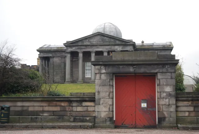
The City Observatory site on Calton Hill. Photo: N Chadwick, CC BY-SA 2.0, via Wikimedia Commons (resized). Follow the path on to the City Observatory, the walled group of buildings on top of the hill. The oldest part is the Gothic tower in the corner, designed by James Craig for Thomas Short, who lived in it. The money ran out after this one tower. The Greek-temple building in the middle is the Playfair Building, begun in 1818. Astronomers here mainly kept time: sailors brought their ships' chronometers up from Leith to be checked, and in the 1850s the time ball on the Nelson Monument was linked to the observatory clock. The Royal Observatory moved to Blackford Hill in 1896, and by 2009 vandalism and theft had left the site unusable. Since 2018 it has been Collective, a contemporary art centre that is free to enter. It is open Wednesday to Sunday, 10am to 5pm, and closed on Monday and Tuesday. The restored Playfair Building has its original transit telescope on show.
More history
Thomas Short's daughter Maria Theresa Short ran a second, more popular observatory on the hill. In 1850 she moved it to Castle Hill, and it is the ancestor of today's Camera Obscura on the Royal Mile. The £4.5 million restoration opened to the public on 24 November 2018.
Sources: Wikipedia, City Observatory; Historic Environment Scotland, City Observatory; Collective, visit.
-
The National Monument, Scotland's unfinished Parthenon
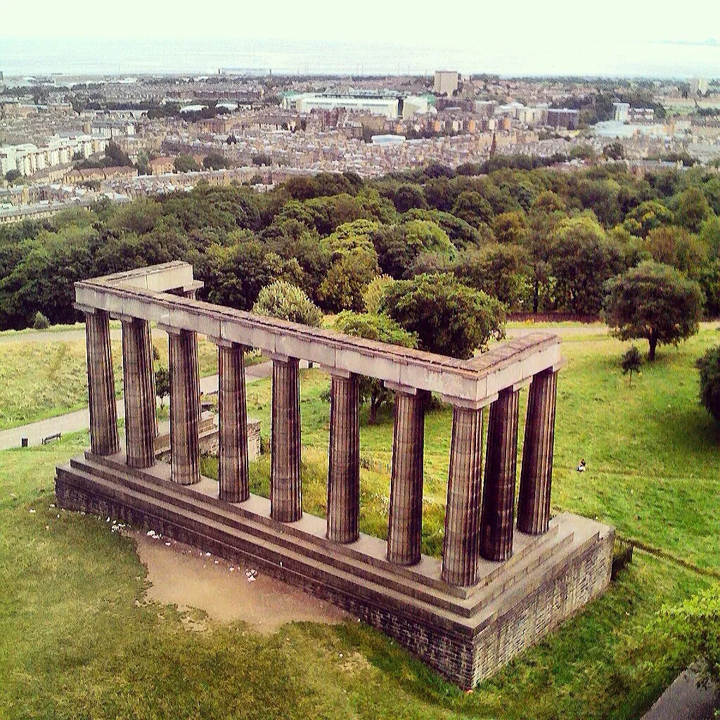
The National Monument from above. Photo: Sean-sabhaois, CC BY-SA 4.0, via Wikimedia Commons (resized). Walk on across the hilltop to the row of columns that has no building behind it. The National Monument was meant to be a copy of the Parthenon in Athens, in memory of the Scottish soldiers and sailors killed in the Napoleonic Wars. Charles Robert Cockerell and William Henry Playfair designed it, and work began in 1826. By 1829 the money had run out, and only the columns and beam of the west end were finished. The appeal had asked for £42,000, and the first building contract was for about £15,000, all that had been raised. The stone was the best Craigleith stone, and it reportedly took twelve horses and 70 men to haul some of the blocks up the hill. Historic Environment Scotland notes that it still looks as it did in 1829. It earned nicknames such as Scotland's Pride and Poverty, and Edinburgh's Disgrace.
More history
The plan included catacombs under the temple, a “Scottish Valhalla” for famous Scots. Later proposals to finish it included a Queen Victoria memorial in 1901, a Scottish Parliament building in 1908 and a First World War memorial in 1918. None was built.
Sources: Historic Environment Scotland, National Monument; Wikipedia, National Monument of Scotland.
-
The Nelson Monument and its time ball
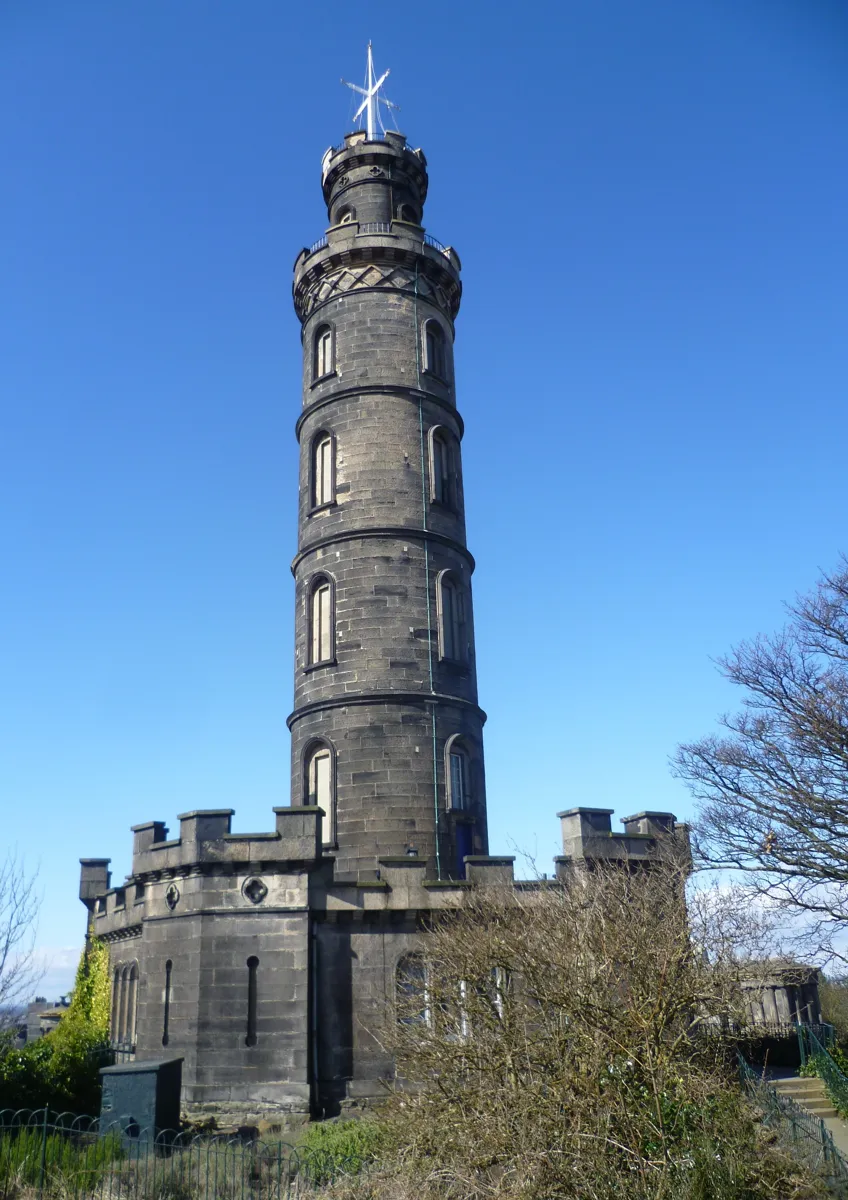
The Nelson Monument. Photo: Kim Traynor, CC BY-SA 3.0, via Wikimedia Commons (resized). The last stop on the hill is a few steps away: the tower with a castle-style base. It stands 32 m high and is said to look like an upturned telescope. Robert Burn designed it, after the painter Alexander Nasmyth's pagoda-style plan was judged too expensive, and Thomas Bonnar finished the base in 1814–16. It was paid for by public subscription to mark Nelson's victory at Trafalgar in 1805. Look to the top for the time ball, added in 1853 so that ships at Leith could set their clocks. The ball is dropped at 1pm every day, as the One O'Clock Gun fires from Edinburgh Castle. A climb of 143 steps leads to a viewing platform. Culture Edinburgh lists it as open seven days a week, 10am to 3:30pm, but we found no price on its page, and it posts maintenance closures, so check first. Every 21 October, Trafalgar Day, the Royal Navy's White Ensign and Nelson's famous signal are flown from it.
More history
The time ball was Charles Piazzi Smyth's idea, and at first the observatory clock triggered it through an underground wire. The One O'Clock Gun was added in 1861 for foggy days, when the ball could not be seen. The time ball is now dropped by hand.
Sources: Wikipedia, Nelson Monument; Historic Environment Scotland, Nelson's Monument; Culture Edinburgh, Nelson Monument.
-
St Anthony's Chapel, above St Margaret's Loch
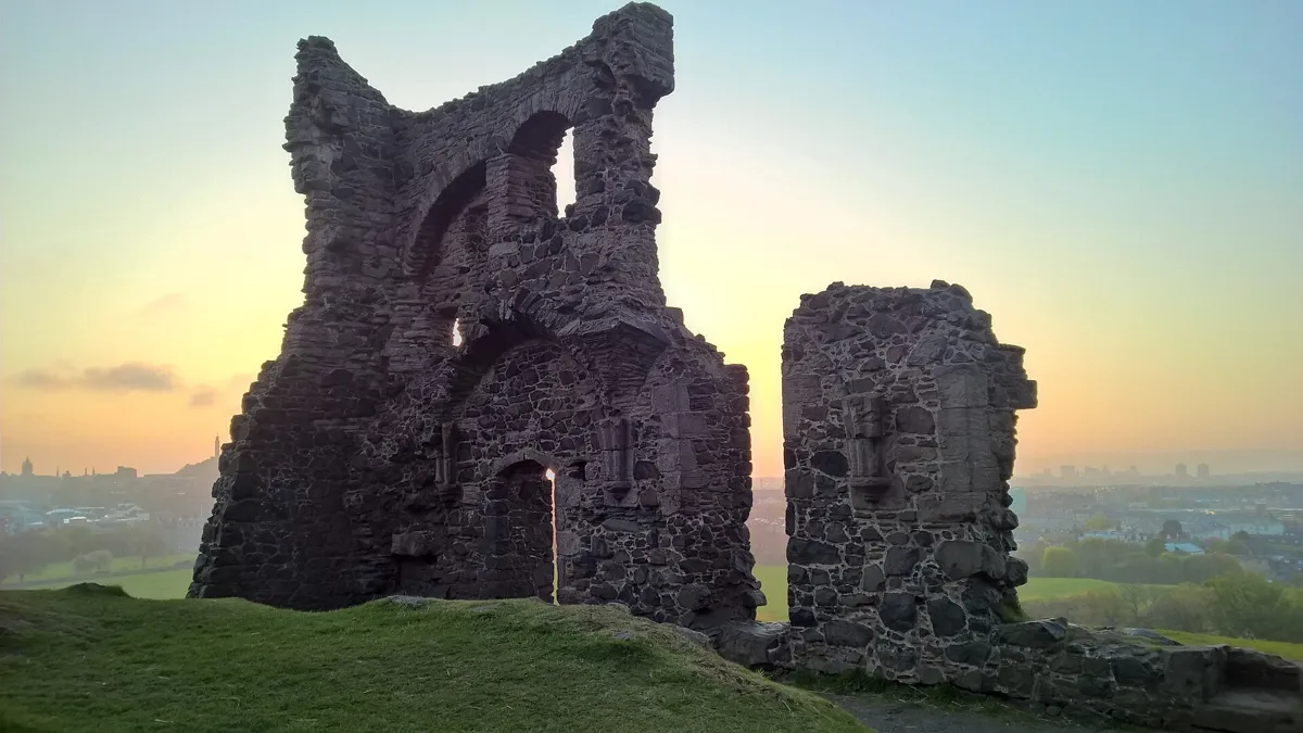
The ruin of St Anthony's Chapel. Photo: Johnson twj, CC BY-SA 4.0, via Wikimedia Commons (resized). Now the walk changes. Leave Calton Hill by Regent Road, then follow Calton Road, Abbeyhill and the foot of the Canongate to Abbey Strand by Holyrood Palace. This 2.1 km stretch is mostly on streets. Go into Holyrood Park and take Volunteer's Walk uphill to the chapel ruin. Its origins are unclear, but it was built by the early 15th century, as the Pope is recorded as paying for repairs in 1426. It was a small rectangular building about 13 m by 5.5 m, with a tower at the west end that stood about 12 m high. Only the north wall and a fragment of the west wall remain. St Margaret's Loch, roughly 100 m to the north, is not medieval: it was made in 1856 as part of Prince Albert's improvements. This is the first real climb of the day.
More history
Salisbury Crags, the cliff line on the park's west side, are 46 m high. The Radical Road, the track below them, was paved after the Radical War of 1820 with the labour of unemployed weavers, at Walter Scott's suggestion. A rock fall closed it in 2018.
Sources: Wikipedia, Holyrood Park; Historic Environment Scotland, Holyrood Park history; Wikipedia, Arthur's Seat.
-
Dunsapie Loch
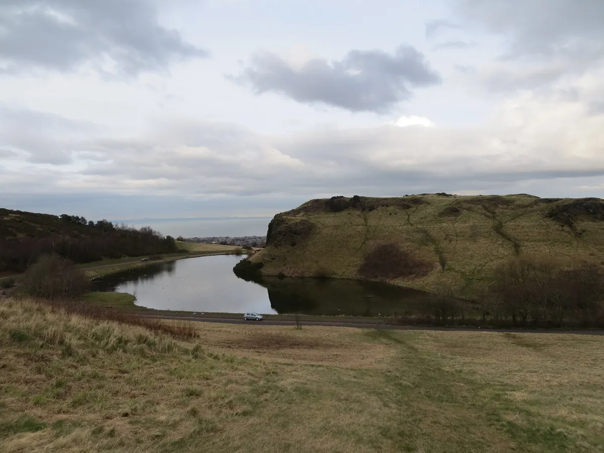
Dunsapie Loch below Dunsapie Hill. Photo: John Ferguson, CC BY-SA 2.0, via Wikimedia Commons (resized). From the chapel, follow the path along the valley that OpenStreetMap names The Dry Dam, then the last stretch beside Queen's Drive, to Dunsapie Loch. This leg is 1.1 km. The loch is small and man-made, between Dunsapie Hill and Arthur's Seat. Traces of a prehistoric hill fort survive on Dunsapie Hill. In May 1562 the loch was the setting for entertainment at a noble wedding, which included a staged re-creation of the siege of Leith. The car park here is open to vehicles only Tuesday to Thursday, 9.30am to 3pm, according to Historic Environment Scotland, so on other days you arrive on foot like everyone else.
More history
Wikipedia says the easiest ascent of Arthur's Seat is from this side, up the grassy slope above the loch. Farming terraces can still be seen on the hill's eastern slopes when the sun is low.
Sources: Wikipedia, Holyrood Park; Wikipedia, Arthur's Seat; Historic Environment Scotland, roads and car parks; Historic Environment Scotland, history and stories.
-
The summit of Arthur's Seat
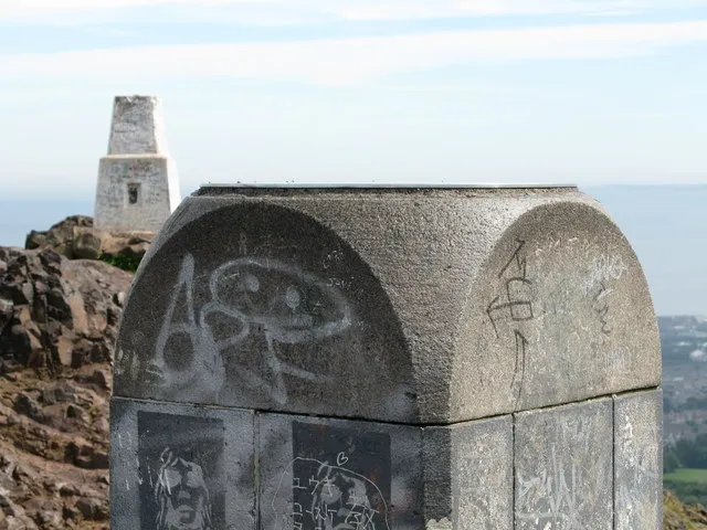
The viewpoint and trig point at the summit. Photo: G Laird, CC BY-SA 2.0, via Wikimedia Commons (resized). Climb the grassy slope above the loch to the top, 809 m on from the loch. Wikipedia gives the summit's height as 250.5 m in one article and 251 m in another. It is the highest point in Edinburgh. This is an extinct volcano, formed in the early Carboniferous period, with lava samples dated to 341 to 335 million years old. A glacier moving west to east later stripped the rock into crags on the west side and left a long tail to the east. A prehistoric hill fort sat on the summit, and the earliest written Arthur form of the name, Arthurissete, comes from a poem of 1508. Wikipedia says the name is sometimes linked to King Arthur legends, but that link is only suggested. Robert Louis Stevenson called it a hill for magnitude and a mountain by virtue of its bold design.
More history
The geologist James Hutton studied the rocks of Salisbury Crags, and his observations helped him develop the idea of deep time. Tradition says that on May Day young girls in Edinburgh wash their faces in the dew on the hill's slopes to become more beautiful.
Sources: Wikipedia, Arthur's Seat; Wikipedia, Holyrood Park; Historic Environment Scotland, history and stories.


Practical details
- The climb
- The first 2.7 km, to the chapel, are on streets and paths. After that the walk is uphill: 1.1 km from the chapel to Dunsapie Loch, then 809 m up the grassy slope to the summit. Two elevation models (Open-Meteo and EU-DEM) put the chapel at about 38 to 61 m and the summit at about 205 to 214 m, so roughly 150 to 170 m of climb, most of it in the last 2 km. The models read the summit lower than its surveyed 251 m, so treat this as approximate. The router counts 61 minutes for the whole walk, but it ignores slope, so the climb takes longer.
- Footwear and weather
- Historic Environment Scotland warns of sheer drops and uneven, slippery surfaces in the park and asks visitors to wear sturdy shoes with good grip. OpenStreetMap tags the park's paths as unpaved and unlit, and some on the upper slopes as mountain hiking paths. The park is open 24 hours a day, but go in daylight, and check the forecast first. We found no weather guidance in our sources.
- Step-free
- No. OpenStreetMap maps flights of steps around the Calton Hill stops, including 37 steps by the Dugald Stewart Monument and 21 steps by the observatory. The Nelson Monument's tower has 143 steps. The paths in Holyrood Park are grass and ground.
- Water
- OpenStreetMap shows no drinking fountains on the route. Bring water.
- Toilets
- Public toilets are next to the Holyrood Park Education Centre, on the north side of the park behind the Palace of Holyroodhouse. Historic Environment Scotland lists them as open 8am to 3pm daily from October to March, with longer hours from April to September. We found none marked further along the route.
- Sit and eat
- Collective has a café, Cafe Calton, on Calton Hill. There is nothing marked on the route once you are in the park, so bring what you need.
- When to go
- Collective is closed on Mondays and Tuesdays. The Nelson Monument is listed as open 10am to 3:30pm daily, and the time ball drops at 1pm. If you want the Dunsapie Loch car park, it is open to vehicles Tuesday to Thursday only. In July 2026 a grass fire burned on Arthur's Seat for about three days (SWNS, ITV News), and the park bans fires and barbecues.
- Closed areas
- On 5 October 2026 Historic Environment Scotland's page said the Radical Road was closed because of falling rock, with work under way to reopen parts of it, and that the climbing areas were closed for safety. The High Road is closed to motor traffic, but you can walk it. Check the park's page before you go.
- Shorter walk
- Calton Hill only, stops 1 to 5: 0.5 km, with a long stop at Collective or up the Nelson Monument. Or stop at Dunsapie Loch (stop 7): 3.8 km, skipping the last 809 m climb.
- Getting back
- From the summit to Holyrood Palace it is 3.5 km, about 47 minutes on the router's flat-ground estimate, by the way you came. Collective says buses stop on Waterloo Place and Royal Terrace, and Waverley station is a few minutes' walk. Our Royal Mile walk ends at Holyrood, so you can walk it first.
Walking distances and times from the OSRM foot router on OpenStreetMap data. Steps, water and path tags from OpenStreetMap; opening times from Collective, Culture Edinburgh and Historic Environment Scotland. Hours and closures change, so check before you go. Checked 5 October 2026.
Questions people ask
How long does it take to walk up Arthur's Seat?
On this walk, the last climb from Dunsapie Loch to the summit is 809 m. The router counts about 12 minutes for it at flat-ground speed, so expect longer on the slope. The whole route from Calton Hill is 4.6 km and 61 minutes of walking at that speed; with eight stops and the climb, allow two to three hours.
What is the easiest route up Arthur's Seat?
Wikipedia says the easiest way up is from the east, where a grassy slope rises above Dunsapie Loch, and that the hill can be climbed from almost any direction. This walk finishes on that slope. Historic Environment Scotland says the Dunsapie Loch car park is open to vehicles only Tuesday to Thursday, 9.30am to 3pm, though you can always arrive on foot.
Is Arthur's Seat a volcano?
Yes, an extinct one. Wikipedia says it was formed by a volcanic system of early Carboniferous age, with lava samples dated to 341 to 335 million years ago, and Historic Environment Scotland puts the eruption at around 340 million years ago. Glaciers later wore the hill into the cliffs and valleys you see now.
How long does it take to walk up Calton Hill?
Not long, but there are steps. Collective says steps lead up from Waterloo Place and Royal Terrace. On this walk, the five stops on Calton Hill, from David Hume's tomb to the Nelson Monument, are only 532 m apart in total, though you will want time inside the Collective gallery and perhaps up the Nelson Monument's 143 steps.
Is the Radical Road open?
Not according to Historic Environment Scotland's Holyrood Park page, which on 5 October 2026 still said the path is closed because of falling rock and that work to reopen parts of it was continuing. It has been shut since a rock fall in 2018. In July 2025 Historic Environment Scotland planned to reopen part of it in early 2026, and Wikipedia says it expected June 2026, so check before you go. The walk on this page does not use it.
Walk it with Strolio
Open Strolio on Calton Hill and ask for a walk to Arthur's Seat. Strolio builds walks in any city with mapped streets, so its route may pick different stops from this page. Stories play as you reach each place, and you can ask about anything else you pass, by voice or with a photo. You can also start from your hotel and choose your own time and interests.
More walks in Edinburgh
- The Royal Mile: ~1½ h, 8 stops. From Greyfriars Bobby and Victoria Street up to the Castle and down the Royal Mile to Holyrood.
- The New Town: ~1½ h, 8 stops. James Craig's Georgian grid from Register House to Charlotte Square, then the castle view and the Scott Monument.
- Dean Village and Stockbridge: ~1 h, 8 stops. Telford's Dean Bridge, the old milling village, the Water of Leith to Stockbridge and cobbled Circus Lane.
- All Edinburgh walks, with maps side by side.
- Walks in other cities.
Sources
- Historic Environment Scotland: listed building records for the burial ground, Dugald Stewart Monument, City Observatory, National Monument and Nelson Monument; Holyrood Park pages: plan your visit, history and stories, roads and car parks; news: Radical Road update, July 2025
- Collective: visit. Culture Edinburgh: Nelson Monument
- Wikipedia: Arthur's Seat, Holyrood Park, Calton Hill, Old Calton Burial Ground, Dugald Stewart Monument, City Observatory, National Monument of Scotland, Nelson Monument
- Map data and places: © OpenStreetMap contributors, ODbL; walking route from the OSRM foot router run by FOSSGIS
- Photos: Wikimedia Commons contributors Euan Nelson, Arran Bee, N Chadwick, Sean-sabhaois, Kim Traynor, Johnson twj, John Ferguson and G Laird, credited under each photo