
Central Park self-guided walking tour · 1.5 hours · map
Central Park on foot: from the Pond to the Reservoir by Bethesda Fountain, Strawberry Fields and Belvedere Castle
Central Park runs 2.5 miles up the middle of Manhattan. This hour-and-a-half walk crosses its best-known southern half, from the Pond at 59th Street up the Mall to Bethesda Fountain, over to the John Lennon memorial, across Bow Bridge and through the woods to a castle and the Reservoir.
Almost every hill, lake and meadow here was designed and built. Frederick Law Olmsted and Calvert Vaux won the design competition in 1858 with their "Greensward Plan". The first areas opened late that year, and the park was finished in 1876. To clear the site the city evicted about 1,600 people, among them the residents of Seneca Village, a mostly Black settlement. More than 20,000 people worked on the park. It became a New York City scenic landmark in 1974. Since 1980 the Central Park Conservancy, a non-profit, has restored much of it, and it runs the park under a contract with the city.
A note on accuracy: several things you see have been rebuilt, such as the Dairy's porch and Belvedere Castle's wooden pavilions. We say so where it matters, and every fact links to its source. Bethesda Fountain was switched off in August 2026 for about a year of restoration.
- Start
- Grand Army Plaza, Fifth Avenue at 59th Street, by 5th Avenue–59th Street station (N, R, W)
- Finish
- The south end of the Reservoir, near Fifth Avenue and 86th Street, about 570 m from the Metropolitan Museum of Art
- Distance
- 4.0 km (2.5 miles), one way
- Time
- About 1½ hours: 53 min walking and 8 stops, plus any time in the castle
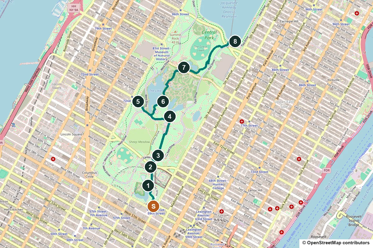
Terrain, toilets, opening hours and a shorter version ↓
What to see: the stops
-
The Pond and Gapstow Bridge
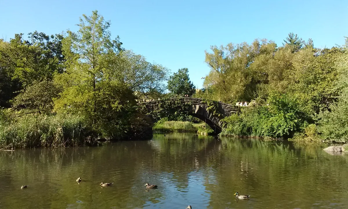
Gapstow Bridge over the Pond. Photo: Mjburgesswiki, CC BY-SA 4.0, via Wikimedia Commons (resized). Start at Augustus Saint-Gaudens's gilded statue of General William Tecumseh Sherman, put up in 1903. It was dedicated on Memorial Day, a holiday established by the Union veterans' group the Grand Army of the Republic, and the plaza came to be called after them. Enter the park at the corner, follow the park drive (the Outer Loop) north for about 100 m, then take the path down to the Pond and along its shore to Gapstow Bridge. The Pond lies below street level, so you step down out of the traffic into the landscape, just as the designers intended. The stone bridge dates from 1896 and replaced a wooden one. It is a favourite spot for photographs, with the Midtown towers rising over the trees. The wooded hill across the water is the Hallett Nature Sanctuary, the smallest of the park's three woodlands.
More history
The Pond was once larger: its upper arm was paved over in 1950 to make Wollman Rink. The Hallett Sanctuary was fenced off for birds in the 1930s and opened to visitors again in 2016. Grand Army Plaza got its present shape in 1916, paid for by Joseph Pulitzer's estate; Karl Bitter's bronze Pomona tops the fountain on the south side.
Sources: Central Park Conservancy, Grand Army Plaza; the Pond; Gapstow Bridge; Wikipedia, The Pond and Hallett Nature Sanctuary; Wikipedia, Arches and bridges in Central Park.
-
The Dairy, a Victorian cottage for children
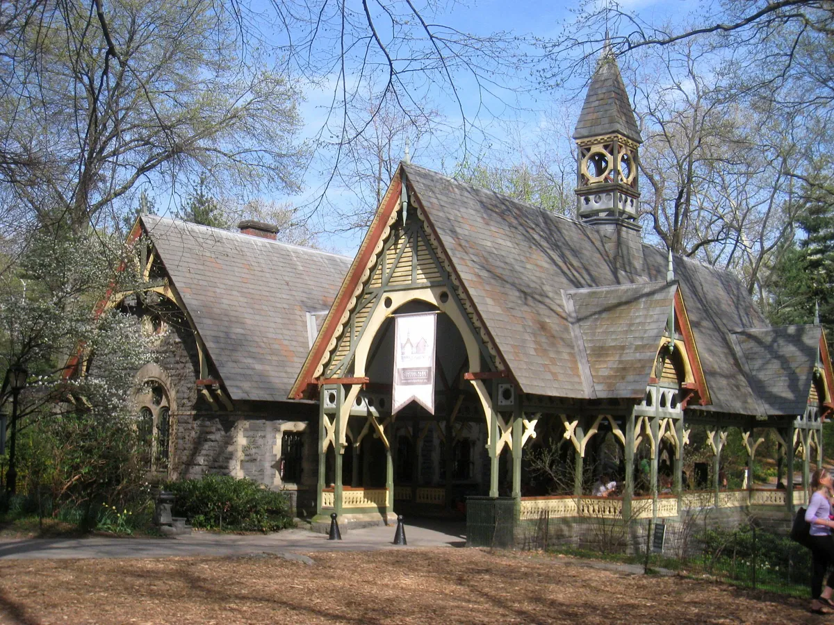
The Dairy and its rebuilt porch. Photo: Daderot, public domain, via Wikimedia Commons (resized). From the bridge, take the path north for about 270 m, with Wollman Rink on your left. The rink was built in 1950 over the northern part of the Pond, paid for by Kate Wollman; skaters use it from October to April, and there is an entrance fee. Ahead is the Dairy, which Calvert Vaux designed to look like a Victorian country cottage. It was finished in 1871 in the Children's District, the part of the park set aside for the young, and it sold fresh milk, which many city families could not easily get. Today it is a visitor centre and the park's largest gift shop, and you can pick up a park map here.
More history
The Dairy had hard years. In the 1930s Robert Moses turned it into a storeroom, its porch (the loggia) was pulled down in 1955, and in the 1970s it served as a maintenance shed. Restoration began in 1979, and in 1981 the Conservancy rebuilt the porch, so the one you see is a reconstruction. It was restored again in 2020–21.
Sources: Central Park Conservancy, the Dairy; Wollman Rink; Wikipedia, The Dairy.
-
The Mall and Literary Walk
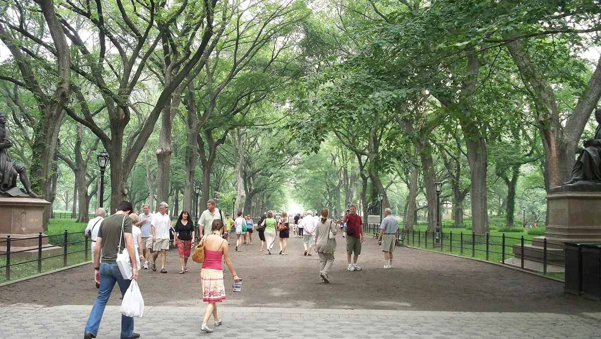
Literary Walk at the south end of the Mall. Photo: Ahodges7, CC BY-SA 3.0, via Wikimedia Commons (resized). Walk north from the Dairy for about 200 m, crossing the park drive, to the statue of Shakespeare at the south end of the Mall. Olmsted and Vaux called this straight promenade "an open-air hall of reception". It is the only formal feature in their plan, meant as a place where New Yorkers of every class could stroll and meet. Its double rows of American elms, arching overhead like a cathedral vault, are one of the largest surviving plantings of a tree that Dutch elm disease killed on most American streets. This southern stretch is called Literary Walk after its statues of writers. Shakespeare, by John Quincy Adams Ward, was dedicated in 1872. The Scots Walter Scott (1872) and Robert Burns (1880), both by John Steell and paid for by Scottish Americans, face each other across the path. Fitz-Greene Halleck, a poet few visitors recognise today, was the park's first monument to an American, unveiled in 1877 by President Rutherford B. Hayes. At the north-west corner, the Women's Rights Pioneers Monument of 2020 shows Sojourner Truth, Susan B. Anthony and Elizabeth Cady Stanton, the first statue in the park of real historical women.
More history
Olmsted did not want statues in his landscape, but donors pressed for them. Many were paid for by immigrant groups who wanted their heroes honoured in the city's grandest public space. Near the top of the Mall, the Naumburg Bandshell of 1923 still hosts free concerts, a series founded in 1905.
Sources: Central Park Conservancy, the Mall and Literary Walk; William Shakespeare; Walter Scott; Robert Burns; Fitz-Greene Halleck; Wikipedia, Central Park Mall; Wikipedia, Women's Rights Pioneers Monument.
-
Bethesda Terrace and the Angel of the Waters
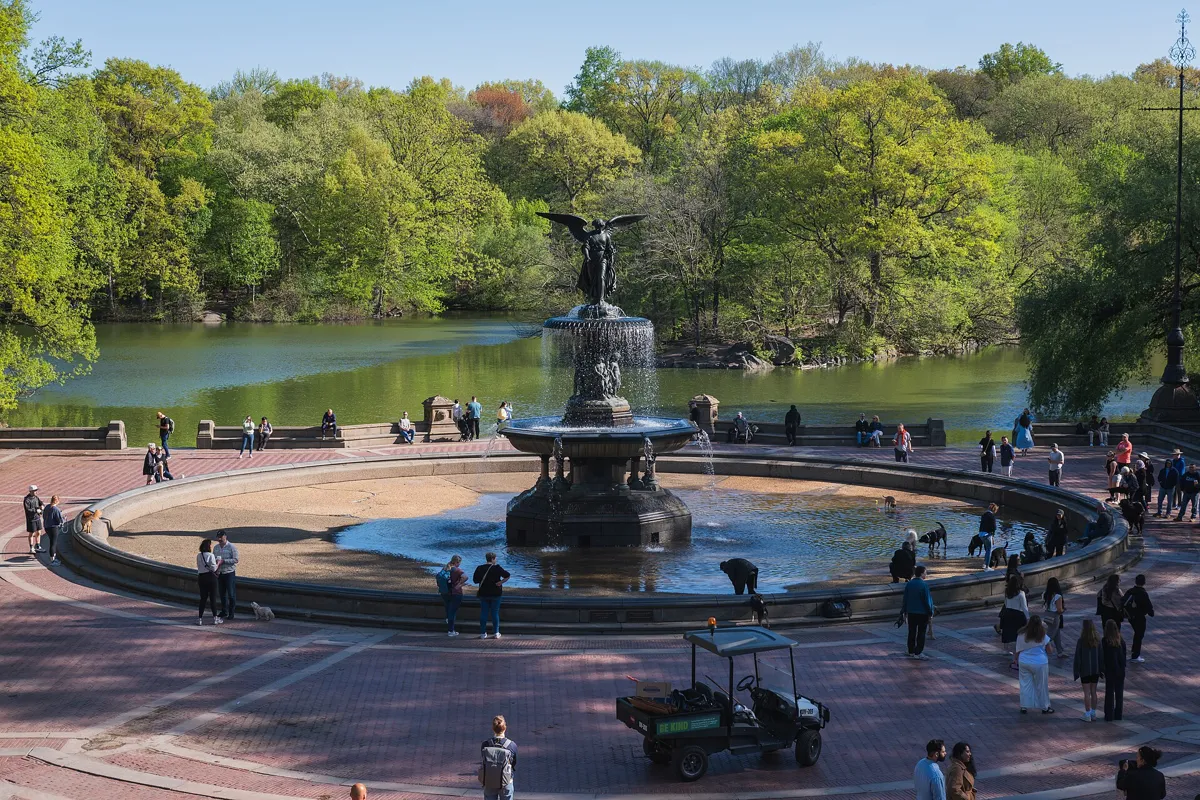
Bethesda Fountain and the Lake. Photo: Christian David, CC BY-SA 4.0, via Wikimedia Commons (resized). Walk north up the Mall, about 500 m, past the Naumburg Bandshell. At the top, cross Terrace Drive and take the right-hand staircase down to the lower terrace by the Lake (or, before the drive, take the central stairs down through the arcade). Calvert Vaux designed the terrace as the park's showpiece, with his assistant Jacob Wrey Mould, who was responsible for its carvings. Look at the stair rails: carved birds, fruit and plants stand for the four seasons. The arcade under the road has a ceiling of Minton tiles made in Stoke-on-Trent in England: nearly 16,000 of them by the Conservancy's count (Wikipedia says 14,000). In the middle stands Emma Stebbins's Angel of the Waters, dedicated in 1873. Stebbins was the first woman to get a public art commission in New York City. Her angel recalls the story in the Gospel of John of an angel giving the Pool of Bethesda its healing power, and celebrates the Croton Aqueduct, which brought clean water to the city in 1842. She holds a lily for purity, and the four cherubs below stand for peace, health, purity and temperance. The fountain is off for restoration from August 2026 for about a year; the terrace stays open.
More history
The terrace was built during the Civil War. By the 1970s the fountain was dry and the terrace a place for drug dealing. The Conservancy restored the fountain in 1980–81, the first part of its plan to renovate the park. The arcade's tiles came down in the 1980s and went back up in 2007.
Sources: Central Park Conservancy, Bethesda Terrace; Bethesda Fountain; Bethesda Fountain restoration; Wikipedia, Bethesda Terrace and Fountain.
-
Strawberry Fields and the Imagine mosaic
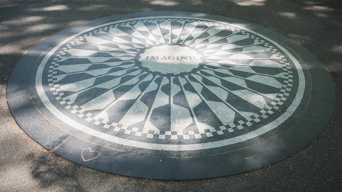
The Imagine mosaic. Photo: Christian David, CC BY-SA 4.0, via Wikimedia Commons (resized). Climb back to the upper terrace and head west along Terrace Drive, the road across the park at 72nd Street. After about 300 m, where it meets West Drive, take the path into Strawberry Fields to the mosaic. This is the memorial to John Lennon. He lived in the Dakota, the big apartment block with deep roofs and dormers just outside the park at Central Park West and 72nd Street, and he was shot dead outside it on 8 December 1980. In 1981 the city named this part of the park after his Beatles song "Strawberry Fields Forever". His widow, Yoko Ono, did not want a statue. She asked for a living landscape and invited countries around the world to send plants and stones. The Conservancy's landscape architect Bruce Kelly designed it, and it was dedicated on 9 October 1985, which would have been Lennon's 45th birthday. The mosaic with the single word Imagine was a gift from the city of Naples. Fans still gather here on 9 October and 8 December.
More history
The Dakota was built in 1880–84 to designs by Henry Janeway Hardenbergh and is the oldest surviving luxury apartment building in New York.
Sources: Central Park Conservancy, Strawberry Fields; Wikipedia, Strawberry Fields; Wikipedia, The Dakota.
-
Bow Bridge over the Lake
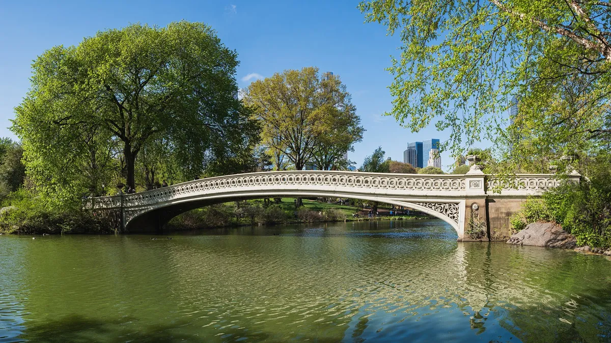
Bow Bridge. Photo: Christian David, CC BY-SA 4.0, via Wikimedia Commons (resized). Go back the way you came, down the path to Terrace Drive and left along it for about 90 m, then take the path on the left past Cherry Hill and along the shore of the Lake to Bow Bridge. Its low curve reminded people of an archer's or a violinist's bow. Vaux and Mould designed it, and it was finished in 1862 in cast iron by Janes, Kirtland & Co., the foundry that built the dome of the US Capitol. Its 87-foot (27 m) span is the longest of any bridge in the park. It was built as one of the main entrances to the Ramble, the woods on the far shore. The Lake was the first part of the park to open, to skaters, in the winter of 1858; on Christmas morning that year about 8,000 people came.
More history
Between 1859 and 1866, 27 arches and bridges went up in the park, all designed by Vaux, some with Mould, and each different. Boating on the Lake began in the 1860s; rowboats are still for hire at the Central Park Boathouse on the eastern shore.
Sources: Central Park Conservancy, Bow Bridge; the Lake; Wikipedia, Bow Bridge.
-
The Ramble and Belvedere Castle
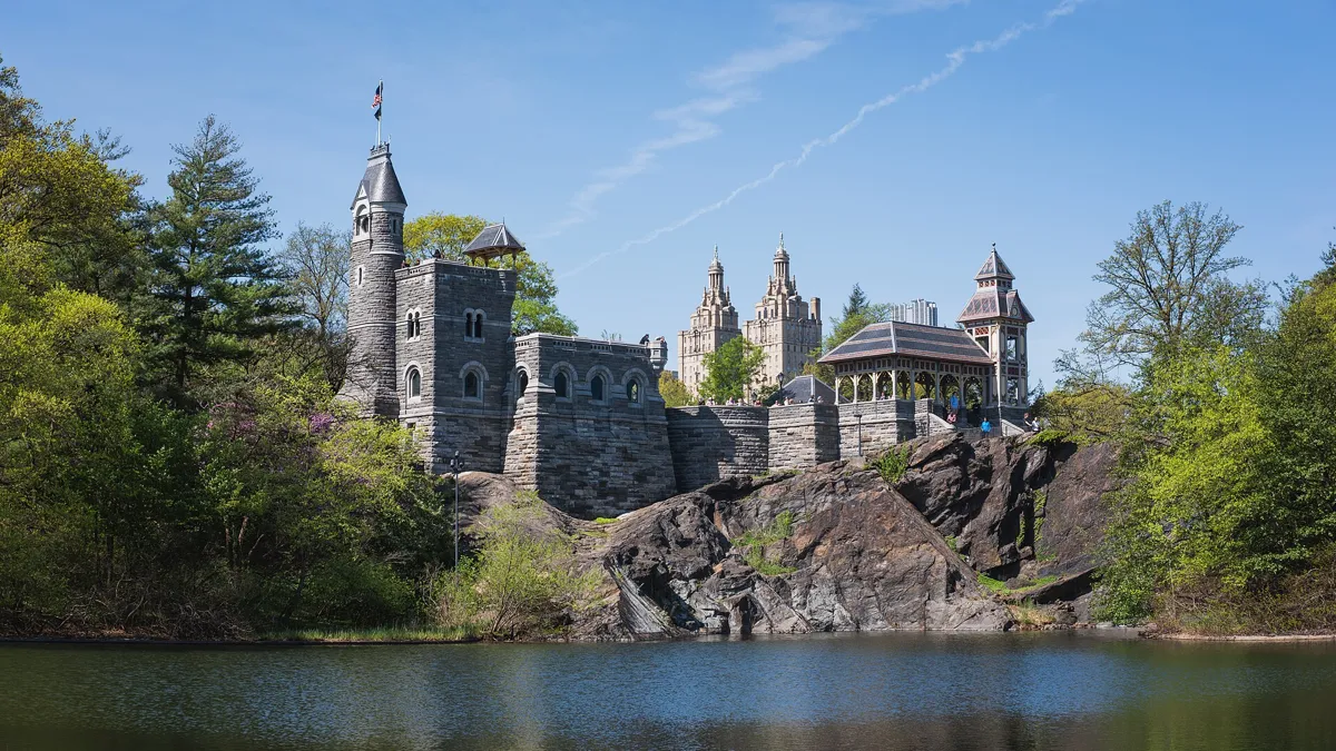
Belvedere Castle on Vista Rock, above Turtle Pond. Photo: Christian David, CC BY-SA 4.0, via Wikimedia Commons (resized). Cross Bow Bridge into the Ramble and follow its winding paths north and uphill to the castle, about 570 m. The paths twist, so keep aiming for the tower. The Ramble's 36 acres were designed to look like the forests of upstate New York; Olmsted called it a "wild garden", wild in look but planned in every detail. The park lies on the Atlantic Flyway, a bird migration route, and more than 200 species visit the Ramble each year. Belvedere means "beautiful view" in Italian. Vaux and Mould designed the castle in 1867 as a lookout, built of schist quarried in the park, on Vista Rock, the park's second-highest natural point. In 1919 the US Weather Bureau turned it into a weather station, and temperature, wind and rain are still measured here. After the bureau left in the 1960s it decayed; the Conservancy restored it in 1983 and again in 2019. It is now a visitor centre; climb to its terraces for the view over Turtle Pond and the Great Lawn.
More history
The first plan had two stone towers, but it was cut back in 1870 to save money. The wooden pavilions decayed and were removed before 1900; the ones you see were rebuilt in the 1980s.
Sources: Central Park Conservancy, the Ramble; Belvedere Castle; Wikipedia, Belvedere Castle; Wikipedia, Central Park.
-
The Great Lawn, the Obelisk and the Reservoir
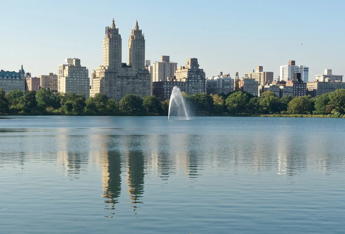
The Reservoir and its fountain. Photo: Jakub Hałun, CC BY 4.0, via Wikimedia Commons (resized). Follow the path east along the south shore of Turtle Pond, past the King Jagiello Monument at its east end. Beyond the pond, on your left, is the Great Lawn. It covers the site of the Croton Aqueduct's receiving reservoir of 1842, which was drained from 1930 and filled in; the lawn and Turtle Pond were finished in 1937. Take the short path up to the Obelisk, or Cleopatra's Needle, on its knoll beside the Metropolitan Museum of Art. Made in Egypt about 3,500 years ago for the pharaoh Thutmose III and given by Egypt's ruler, the Khedive, it was set up here in 1881: the oldest outdoor monument in New York. Come back down and follow the paths north between the Great Lawn and East Drive, then cross the bridle path on a small footbridge and climb the steps to the running track at the Reservoir's south end, about 970 m from the castle. The Reservoir was built in 1858–62 to store the city's water and covers 106 acres. It was taken out of service in 1993 and named the next year after Jacqueline Kennedy Onassis, who used to jog here. The track around it is 1.58 miles (2.54 km). The floating fountain was first installed in 1917.
More history
In the early 1930s, in the Depression, homeless New Yorkers built a "Hooverville" of shacks in the dry bed of the old reservoir; they were allowed to stay until April 1933. Around the Reservoir, the fence installed in 2003 copies the original 19th-century cast-iron fence, a piece of which divers found on the bottom.
Sources: Central Park Conservancy, the Great Lawn; Turtle Pond; the Obelisk; the Reservoir; Wikipedia, Great Lawn and Turtle Pond; Wikipedia, Jacqueline Kennedy Onassis Reservoir.


Practical details
- Terrain
- Rolling. USGS ground elevations run from about 9 m above sea level at the Pond to 42 m at Belvedere Castle on Vista Rock. The main climb is through the Ramble.
- Step-free
- No. OpenStreetMap maps steps on the route: the stairs down to Bethesda's lower terrace and back up, flights in the Ramble and below Belvedere Castle, and steps up to the Reservoir track. It marks 5th Avenue–59th Street station as not wheelchair accessible.
- Water
- OpenStreetMap lists drinking fountains on Literary Walk (stop 3), by Strawberry Fields (stop 5), at Belvedere Castle (stop 7) and by the Reservoir (stop 8).
- Toilets
- The Conservancy lists restrooms at Bethesda Terrace (6:30 to 21:00 daily, late March to early November) and in the Ramble (6:30 to 21:00 daily, all year); neither is wheelchair accessible. OpenStreetMap maps a toilet beside the path south of Turtle Pond, after stop 7; it may be the same Ramble restroom. The Dairy and Belvedere Castle have none.
- Sit and eat
- Benches everywhere: the park has about 9,500. The Central Park Boathouse, on the Lake's eastern shore, has a restaurant.
- When to go
- The park is open daily from 6:00 to 1:00. The Dairy and Belvedere Castle open daily, 10:00 to 17:00 (castle terraces until 16:55), and close on Thanksgiving, Christmas and New Year's Day. Bethesda Fountain is off for restoration from August 2026 for about a year, some benches and paths on the Mall's Concert Ground are closed for building work, and the Great Lawn closes in winter.
- Shorter walk
- Finish at stop 5, Strawberry Fields: 1.9 km, 26 minutes of walking, about 50 minutes with stops. 72 St station (B and C trains) is about 130 m away on Central Park West.
- Getting back
- The Metropolitan Museum of Art is about 570 m (8 minutes) away on Fifth Avenue. The nearest subway is 86 St on Lexington Avenue (4, 5 and 6 trains), about 780 m (10 minutes) on foot.
Walking distances and times from the OSRM foot router on OpenStreetMap data. Elevations from the USGS 3D Elevation Program. Stations, fountains, steps and toilets from OpenStreetMap; opening hours, restrooms and closures from the Central Park Conservancy. Hours change: check before you go. Checked 5 October 2026.
Questions people ask
How long does it take to walk through Central Park?
The park is 2.5 miles (4.0 km) long, from 59th Street to 110th Street, and half a mile wide. This walk covers its southern half, from Grand Army Plaza at 59th Street to the Reservoir at about 86th Street: 4.0 km by the paths and 53 minutes of walking, or about an hour and a half with eight stops.
What is a good walking route through Central Park, and is there a map?
For a first visit, the route on this page links the park's best-known sights from south to north: the Pond and Gapstow Bridge, the Dairy, the Mall and Literary Walk, Bethesda Terrace, Strawberry Fields, Bow Bridge, the Ramble, Belvedere Castle and the Reservoir. The map is on this page, and you can print it or save it as a PDF. Park maps are also available at the Conservancy's visitor centres, including the Dairy and Belvedere Castle.
Where is Strawberry Fields in Central Park?
On the west side of the park, just inside the entrance at Central Park West and West 72nd Street, across the road from the Dakota, where John Lennon lived. The Imagine mosaic is about 130 m from 72 St subway station (B and C trains).
Are there toilets in Central Park?
Yes, there are public restrooms around the park. On this walk the Central Park Conservancy lists restrooms at Bethesda Terrace (6:30 to 21:00 daily from late March to early November) and in the Ramble (6:30 to 21:00 daily, all year). Neither is wheelchair accessible. The Dairy and Belvedere Castle visitor centres have none.
How big is Central Park?
843 acres (341 hectares): 2.5 miles (4.0 km) from north to south and half a mile (0.8 km) across. It is only the sixth-largest park in New York City, but the most visited urban park in the United States, with an estimated 42 million visitors in 2016.
Walk it with Strolio
Open Strolio at Grand Army Plaza and ask for an hour and a half through Central Park. Strolio builds walks in any city with mapped streets, so its route may pick different stops from this page. Stories play as you reach each place, and you can ask about anything else you pass, by voice or with a photo. You can also start from your hotel and choose your own time and interests.
More walks in New York
- Lower Manhattan: ~2 h, 8 stops. Where New York began: from the Battery past Wall Street, Hamilton's grave and the 9/11 Memorial to the Brooklyn Bridge.
- Midtown: ~1½ h, 8 stops. Grand Central's starry ceiling to the red steps of Times Square, by the Chrysler Building, the library lions and Rockefeller Center.
- All New York walks, with maps side by side.
- Walks in other cities.
Sources
- Central Park Conservancy, centralparknyc.org: the page for each place, linked under each stop, plus What to know before you go (hours, restrooms, maps). We used their facts and wrote our own text.
- Wikipedia: Central Park, The Pond and Hallett Nature Sanctuary, Arches and bridges in Central Park, The Dairy, Central Park Mall, Women's Rights Pioneers Monument, Bethesda Terrace and Fountain, Strawberry Fields, The Dakota, Bow Bridge, Belvedere Castle, Great Lawn and Turtle Pond, Cleopatra's Needle, Jacqueline Kennedy Onassis Reservoir
- Stations: Wikipedia, Fifth Avenue–59th Street station, 72nd Street station, 86th Street station
- Map data and places: © OpenStreetMap contributors, ODbL; walking route from the OSRM foot router run by FOSSGIS
- Elevations: USGS Elevation Point Query Service (3D Elevation Program)
- Photos: Wikimedia Commons contributors Mjburgesswiki, Daderot, Ahodges7, Christian David and Jakub Hałun, credited under each photo