
Hometown walks · Nou Barris
A 75-minute walk through Nou Barris
Nou Barris is usually described by its housing blocks. But between them are farmhouses older than most of the Eixample, a stretch of 19th-century aqueduct, and a former asylum that became the district's town hall.
A thread runs through several stops: neighbours who fought for these buildings, and won. This walk is for people who live in the district or nearby and want to see it the way its residents' associations have always seen it.
- Start
- Maragall metro (L4, L5)
- Finish
- Llucmajor metro (L4), now Llucmajor-República
- Distance
- 3.5 km, one way
- Time
- About 75 min: 46 min walking, 6 stops
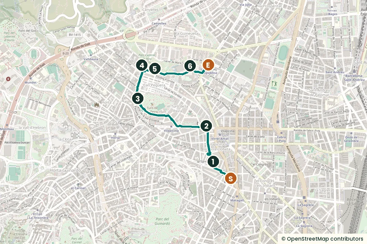
The stops
-
Torre Llobeta, the manor house neighbours occupied
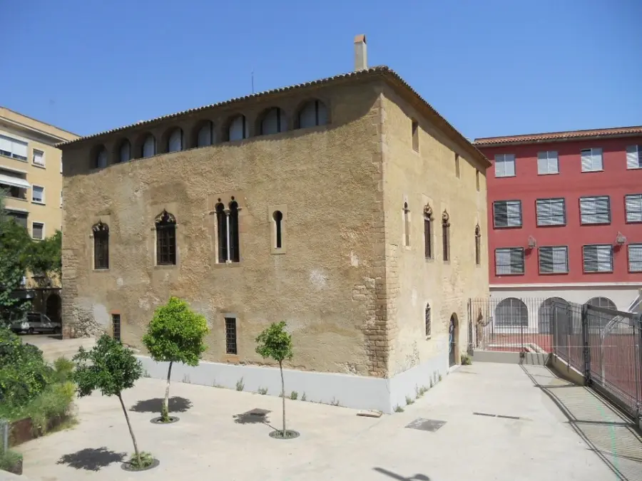
Photo: Puigalder, CC0, via Wikimedia Commons. Torre Llobeta dates back to the 15th century, when it was built as a stately home for the Llobeta family, who gave it its name. It later became a farmhouse. Many Gothic features survive, including the decorated windows, the pointed-arch doorway, the courtyard and the staircase, and the city calls it one of Barcelona's oldest preserved buildings. In 1877 it became a family summer house where literary evenings were held, regularly attended by the poet Joan Maragall. In the Civil War it was confiscated and used by the neighbourhood's revolutionary committee. From 1948 a municipal housing estate went up around it, housing from 1952 families whose shacks had been demolished for that year's Eucharistic Congress. On 26 April 1981 the residents' association occupied the house and stayed until 1983, when the city police removed them. The civic centre opened on 18 December that year.
Sources: Centre Cívic Torre Llobeta; Coneix BCN, La Torre Llobeta; Viquipèdia, Torre Llobeta.
-
Can Basté and Santa Eulàlia de Vilapicina
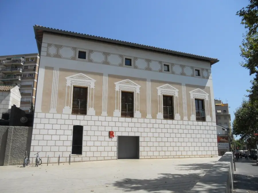
Photo: Puigalder, CC0, via Wikimedia Commons. Can Basté was built on the remains of a medieval tower and was already part of the old village of Santa Eulàlia de Vilapicina in the 17th century. It was a wine farm that declined over time. In the 1970s the Turó de la Peira residents' association campaigned for it to become a public building, and the city bought the estate in 1980. Excavations during the restoration, from 1991, found medieval remains including a square-mouthed grain silo. The civic centre opened in 1995. Since 2004 it has been run by a group of eight neighbourhood organisations, and its speciality is photography. The church beside it stands on a site with a chapel documented in 991, and the bridge that links the church to Can Basté was finished on 10 August 1782.
Sources: Centres Cívics de Barcelona, Can Basté; Meet Barcelona, Can Basté; Viquipèdia, Santa Eulàlia de Vilapicina.
-
Parc del Turó de la Peira
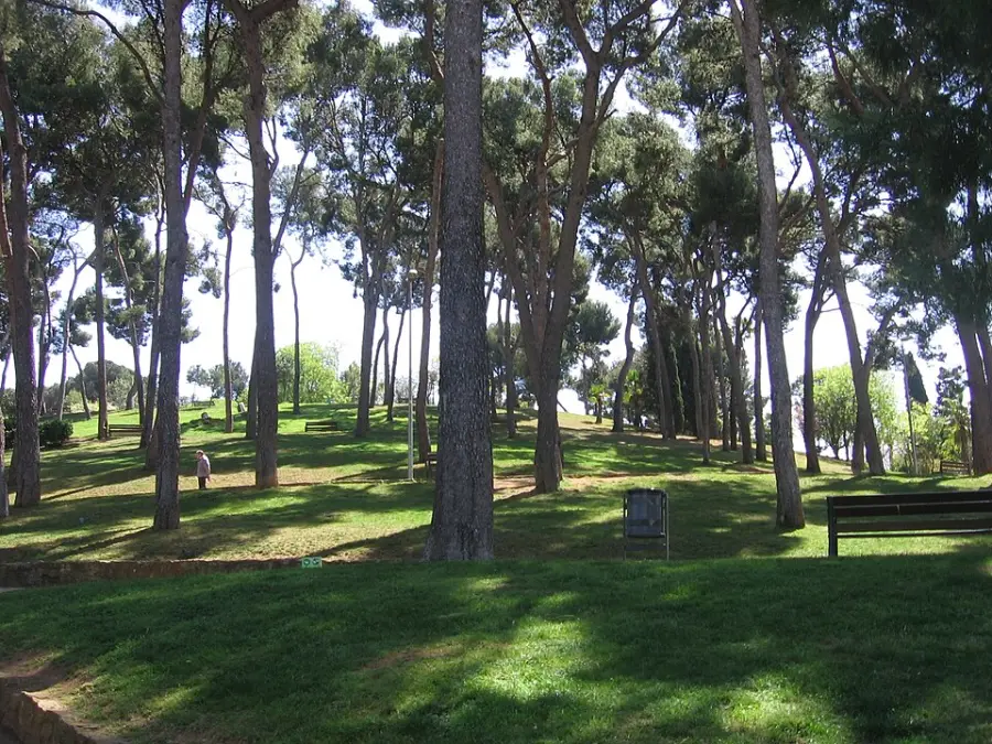
Photo: Canaan, CC BY-SA 3.0, via Wikimedia Commons (resized). The walk's one real climb brings you to a park made from an old quarry. The 7.71 hectares belonged to the Marchioness of Castellbell, passed to the city under the Second Republic, and opened as a public park in 1936. The paths lead to a summit about 140 metres high, with a cross and a view of both Collserola and the sea. Around the hill, housing blocks were put up in a hurry between 1953 and 1961 for families from shanty settlements, using fast-setting cement. That cement later caused aluminosis, a disease that weakens concrete. In 1990 one block collapsed, and most homes turned out to be affected. About 3,000 homes were replaced or rehabilitated.
Sources: Ajuntament de Barcelona, Parc del Turó de la Peira; Coneix BCN, Parc del Turó de la Peira; Viquipèdia, El Turó de la Peira; Districte de Nou Barris, 1980–1990.
-
The aqueduct in Parc Central
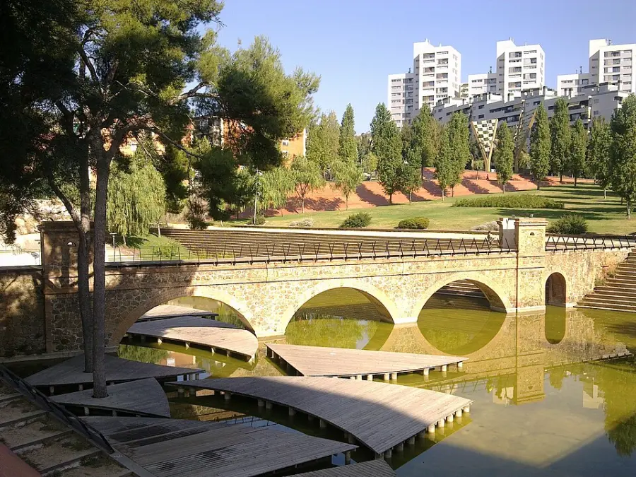
Photo: Deosringas, CC BY-SA 3.0, via Wikimedia Commons (resized). In the second half of the 19th century, the growth of the Eixample pushed Barcelona to bring in water from far away. The Dosrius aqueduct ran more than 50 kilometres, from the Argentona river in the Maresme to Gràcia, and crossed what is now Nou Barris; its water started flowing around 1870. Only this stretch survives, turned into a walkable bridge. Look for the three large round arches and the small turrets on either side of the channel. The Catalan heritage inventory lists it under the name of the Vallès water company, whose pipeline ran alongside. The park around it opened in 1999, was designed by the architects Carme Fiol and Andreu Arriola, and won the International Urban Landscape Award in 2007. Under your feet is a less visible piece of water engineering: an 18,000 cubic-metre tank that stores rainwater to prevent flooding.
Sources: Coneix BCN, L'aqüeducte del parc Central; Ajuntament de Barcelona, Parc Central de Nou Barris; Viquipèdia, Aqüeducte Dosrius; Viquipèdia, Parc Central de Nou Barris.
-
Can Carreras, the last farm
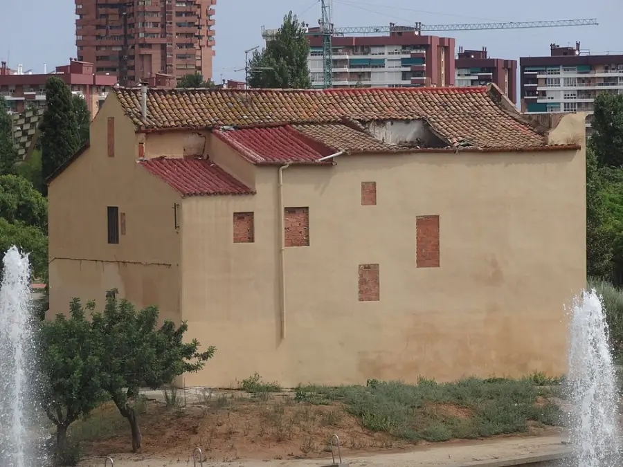
Photo: Jordiferrer, CC BY-SA 3.0, via Wikimedia Commons (resized). This farmhouse sat on very fertile land, watered by a water mine, a hand-dug tunnel bringing water from Collserola. Once known as Mas Sala, it took its current name in the 19th century. Its owner, the paper maker Lluís Guarro i Casas, sold part of the land in 1880 to build the Institut Mental, the next stop. In 1914 the tenant farmers Josep Mompart and Rita Estadella took over and switched from flowers and fruit trees to vines, cereals, carob and vegetables. After the Civil War most of the land was split into plots, which became the now-vanished Can Carreras neighbourhood. In the 1990s the city expropriated the house for Parc Central, and the park's 50,000-euro prize money from 2007 was invested here. The olive tree by the door remembers councillor Antoni Santiburcio, who pushed for the park. The house is closed, waiting for a project to turn it into a neighbourhood facility, so you'll see it from outside.
Sources: Coneix BCN, Can Carreras; Viquipèdia, Parc Central de Nou Barris.
-
The Seu del Districte, once the Institut Mental
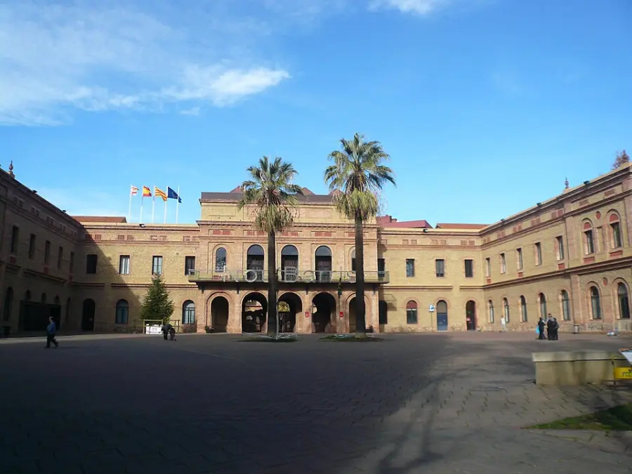
Photo: pere prlpz, CC BY-SA 3.0, via Wikimedia Commons (resized). Nou Barris's town hall was built as an asylum. The Institut Mental de la Santa Creu opened its women's pavilions on 19 December 1889 and was not completely finished until 1915. It was created by Dr Emili Pi i Molist and the architect Josep Oriol i Bernadet, and its therapies based on farm work, crafts and art made it one of the most advanced asylums of its time. It measured 700 by 240 metres, with 12 symmetrical pavilions for up to 700 patients and sixteen garden courtyards. In the 1960s several pavilions were demolished to build the Barcinova and Calinova housing estates. During a lock-in, doctors and nurses drew up an alternative to demolishing the rest. The last patients left in 1987, and in 1988 the district moved in. Today the building also holds the Nou Barris library and a city police station.
Sources: Ajuntament de Barcelona, Antic Institut Mental de la Santa Creu; Ajuntament de Barcelona, Cultura Popular: 100 anys de l'Institut; Viquipèdia, Institut Mental de la Santa Creu; Districte de Nou Barris, 1980–1990.
-08019-2870.jpg)
-08019.2884.jpg)
.JPG)


Practical details
- Getting there
- Metro L4 or L5 to Maragall. Torre Llobeta is about five minutes' walk.
- Length
- 3.5 km one way, about 46 minutes of walking. Allow 75 minutes with the stops.
- Terrain
- One climb of about 35 m over a kilometre, up Passeig de Fabra i Puig from Can Basté to the park. Gently downhill after that. The summit adds about 40 m of stairs.
- Shorter version
- Skip the park stop and walk past it: about 68 minutes and five stops.
- Heads up
- Can Carreras is closed; see it from outside. The civic centres keep their own hours.
Walking distance and times from the OSRM foot router on OpenStreetMap data. Elevations from Open-Meteo and Open-Elevation; the summit height from the city. Checked 15 September 2026.
Walk it with Strolio
Open Strolio at Maragall metro and ask for a walk through Nou Barris's farmhouses. Stories play as you reach each place, and you can ask about anything else you pass, by voice or with a photo.
Sources
- Centre Cívic Torre Llobeta
- Coneix BCN: La Torre Llobeta
- Centres Cívics de Barcelona: Can Basté
- Meet Barcelona: Can Basté
- Ajuntament de Barcelona: Parc del Turó de la Peira
- Coneix BCN: El parc del Turó de la Peira
- Districte de Nou Barris: 1980–1990, la gran transformació
- Coneix BCN: L'aqüeducte del parc Central
- Ajuntament de Barcelona: Parc Central de Nou Barris
- Coneix BCN: Can Carreras
- Ajuntament de Barcelona: Antic Institut Mental de la Santa Creu
- Ajuntament de Barcelona: Un segle d'història compartida
- Viquipèdia: Torre Llobeta, Santa Eulàlia de Vilapicina, El Turó de la Peira, Aqüeducte Dosrius, Parc Central de Nou Barris, Institut Mental de la Santa Creu, Estació de Maragall, Estació de Llucmajor
- Map data and places: © OpenStreetMap contributors, ODbL
- Photos: Wikimedia Commons contributors Puigalder, Canaan, Deosringas, Jordiferrer and pere prlpz, credited under each photo