
Hometown walks · Horta
A 60-minute walk through Horta
Until 1904, Horta wasn't part of Barcelona. It was Sant Joan d'Horta, a separate town about six kilometres from the old city. This walk follows what the village left behind: its square, its farmhouses, its church, and the street where Barcelona's laundry was washed.
It's written for people who live here or nearby and have walked these streets without knowing their story. By the time Horta joined Barcelona it had close to 5,000 residents, and its most important industry was tanning, thanks to its mines and wells. The name itself appears in a document from 965.
- Start
- Horta metro (L5), Plaça d'Eivissa exit
- Finish
- Can Fargas, Passeig de Maragall
- Distance
- 1.8 km, one way
- Time
- About 60 min: 25 min walking, 6 stops
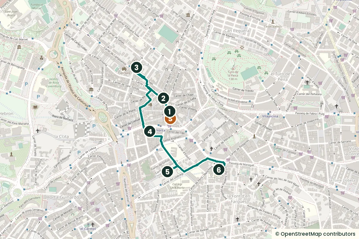
The stops
-
Plaça d'Eivissa, the old market square
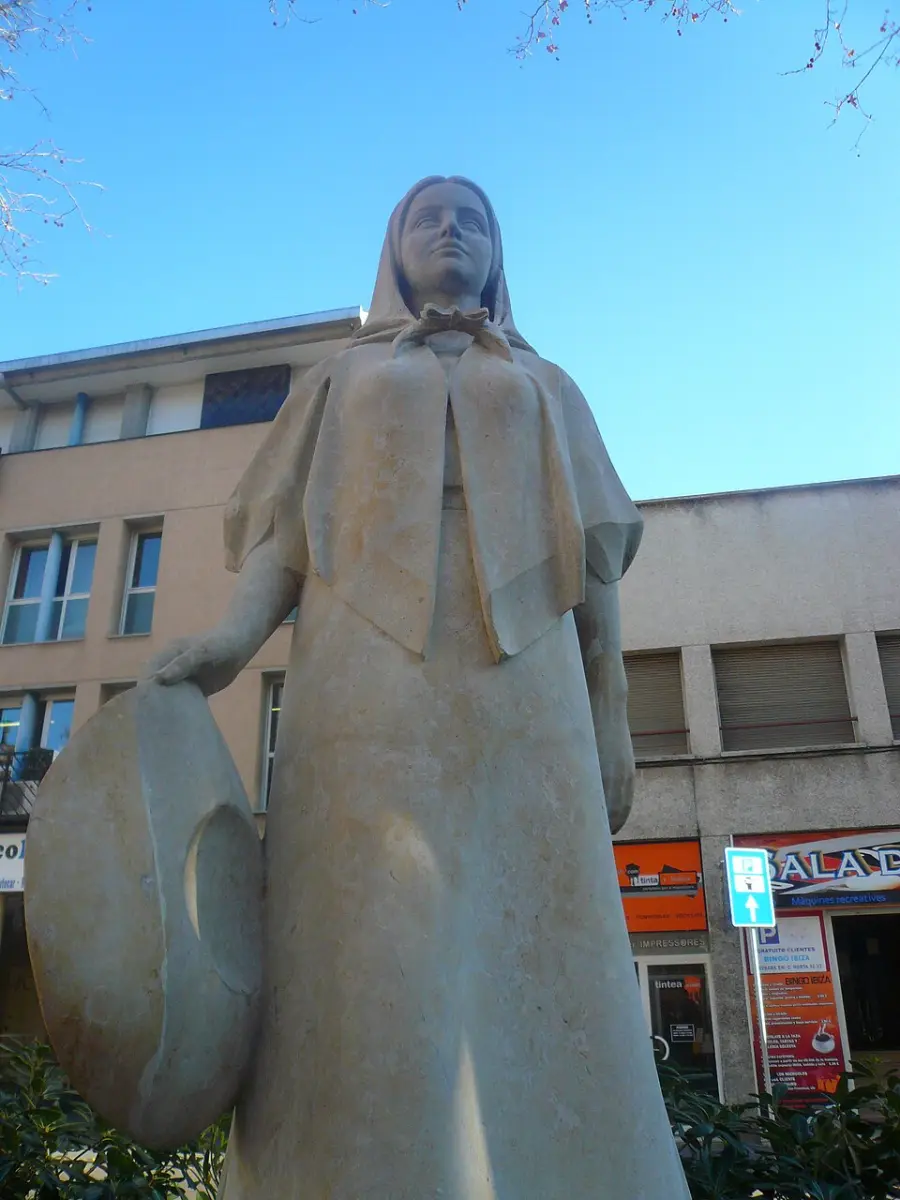
The Eivissenca statue. Photo: Pere prlpz, CC BY-SA 3.0, via Wikimedia Commons (resized). The square was laid out in 1889 as Plaça del Progrés, Progress Square. At the end of the 19th century, 28 market stalls went up around its edge, and for a few years it was called Plaça del Mercat. It got its current name in 1907, three years after Horta joined Barcelona. The open-air market grew here until 1951, when a new market hall was built on Carrer del Tajo. The statue of a woman in Ibizan dress, the Eivissenca by Joan Centelles i Roig, was unveiled on 19 March 1965. On one corner, Bar Quimet has been open since 1927 and is listed as one of the city's emblematic businesses.
Sources: Viquipèdia, Plaça d'Eivissa (Horta); Districte d'Horta-Guinardó, El mercat de la plaça d'Eivissa.
-
Can Mariner, the farmhouse library
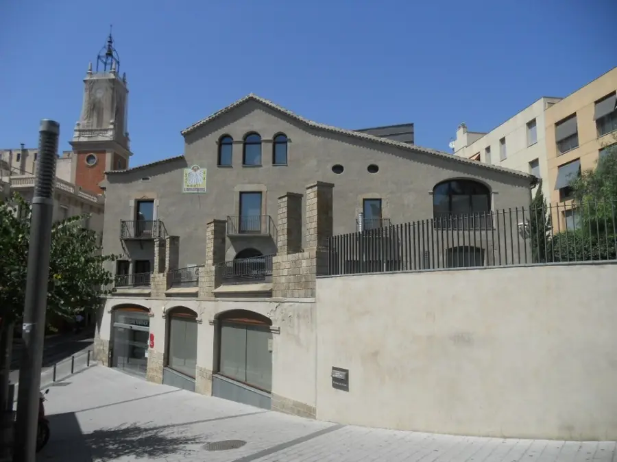
Photo: Puigalder, CC0, via Wikimedia Commons. On the corner of Carrer d'Horta and Carrer del Vent stands one of the important farmhouses of the old Barcelona plain. The first record of it is a census from 1516, and the Gothic-style window on the Carrer d'Horta side may date from that time. The ground floor was for farm workers and tools, the first floor held the family rooms and a large hall, and the top floor was the attic. In 1870 the last heir, Hermenegild Mariner i Cuyàs de Bosch, split the estate into small building plots, on one condition: every new house had to be lower than the farmhouse. The Blanchart family bought it in 1940 and restored it in 1949. The city later converted it, and it has been a public library since 2008, specialising in theatre.
Look across the street at the clock tower. Horta's town council built the first one in 1845, so the bells could be heard as far as Sant Genís dels Agudells. The bells were paid for from a fund meant to give poor young brides an ounce of gold, so people called it the Torre de les Noies, the Girls' Tower. It was demolished in 1946 because it was close to collapse, and a new building with a new tower went up in 1949, reusing the old bells. They still read "A expensas de los Vecinos del Pueblo de Horta": paid for by the people of the town of Horta.
Sources: Districte d'Horta-Guinardó, Can Mariner; Viquipèdia, Carrer d'Horta; Biblioteques de Barcelona, Biblioteca Horta – Can Mariner; Viquipèdia, Campanar d'Horta.
-
Sant Joan d'Horta, the village church
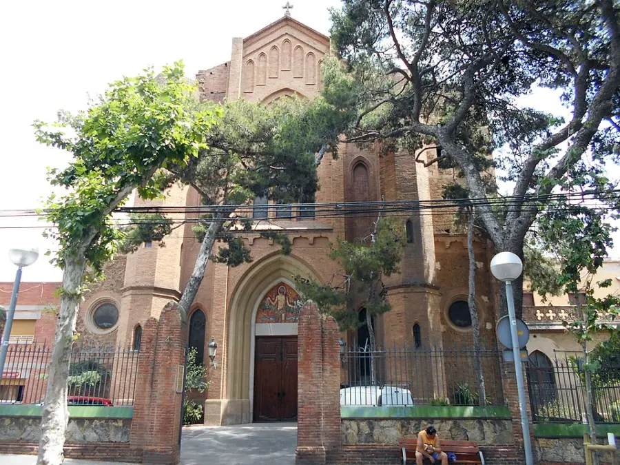
Photo: Canaan, CC BY-SA 4.0, via Wikimedia Commons (resized). This church has been built, burned and rebuilt more than once. The first stone of a new church was laid on 24 June 1905. In 1909 the old village church was destroyed during the riots of the Tragic Week; only its bell tower survived, until it was pulled down in 1929. Work on the new building began in 1911 under the architect Enric Sagnier, and it opened on 21 October 1917. It was burned in 1936 during the Civil War and rebuilt in 1939, but the main door and its carved panel above were only finished on 24 June 1980. The church is neo-Gothic, 47 metres long, and its two eight-sided towers recall those of Santa Maria del Pi in the Gothic Quarter.
-
Mercat d'Horta, the 1951 market hall
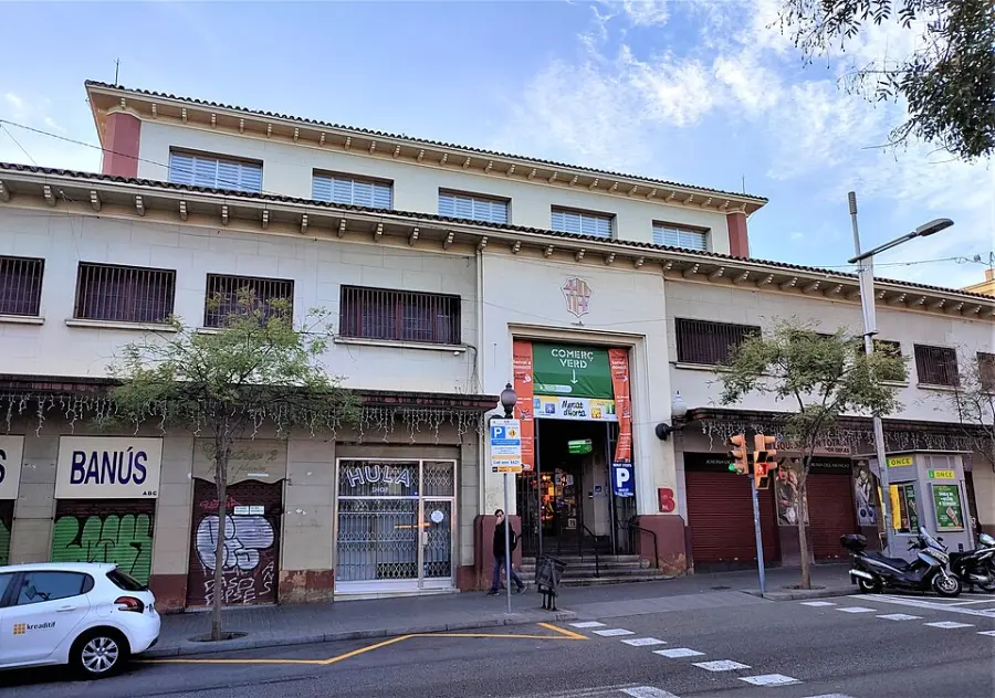
The market in 2022, before the move. Photo: Joandrés, CC BY-SA 4.0, via Wikimedia Commons (resized). When the market left Plaça d'Eivissa, it came here. The building opened on 25 January 1951, designed by the city architect Ramon Termes i Mauri, with a concrete structure like other markets of those years. On opening it had 40 fruit and vegetable stalls, 36 meat stalls, 16 for fish and 17 for offal, among others. The hall is closed now. Since 28 November 2023 the traders have worked from a temporary timber market of 1,400 square metres where Carrer de Porto meets Carrer de Lisboa, about 250 metres away. In February 2026 the city said the renovation would go to tender during the year: a project of nearly 15 million euros and two years of work, for a market of 34 stalls and a supermarket.
Sources: Viquipèdia, Mercat d'Horta; Mercats de Barcelona, Mercat d'Horta; Districte d'Horta-Guinardó, 28/11/2023; 16/12/2023; Info Barcelona, 02/02/2026.
-
Carrer d'Aiguafreda, the washerwomen's street
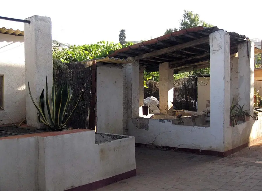
One of the street's washtubs. Photo: Enfo, CC BY-SA 3.0, via Wikimedia Commons (resized). This short pedestrian street is the best reason to come to Horta. Every house here has its own well, and that water filled the washtubs that are still preserved. From the early 1600s until well into the 20th century, much of the laundry of Barcelona's well-off families was washed in Horta: collected dirty on Mondays and returned clean on Saturdays. Most of the washerwomen did it at home, in their own tubs, for extra family income, and walked the road to Barcelona, entering the walled city through the Portal Nou. Houses like these once stood elsewhere in the city too, but they were lost to redevelopment. The street is now protected heritage. These are private homes, so enjoy it quietly.
Sources: Viquipèdia, Carrer d'Aiguafreda; Districte d'Horta-Guinardó, Història d'Horta; Wikidata Q11912548.
-
Can Fargas, the tower that grew a house
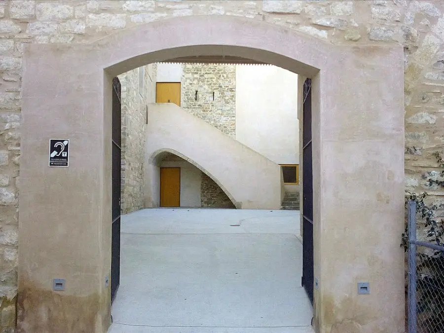
Photo: Enric, CC BY-SA 4.0, via Wikimedia Commons (resized). The last stop is just over the line in La Font d'en Fargues, the neighbour of Horta. The farmhouse grew around a defence tower about a thousand years old, listed as a Cultural Asset of National Interest, Catalonia's highest heritage level. Inside the tower are medieval wall paintings from between the 13th and early 15th centuries. The estate was huge: it covered all of today's Parc del Guinardó and reached the top of the Hospital de Sant Pau. Its name comes from Montserrat de Casanovas, who married Pere Fargas and, after his death in 1925, spent long periods here. After years of campaigning by neighbours under the banner "Salvem Can Fargas", the city took it over in 2009. Today it is a municipal music school.
Sources: Viquipèdia, Can Fargas; Ajuntament de Barcelona, Escola Municipal de Música Can Fargues.

.jpg)


,_III.jpg)
Practical details
- Getting there
- Metro L5 to Horta. Take the Plaça d'Eivissa exit; the square is right there.
- Length
- 1.8 km in a line, about 25 minutes of walking. Allow an hour with the stops.
- Terrain
- Gentle. Stops sit between 81 and 102 m above sea level; the longest climb is about 18 m, from the square up to the church.
- Coffee
- Bar Quimet on Plaça d'Eivissa at the start. OpenStreetMap lists Boheme café about four minutes from Can Fargas.
- Heads up
- The 1951 market hall is closed for renovation. The temporary market is at Carrer de Porto and Carrer de Lisboa.
- Longer walk
- The Parc del Laberint d'Horta is about 2.3 km from Plaça d'Eivissa on foot. Save it for another day.
Walking distance and times from the OSRM foot router on OpenStreetMap data. Elevations from Open-Meteo. Checked 15 September 2026.
Walk it with Strolio
Open Strolio at Horta metro and ask for an hour through the old village. Stories play as you reach each place, and you can ask about anything else you pass, by voice or with a photo.
Sources
- Districte d'Horta-Guinardó: Història d'Horta
- Arxiu Municipal de Barcelona: Itinerary through Horta
- Districte d'Horta-Guinardó: El mercat de la plaça d'Eivissa
- Districte d'Horta-Guinardó: Can Mariner
- Biblioteques de Barcelona: Biblioteca Horta – Can Mariner
- Mercats de Barcelona: Mercat d'Horta
- Districte d'Horta-Guinardó: Obre el mercat provisional d'Horta (28/11/2023)
- Districte d'Horta-Guinardó: El mercat provisional d'Horta ja està actiu (16/12/2023)
- Info Barcelona: Green light for the renovation of the Mercat d'Horta (02/02/2026)
- Ajuntament de Barcelona: Escola Municipal de Música Can Fargues
- Viquipèdia: Plaça d'Eivissa (Horta), Carrer d'Horta, Campanar d'Horta, Sant Joan d'Horta, Mercat d'Horta, Carrer d'Aiguafreda, Can Fargas, Estació d'Horta
- Wikidata: Carrer d'Aiguafreda
- Map data and places: © OpenStreetMap contributors, ODbL
- Photos: Wikimedia Commons contributors Pere prlpz, Puigalder, Canaan, Joandrés, Enfo and Enric, credited under each photo